

The area across the River Wyre from Fleetwood was, for many years, quite isolated. There was a ferry across the river to Fleetwood, which still operates in the 21st century, otherwise, narrow un-metalled roads had to suffice.
The local community, particularly those with agricultural interests, were determined to have a railway. The line was built between Garstang and Pilling by those local agricultural interests to develop unproductive land. It had been intended to continue to Knott End but the company ran out of money. It eventually opened between Garstang and Pilling in 1870. [2]
In 1898 the Knott End Railway was authorised to continue to Knott End; the extension opened in 1908.
Until around the turn of the 20th century the line operated in the control of the receivers having had a couple of years lying dormant as a result of significant overspend during construction. [1: p68] However, by 1908 the line was solvent. [1: p69] For much of the life of the line, it operated as two separate companies but using the same rolling stock. [1: p70]
Enough income was forthcoming to allow a branch to be constructed to serve the Saltworks at Stalmine Moss. [1: p69] Salt extraction became a dominant industry in the area from 1890, ”and the railway conveyed some remarkable tonnages of salt (outward) and coal (inward, for power).” [2]
Ultimately the line did not survive beyond the 1960s. Passenger traffic ceased in the 1930s although Scott-Morgan points out that excursion traffic continued in the summer months. He goes on to say that in 1950, ”British Railways closed the line to goods traffic between Knott End and Pilling. The remainder of the branch was often worked by Ivatt Class 2 2-6-0 tender locomotives and, strangely, Stanier Black 5 4-6-0s on four or five wagon goods trains. Final closure came on 31st July 1963, and the track was lifted shortly after.” [1: p70]
I am aware of two books of substance which have been written about the line. The first was initially published by the Oakwood Press in the 1960s. Its most recent incarnation was printed in the mid-1980s. [4]
A much more recent contribution was made by Dave Richardson in his book entitled, ‘The Pilling Pig’. It was published by the Cumbrian Railways Association in 2018. [5]
Dave Richardson was able to unearth more information in the 21st century than R.W. Rush and M.R.C. Price had available to them in the 1960s. Nonetheless, Dave Richardson comments: “Given the limited sources of information and facilities for research available at that time, the [earlier] book represented a considerable achievement.” [5: p5]
Both books provide excellent plans, maps and drawings. I particularly appreciated the colour station plans in Dave Richardson’s book. [5]
Both texts describe the line travelling East to West. I plan to do so from West to East. This is the way in which the line would first have been encountered by holiday-makers from Blackpool and Fleetwood. I guess that the railway prioritised passenger traffic coming over on the ferry from Fleetwood. This is shown by the station facilities at Knott End which were not rivalled by any other station on the line.
The Line
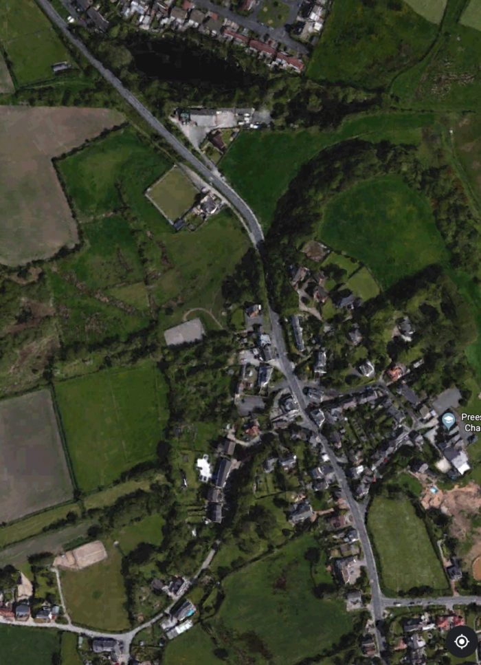
As we have noted, there was a relatively substantial terminus station at Knott End. The extract from the OS 25” Map below shows the station and it’s approaches. [3] The station opened with the line in 1908. It closed to passenger traffic in 1930 and goods traffic in 1950. [2][8]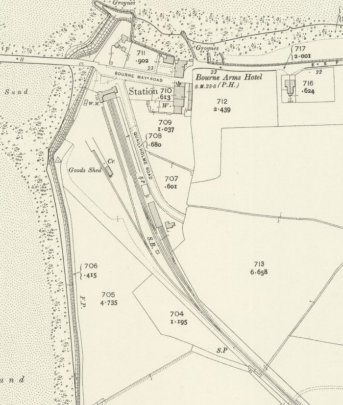 The station is long-gone. Quail Holme Road now extends into an estate of 1960s bungalows. Knott End Cafe sits on the site of the old passenger facilities at the North end of the Station site. It appears to be built on the footprint of the old station building, possibly with an extension at the front.
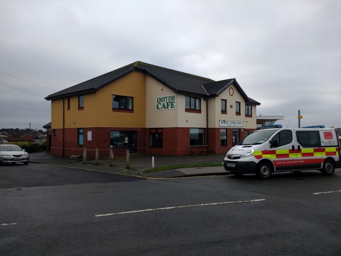 Knott End Cafe.
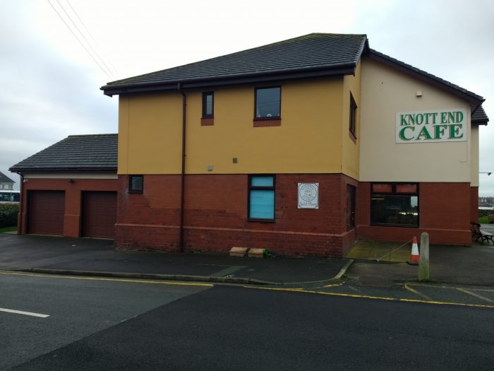 A view of the Cafe building from the Northeast. It seems as though the modern structure was built on the foundations of the old. Older brickwork seems to make up the plinth and a number of courses close to the corners of the building.
A large car park and private housing covers much of the rest of the station area as can be seen in the Google Earth satellite image below.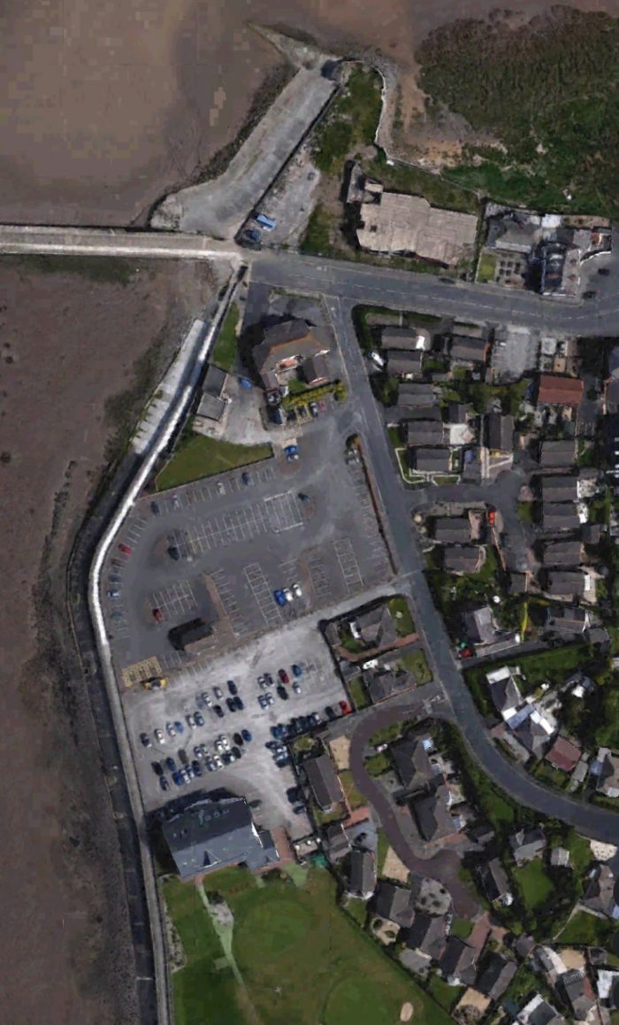 The line left Knott End gradually swinging round to an easterly trajectory. It passed the old Quail Holme which was North of the line and Hackensall Hall to the South of the line, and then crossed Hackensall Road on the level. There was a crossing keepers cottage on the North side of the line.
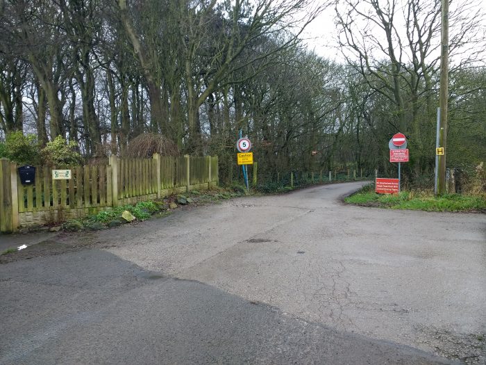 The line crossed Hackensall Road at the point where it became a private access road to Hackensall Hall. The crossing was immediately in front of the location of the modern road signs above (24th January 2020).
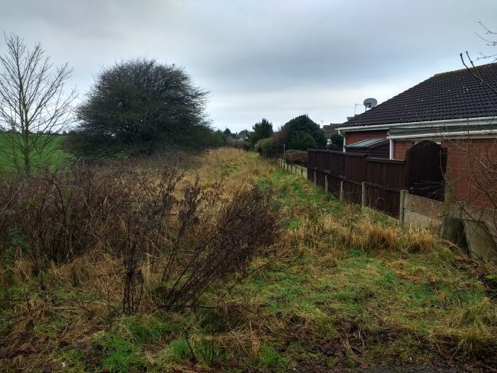 Looking West along the route of the old railway line (24th January 2020).
 Looking East along the old line. The route goes through the garden of the last bungalow on Hackensall Road which is built on the site of the old Crossing Keeper’s Cottage. An early postcard showing Hackensack Hall (24th January 2020).
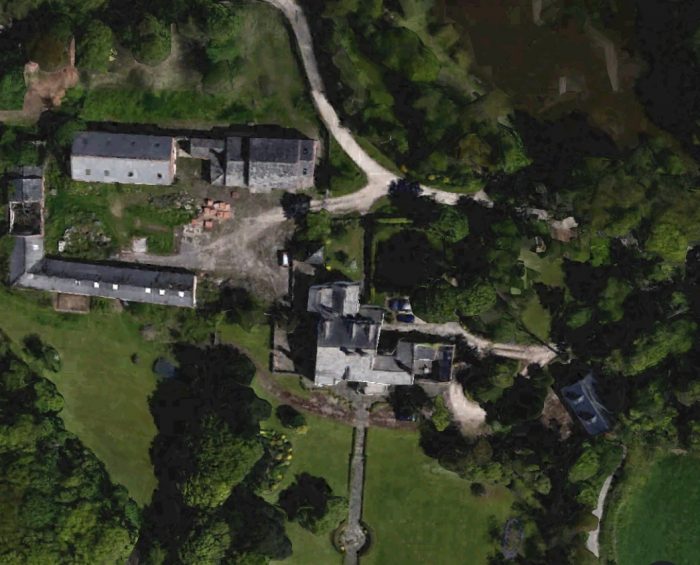 A satellite image of Hackensall Hall in the 21st century.
A short distance further on, the old railway crossed Whinney Lane at a level-crossing as well. No keepers cottage was provided here.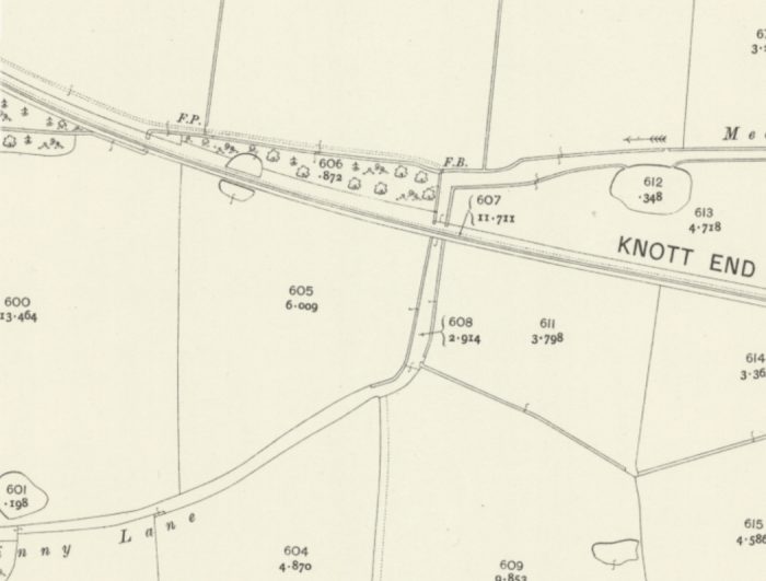
 This extract from Google Earth shows the alignment of the old railway running East-West and crossed by Hackensall Road and the extension of Whinney Lane. This length of the line is now a public right of way. Quail Holme was demolished to make way for the housing estate which is visible on the top left of the satellite image. New New Farm is on the right of the image.
To the East of Whinney Lane and a little beyond New Hey Farm a private siding used to exist which for a time provided excellent income for the line. The siding served Preesall Salt Mines. The mines were owned by the United Alkali Co. Ltd and traffic from the mines was marshalled in the sidings at Knott end before transporting across the railway network. The siding opened in 1912. [4: p22] As a result of this traffic the line was solvent for a number of years. Sadly with the advent of the First World War mist of the income was taken by the Government. After the war, the line was included in the LMS estate and under its watch the LMS managed to upset the United Alkali Co. in negotiations over cartage rates. The result was that, in 1925, the United Alkali Co. installed a pipeline under the River Wyre to another of their sites on the outskirts of Fleetwood (Burn Naze) and terminated their arrangement with the railway company. [4: p25] It seems as though the siding remained in place until 1934. The OS Map extract below [3] shows the mineral railway which remained for a time linking the mine, the jetty at the Wyre and the pumping station south of the village of Preesall. Evidence of the link to the Garstang and Knott End line had disappeared by the time surveys were undertaken for the OS Map. Dave Richardson provides a map of its route in his book. [5: p95]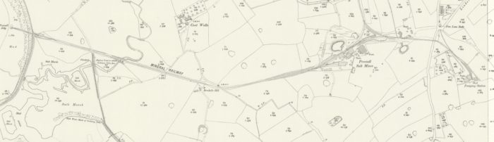 Interestingly, a pumping station from the Preesall Salt Mines and its associated boreholes remain evident to the Northeast of Preesall Station on another OS Map extract from the same series below .
Parrox Hall was then passed to the North of the line, with Curwens Hill Farm to the South. Parrox Hall is one of the oldest family homes in Lancashire with a history stretching back at least 600 years. [7]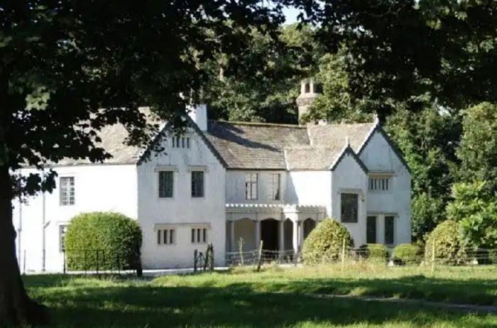 Parrox Hall.
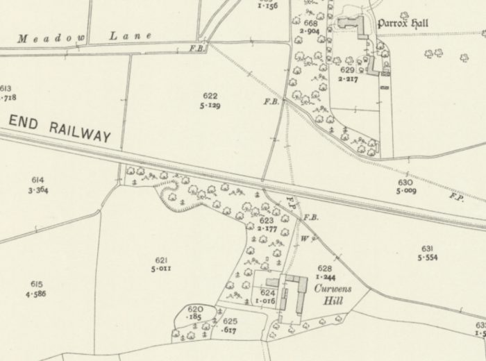 By the time that trains passed under the road bridge into Preesall Station they were travelling due East. The road bridge was expensive to construct. Given that it is the only structure over the line and given the extensive embankments required, it may well have been better for the line if an at-grade crossing had been used. The next two OS Map extracts below show the track layout, and the satellite images show the site in the 21st century.
 The village of Preesall was to the South of the Station. It and the station are shown in the OS Map extract immediately below as they were in the early 20th century, and on the satellite image as they are in the early 21st century.
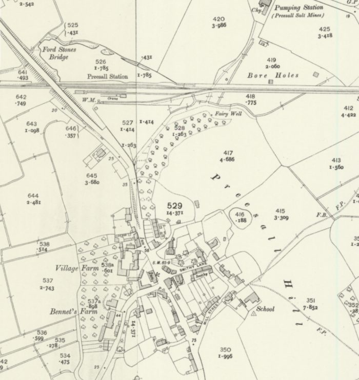
 Preesall Station opened in 1908 , lost its passenger service in 1930 and finally closed to all traffic in 1950. [8] A passing loop was provided on the North side of the main line by 1910. [5: p74] A two-track goods yard was on the South side of the line.
The station access road is shown in the picture below as it was on 24th January 2020. The goods facilities are now redeveloped as an egg-packing plant.
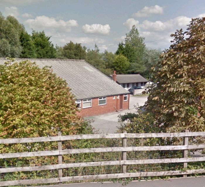 An egg-packing plant now occupies the site of the old station’s goods yard. The main running line of the old railway followed what is now a line of large trees behind the factory. The view above is taken from Google Streetview.
 Looking West back along the formation of the old line towards Knott End from the B5377 (24th January 2020).
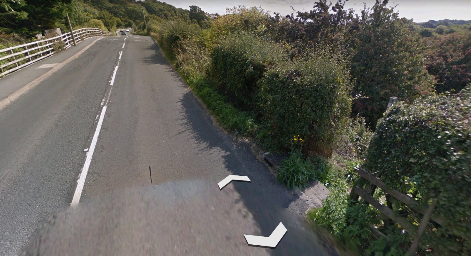 This view from Google Streetview shows the B5377 looking Southeast in the 21st century towards what was the crown of the road over the railway bridge. The opening in the hedge to the right of the image is the footpath down to rail level. The footpath extends in a Westerly direction towards Knott End.
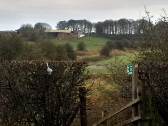 The footpath runs down a slope to join the original rail formation (24th January 2020).
The RAILSCOT website has a series of five pictures from this location which are copyright protected and which are worth viewing on their site. [9]
The small lake on the North side of the line is what remains of the gravel pit excavated by the contractor during the construction of the line. This was used to supply ballast to the work undertaken on the extension between Pilling and Knott End. Dave Richardson notes that the “station had the dubious distinction of languishing in a semi-completed state from January 1890 until work recommenced in the extension at the end of 1907.” [5: p73]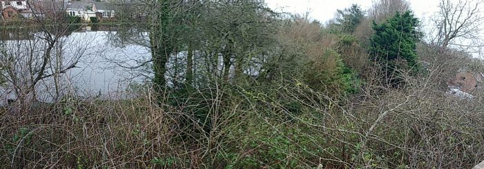 This panorama shows the small lake which was on the North side of Preesall Station and the station site itself. The old mainline and loop are now heavily covered in trees (24th January 2020).
Preesall station’s two goods sidings came directly off the main line with no headshunt. “One ran behind the passenger platform to serve a small goods shed and loading bank. The 1923 LMS report says that the shed was built of timber, but photographs show that it was of … corrugated iron construction, probably wood-framed and on a brick base. The loading bank was equipped with a crane having a capacity of two-tons.” [5: p 74]
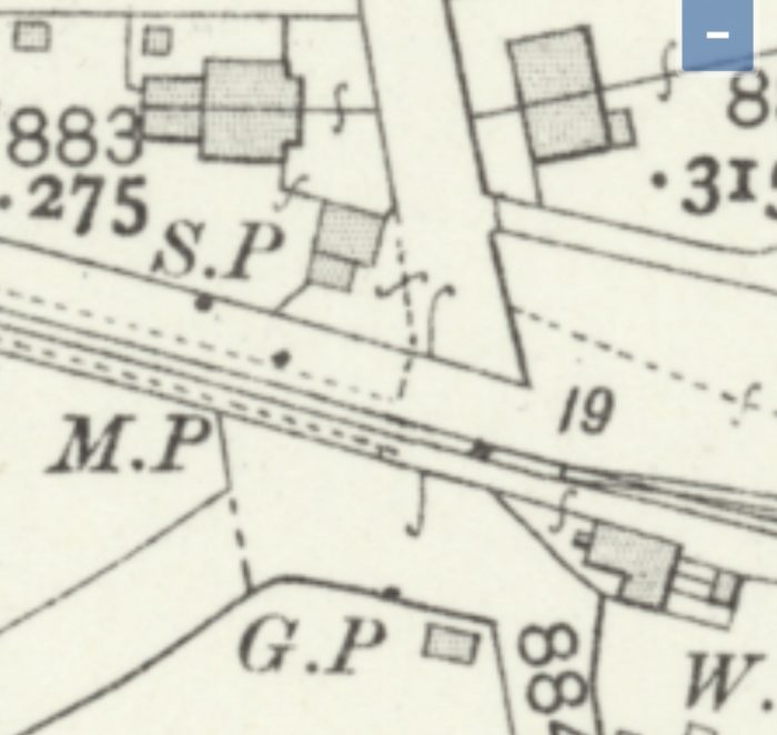
The next crossing was at Sandy Lane, shown on the OS Map below.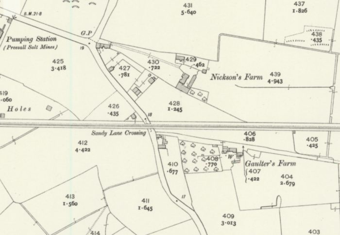 The Crossing Keeper’s Cottage was on the North side of the line, West of Sandy Lane.
 The old line continued East from Sandy Lane across what are, in the 21st century, open fields.
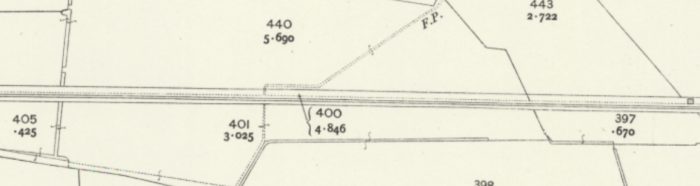
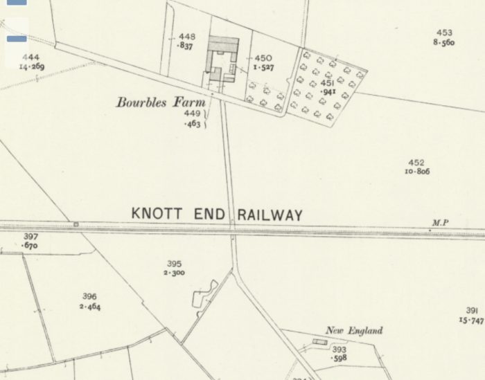 The line passed South of Bourbles Farm and on toward Green Dick’s Lane.
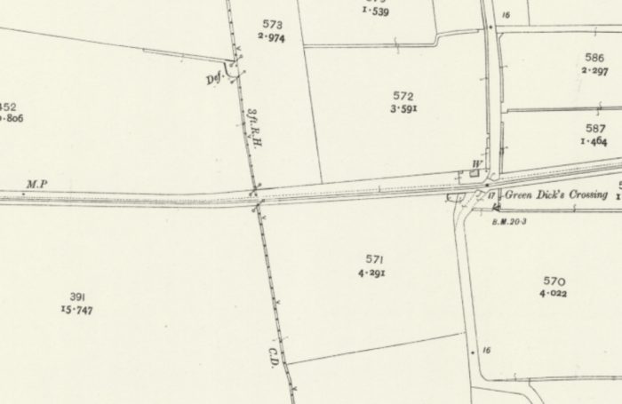 The Crossing Keeper’s Cottage was once again to the Northwest of the Level Crossing. The road crossed the old line at a sharp angle as can be seen on the OS Map extract above. The cottage is own in the Google Streetview image below.
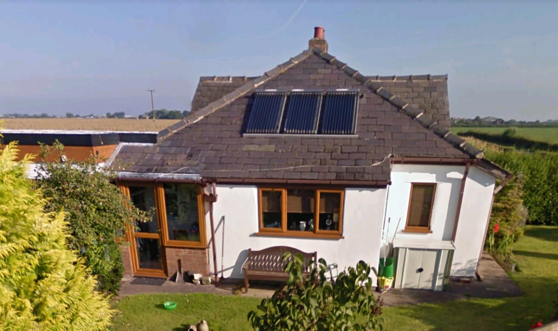 On my visit in January 2020 the skies were more leaden but the two images below look back along the line towards Knott End to the West, and forward in the direction of Pilling and Garstang to the East.
 This picture looks West along the side of what was the crossing keeper’s cottage but gives very little idea other route of the old line to the West. (24th January 2020).
 Taken from a point slightly to the South of the previous image, this picture allows a glimpse back down the route of the old line (24th January 2020).
 This final image at the location of Green Dick’s Crossing looks East. The old line passed through the trees to the left of the open gate (24th January 2020).
From Green Dick’s Crossing the line continued in a generally easterly direction, crossing first Lamb’s Lane and then Carr Lane Crossing.
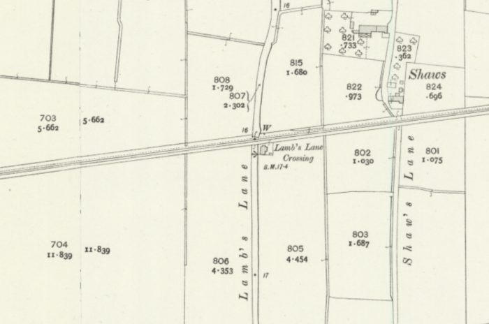 At Lamb’s Lane the crossing keeper’s cottage was to the Southeast of the Crossing.
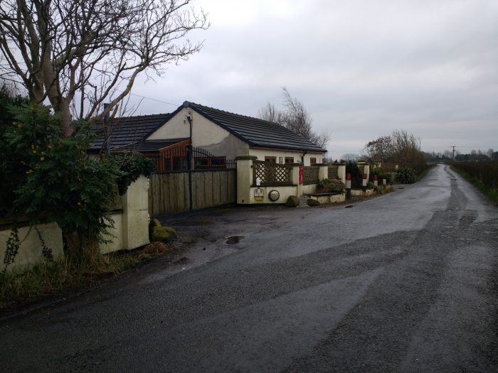 The building on the site of the old crossing keeper’s cottage at Lamb’s Lane (24th January 2020).
 Looking back West along the old line from the site of Lamb’s Lane Crossing (24th January 2020).
 Looking East along the route of the old line. The modern gates will be a couple of metre a east of the old crossing gates (24th January 2020).
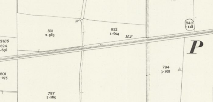
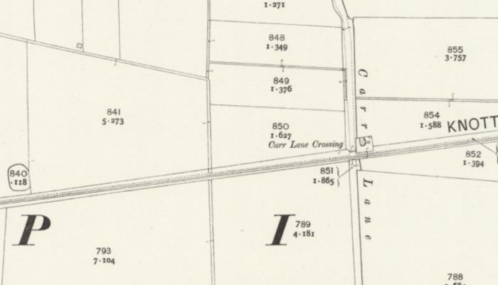 At Carr Lane the Cottage was to the Northeast of the Crossing.
 The Cottage was a substantial older brick structure which appears to have been extended in good-keeping with the original structure. The old line passed to the right of the modern garage (24th January 2020).
 Looking West from Carr Lane. The formation of the old line is approximately under the plastic wrapped bales in the picture. The house just visible on the right was built long after the closure of the line (24th January 2020).
Beyong Carr Lane the old line gradually swung round from an East-Northeast alignment to a East-Southeast alignment, passing to the North of Fold Houses and approaching Pilling.

 Pilling Station was the one time terminus of the line. Finances initially only permitted construction from the West Coast mainline as far as Pilling. For the last years of the 19th century and the early years of the 20th century, locomotives ran round their trains at Pilling and in doing so blocked the road junction to the West of the station.
The Crossing Keeper’s Cottage was to the Southeast of the crossing.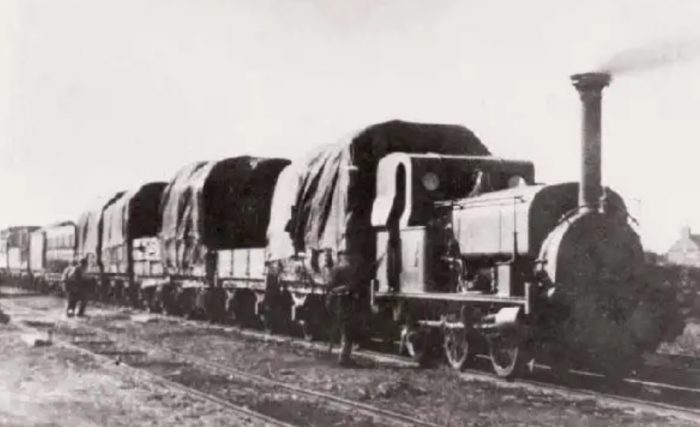 One of the early locomotives on the Garstang to Knott End line. This is either Hope or Farmers’ Friend at Pilling about 1890. [10]
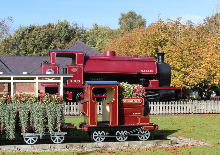 The saddle tank in the picture above has been called ‘The Pilling Pig’, the wooden model has been called ‘The Piglet’. They are sited to the West of the site of The level crossing at Pilling. [11] They stand at the entrance to the Fold House caravan park. The saddle tank is ex-NCB Mountain Ash Hudswell Clarke 0-6-0ST No 1885 of 1955. It took three days to be transported to the site by road in 2001, was lifted into position over the trees and then restored and named Pilling Pig. [12]
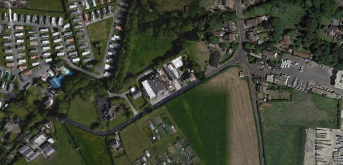 The Fold House Caravan Park is in the top left of the satellite image. The old line ran through the modern caravan park. The old station site is on the right side of the image. The old level-crossing is about a third into the image from the right of the picture.
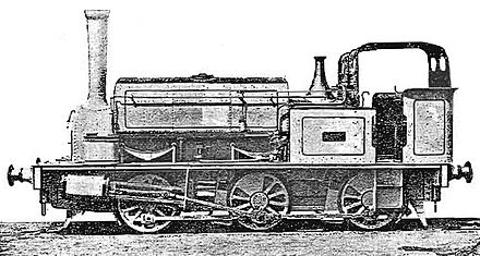 This loco was used on the line. It was a Saddle Tank and so has some similarity to the locomotive on display at the entrance to the caravan park. It is Farmer’s Friend (or “Pilling Pig”), an 1875 Hudswell Clarke 0-6-0ST and the third locomotive on the line.
The road crossing at the West end of Pilling Station. The original branch terminated here with the headshunt for passenger locos at the station crossing the road junction. The crossing keeper’s cottage can be seen on the South side of the line on the East side of the road junction on the above map.
We finish this leg of the journey from Knott End to the West Coast mainline with a view looking across the location of the old level crossing into the old station site. Looking East into the site of Pilling Station. A house has been built over the old line. The Crossing Keeper’s Cottage is still present on the right hand side of the photograph (24th January 2020).
References
1. John Scott-Morgan; British Independent Light Railways; p68-70.
2. https://en.m.wikipedia.org/wiki/Garstang_and_Knot-End_Railway, accessed on 1st January 2020.
3. https://maps.nls.uk/geo/explore/#zoom=17.178395503900667&lat=53.9271&lon=-2.9956&layers=168&b=1, accessed from 2nd January 2020 to 26th January 2020.
4. R.W. Rush & M.R.C. Price; The Garstang and Knott End Railway; Oakwood Press No. 23, Headington, Oxford, 1985.
5. D. Richardson; The Pilling Pig; Cumbrian Railways Association, Amadeus Press, Cleckheaton, 2018.
6. https://rover.ebay.com/rover/0/0/0?mpre=https%3A%2F%2Fwww.ebay.co.uk%2Fulk%2Fitm%2F372660735333, accessed on 22nd January 2020.
7. http://www.blackpoolgazette.co.uk/news/life-inside-lancashire-s-oldest-family-home-1-9317599, accessed on 21st January 2020.
8. https://en.m.wikipedia.org/wiki/Preesall_railway_station, accessed on 22nd January 2020.
9. https://www.railscot.co.uk/img/63/448, accessed on 22nd January 2020.
10. https://www.blackpoolgazette.co.uk/news/reviving-a-forgotten-lancashire-rail-route-dream-1-8379821, accessed on 28th January 2020.
11. https://www.picturesofengland.com/England/Lancashire/Pilling/pictures/latest
12. https://redrosecollections.lancashire.gov.uk/view-item?i=236766&WINID=1580218325907#.XjA31R7Lc0M

Brilliant work. Knott end was used in the early 1900’s for Troop trains. The Troops camped and had a training camp at Knott End.
Thank you!
Thanks very much for this fine piece of work Roger. I live local to Knott End, am passionate about railways and have read two books on the KE & GR. Am planning to do a recce of the gatekeepers crossings in the photo’s. I travel from Knott End to Garstang on a weekly basis and so pass over, or near to what would be various parts of the line. I am also a member of Railway Ramblers and am would love to walk as much of the route as possible. But this last part may be easier said than done as most of when is left of the old track bed has now completely disappeared and is on private land.
Hi John, thank you for taking the trouble to get in touch. Merry Christmas. Roger
Hello Roger
What a fantastic job you have done with this! I am currently in the process of building this route for Train Simulator and was wondering if I could credit you and your website when I eventually publish the route?
It would be great to hear from you and I can explain in a bit more detail what exactly I am undertaking
My email address is jgregson28@yahoo.co.uk
Kind regards
James 🙂
Pingback: The Garstang to Knott End Railway again. … | Roger Farnworth