
Glasson Dock sits at the mouth of the Lune Estuary to the Southwest of the City of Lancaster.
Navigation up the River Lune to the Port of Lancaster was not easy. In 1779, the Port Commission decided to build a dock/port at the coast. Land was purchased and, by 1782, a pier had been constructed. Delays occurred and it was not until March 1787 that work was completed. When the dock was opened it could hold up to 25 merchant ships. [2: p182]
Following the demise of Lancaster as a port, Glasson Dock was, at its height, the largest port in the north west, importing cotton, sugar, spices and slaves from Africa and the Indies. [3]
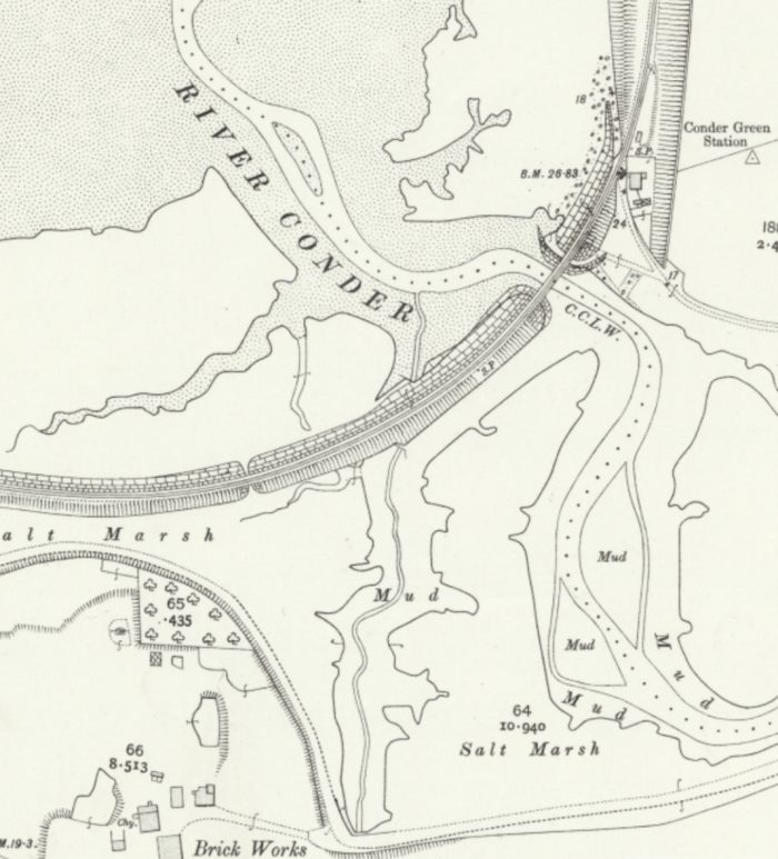
Lancaster Canal was important in affording swift distribution of cargo landed at the port into the heart of industrial Lancashire. [3] The construction of the Lancaster Canal started in 1792. A connection from the canal to the sea at Glasson was considered, ”and John Rennie’s plans for a Glasson branch formed the basis for an Act of Parliament which was obtained in May 1793. No work took place, [2: p186] and it was not until 1819 that the plans were revived, when another Act of Parliament was needed to raise additional finance. The estimated cost of the branch was £34,608, and work began in 1823.” [1]
The branch was only 2.5-mile (4.0 km) long. Over this length it dropped through 52 feet (16 m) from Galgate. The canal itself was completed in December 1825, but financial difficulties meant that warehousing and wharves were not constructed immediately and the growth of trade was slow. ”However, by 1830 over 10,000 tons of goods passed through the dock, most of it passing on to the canal. Because the locks were 14 feet (4.3 m) wide, smaller ships did not have to transship their cargoes to canal boats, as they could sail through the dock and along the canal. The first such boat to do so was a schooner called Sprightly, which carried slate to Preston in May 1826. Incoming trade included slate, timber, potatoes and grain, while coal was exported through the port to Ulverston, North Wales and Ireland.” [1][2: p195-197]
The settlement of Glasson remained relatively small and only saw some limited growth in the 19th century. A shipyard and Customs House were built in 1834, a Watch House in 1836, a Church in 1840, and a Dry Dock in 1841. The shipyards were largely concerned with ship repair rather than shipbuilding. [1]
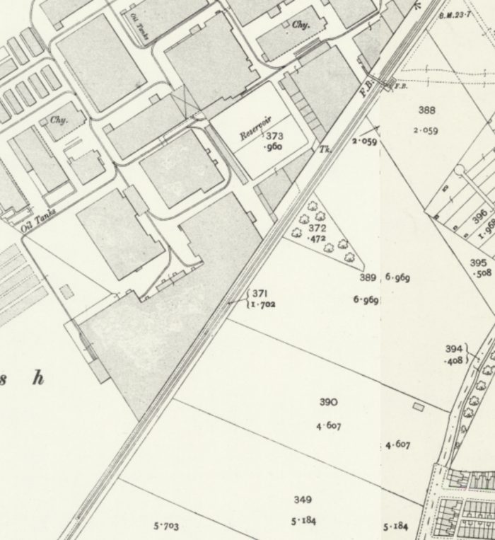
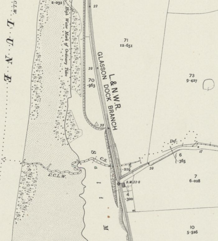
The quay was not connected to the railway network until 1883, [1] when a branch line from the LNWR mainline through Lancaster was completed. The branch also connected St. George’s Quay in Lancaster to the mainline. Lancaster Archives have a copy of the 1884 plan showing the branch and St. George’s Quay bat a scale of 2 chains to 1 inch. [4] More detailed maps can be sourced from the National Library of Scotland website. [5]
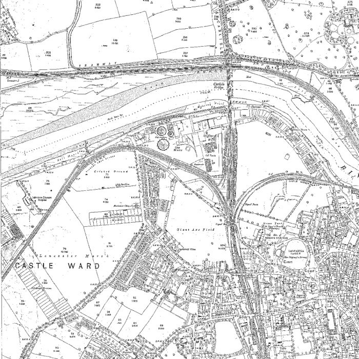
Passenger trains for Glasson Dock left the Station at Lancaster travelling North from the down bay platform which was on the West side of Castle Station. Their route is shown dotted on the map below, turning from the North to the Southwest and running alongside the mills on the south side of the River Lune, before heading South towards Glasson Dock. The second map below shows the branch leaving the North end of Castle Station and then heading away to the West on the South side of the Lune. The connection to St. George’s Quay is also evident. Both of these maps are available on the Lancashire Archive website. [7]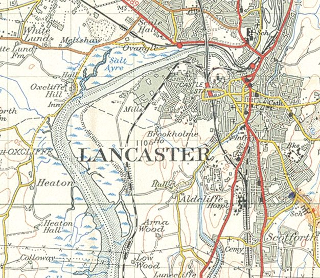

 Both Long Marsh Lane and the Glasson Dock Branch were on a downgrade towards the River Lune. The following OS Map shows the branch crossing the highway once again. This time it is Lune Road, very close to its junction with Long Marsh Lane. Also visible on the map is most of the length of the short Lancaster Quay Branch along St. George’s Quay. [5]
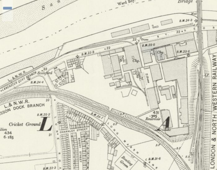
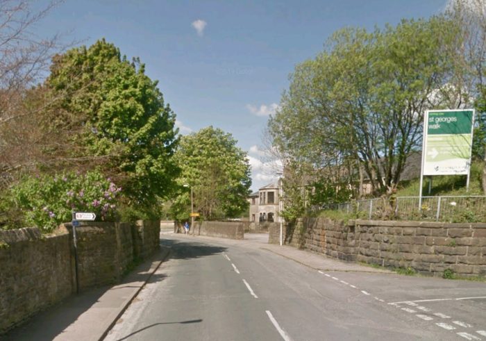 The location of the bridge which carried the Glasson Dock Branch over Lune Road (Google Streetview, November 2019).
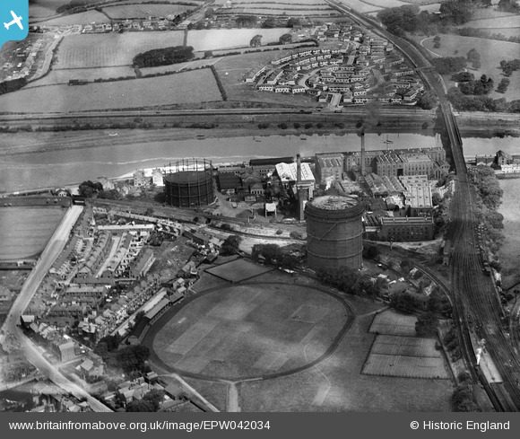 The route of the Glasson Dock Branch can clearly be seen leaving the mainline North of Castle Station in Lancaster and curing away to the West. The bridge over Lune Road is on the left of the image. [9]
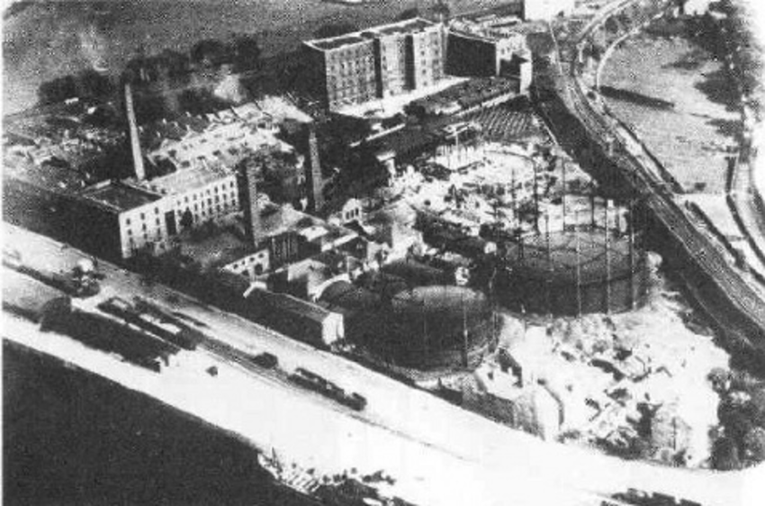 St. George’s Quay and Gas Works shown from the air in the 1950s. The photograph is taken from the Northwest. The Glasson Dock Branch can be seen to the top right of the picture. The Lancaster Quay Branch is in the foreground. [10]
To the West of Lune Road the branch continued on a downgrade to meet the Lancaster Quay Branch and then on towards the Southwest alongside the Lune Mills. [5]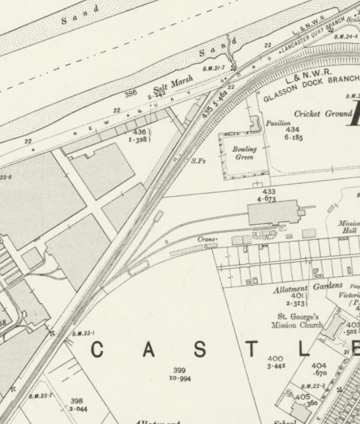
 The line the continued out towards the foreshore of the Lune Estuary. [5]
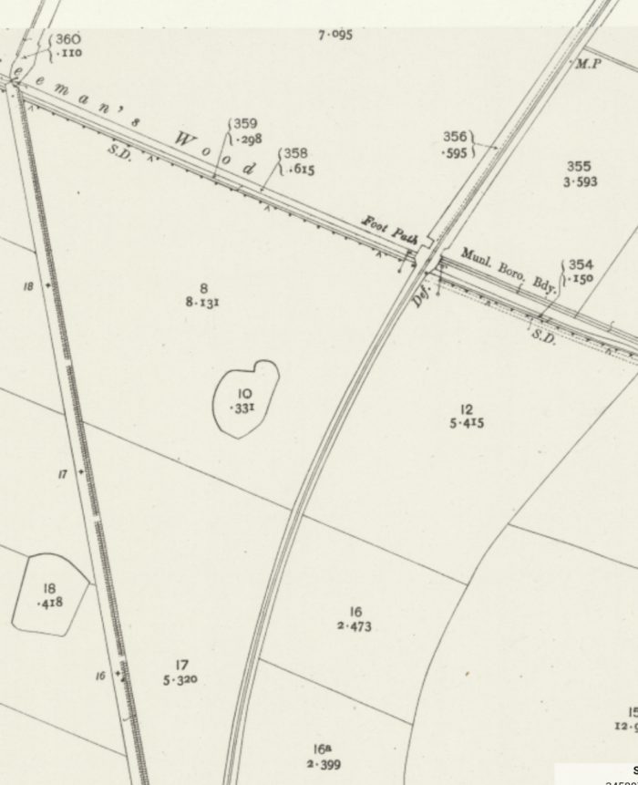
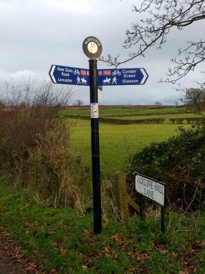
 The lane shown approaching the railway from the East on the OS Map extract immediately above [5] linked the line to Aldclffe and Aldcliffe Hall. A signal post is marked on the Mao at this location but no formal halt was provided for the residents of Aldcliffe Hall.
Aldcliffe Hall was a 19th-century country house, now demolished, which replaced a previous mediaeval building, on the bank of the Lune estuary. It was built in a porous local stone, it was covered in stucco for protection. The building was demolished in the 1960s. The estate was first identified in 1557 as belonging to the Dalton family. Their lands were forfeit to the Crown and their old hall was demolished and replaced by a new building in 1817 by Edward Dawson. [11]
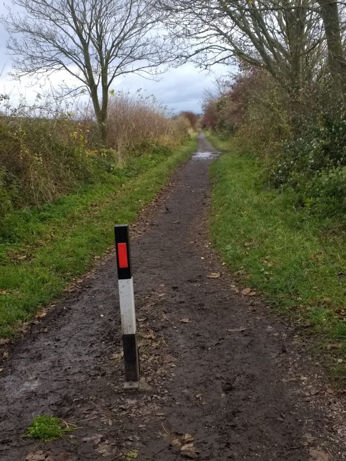
The next three pictures are photographs taken by me in November 2019 at the point where the lane-way meets the old railway route. The first looks back north towards Lancaster. The second shows the signpost at Aldcliffe Hall Lane and the third looks ahead towards Glasson Dock.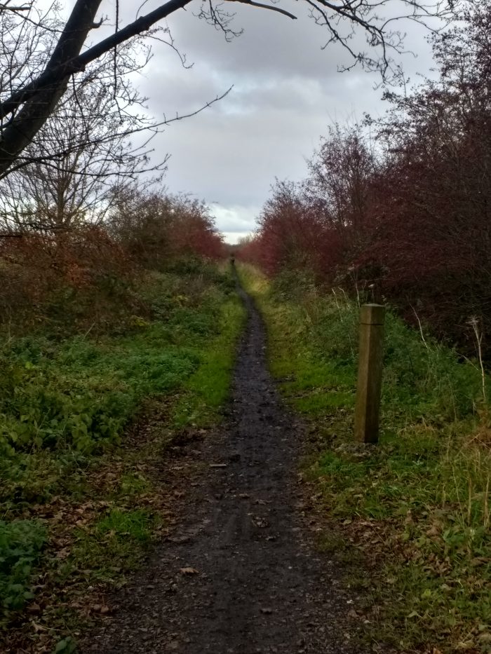
 From Aldcliffe Hall Lane, the railway continued in a Southerly direction along the foreshore.
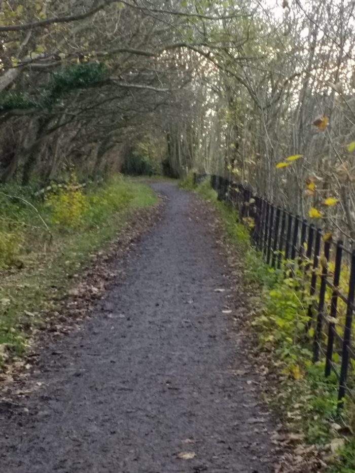
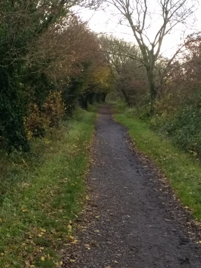
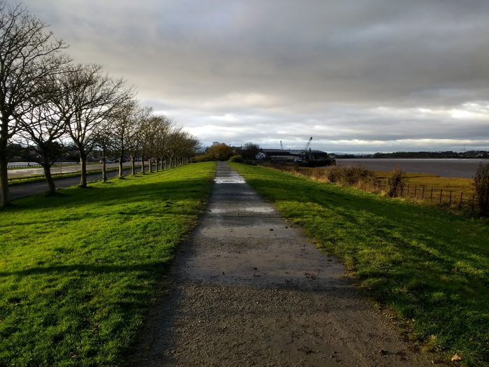
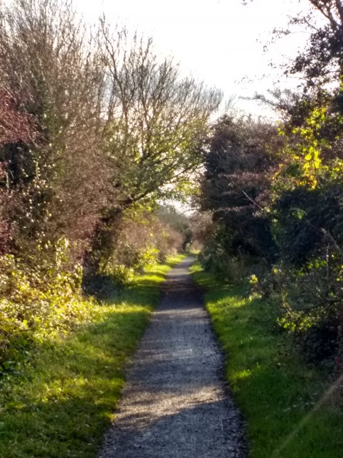 Typical of the cycleway which now (November 2019) follows the old railway formation to the North of Ashton Hall halt (my photograph).
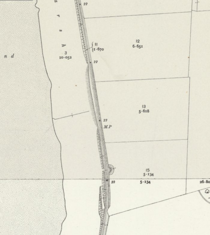
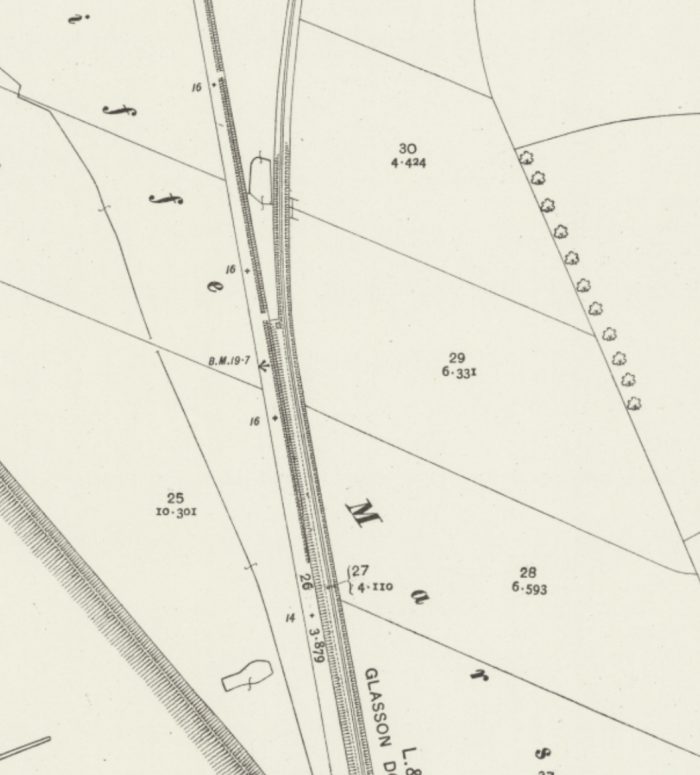
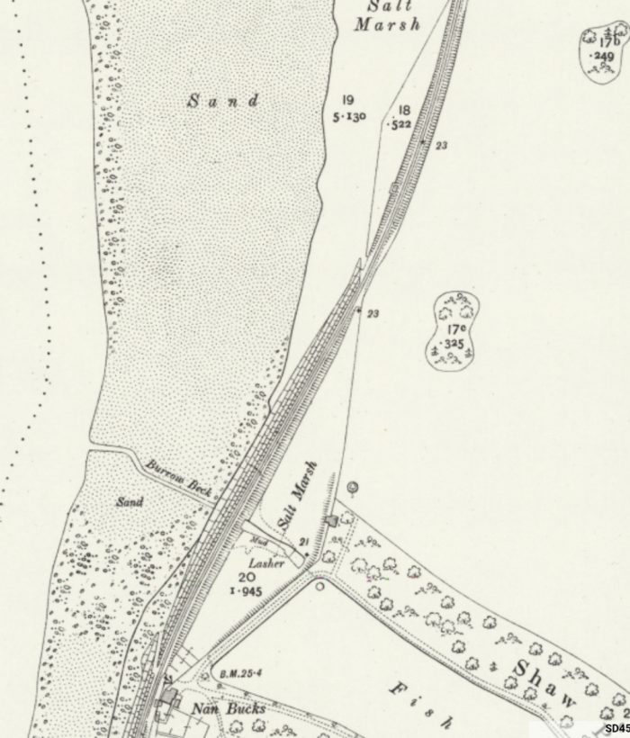 The next significant point on the line can be seen on the OS Map extract immediately above – the private halt for Ashton Hall at Nan Bucks.
 Ashton Hall Private Halt, circa 1960s, © Graham Hibbert. [12]
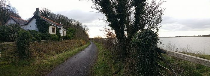 The Ashton Hall halt in private ownership in November 2019 (my photograph). This image emphasises the proximity of the line and halt to the River Lune at this point.
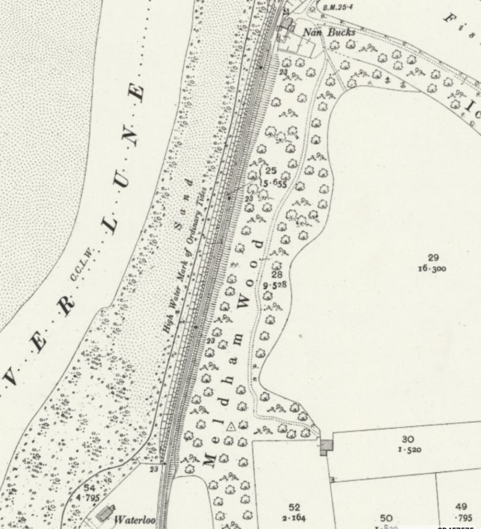
 The old line ran alongside Meldham Wood and the estate of Ashton Hall which is now Lancaster Golf Club (November 2019, my photograph).
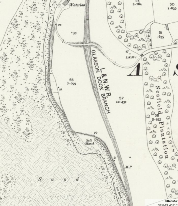
 Further South, also in November 2019, approaching the location of the arched accommodation bridge over the old line (my photograph) which can be seen on the OS Map above. The property at Waterloo has, in 2019, been replaced by a newer building closer to the old railway line.
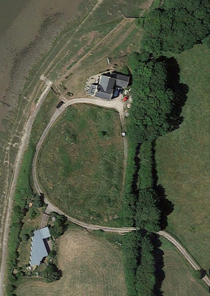 This satellite image shows the replacement property at Waterloo, the accommodation bridge and another new property in the early 21st century (Google Earth).
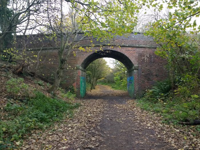 The arched accommodation bridge which provides access to the foreshore and to a private property to the West of the line. To the East of the line the lane leads to the Ashton Hall Garden Centre (November 2019 – my photograph).
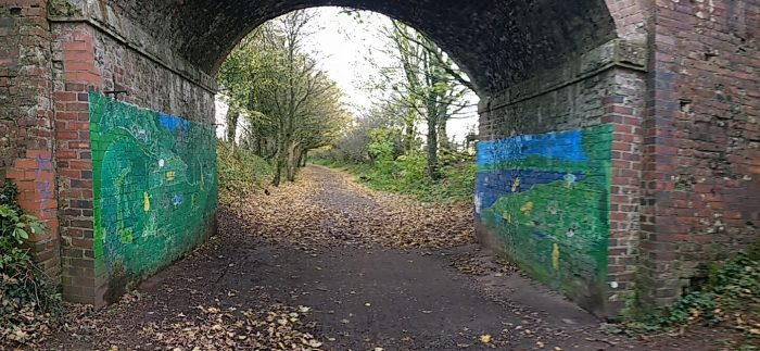 The bridge abutments have been decorated by primary school children from Thurnham school (November 2019, my photograph).
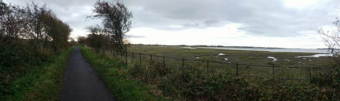
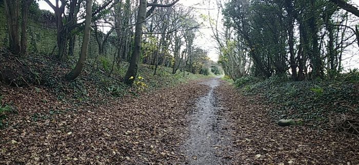
 These two pictures show the formation of the old line travelling towards the Station at Conder Green (November 2019, my photographs). The OS Map extracts below track the old line through the Station. [5]
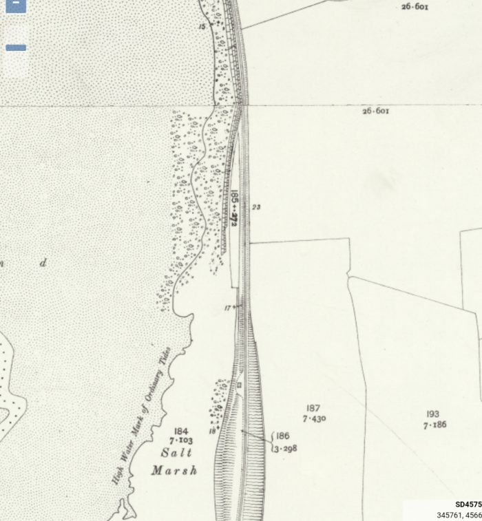
 Conder Green was the last stop on the branch before Glasson Dock Station and the terminus of the line. Conder Green Station sat just to the North of the confluence between the Conder River and the River Lune.
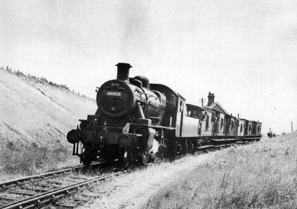 This picture was taken facing South towards the station building at Conder Green, it shows No. 46433 working a RCTS Railtour on the 20th June 1964 (c) Ron Herbert. [16]
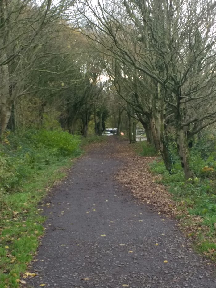 This picture shows the approach to Conder Green Station from around a 100 metres further South than the monochrome image above (November 2019, my photograph).
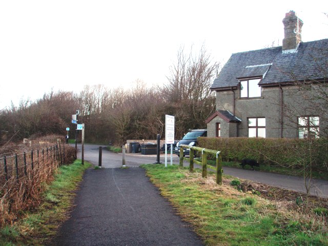 Conder Green Station looking North towards Lancaster in 2008, (c) Mark Bartlett. There is now a cafe to the left of and attached to the station building [15]
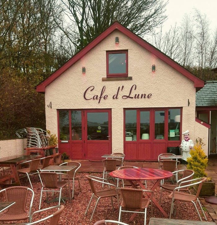 Cafe de Lune [17]
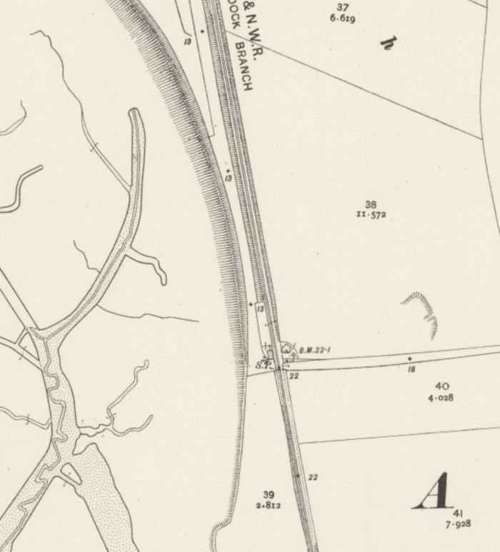
Immediately beyond Conder Green Station was the most significant structure on the branch – the bridge over the Conder River.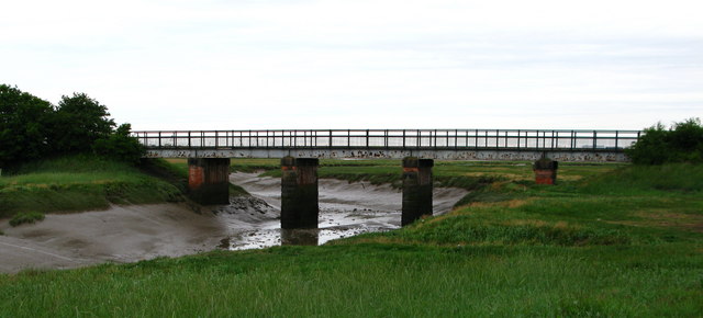 Conder Green Railway Bridge now carries a cyclway over the River Conder © David Rogers. [18]
Two photographs taken in the late afternoon light at the same location. The first looks East towards Conder Green the second looks West towards Glasson Dock. Both are taken looking along the route of the old line into Glasson Dock Station (November 2019, my photos).
After crossing the River Condor trains turned to the West to head for Glasson Dock.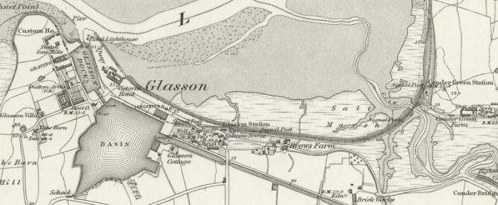 This 1890 OS Map shows the approach to Glasson Dock from Conder Green. There was little change throughout the years of the 20th century until the line was finally closed in the 1960s [5]
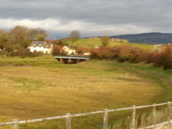 The view back towards the Conder River Bridge and the Cafe de Lune at the site of the old Conder Green Station (November 2019, my photo).
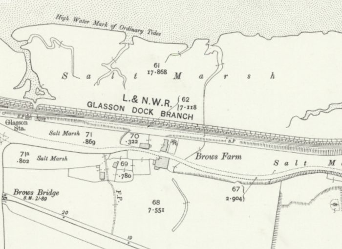 From this point the branch ran along a causeway alongside the River Lune. Glasson Station’s location can be picked out to the left of the OS Map above. [5]
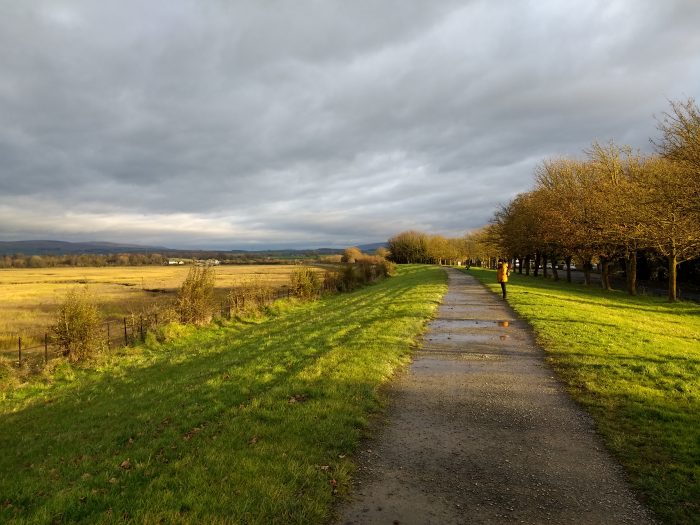 Two photographs taken in the late afternoon light of a November day at the same location on the branch line close to the position of Glasson Dock Station. The first looks East towards Conder Green, the second looks West towards Glasson Dock.
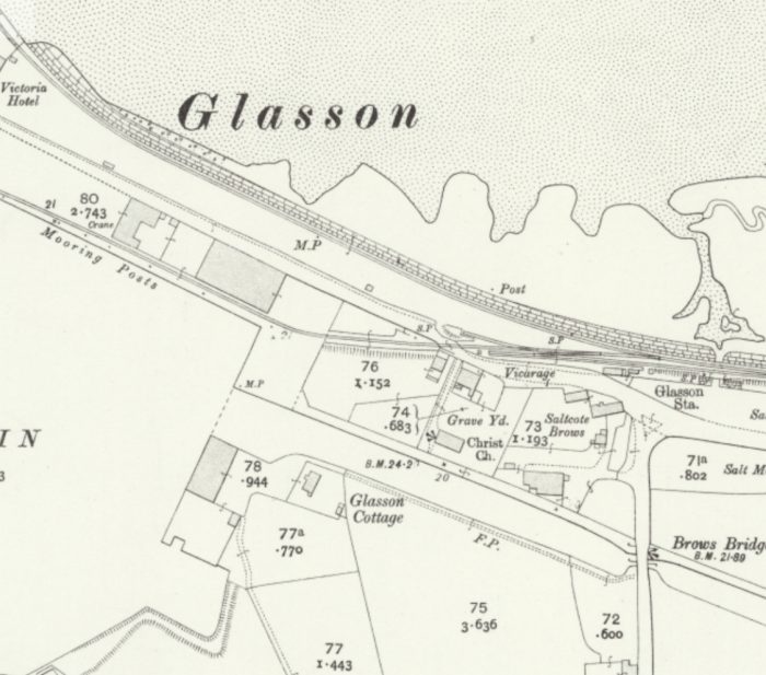 Glasson Dock Station was on the right of the above OS Map and is shown in a few images from the late 1950s and early 1960s below. [5]
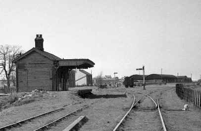 Glasson Dock Station in the early 1960s. [13]
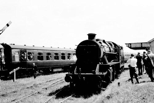
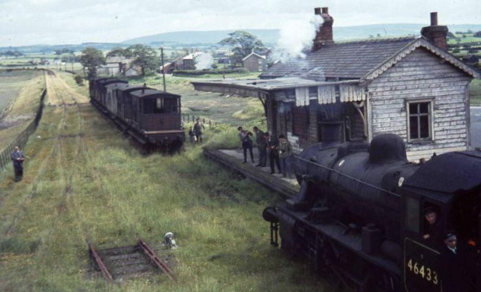 A rail tour at Glasson Station after closure of the Line. [14]
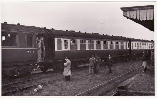
 Two pictures of Glasson Dock from a May 1960 rail tour, © Ron Herbert. [19][20]
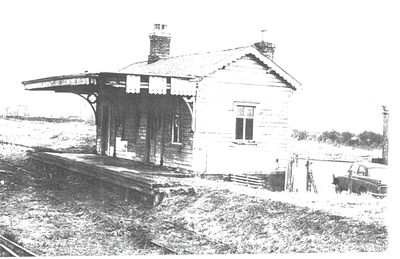 Glasson Dock Railway Station after Closure in the 1960s. [21]
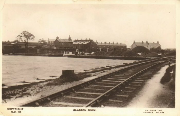 There were two lines at the end of the Glasson Dock Branch. One served riverside. The other ran alongside the large canal basin(and is shown on the postcard image above). Both terminated at the Warehousing, Dock and Quay. [22]
 This OS Map extract shows the very end of the branch which served the River Lune and Glasson Dock. The old dry dock is visible to the West of Glasson Dock. [5]
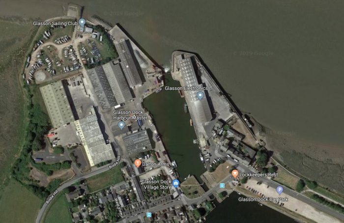 The same location today. In 2019, the route of the railway is highlighted by the cycle-way which enters from the right of the satellite image. The remainder of the track-bed and sidings at the dock have been lost under various developments and car-parks.
References
- https://en.m.wikipedia.org/wiki/Glasson_Dock, accessed on 11th November 2019.
- Charles Hadfield & Gordon Biddle; The Canals of North West England, Vol 1 (pp.1-236). David and Charles, Newton Abbot, 1970.
- https://www.visitlancashire.com/explore/glasson-p93070, accessed on 12th November 2019.
- https://discovery.nationalarchives.gov.uk/details/r/ffe58ab1-a697-4b97-ab7c-c10bc165d8a0, accessed on 14th November 2019.
- http://www.nlshttps://maps.nls.uk/geo/explore/#zoom=15.079642735363752&lat=53.9987&lon=-2.8474&layers=168&b=1, accessed on 12th November 2019.
- https://www.lancasterguardian.co.uk/news/traffic-and-travel/hs2-stop-lancaster-critical-business-leisure-and-tourism-growth-city-657294, accessed on 14th November 2019.
- https://www3.lancashire.gov.uk/environment/oldmap, accessed on 14th November 2019.
- https://images.historicenglandservices.org.uk/landscapes/aerial-views/lancaster-castle-epw002086-5554481.html
- https://britainfromabove.org.uk/en/image/epw042034, accessed on 17th November 2019.
- https://www.researchgate.net/figure/St-Georges-Works-the-gas-works-and-Ford-Quay-from-the-air-circa-1950s-now-Luneside_fig1_273168246, accessed on 17th November 2019.
- https://en.m.wikipedia.org/wiki/Aldcliffe_Hall, accessed on 18th November 2019.
- https://www.flickr.com/photos/grahamhibbert/6002463424, accessed on 17th November 2019.
- http://publictransportexperience.blogspot.com/2016/09/have-you-been-to-conder-green-1.html, accessed on 21st November 2019.
- https://www.nwemail.co.uk/features/nostalgia/16433201.nostalgic-rail-trip-from-morecambe-to-windermere-in-the-last-days-of-steam, accessed on 17th November 2019.
- https://www.railscot.co.uk/img/18/239, accessed on 21st November 2019.
- https://www.stevependrillphotography.com/photographers-ramblings-glasson-dock-curiosities, accessed on 22nd November 2019.
- https://www.facebook.com/CafeDLuneAtCondorGreen/photos/a.1519968901661822/1519968914995154/?type=1&theater, accessed on 22nd November 2019.
- https://www.geograph.org.uk/photo/1969072, accessed on 26th November 2019.
- https://www.sixbellsjunction.co.uk/50s/540501sl.html, accessed on 17th November 2019.
- https://www.sixbellsjunction.co.uk/60s/600529sl.html, accessed on 17th November 2019.
- https://redrosecollections.lancashire.gov.uk/view-item?i=237954&WINID=1574015967496#.XdGUXHHLe9e, accessed on 17th November 2019.
- https://images.app.goo.gl/q7qxLb3aTvfAj2Ls9, accessed on 17th November 2019.

First and foremost may I say what a superb production, the photograph of 46433 near Conder Green is working a RCTS Railtour on the 20th June 1964 and not the 1950`s. as stated. I took the photograph and would appreciate my name been credited Ron Herbert. The Railway Correspondence & Travel Society organised the tour which was booked to leave Lancaster Castle at 2/15pm for a return journey to Glasson Dock. I am not sure where you obtained the photograph, but if you would like a copy taken from my original negative please let me know.
Hello Ron,
First, please accept my apologies, I was unable to find out who the photographer was.
I found the picture on this link ….. https://www.stevependrillphotography.com/photographers-ramblings-glasson-dock-curiosities, on 22nd November 2019.
I have updated the blog to provide your copyright under the picture concerned and I have changed the text as well. Neither I, nor Steve Pendrill, could determine who had taken the photograph.
It is entirely my responsibility, however, that it has been included in this blog without having been able to make contact with you, so, once again, please accept my apologies.
It would be brilliant to have a copy of the original.
Yours sincerely
Roger
This is an excellent guide to a favourite walk. A friend of mine used to work on the Glasson branch line, and rode on the last train from Glasson to Lancaster. One of his tasks on that last journey was to remove the oil lamps from the brackets under the accommodation bridge. The brackets can be made out on the lower of the two pictures of the bridge shown, just above the height of the wall paintings on the left hand side. One is near the front of the bridge, the other near the back.
Many thanks for this interesting collection of information. My last visit to Glasson Dock, as a small boy in 1960, is engraved into my memory. I was already a railway fanatic back then, and it was the first opportunity I had had to run along an abandoned trackway, overgrown with weeds which obscured the small pit close to a semaphore signal where I fell down and cut my knee. This dampened my entusiasm for a little while!
This is a great ppost thanks