Letterkenny once had two railway stations immediately adjacent to each other. One was the terminus of the County Donegal Railways Strabane to Letterkenny branch. The other was a through station on the Lough Swilly (when operation in the first half of the 20th century it’s formal title was the ‘Londonderry & Lough Swilly Railway’).
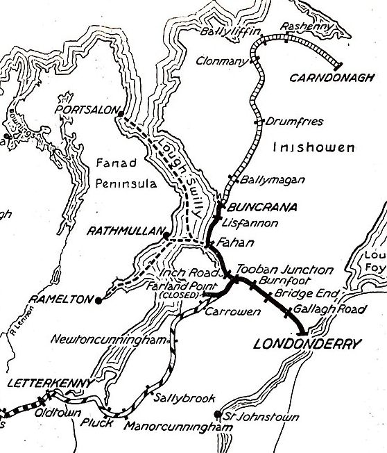
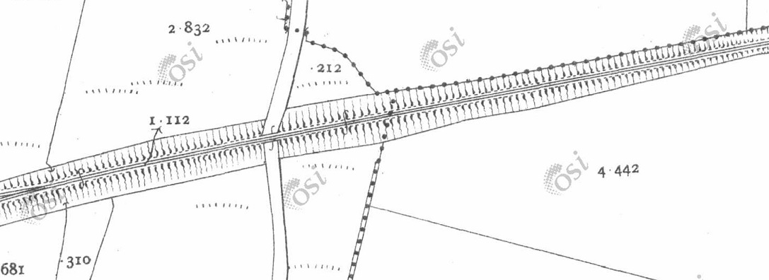
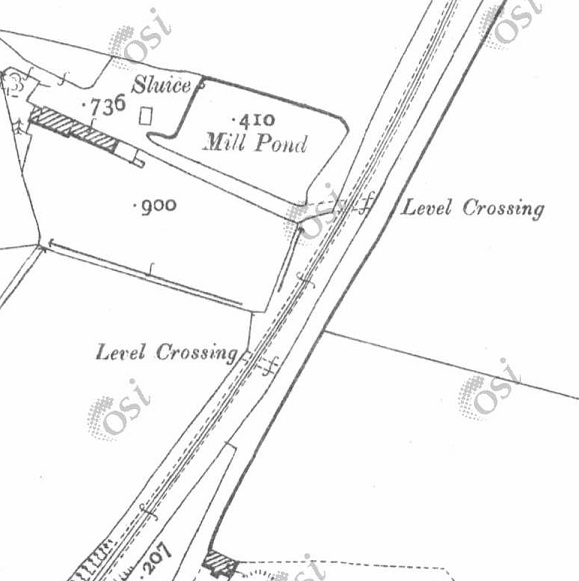
The two railway stations in Letterkenny lay side by side. That to the North was the terminus if the County Donegal Railways branch which connected Letterkenny to Strabane. That to the South was the Lough Swilly station through which passed trains between Burtonport and Derry. OSi 6″ to 1 mile last series. [3]The same area as shown on the railmaponline.com satellite imagery. Contrary to what appears on the image, both railway lines ran on the South side of Ramelton Road. That shown in Orange is the Lough Swilly line. [4]
In an East-Southeast direction, the two companies’ lines ran parallel for some distance, before the Co. Donegal line headed away to the South through Convoy and Raphoe before crossing the border at Lifford and meeting the other Co. Donegal lines at Strabane. The Loch Swilly found its way to Derry via Tooban Junction where a significant branch line to Buncrana and Cardonagh left the line to Derry.
To the West, the Lough Swilly’s Burtonport Extension Railway meandered across the moors and between small villages nearer the coast.
Three articles cover the Strabane to Letterkenny branch of the Co. Donegal Railways. They can be found on the following links. ….
The Lough Swilly’s line between Derry and Letterkenny was built in stages and included a change of track gauge from 5ft 3in to 3ft.
“The railway was initially planned as the Derry and Lough Swilly Railway Company when an application for incorporation was filed in 1852, … The company opened its first line, a 5 ft 3 in (1,600 mm) link between Derry and Farland Point, on 31st December 1863. A branch line between Tooban Junction and Buncrana was added in 1864 and much of the Farland Point line was closed in 1866.” [1][2: pxiv]
Wikipedia’s history of the railway company goes on to say that “in 1883, the 3 ft (914 mm) narrow gauge Letterkenny Railway between Cuttymanhill and Letterkenny was opened and the L&LSR connected with it by reopening the Tooban Junction – Cuttymanhill section of its Farland Point line. The L&LSR worked the Letterkenny Railway, and in 1885 it converted its track from 5 ft 3 in (1,600 mm) gauge to 3 ft (914 mm) narrow gauge to enable through running. In 1887, ownership of the Letterkenny Railway passed to the Irish Board of Works, which continued the agreement by which the L&LSR operated the line.” [1][2: pxiv & p3]
“Carndonagh was reached by an extension completed in 1901 and Burtonport by a one completed in 1903. Both lines were constructed as joint ventures with the UK Government, with ownership and liabilities shared between the two parties. During this period the company did not make a profit, and struggled to meet its debts.” [1][2: p2 & p3]
Letterkenny to Newtoncunningham. The L&LS railway is shown on this extract from OSi mapping of the mid-20th century. [3]
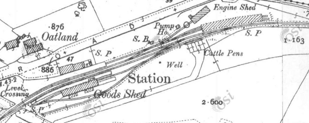
The first map extract from OSi mapping which appears close to the top of this article shows the Co. Donegal and the Lough Swilly stations in Letterkenny. The 6″to 1 mile series as digitised is not the clearest mapping. An earlier 25″ to 1 mile series shows only the Lough Swilly line but is of a higher quality.
Ernie’s Railway Archive on Flickr has a range of photographs of the L&LS Letterkenny Railway Station site from the 1950s, the links are embedded here below, click on each link to see the image in Ernie’s Railway Archive on Flickr:
https://flic.kr/p/2nMqBvu – The L&LSR Station site from the East in 1952. The carriage shed is closest to the camera on the right of the image. The locomotive shed and turntable are hidden behind the carriage shed. At the centre-top of the image, the Goods Shed can be seen.
https://flic.kr/p/2nM8xYs – The Goods Yard of the L&LSR in 1952. Beyond wagons L&LSR No. 124 and L&BER No. 73 the Goods Shed and the passenger station building can be seen.
https://flic.kr/p/2nWyB5y – The L&LSR Goods Yard in 1952. The side elevation of the Goods Shed is visible beyond the wagons in the yard. Prominent in the picture is L&LSR Wagon No. 71.
https://flic.kr/p/2nCR8dg – L&LSR No. 12 is featured in this image from 1952. No. 15 is just poking its nose into the shot on the left.
https://flic.kr/p/2kHNdD9 – L&LSR No. 8 is being turned on Letterkenny’s turntable on 27th June 1952.
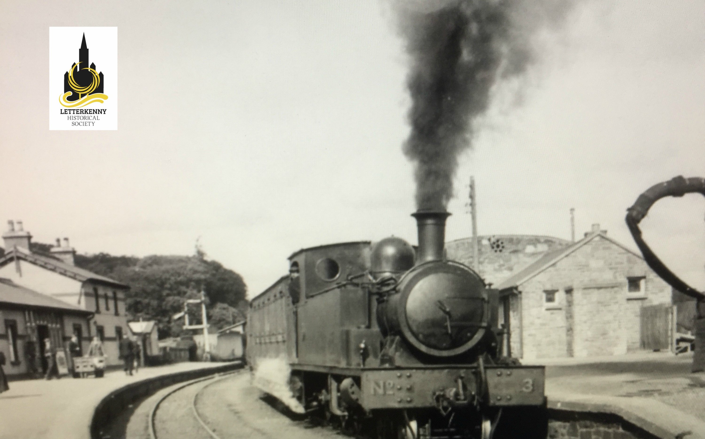
https://flic.kr/p/BWoyiF – L&LSR No3 at Letterkenny. On the left, the image is framed by the wall of the Goods Shed. The crossing gates at the West end of the station are visible beyond No. 3’s train. The passenger facilities are on the right. Note the coach acting as a brake van for the train. (c) JW Armstrong/ARPT
https://flic.kr/p/BvajsP – L&LSR No. 12 in the Engine Shed at Letterkenny, (c) JW Armstrong/ARPT
https://flic.kr/p/2ma5Lo3 – The L&LSR Station at Letterkenny on 1st July 1959 after the rails had been lifted. The Goods Shed door is closed (on the left) and the station buildings are on the right.
https://flic.kr/p/2k1hGvQ – The L&LSR operated a daily goods service by lorry after the closure of the line. A company rail lorry bearing the number plate IB7024 is shown standing where trains would once have passed, adjacent to the station building at Letterkenny. The photograph was taken on 23rd August 1954.
Other photographs of Letterkenny’s L&LSR railway station can be found on Flickr or elsewhere on line:
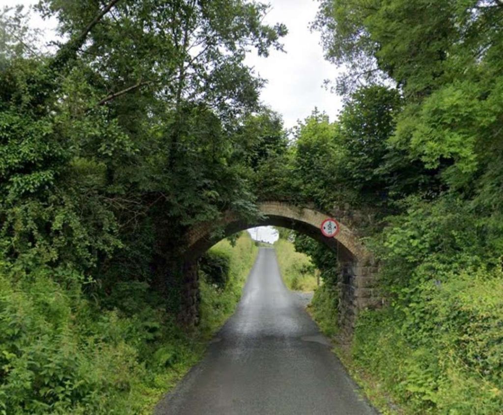
Dave Bell and Steve Flanders describe the use of the bridge arches in the 1980s like this: “The present owner of the filling station has made good use of the … bridge by bricking up one side and building a garage against the other. In effect he now has a garage with three bays, the roof of which is actually the side road.” [18: p47] There are two pictures of the arched bays in Bell and Flanders book.
Kerry Doherty also very kindly supplied this photograph which shows the arches of the old bridge inside the garage facility, (c) Dave Bell. [17]
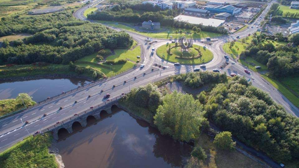
A short distance to the South East the CDR branch crossed the Lough Swilly and turned away to the South.
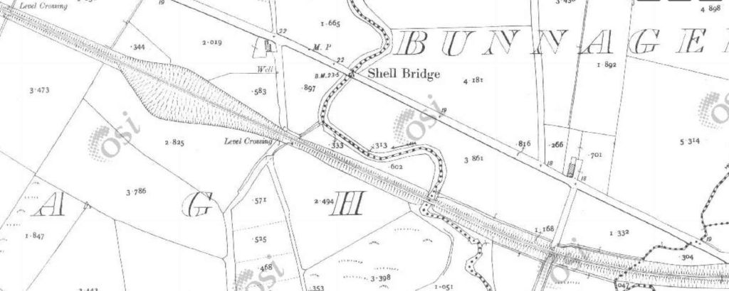
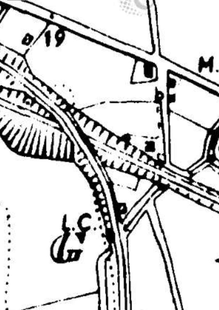
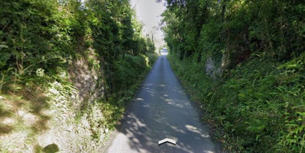
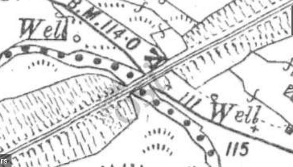
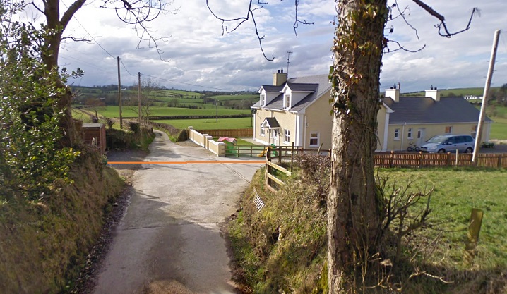
A short distance to the East of the over bridge the Lough Swilly line crossed another road at a level crossing.
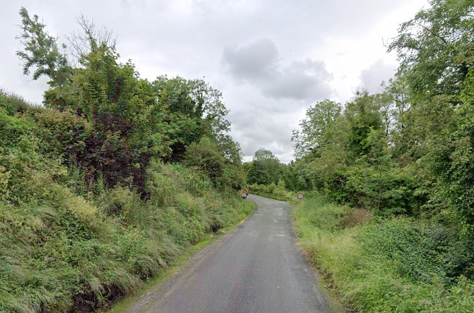
The site of the level-crossing as shown by Google Maps [May 2024]At the site of the level-crossing, this view looks back towards Letterkenny along the line of the old railway. [Google Streetview, August 2021]Also at the level-crossing this view looks ahead to the Southeast along the line of the railway. [Google Streetview, August 2021]
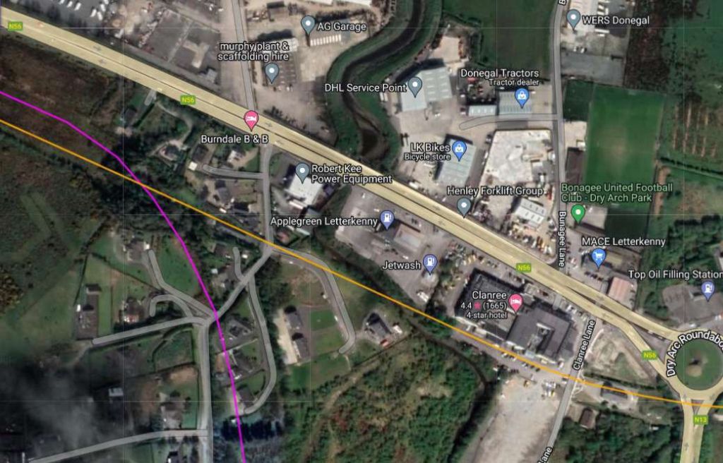
A few hundred metres to the Southeast the line crossed Clanree Lane at the level.
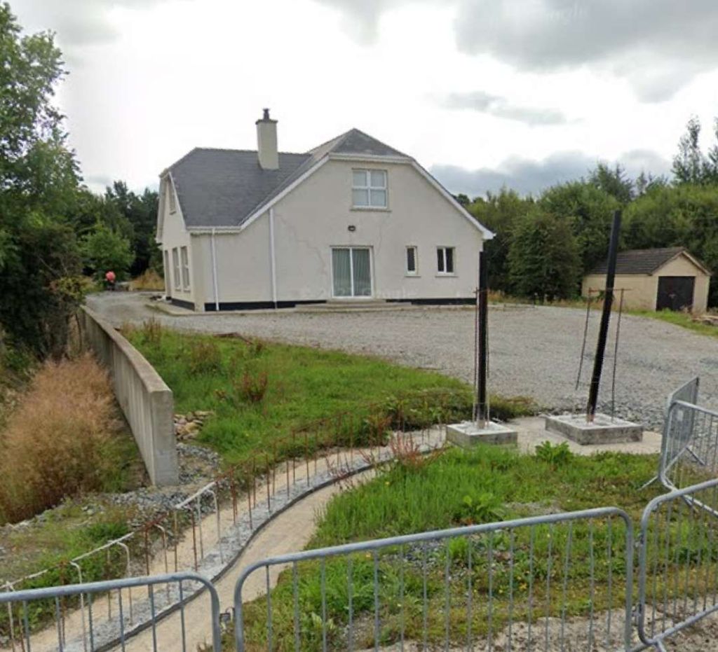
Anticipating that the Sallybrook Station House would’ve been fully renovated, we drove down the access road and discovered that no further work had been undertaken since the July 2031 photo was taken. Two pictures of the building are included here.
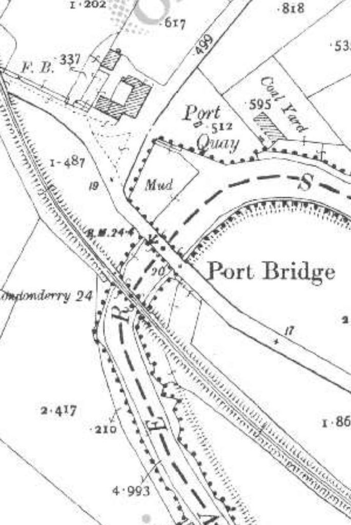
The station forecourt side of Sallybrook Station building, [My photograph, 10th May 2024]Looking West along the line of the Lough Swilly Railway along the platform side of the Station building. [My photograph, 10th May 2024]Looking Northwest from the minor road across the level-crossing at Sallybrook Station. [Google Streetview, July 2021]Looking ahead, East, at Sallybrook Station, towards Newtoncunningham. [Google Streetview, July 2021]The next extract from the 25″ OSi survey shows the length of the line immediately yo the East of Sallybrook Station. Land levels are such that the Lough Swilly Railway [passed over the next road. [15]Google Maps shows the same location in the 21st century. [Google Maps, 15th May 2024]Looking North along the minor road which appears in the map extract and the image above. The trees to the right and left of the road mask the embankment which carried the old railway. The bridge at this location has been removed. [Google Streetview, October 2021]
This next series of extracts from the 25″ OSi survey shows the Lough Swilly Railway crossing opens country between Sallybrook Station and Newtoncunningham Station.
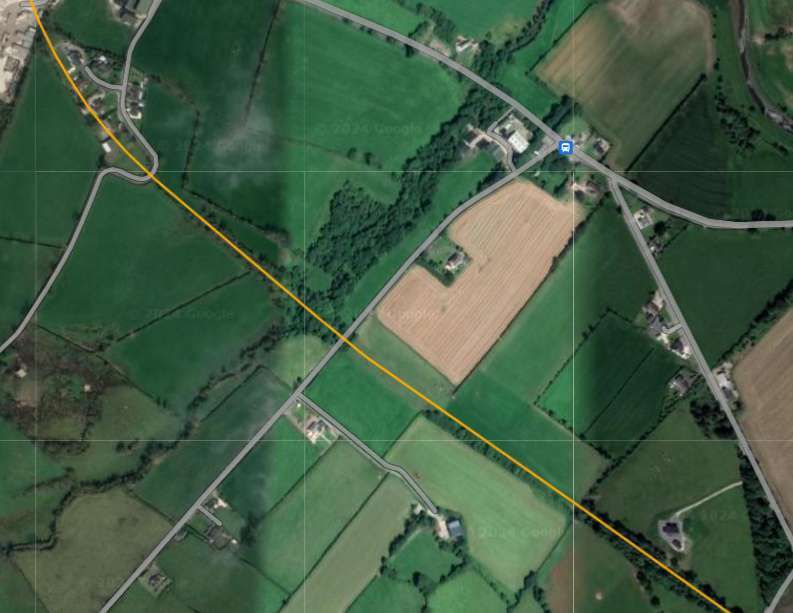
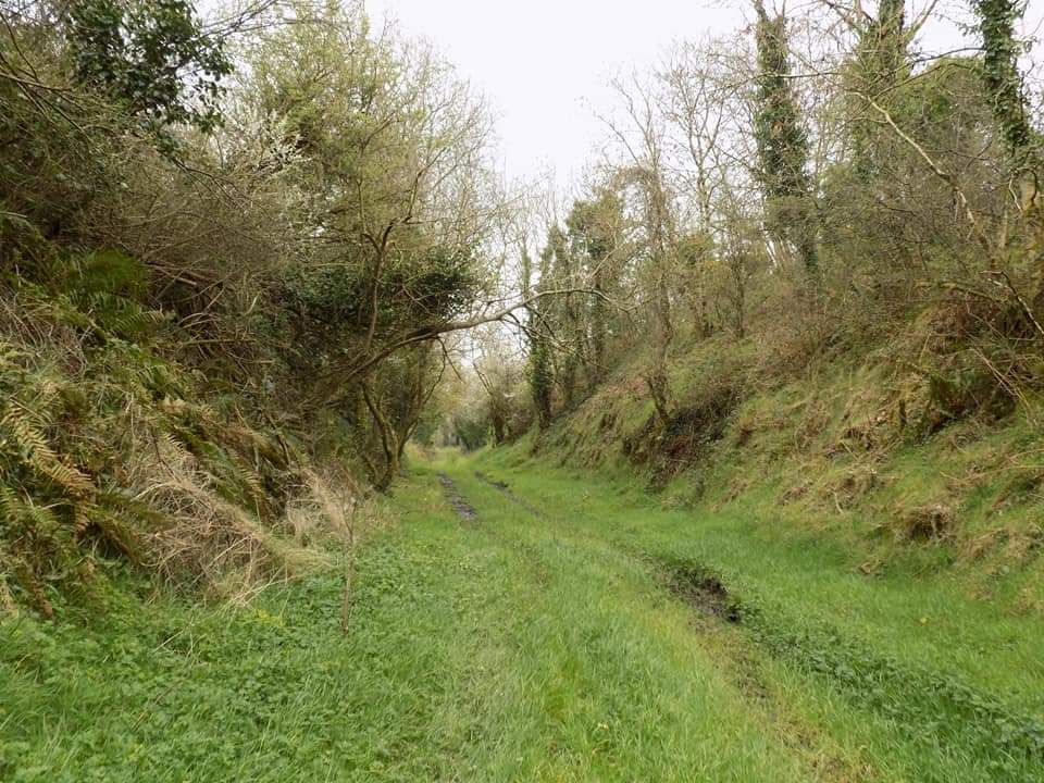
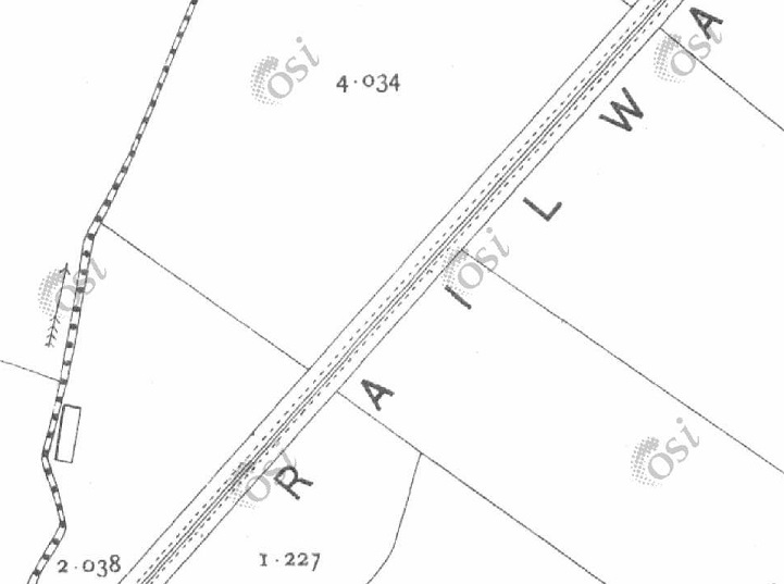
The seven map extract above show the Lough Swilly Railway traversing open country/farmland in a generally Northeasterly direction. [15]This satellite image from Google Maps shows that same length of the line as covered by the seven extracts immediately above. Field boundaries remain as they were at the time of the 25″ OSi survey. Over parts of this length of the line, hedgerows which used to flank the old railway have disappeared. [Google Maps, 16th May 2024]This next extract from the 25″ OSi survey shows the point at which Castleblaugh crossed the line. [15]A similar area to that shown on the map extract immediately above as it is shown on Google Maps satellite imagery in the 21st century. [Google Maps, 16th May 2024]Looking East along Castleblaugh, the only indication of the old railway at this point is the crest in the road alignment at the point where the road bridged the line. [Google Streetview, July 2021]
From Castlebaugh heading North to Milltown much of the old railway formation has been ploughed back into the landscape. The next few 25″ OSI survey extracts show the line as it was.
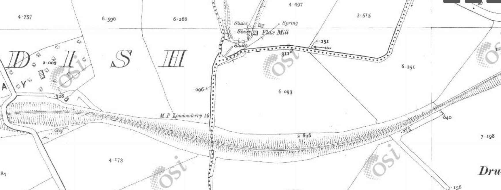
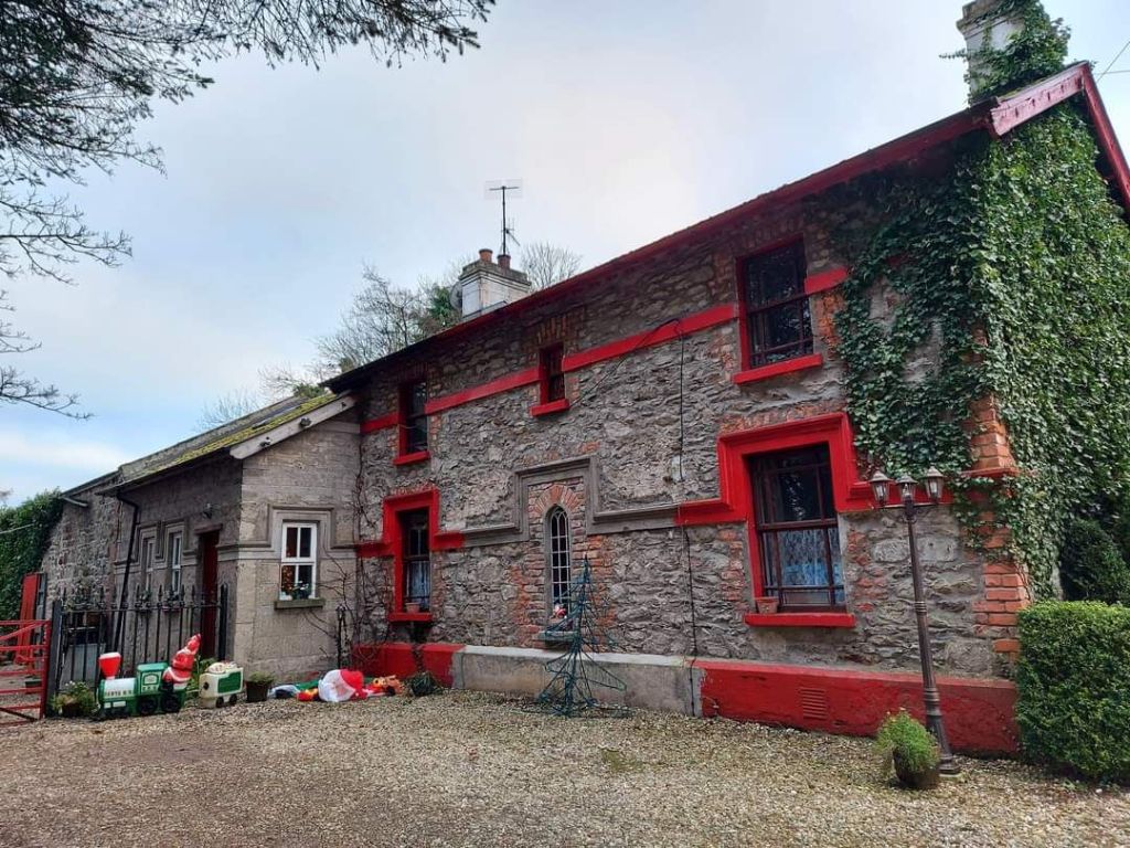
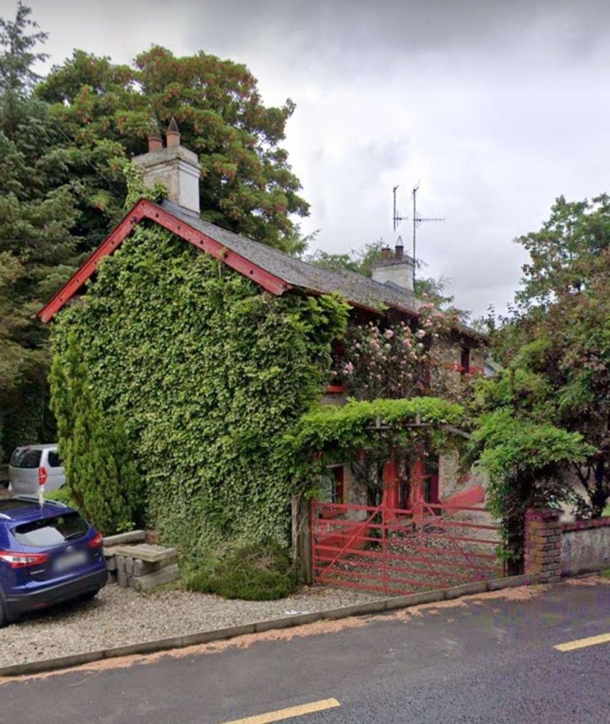
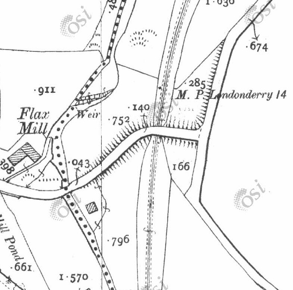
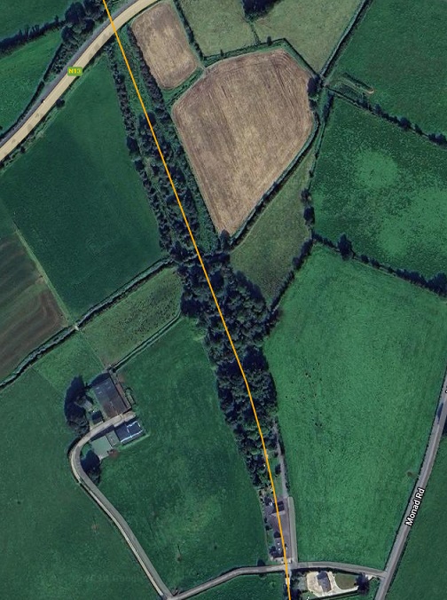
The eight extracts from the 25″ OSi survey show the length of the railway between the road bridge carrying Castleblaugh and that at Milltown. [15]The length of the Lough Swilly Railway from Castleblaugh to Milltown as shown on railmaponline.com’s satellite imagery. Much of the formation of the old railway has been ploughed back into farmland. [4]The Flax Mill at Milltown and the road bridge over the Lough Swilly Railway. [15]Railmaponline.com’s satellite imagery shows the same area close to the old flax mill, as it appears in the 21st century. [4]The bridge at Milltown as it appears in the 21st century. This view looks from the East over the bridge towards the location of the flax mill. [Google Streetview, July 2021]Looking South from Monad Road along the line of the old railway. The curtting at this location has been infilled and only the bridge parapet remains visible. [Google Strettview, July 2021]Looking North from Monad Road along the line of the Lough Swilly Railway towards Newtoncunningham. More of the cutting of te old railway can be seen in this direction. [Google Streetview, July 2021]
The next 4 extracts from the 25″ OSi survey cover the length of the line as far as Mason Lodge and the overbridge at that location.
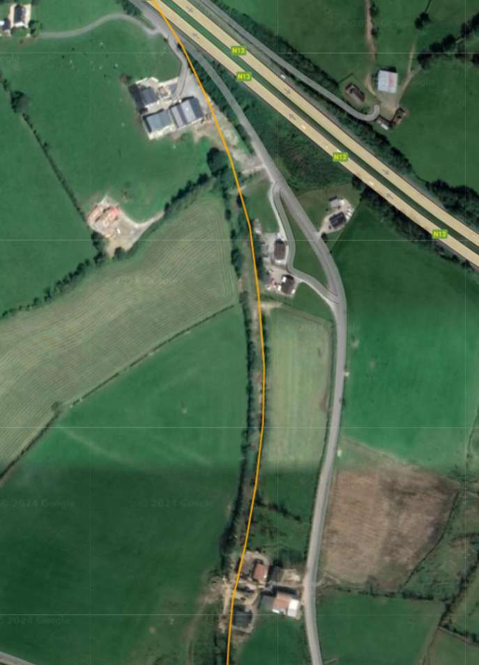
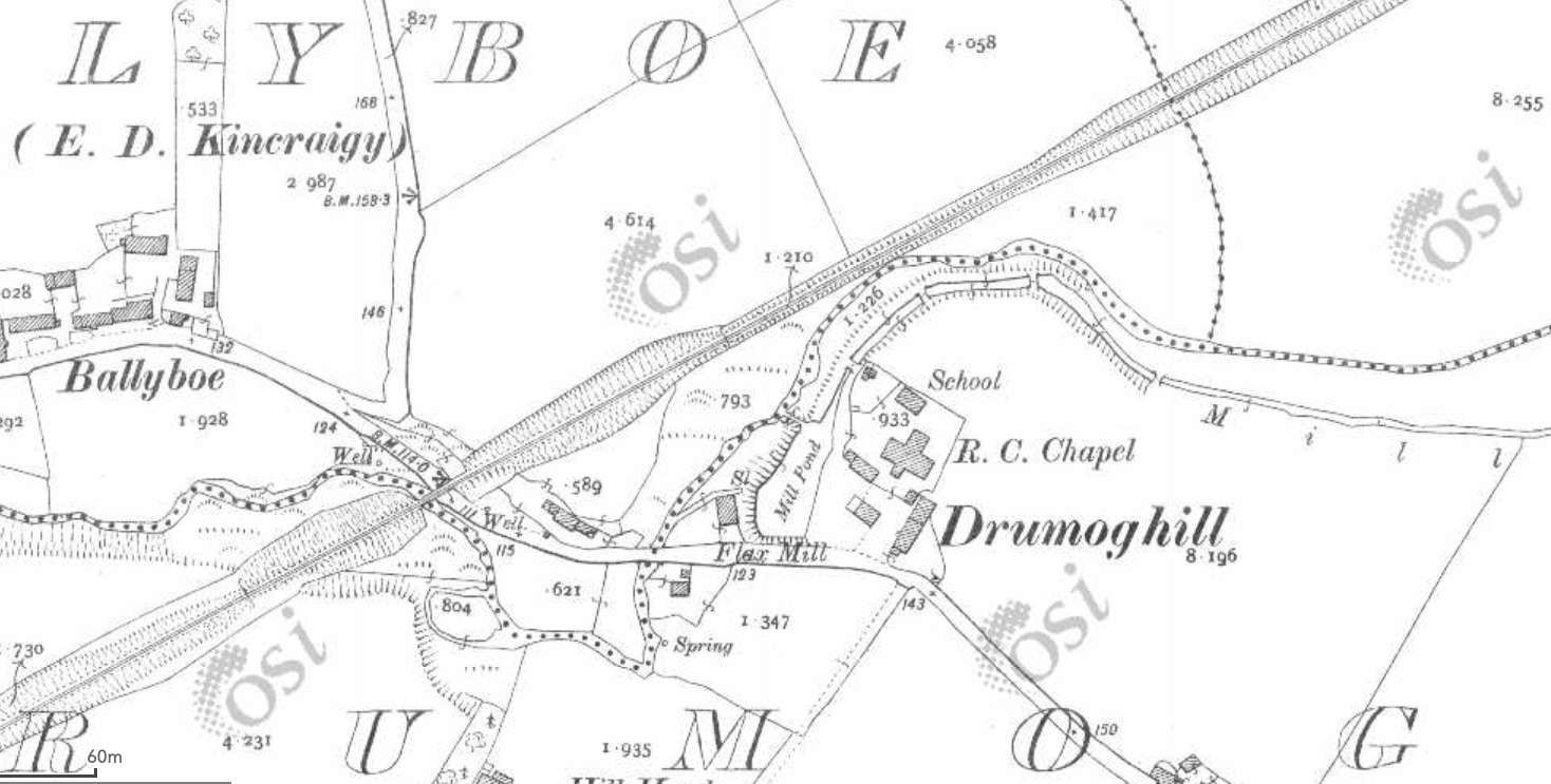
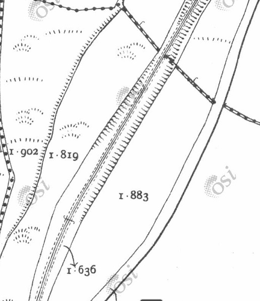
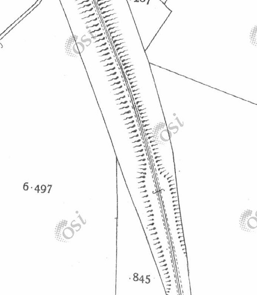
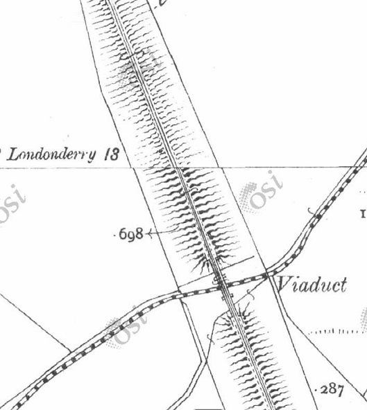
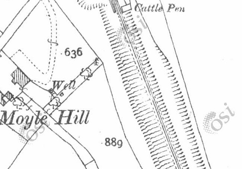
Four extracts from the OSi 25″ survey take us as far as Mason Lodge and the bridge over the line at that location. [15]The length of the line covered by the four map extracts above as it is shown on railmaponl;ine.com’s satellite imagery. [4]An enlarged extract from railmaponline.com’s satellite imagery focussed on the location of the bridge over the line adjacent to Mason Lodge. [4]Looking West across the old bridge over the Lough Swilly Railway adjacent to Mason Lodge. This 21st century image shows the bridge parapets still in place. [Google Streetview, July 2021]Looking South along the old railway the cutting is heavily overgrown in the 21st century. [Google Streetview, July 2021]Looking North over the bridge parapet in 2021a private property straddles the old formation with the line running close to the hedge in the foreground and through the out-building ahead. {Google Streetview, July 2021]From a point a little further to the North on the minor road which ran parallel to the old railway, it is possible to make out the stone arch which carried the road over the line. It is masked by the landscaping of the private garden. [Google Streetview, July 2021]The line continued Northward in cutting. [15]As this next extract from the 25″ OSi survey shows, where the cutting came to an end and before the line ran North onto embankment there was a further road crossing, this time at level. [15]This extract from railmaponline.com’s satellite imagery covers the same length of the old railway as the two map extracts immediately above. The bridge close to Mason Lodge appears at the southern edge of the extract, the level crossing noted above appears at the top of this image. [4]This photograph shows the view looking West across the line of the old railway at the location of the lvel-crossing. [Google Streetview, March 2011]Looking South along the line of the Lough Swilly Railway from the levle-crossing noted above, the formation continues to be defined by boundary hedges although, in the 21st century, it is in private hands. [Google Streetview, March 2011]Looking North from the location of the level crossing. The approximate route of the old railway is shown by the orange line. [Google Streetview, March 2011]This next extract shows that the line North of the level crossing was on a relatively significant embankment. [15]Continuing to the North, this next extract from the 25″ OSi survey shows a significant viaduct which carried the line over a stream. [15]The line then crossed a more significant road by means of another bridge. This road was to become the N13 linking Letterkenny to Derry. [15]The location of the level-crossing appears at the bottom of this next extract from railmaponline’s satellite imagery, the N13 at the top and the viaduct location just above the centre of the image. [4]Looking Northeast along the N13 through the location of the bridge which carried the Lough Swilly Railway over the road. [Google Streetview, November 2022]Looking South from the N13 the rail embankment has been removed for some distance from the modern road, but the embankment can be seen in the distance. Railway land at this location was wide enought o accommodate the full width of the embankment and remains delineated by the modern hedges seen in this image. [Google Streetview, November 2022]Looking Northwest from the N13, the embankment has not been removed. The stonework of the bridge abutment and the springing at the base of the arch which spanned the old road before its widening can clearly be seen. [Google Streetview, November 2022]The two extracts from the 25″ )Si survey show the southern approach to the station at Newtowncunningham. [15]Newtowncunnigham Railway Station as shown on the 25″ OSi survey. The station was sited in the area known as Moyle. [15]The site of Newtowncunningham Railway Station as shown on railmaponline.com’s satellite imagery. The bridge at the North end of the station has been removed and the road realigned. The Station House and the Water Tower remain. The Station House in private hands. [4]
(c) National Inventory of Architectural Heritage (@niah_ireland [Instagram], @NIAH_Ireland [Twitter])
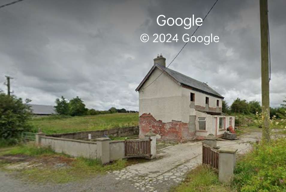
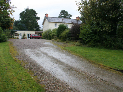
Two views of Newtowncunninham Railway Station House, now in private ownership, (c) National Inventory of Architectural Heritage (@niah_ireland [Instagram], @NIAH_Ireland [Twitter]). [22]
Newtowncunningham Station Water Tower. The National Inventory of Architectural heritage describes this as a “freestanding single-bay two-storey former railway water tower associated with Newtowncunningham Railway Station, built c. 1883, having rendered platform over surmounted by timber-clad metal water tank.” (c) National Inventory of Architectural Heritage (@niah_ireland [Instagram], @NIAH_Ireland [Twitter]). [22]
The Station House seen from the road. [My photograph, 9th May 2024]
We complete this article here at Newtowncunningham Railway Station. The next article in this series will look at the line from Newtowncunningham to Derry.
In 2020, Kerry Doherty of Ballindrait very kindly sent me a series of pictures of the Co. Donegal Railways Strabane and Letterkenny Railway route. Each of these, in this article, bears the reference number [17].
Dave Bell and Steve Flanders; The Londonderry and Lough Swilly Railway: A Visitor’s Guide; County Donegal Railway Restoration Society.


Hi Roger. Thank you for such a fantastic piece of research. I really enjoyed reading your articles and seeing the maps and photographs of the sites.
div>I have a personal interest
I appreciate the positive comments, Jim.
Thank you.