The line ran from Derry to Burtonport. Initially constructed from Derry to Letterkenny it was later extended, via a circuitous route, to the fishing village of Burtonport. We have been following the route of the line from Burtonport to Letterkenny in a series of articles of which this is the fourth.
This length of the line begins at Barnes Gap (not to be confused with Barnesmore Gap further South on the Co. Donegal Railways network) and travels first in a generally Southerly direction before approaching Letterkenny from the West.
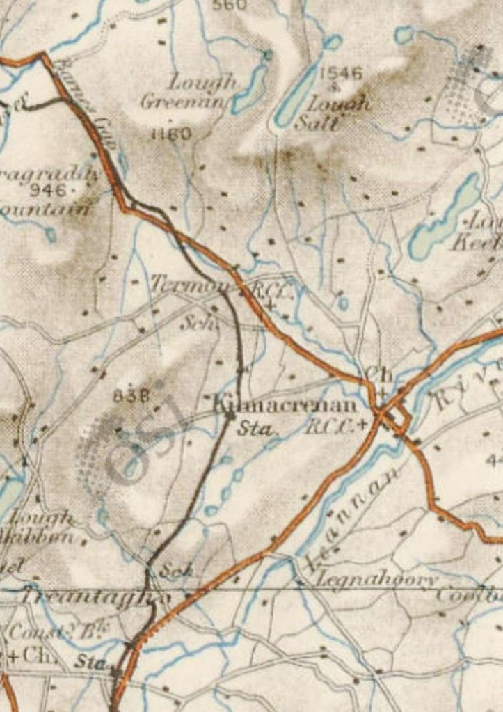
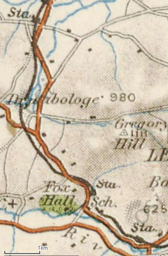
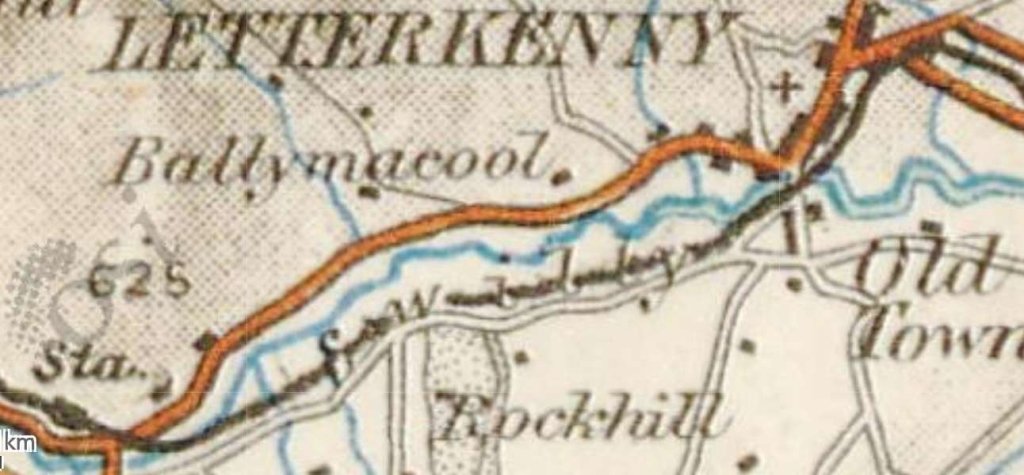
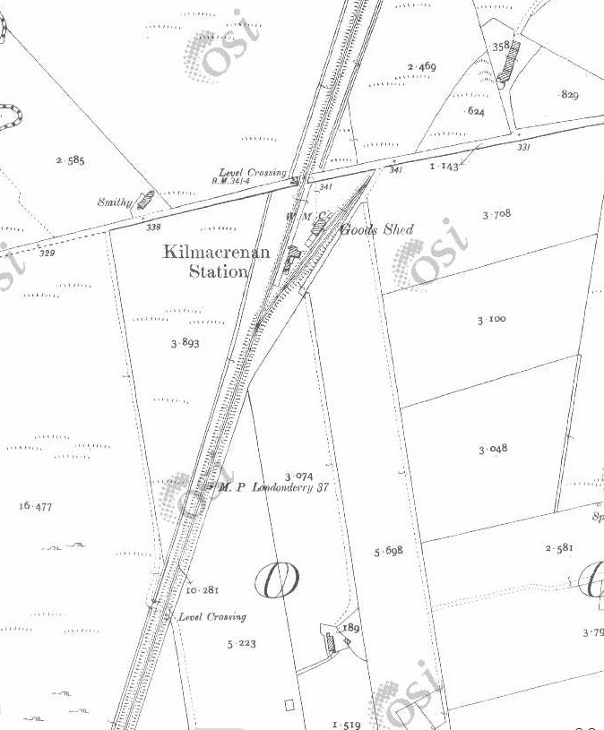
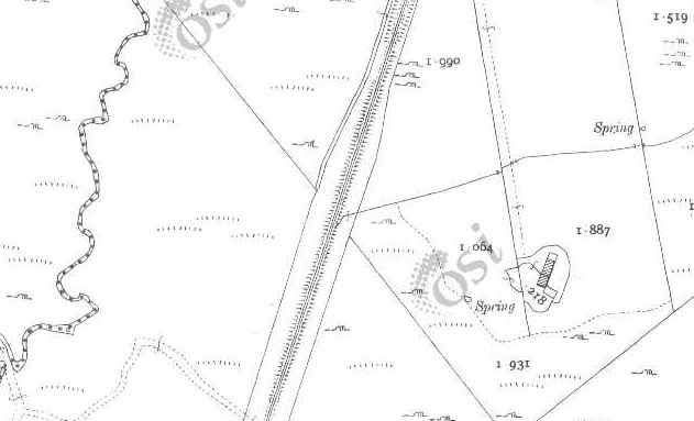
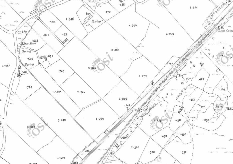
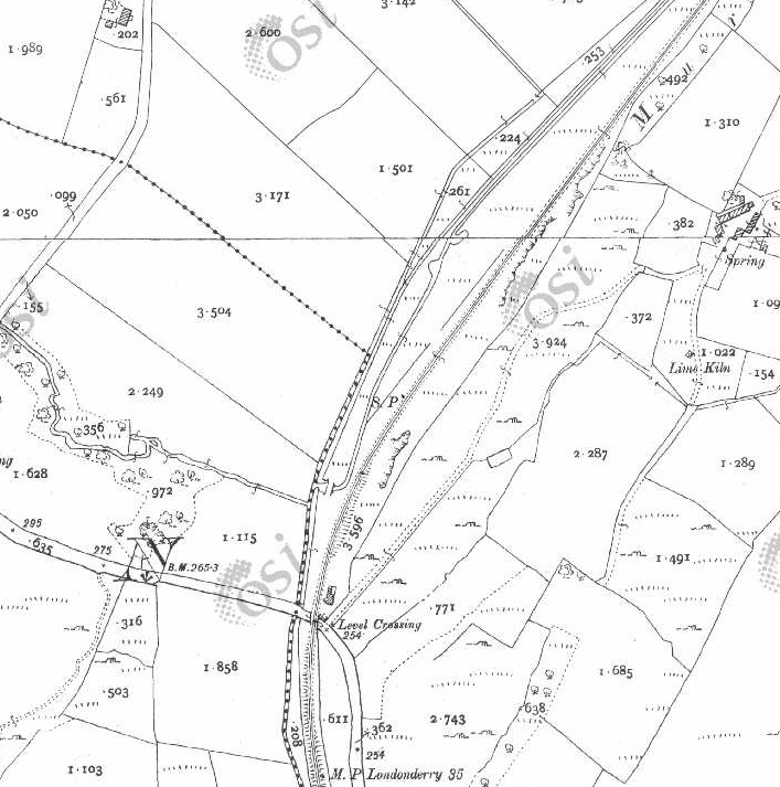
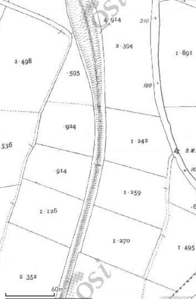
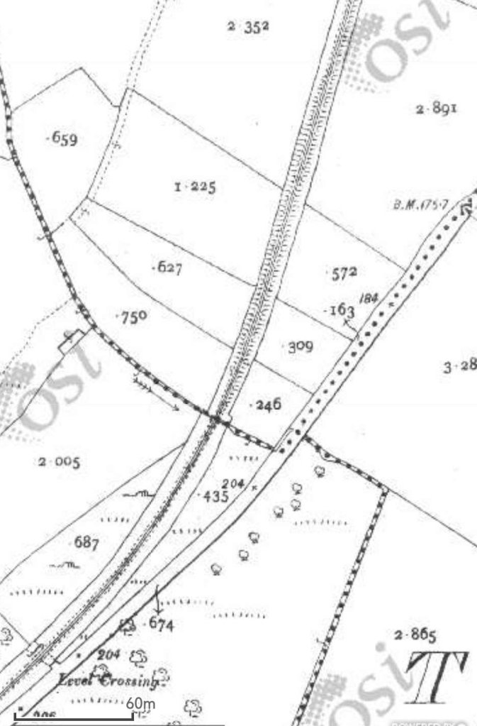
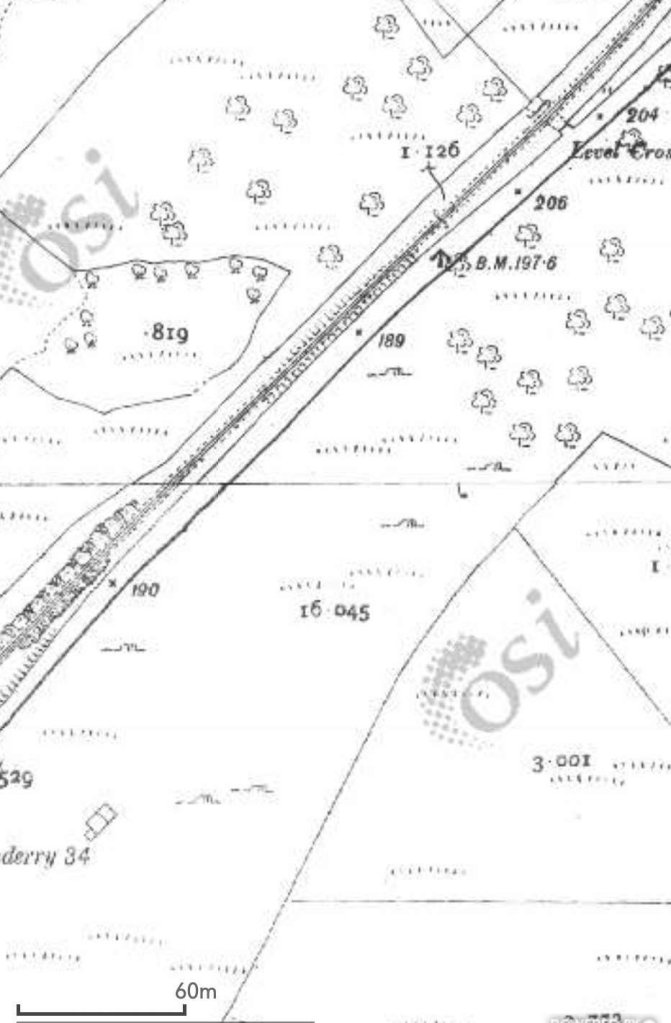
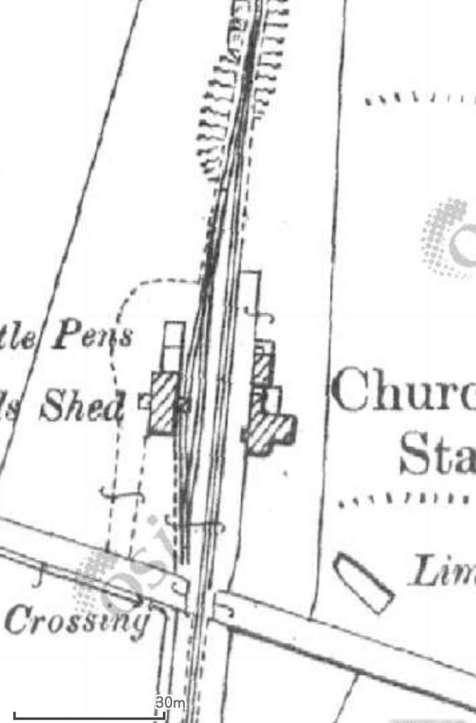
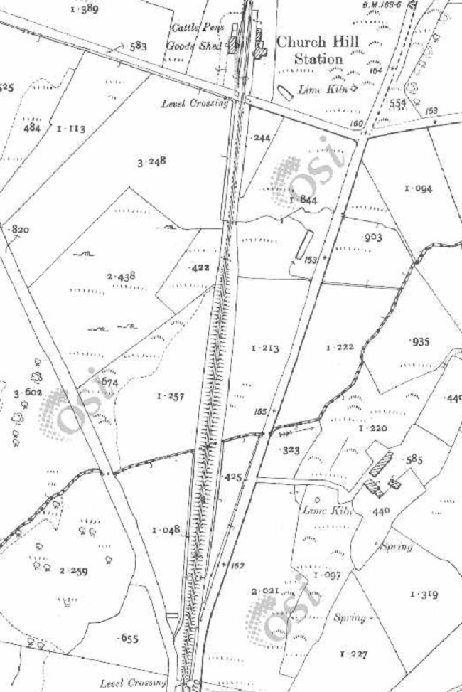
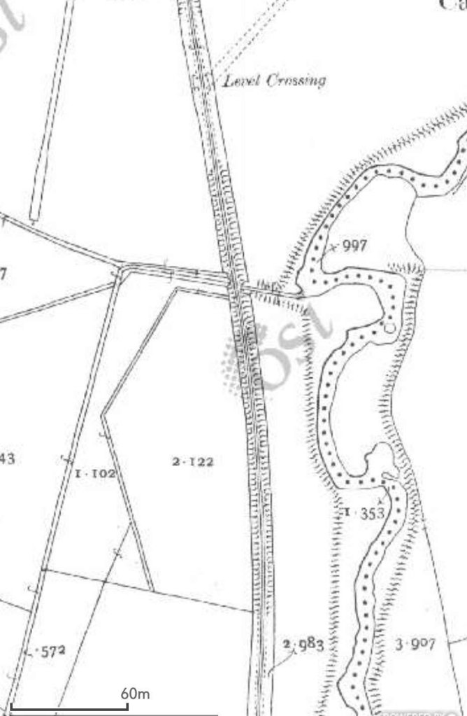
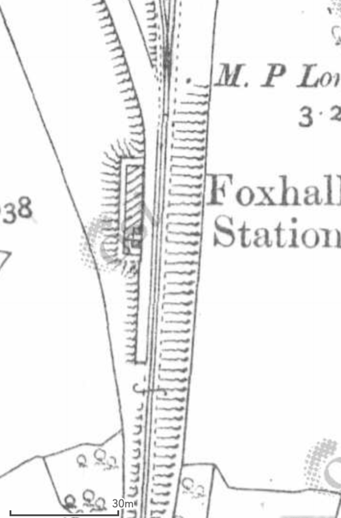
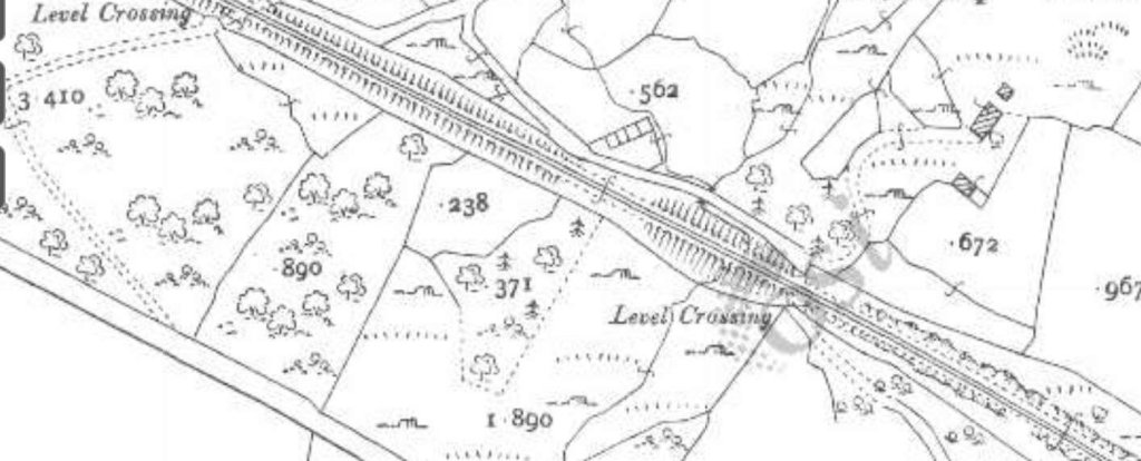
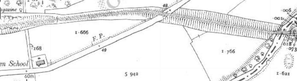
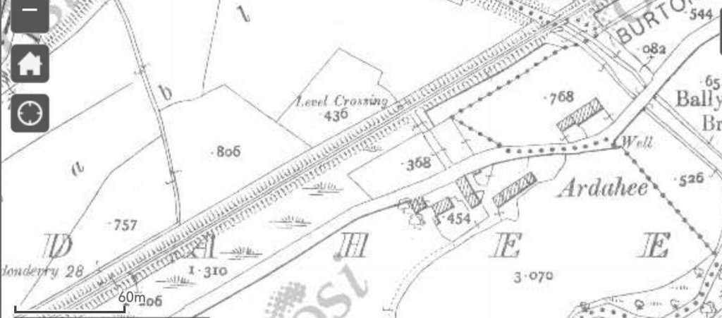
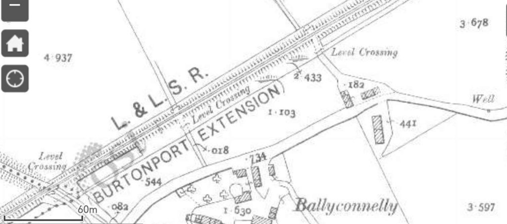
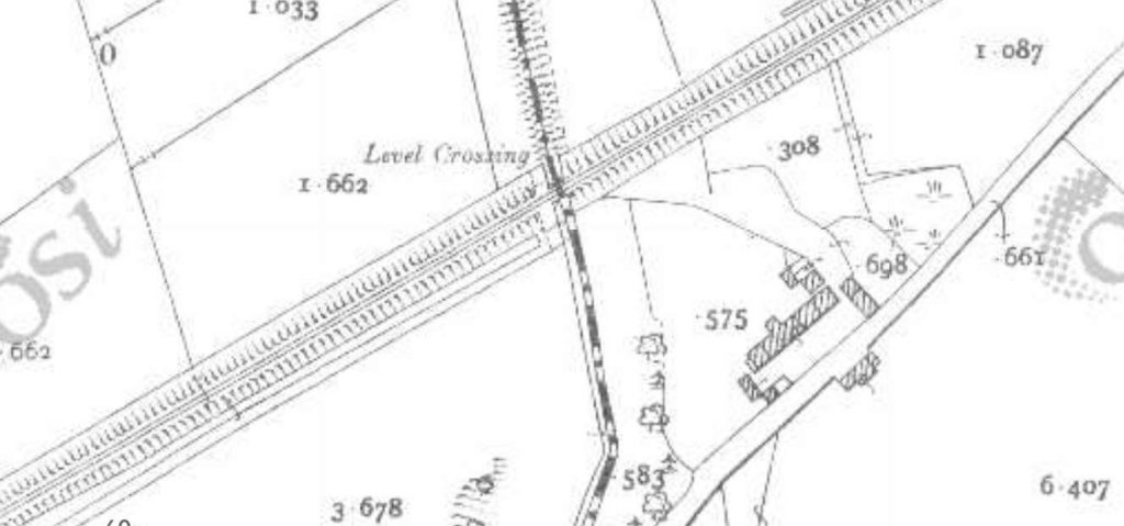
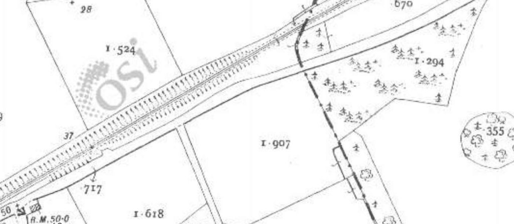
The first length of this part of the route of the old railway begins at Barnes Gap and travels via Kilmacrenan Railway Station to Churchill Station as shown on this extract from the 1″ OSi mapping of the mid-20th century. [2]Churchill Station is at the top-left of this next extract. The next Station was at Fox Hall at the point where the old railway entered the valley of the River Swilly. A little further to the East was Newmills Station which can be seen in the bottom-right of this image. [2]The the East of Newmills Station the railway bridged the River Swilly and ran along its South side at far as Old Town in Letterkenny where the line bridged the river once again and ran on into Letterkenny Station which sat at the right-hand edge of this map extract. [2]
We now look at this section of the Burtonport Extension Railway in more detail, starting at Barnes Gap.
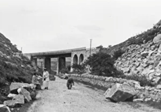
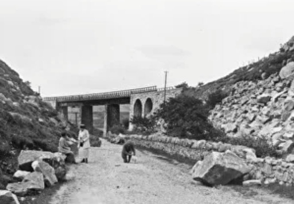
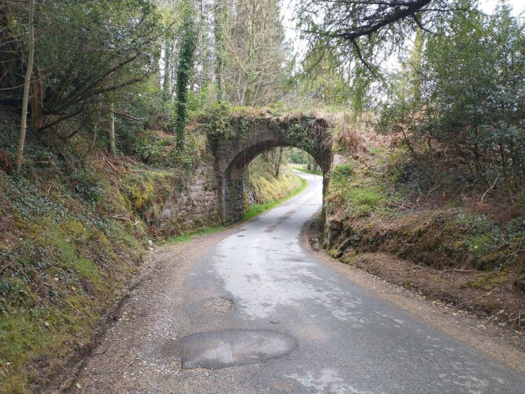
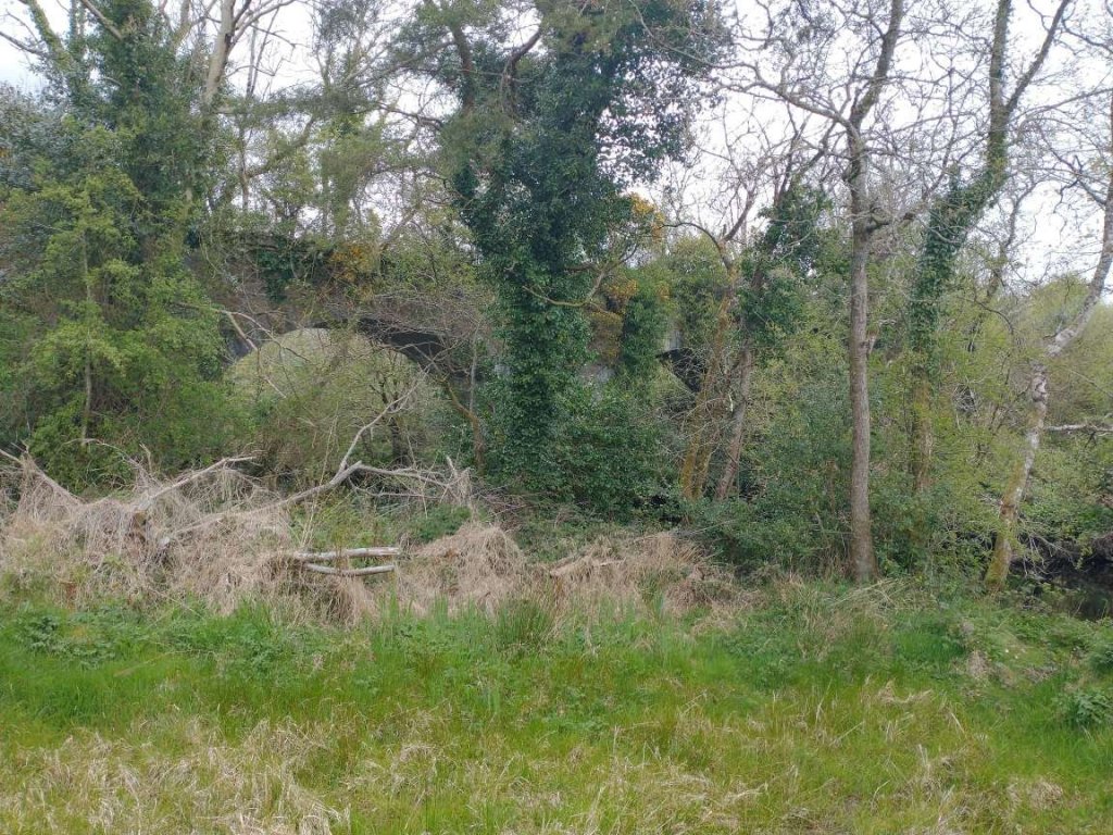
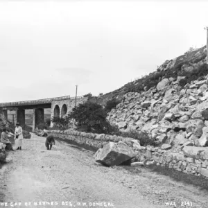
The first image is an excellent view of the viaduct by which the old railway crossed the road at Barnes Gap. It seems as though rock falls may have been a problem at this location, evidenced by the large rocks which sit alongside the road and a large boulder sitting on the right hand edge of the unmetalled carriageway
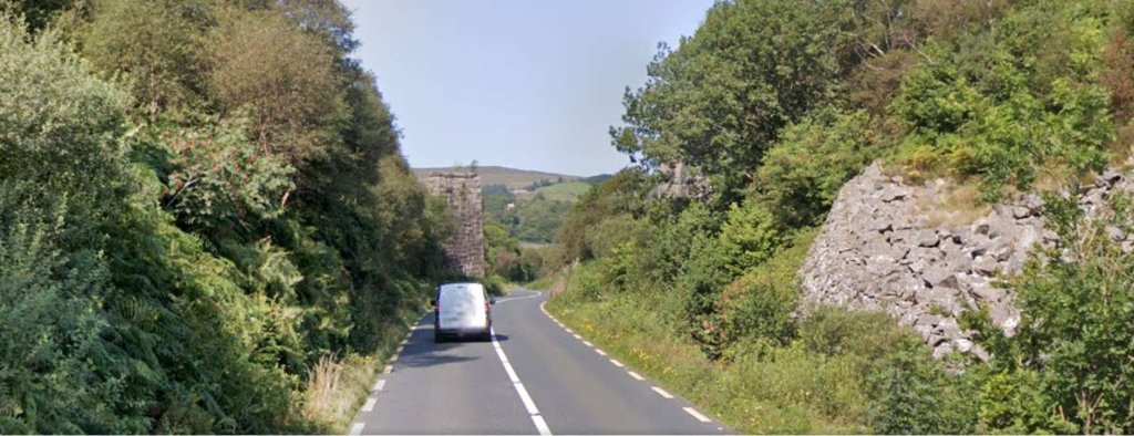
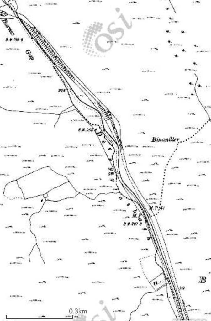
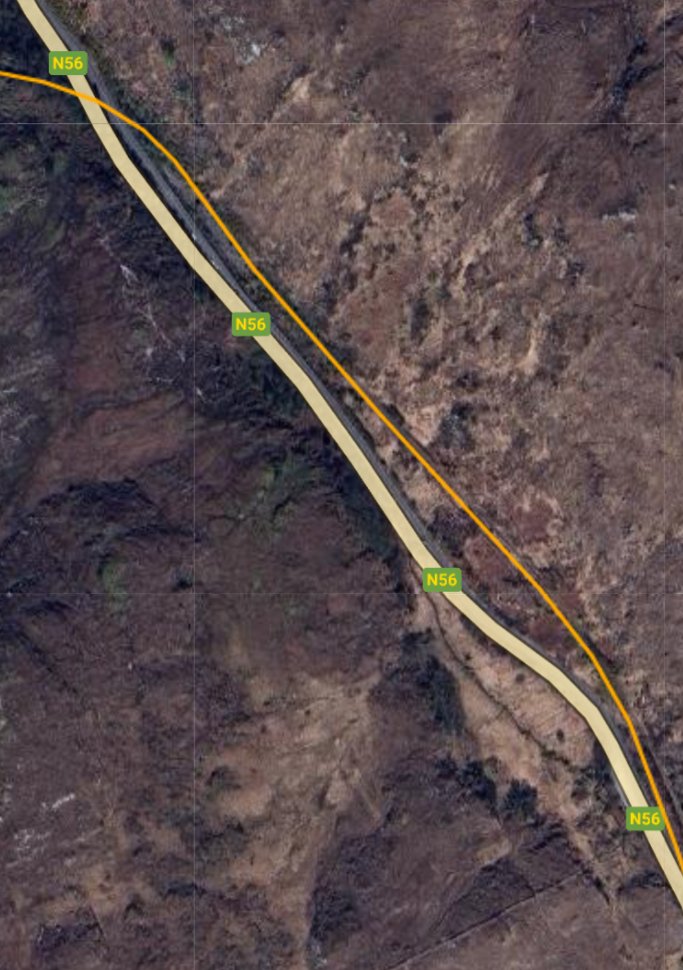
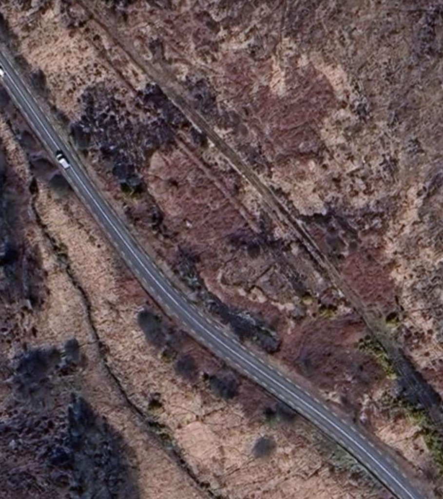
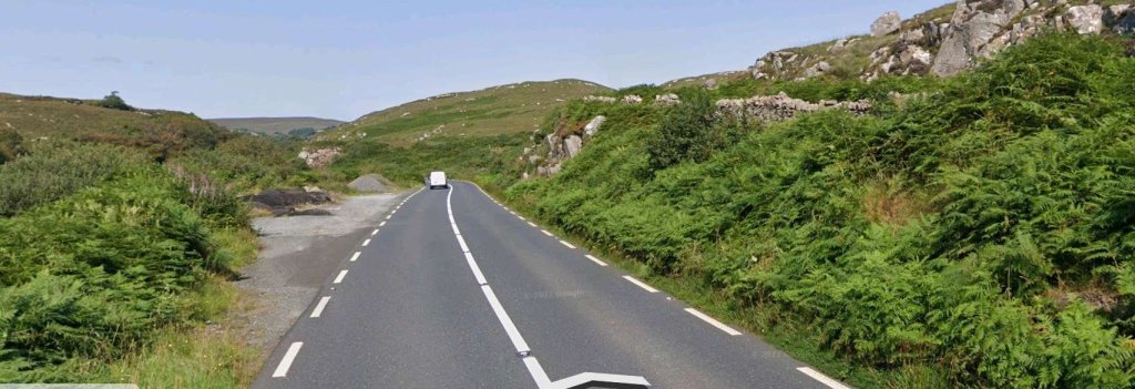
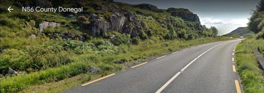
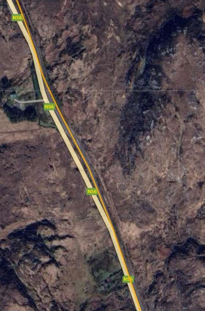
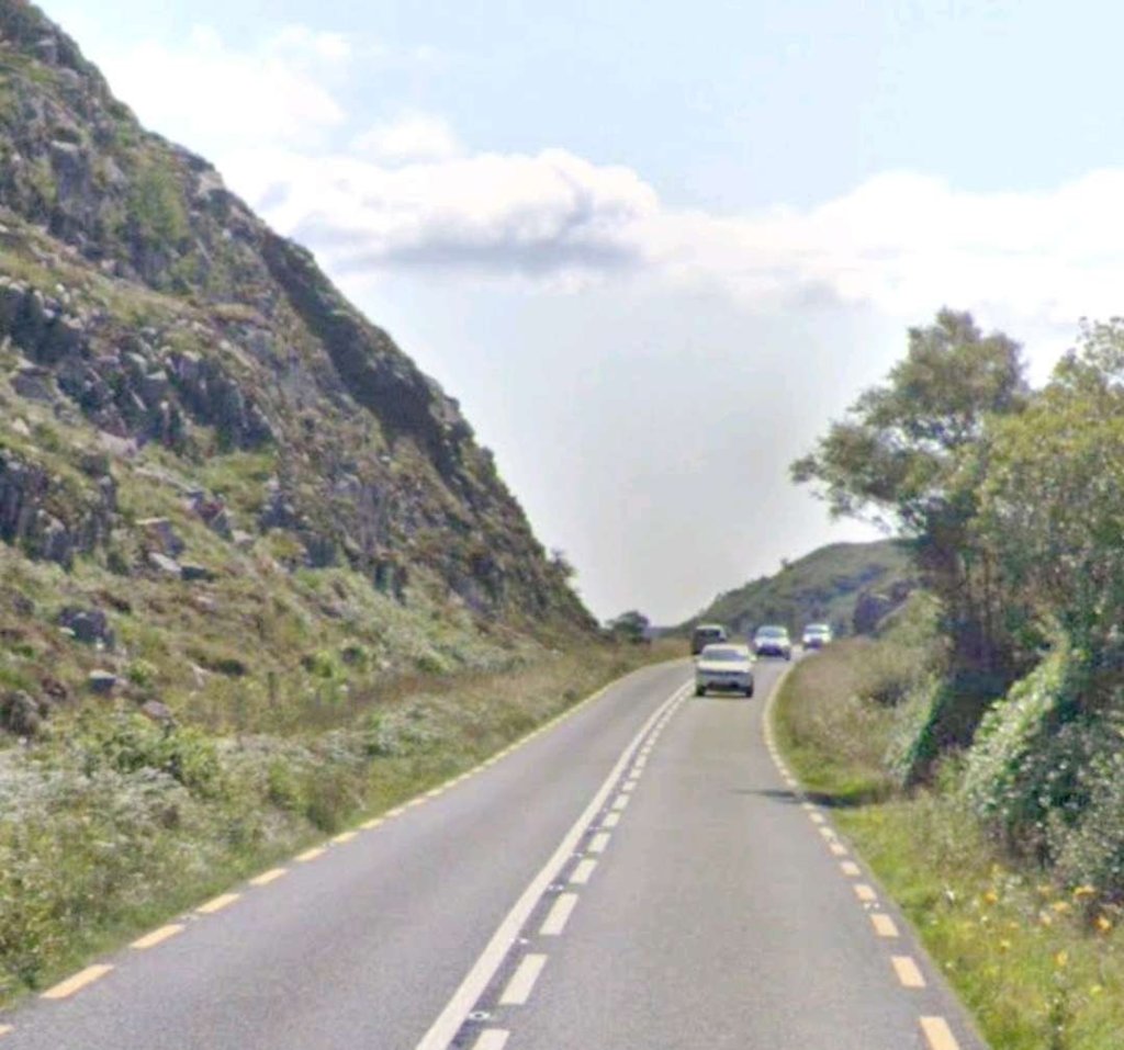
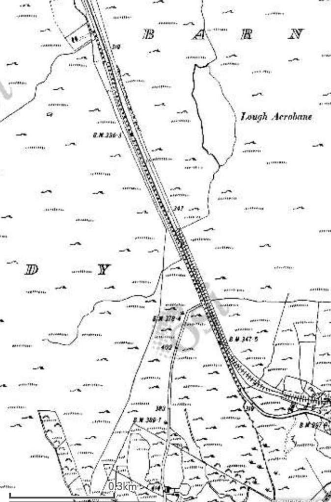
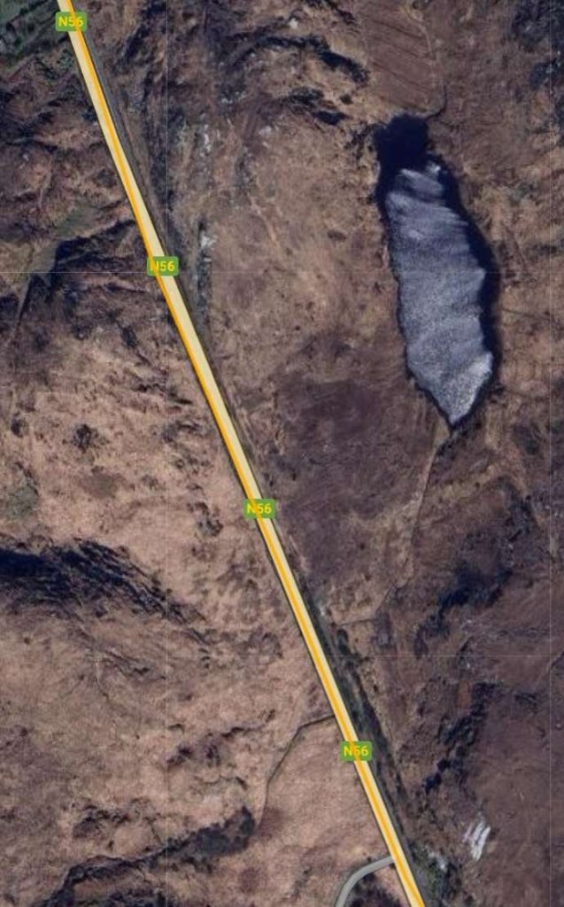
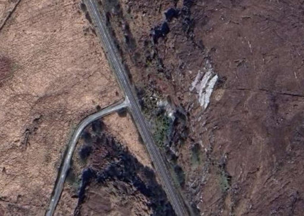
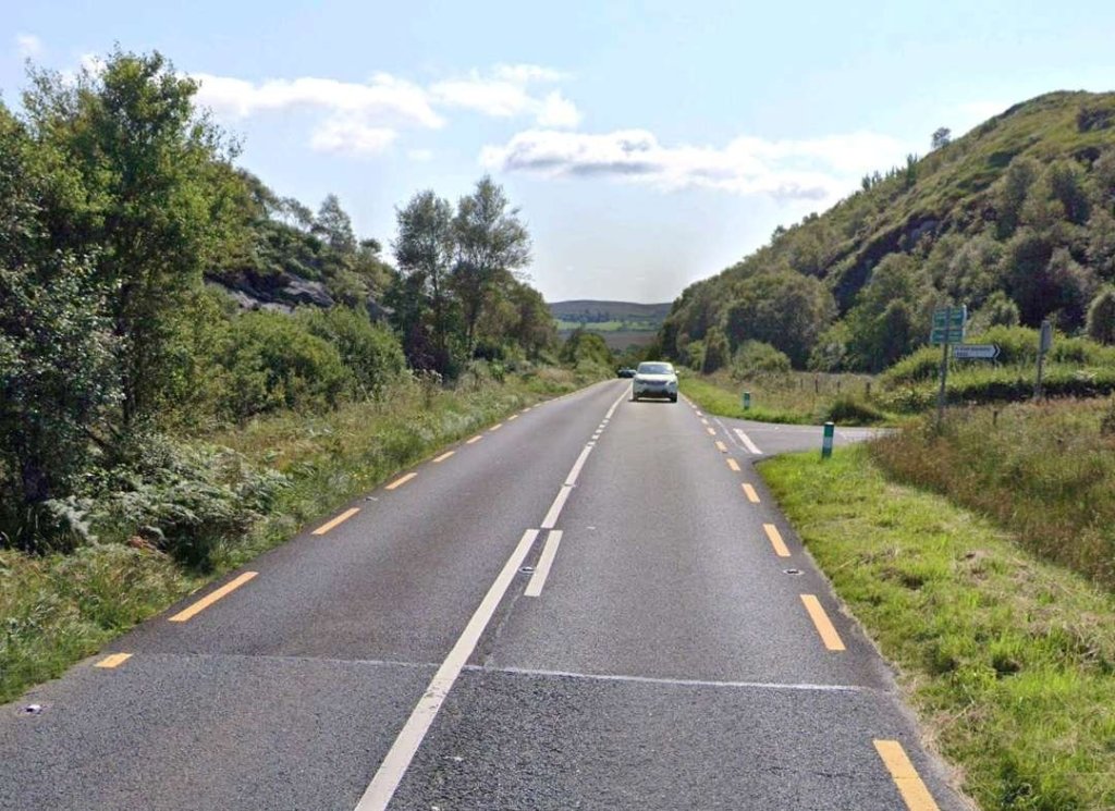
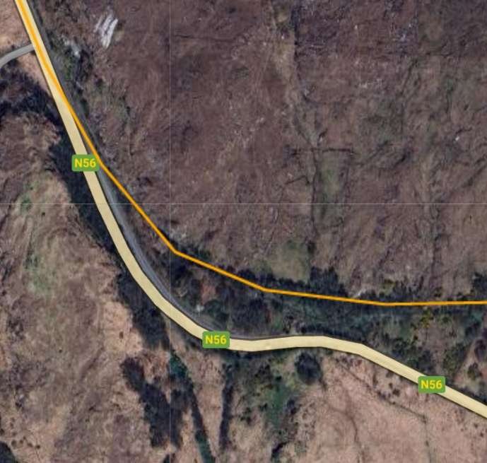
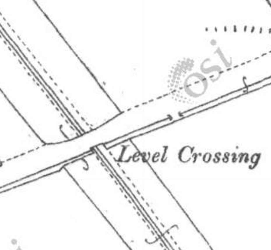
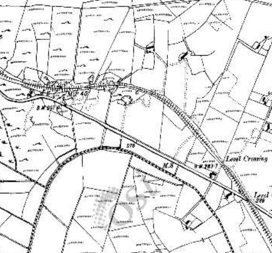
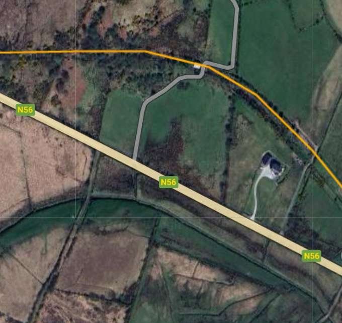
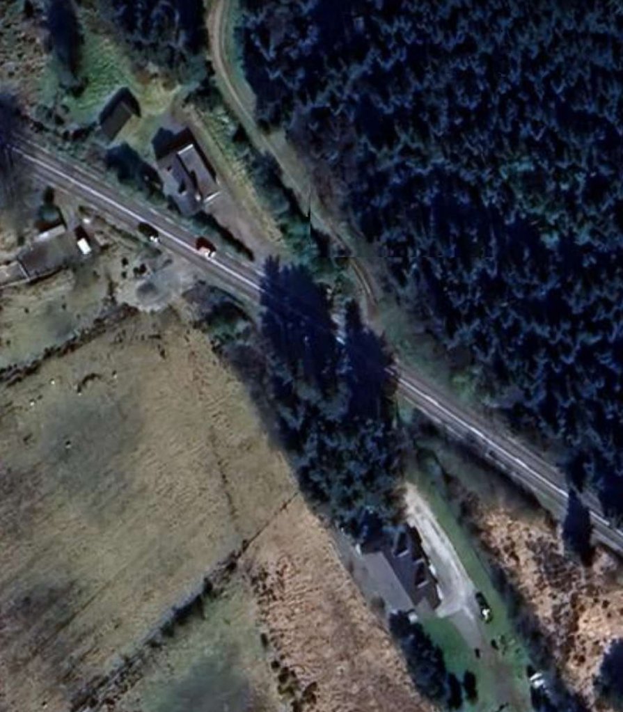
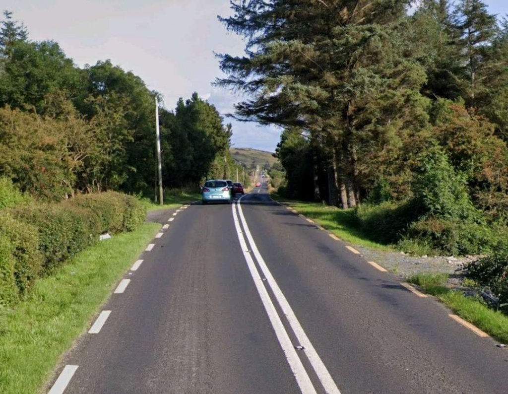
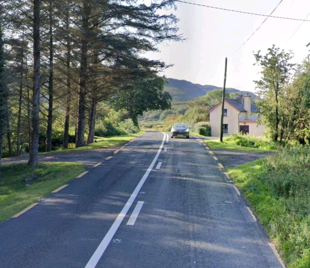
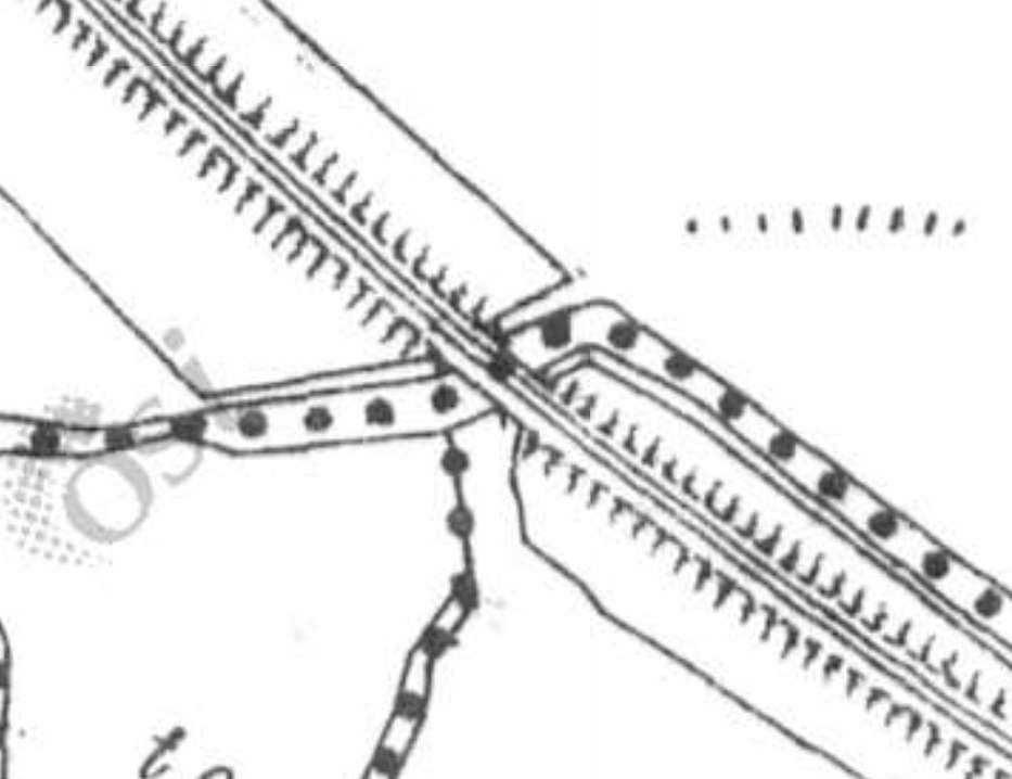
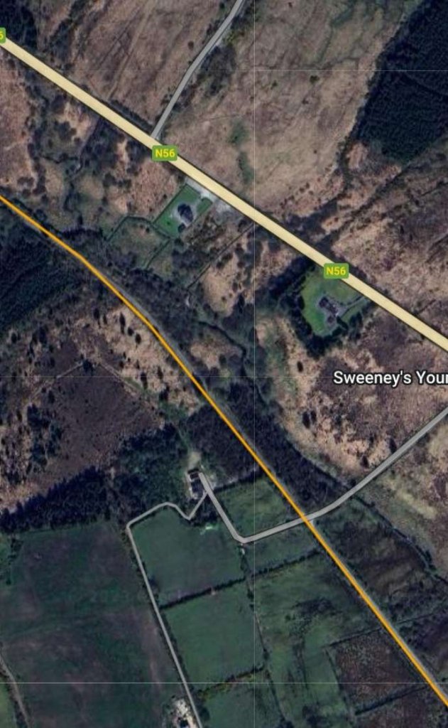
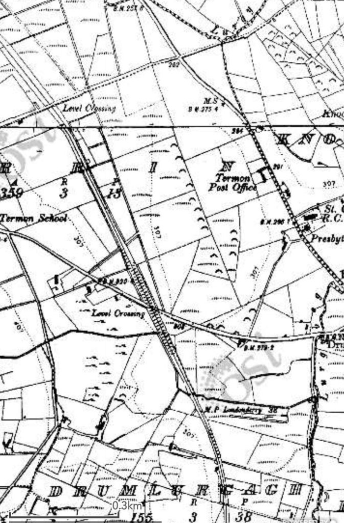
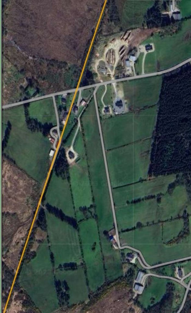
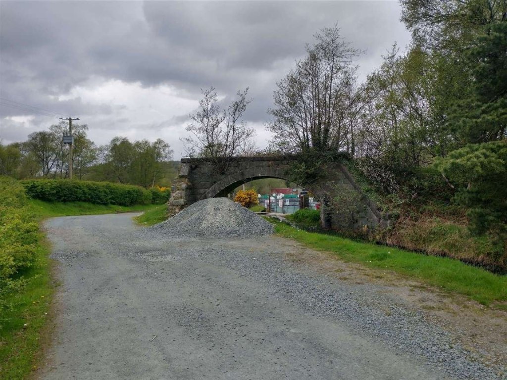
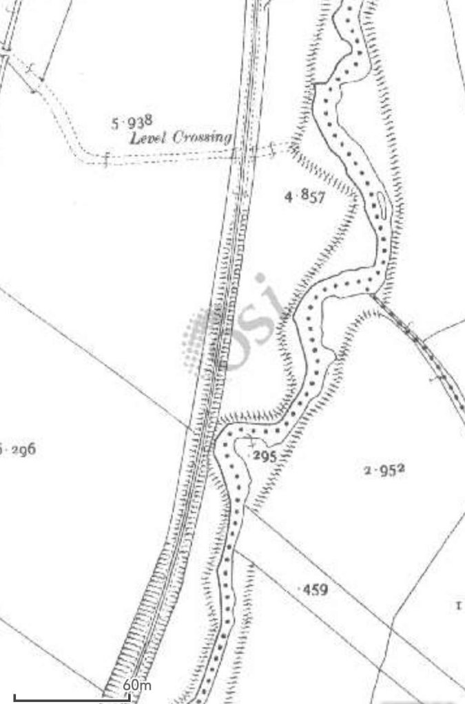
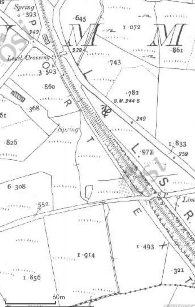
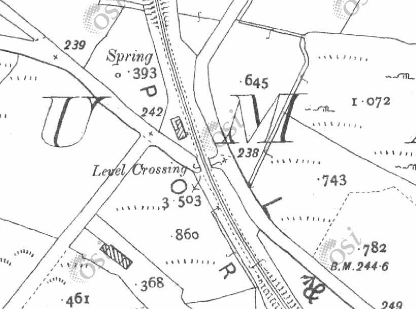
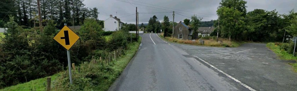
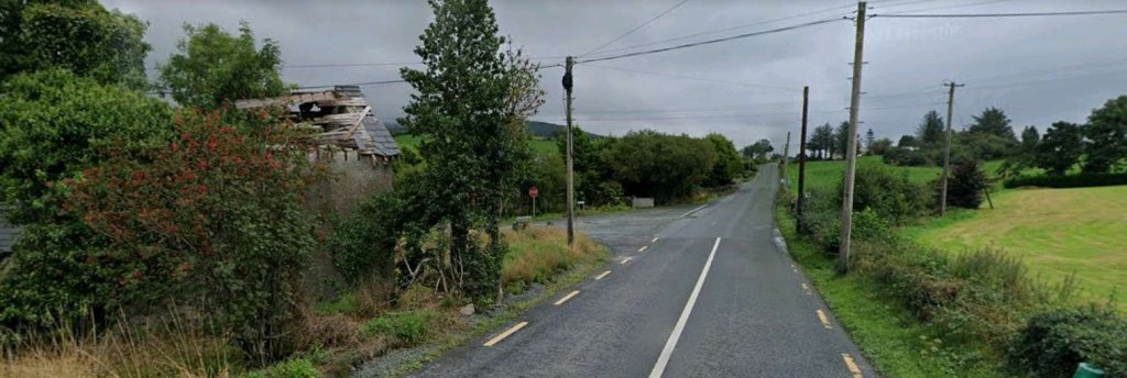
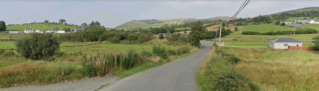
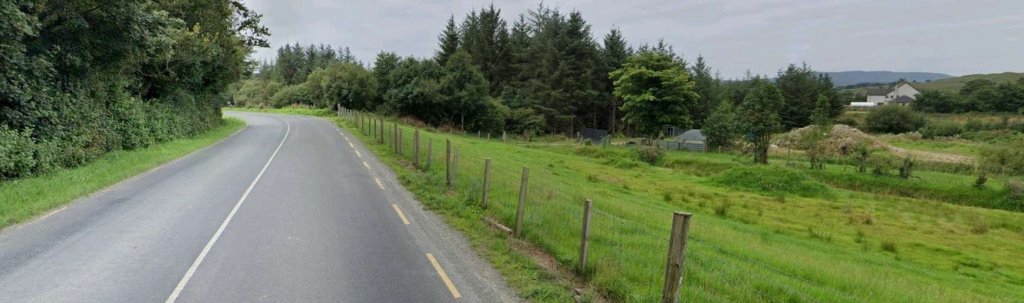
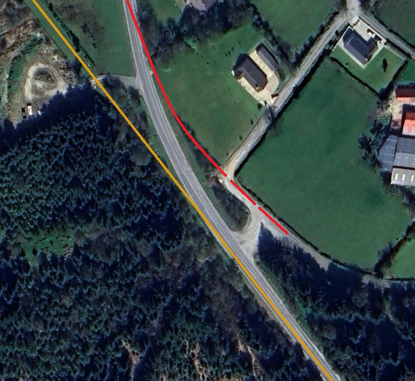
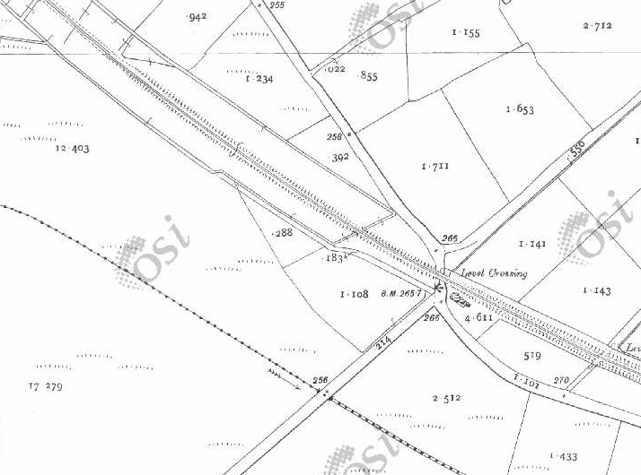
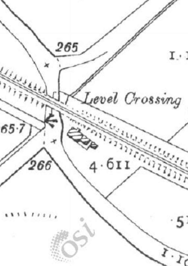
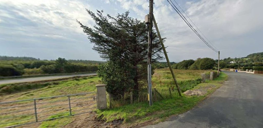
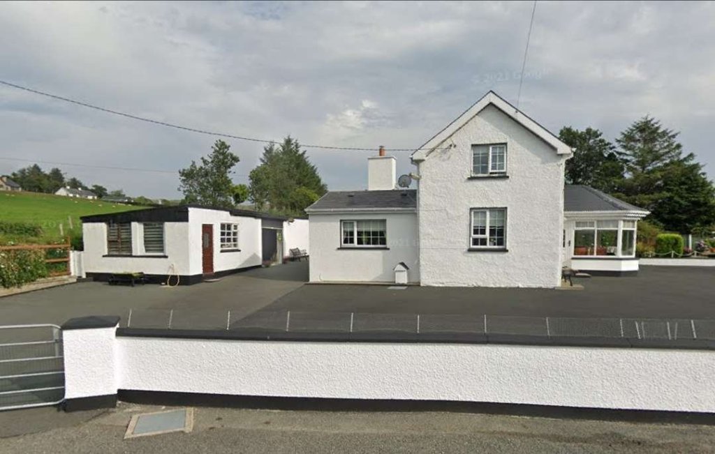
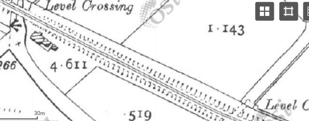
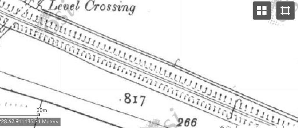
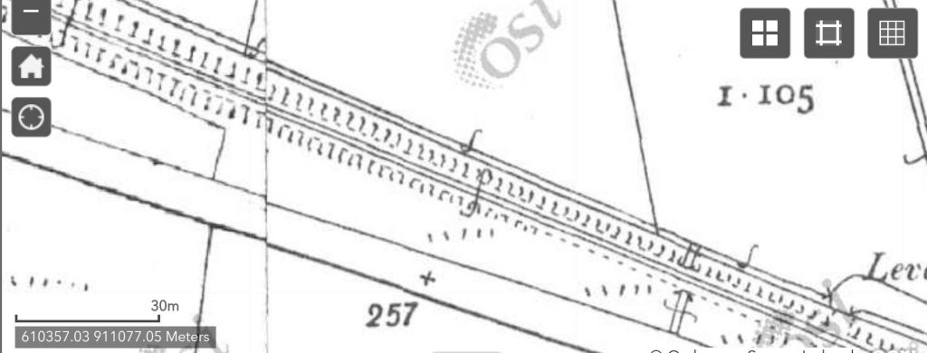
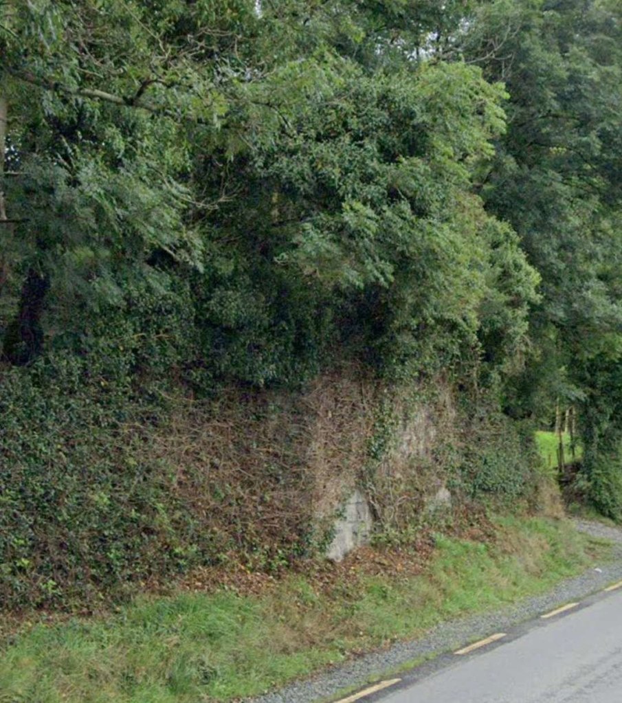
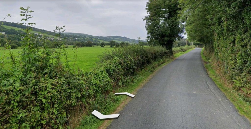
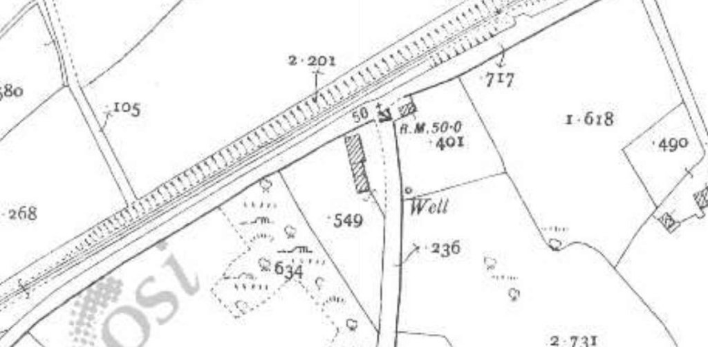
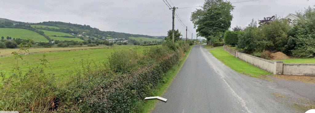
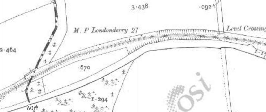
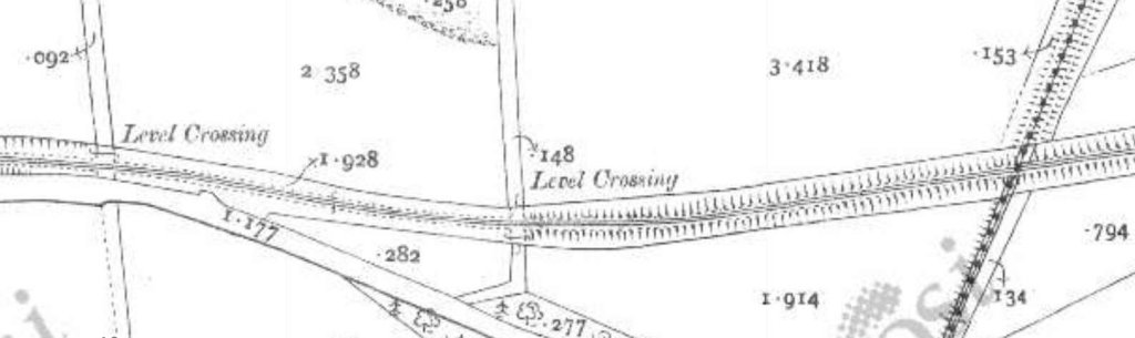
A view looking North towards the viaduct at Barnes Gap. [3]Approximately the same view in August 2021. [Google Streetview, August 2021]Barnes Gap, not to be confused with the Barnesmore Gap further South in Co. Donegal, sits at the top left of this first map extract from the 6″ OSi survey of 1901. Road and rail run close to each other with the road on the valley floor and the railway above. [2]This extract from RailMapOnline.com’s satellite imagery covers the top half of the map extract above. [4]A closer view as can be seen on Google Earth, the railway formation can be seen 50 metres or so to the Northeast of the N56. [Google Earth, June 2023]Taken just to the Southeast of the location of the satellite image immediately above, this photograph looks Northwest along the N56 as the old railway formation, marked by the stone wall to the left of the road, closes in on the line of the road. [Google Streetview, August 2021]Turning through 180° to look Southeast along the N56, the old railway formation is now at the same level as the road. It runs between the road edge and the rock outcrop its left. [Google Streetview, August 2021]This next satellite image emphasises how close the road and old railway ran as they headed South and it covers the bottom half of the map extract abovel. [4]Further to the South and looking South-southeast along the N56. The old railway alignment runs parallel to the road on its Eastern (left) side. [Google Streetview, August 2021]The road and railway followed each other closely for another kilometre or so until, as this extract from the OSi mapping shows, the railway required a larger radius curve, shown at the bottom-right of the extract. [2]The road and old railway formation are shown coinciding on this next RailMapOnline image. The reality on the ground is a little different as the next two images show. [4]This extract from the Google Earth satellite imagery, sowing the road junction at the bottom of the RailMapOnline image above. It also shows that the two forms of transport, road and rail were generally separated by a few metres with them closer where ground features needed them to be. [Google Earth, June 2023]The view South-southeast along the N56 and the road junction in the satellite image above. The tree line to the left of the road indicates the location of the old railway formation. [Google Streetview]Here we see the two alignments, road and old railway, diverging as shown on the OSi map extract above. The modern N56 seems to follow the alignment of the old road. [4]This extract from the 25″ OSi survey shows what was probably an ungated crossing over the lane that linked the crossroads close to Termon School to the main road, now the L5542. The crossing appears in the top-left of the 6″ OSi map extract above. [2][4]The road and the old railway follow separate paths once the valley broadens out. The railway remained, at first, on the North side of the road. [2]This extract from RailMapOnline shows the majority of the area covered by the 6″ OSi map extract above. [4]Once it crossed to the South side of the road the line drifted away from the road in a Southeasterly direction and crossed to the South side of the river valley. The line headed Southeast, the road East-southeast. [2]This satellite image shows approximately the same length of the line as the top half of the map extract above. [4]This enlarged extract from the 25″ OSi survey from the early 20th century shows the precedence given at the time to rail traffic with the gated crossing requiring traffic to turn to cross the line. [2]This enlarged image from Google Streetview shows the location of the level crossing in the 21st century. The larger building on the top-left, just North of the road is the crossing-keeper’s cottage. [Google Earth, June 2023]The view Southeast along the N56 through the location of the level-crossing. [Google Streetview, August 2021]The view Northwest along the N56 through the location of the level-crossing. The crossing-keeper’s cottage is on the right of the road. The railway ran to the right of the cottage. [Google Streetview, August 2021]The crossing-keeper’s cottage, the old railway ran to the right of the cottage. [Google Streetview, August 2021]Looking Southeast along the N56. The old railway formation is the track on the right of this image. [Google Streetview, August 2021]
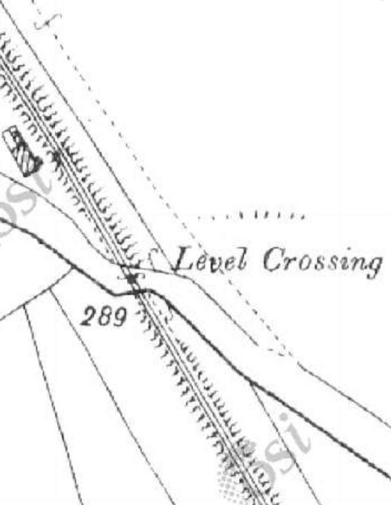
Barnes Halt was adjacent to the road at this location. This is how it is described on Wikipedia:
“Barnes Halt was not a ‘station’ in the ordinary sense. It was simply a stopping point at the level crossing across the Kilmacrennan-Creeslough road, a few miles north of Termon. There was no station building or platforms, only the embankment on which the rail track ran, and the house occupied by the railway employee responsible for manning the level crossing gates.” [5]
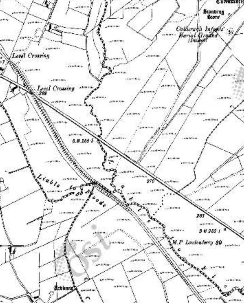
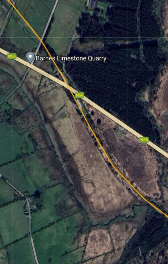
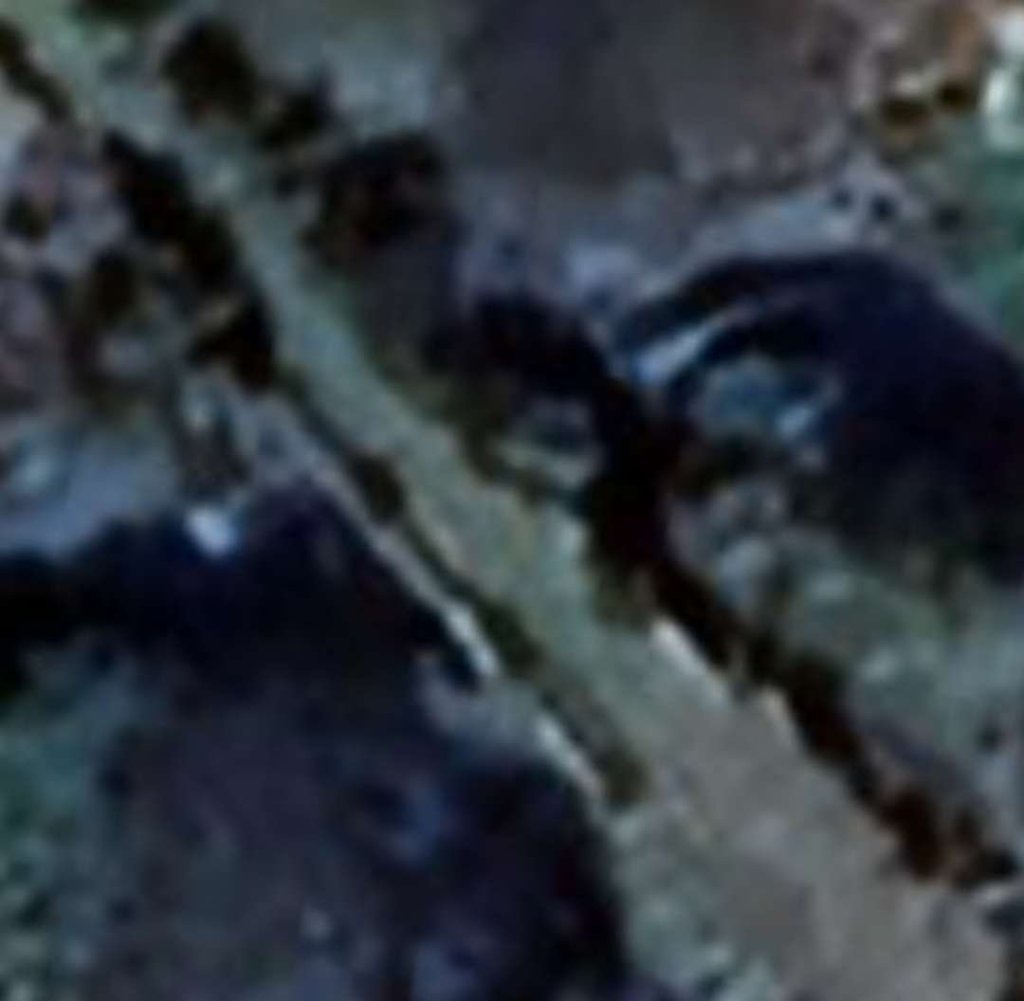
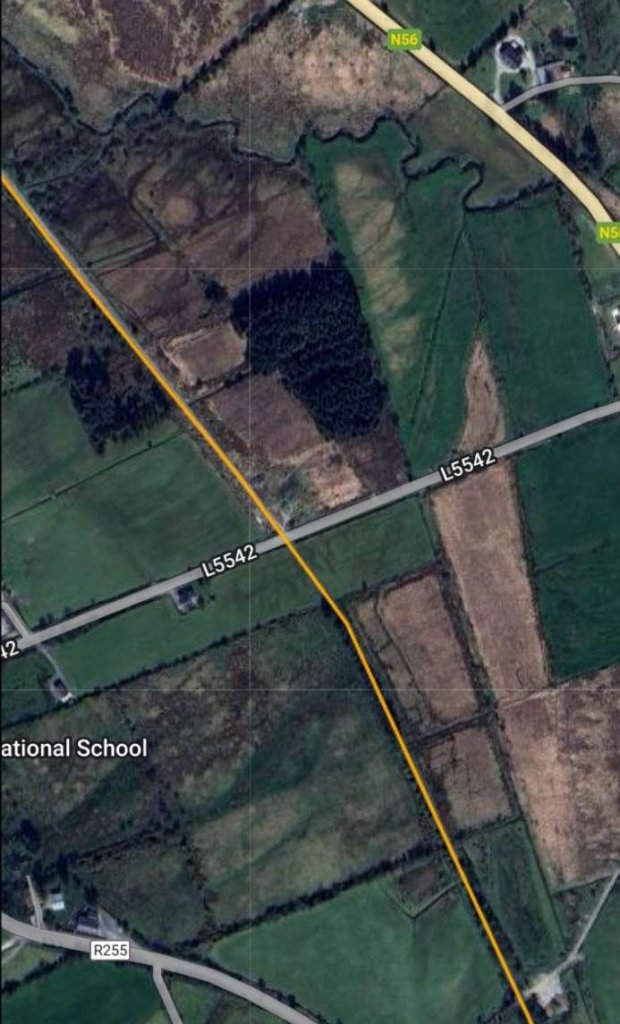
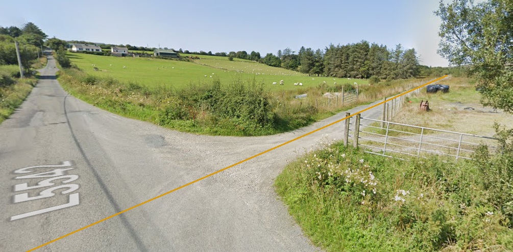
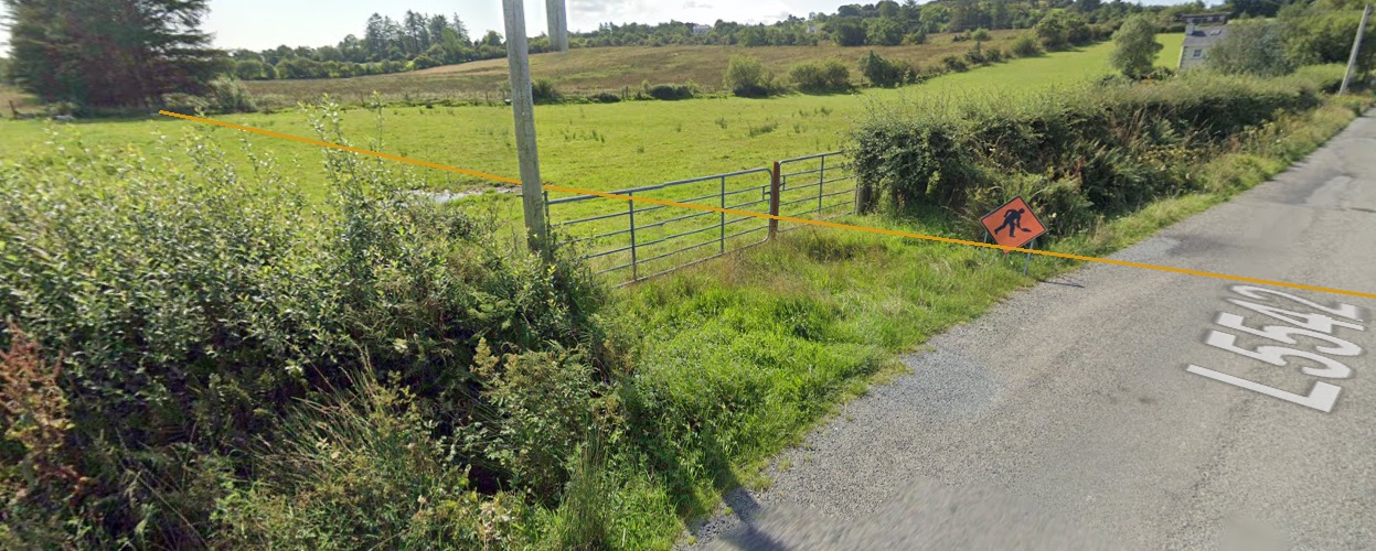
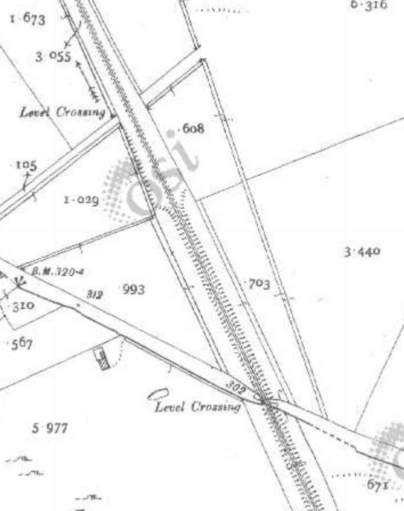
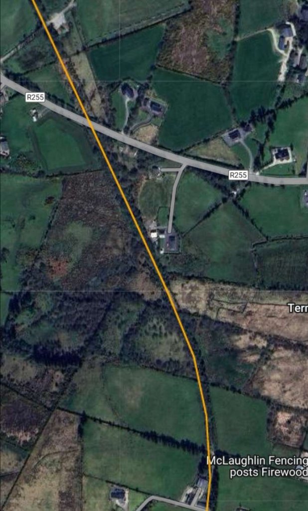
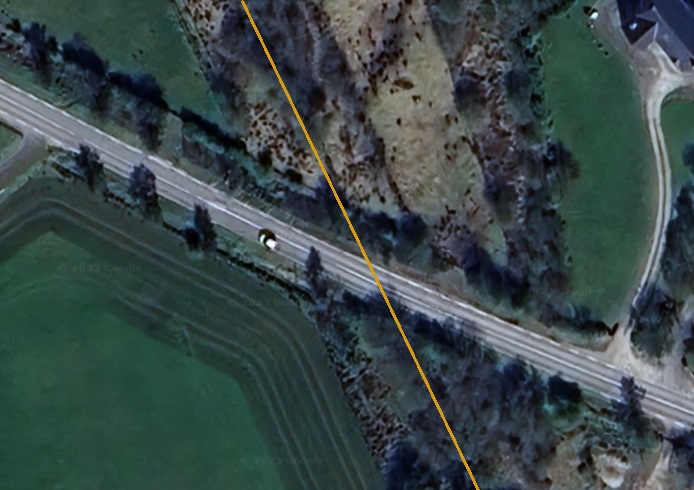
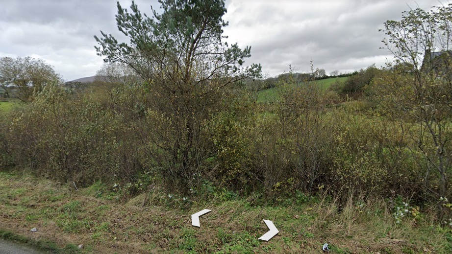
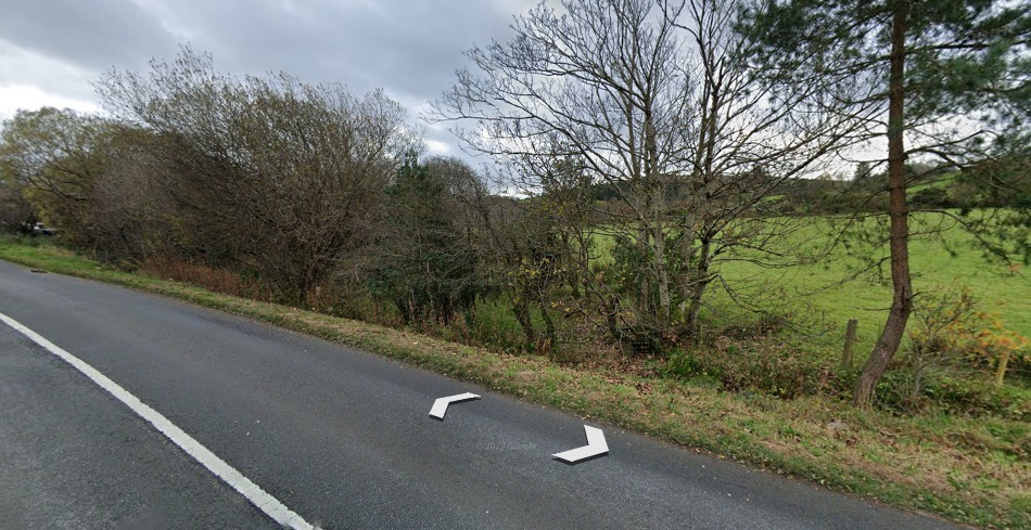
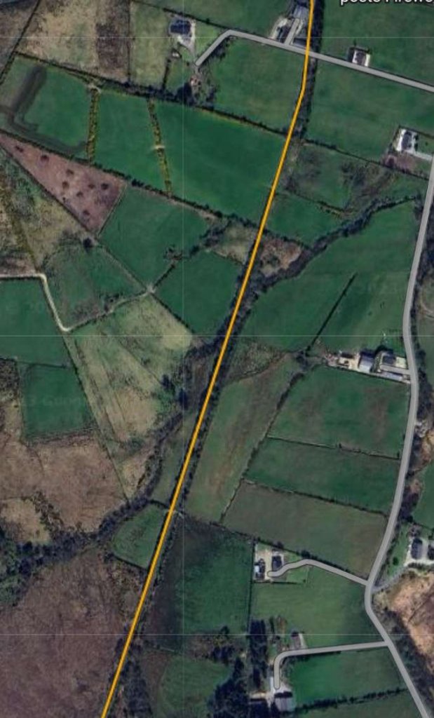
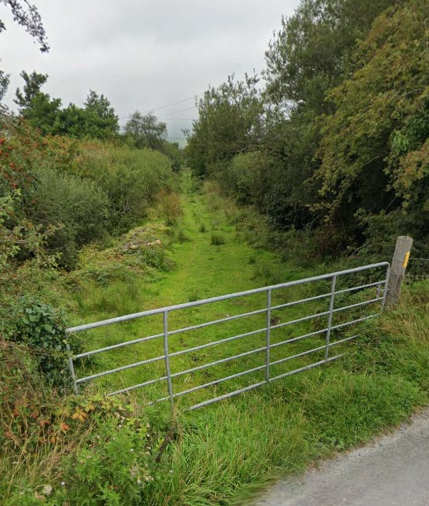
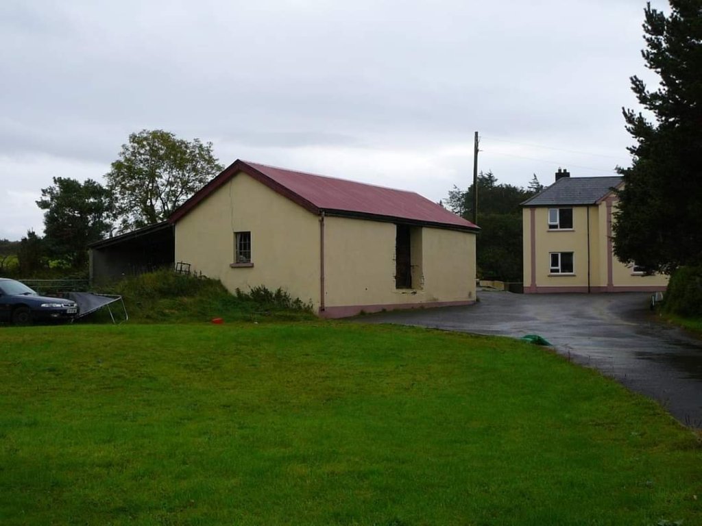
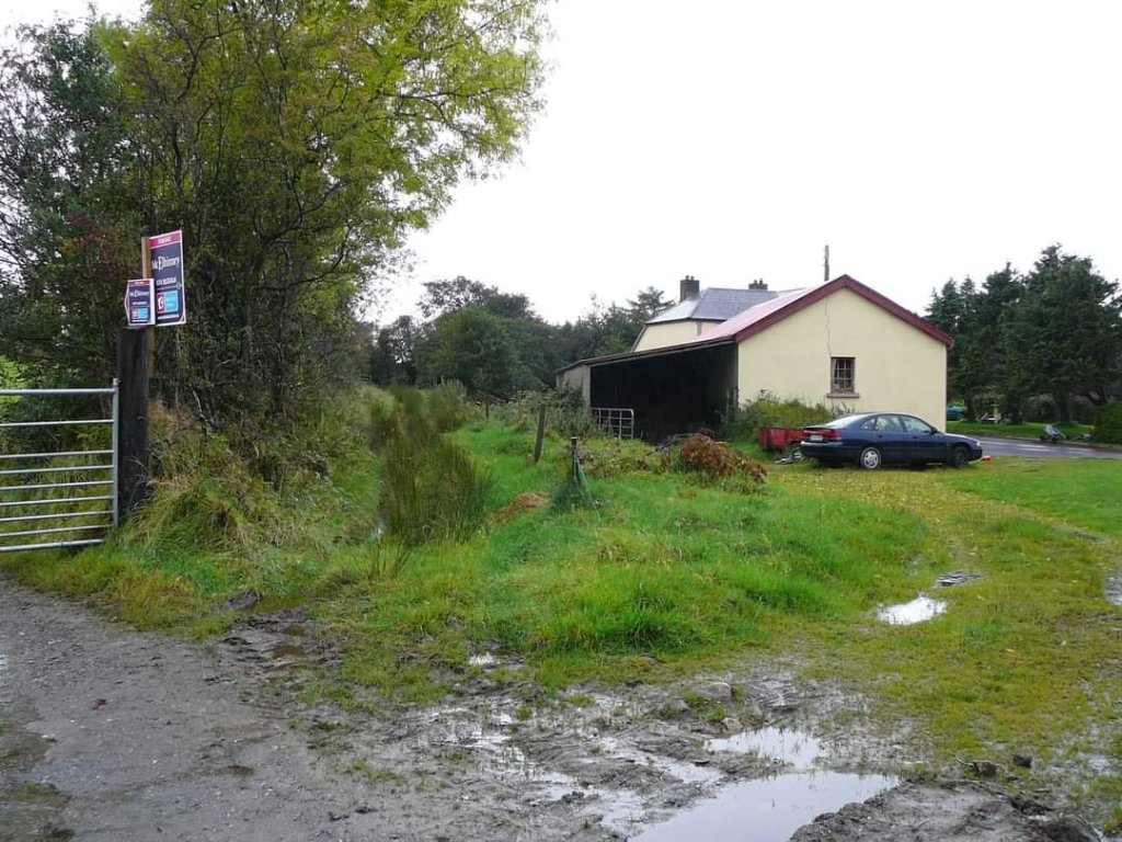
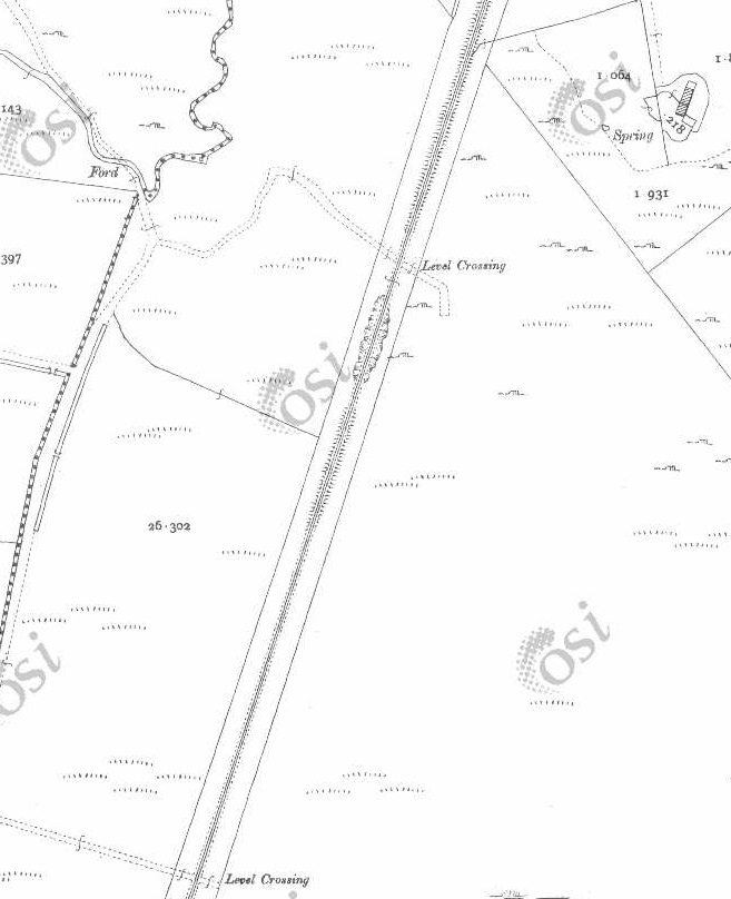
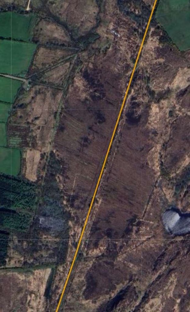
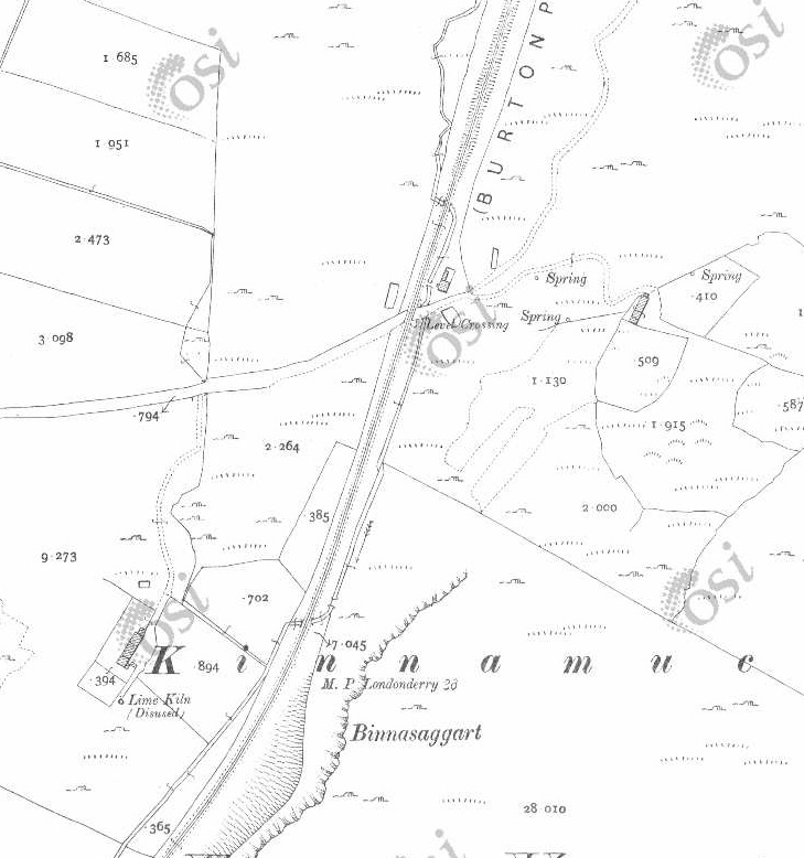
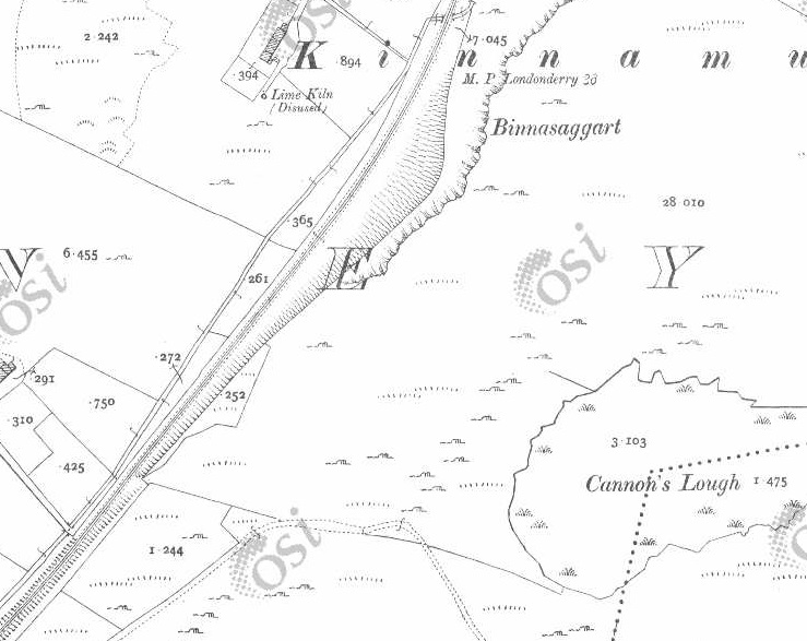
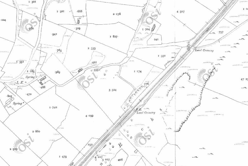
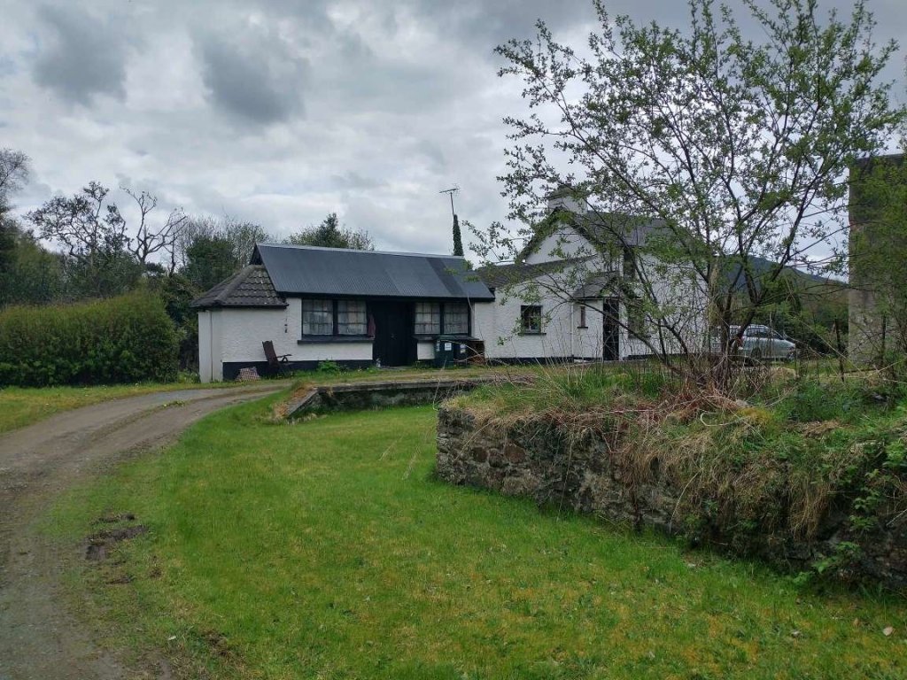
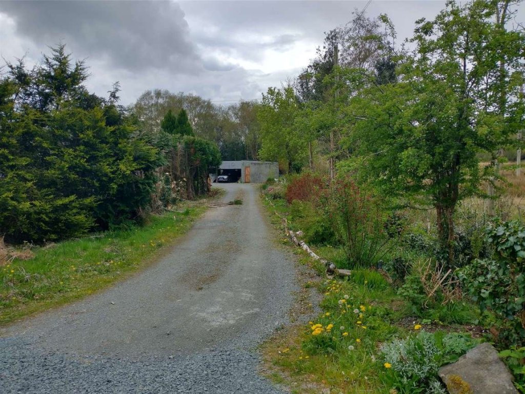
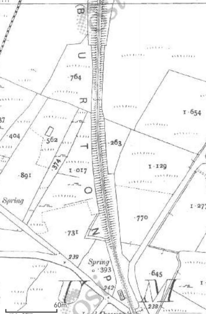
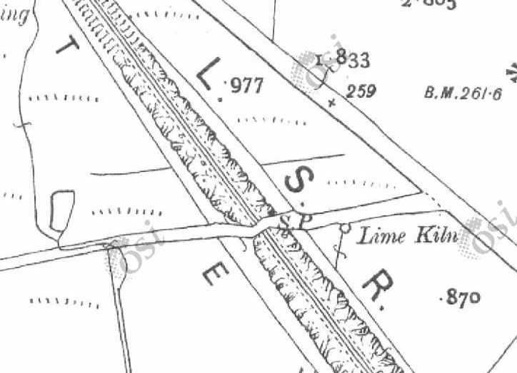
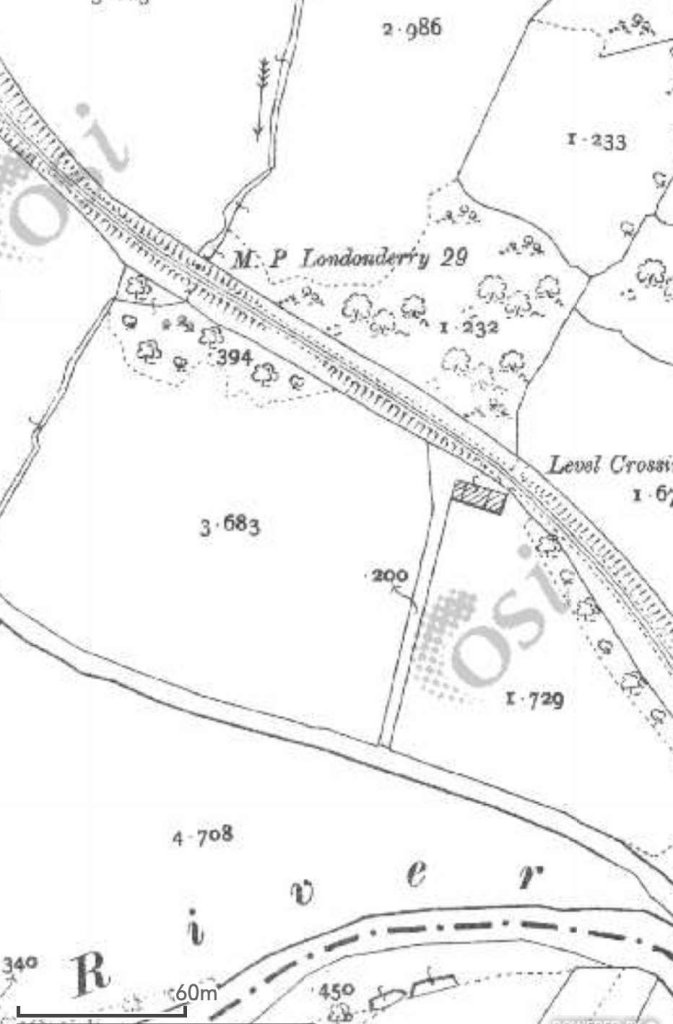
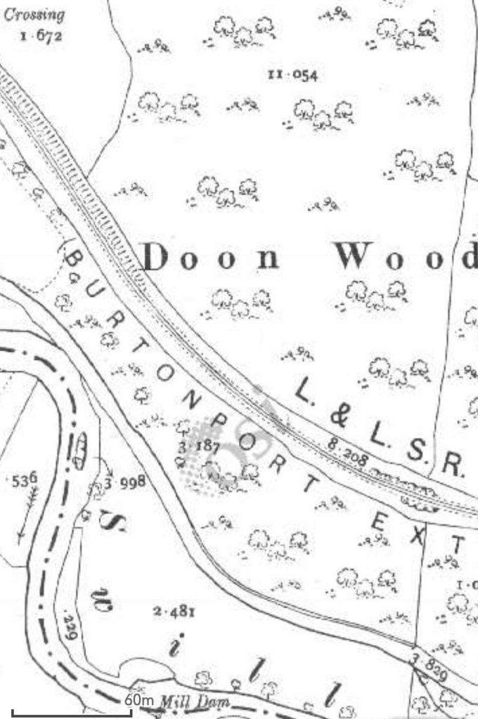
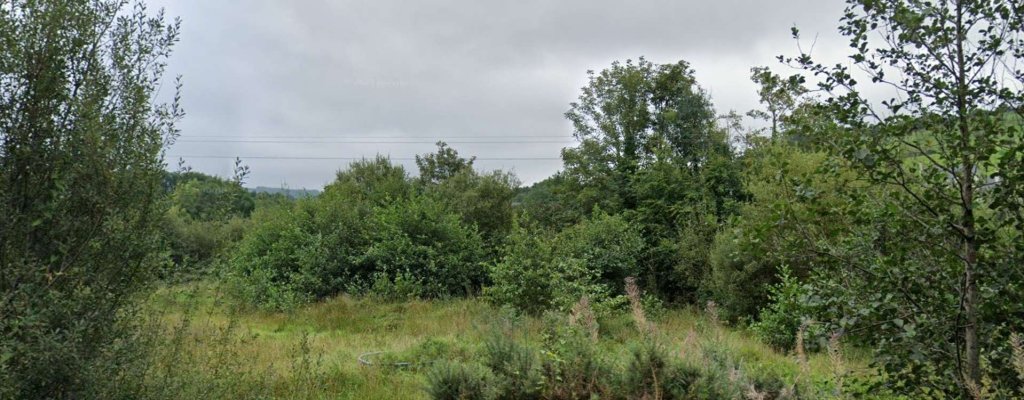
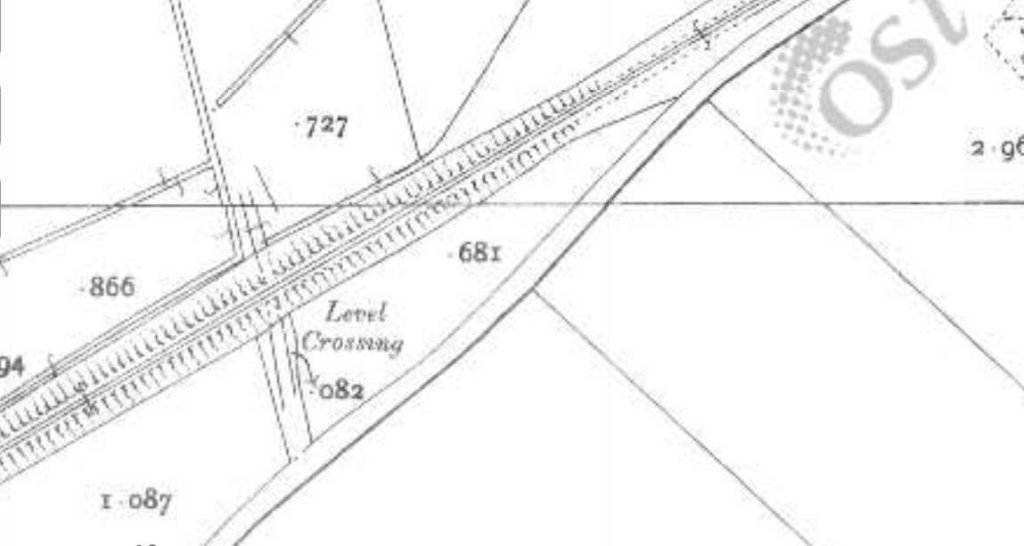
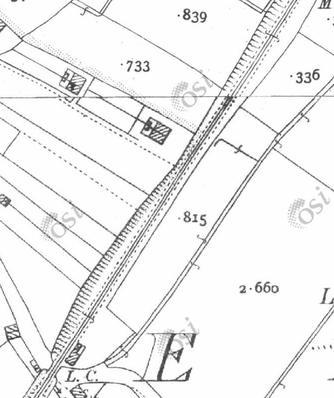
This next extract from the 25″ survey shows the bridge which carried the line across the river to the Southeast of the road crossing. The bridge appears at the bottom-right of the RailMapOnline image above. I do not have a photograph of this location in 21st century. However the image below shows that the bridge is still in place in 2023. [2]This grainy image is an enlarged view of the bridge as it appears on Google Earth. The old railway formation is in use as a moorland access track. [Google Earth, June 2023]This satellite image shows approximately the same length of the old railway as appears in the bottom half of the 6″ OSi map extract above. [4]This next extract from the 6″ OSi survey of 1901 shows the line turning from a South-southeast trajectory to a Southerly direction. In this length the line crossed what became two metalled minor roads. The mapping also crossed onto a new map sheet just to the South of the first of those level-crossings. [2]This image covers the top half of the map extract above. It again comes from the RailMapOnline.com website with the route of the old railway shown as a yellow line. [4]Looking West along the L5542 through the location of the old level crossing. The track to the right of the image follows the formation of the old railway. The crossing was gated (Gates No. 7), although no crossing-keeper’s cottage was provided. This suggests that train crews would probably have been responsible for opening and closing the gates. [Google Streetview, August 2021]Looking Southeast at the same location. The Burtonport Extension Railway route is marked by the yellow line. There is a line of conifers at the left side of this image which run along the line of the old railway. [Google Streetview, August 2023]The extract from the 25″ OSi survey shows two further level crossings. The more northerly of the two provided field access across the railway and would have been ungated. At the more southerly of the two the old railway crossed what eventually became a metalled road, the R255. This map extract ties in with the bottom half of the 6″ OSi map extract and the top left of the next RailMapOnline.com image below. [2]The old railway continued in a generally southerly direction beginning to turn towards the South-southwest. [4]A closer view of the location of the old railway crossing. Comparing this image with the map extract from the 25″ OSi survey shows that the carriageway is a little wider. Interestingly, looking back at the map extract from 1901, the road only seems at that time to have narrowed slightly at the crossing rather than turning to allow a crossing at right-angles to the railway. The crossing was gated (Gates No. 6) with train crews again needing to operate the gates. The location of the boundary fences which marked the extent of railway land can easily be seen North of the road. South of the road the railway land has become a woodland corridor. [4]Looking North at the location of the level crossing. [Google Streetview, August 2021]Looking South from the R255 at the same locagtion. The old railwayroute runs through the undergrowth directly ahead. The edge of railway land is the edge of the field on the right. [Google Streetview, August 2021]This and the next map extract are taken from the 25″ OSi survey of 1901 and show the railway heading South-southwest towards Kilmacrenan Station. There were two ungated crossings on this length of the line. [2]This map extract shows the length of the line just to the North of Kilmacrenan Railway Station. [2]This satellite image from RailMapOnline.com covers approximately the same length of line as shown on the two 25″ map extracts above. [4]This map extract shows the layout of Kilmacrenan Railway Station. This was another station with no passing loop at the turn of the 20th century, and where trains would need to lay back into the goods sidings to allow another one to pass. The road crossing on the Northern boundary of the station site would have been gated. The gates probably would have been operated by station staff. [2]The length of line South of Kilmacrenan Railway Station. [2]This satellite image covers approximately the same length of line as the two 25″ map extracts above. The line runs on a South-southwest/North-northeast axis. [4]The approach to Kilmacrenan Railway Station from the North as seen from the minor road at the North end of the station. [Google Streetview, August 2021]Kilmacrenan Railway Station site in 2021. The station is seen from the minor road at the North end of the Station platform. The goods shed/store is left of centre, the platform edge remains, as does the station house. [Google Streetview, August 2021]
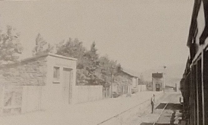
“Kilmacrenan Station was to the west of the town, approximately two miles away by road in the townland of Doon. Nearby is Doon well, which was a pilgrimmage venue which generated passenger traffic to the station. The station building and platform were on the Up side with a goods store and two sidings behind this.” [6]
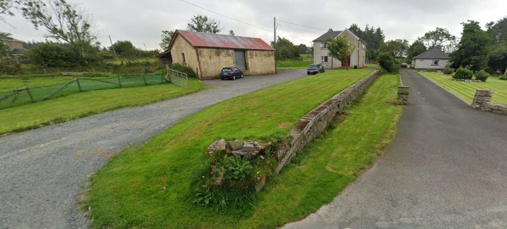
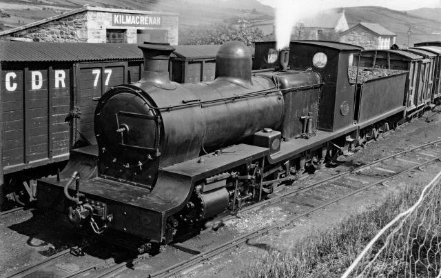
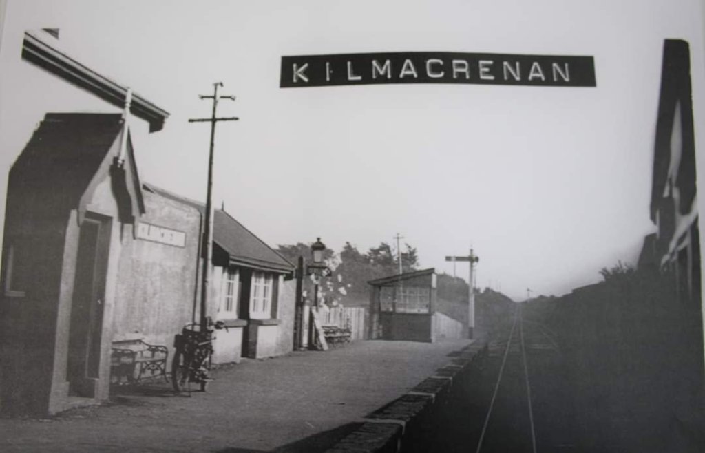
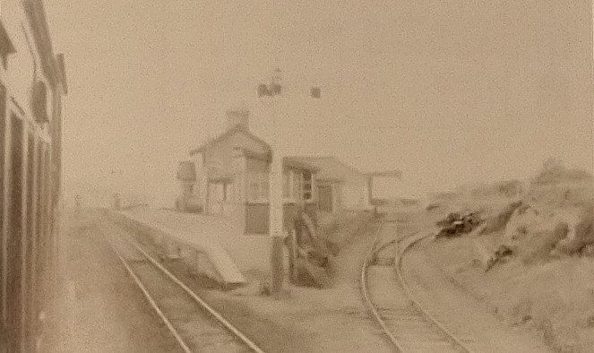
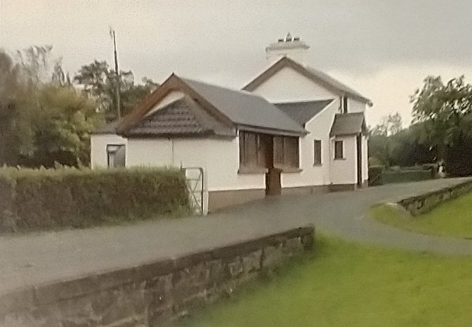
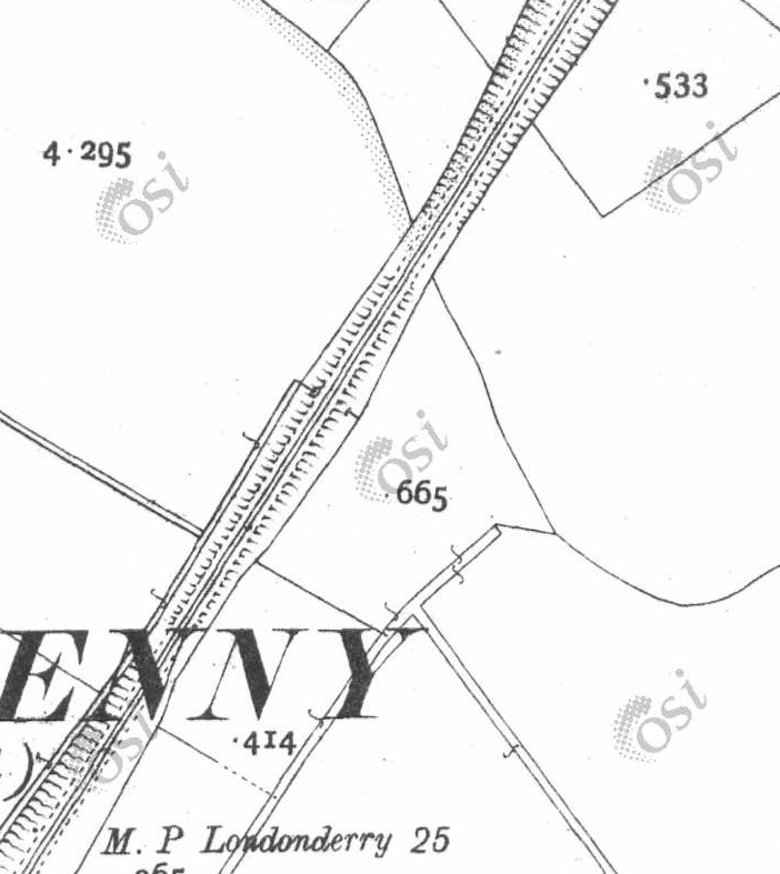
These two photographs show Kilmacrenan Railway Station as it appeared in 2007. The goods shed and the station house are seen above in a photograph taken from the Northeast, just to the South of the road serving the station. [7]This photograph looks along the line of the sidings at Kilmacrenan Station from close to the location of the buffers. Both this image and that immediately above were shared on the Londonderry & Lough Swilly Railway Facebook Group on 19th November 2020 by Chris Stewart. [7]This photograph of 4-8-0 Locomotive No. 12 shows it on a goods train at Kilmacrenan Railway Station. Two trains appear to be passing each other. The picture was shared by the Donegal Railway Heritage Centre on Facebook on 25th March 2022. [8]This image was shared on Facebook by Donegal County Museum on 17th August 2020. It shows the passenger station building on the left. It seems that, in this picture, two lines ran alongside the platform. The photograph was taken from a train in 1937 by H.C. Casserley. [9]These two further pictures of the station were also taken by H.C. Casserley in 1937 from the train on which he was travelling. This image looks North, the train appears to be heading South. [1: p64]This photograph also looks North but from a different train heading North towards Barnes Gap and Creeslough. The photograph was also taken by H.C. Casserley. [1: p63]These two map extracts show the railway line further to the South of Kilmacrenan Station. The line ran for some distance on a straight course. [2]This RailMapOnline.com satellite image shows approximately the same length of the line as shown on the two 25″ map extracts immediately above. [4]The line continues, eventually curving further to the Southwest, through Mile Point 36 (from Londonderry). [2]And on, passed Cannon’s Lough. [2]Again, this satellite image covers the same length of the line as the two map extracts above. [4]This and the next two extracts from the 25″ OSi survey of 1901 take the line as far as Level Crossing No. 5. [2]These two images cover the same length of the line as the three map extracts above. [4]Crossing-keeper’s cottage and gates No. 5 appear at the bottom-left of this satellit image.[4]
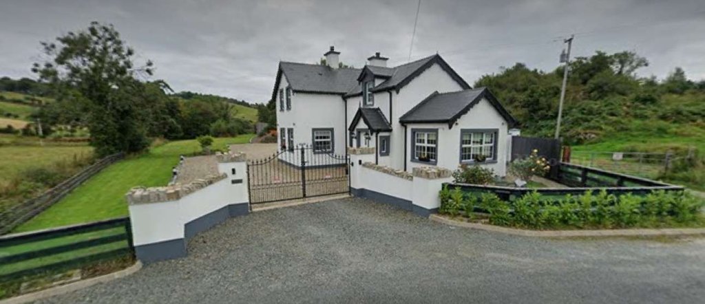
Crossing Cottage No. 5 has been significantly extended since the demise of the line.
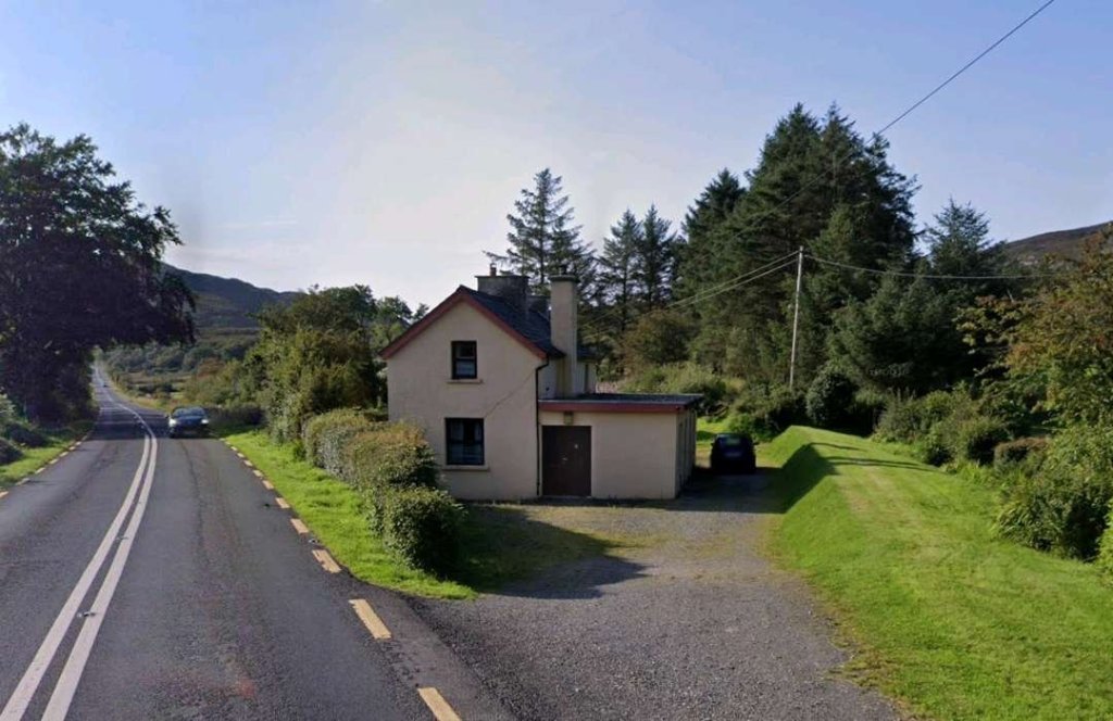
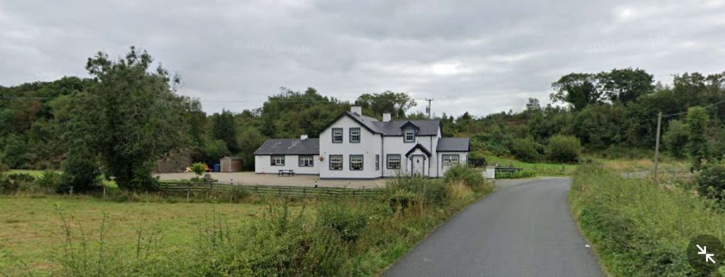
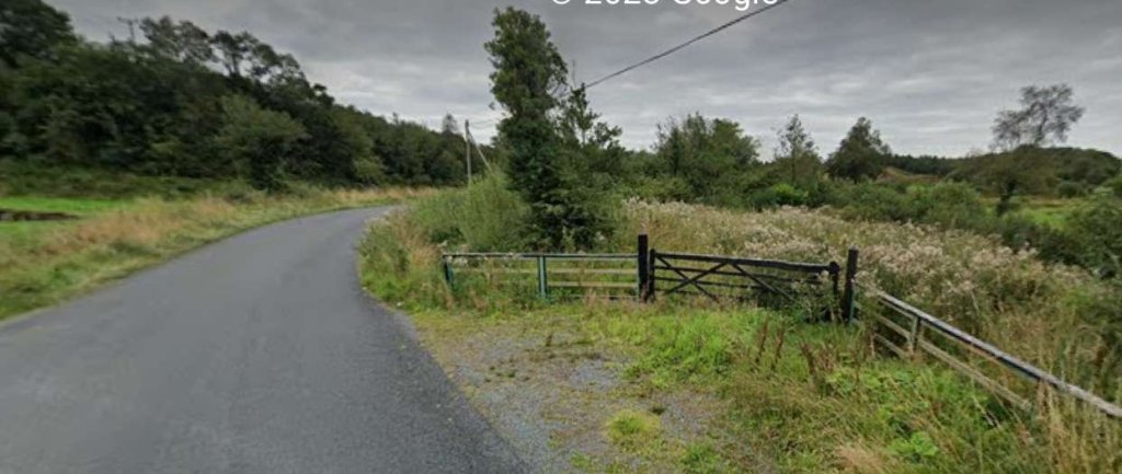
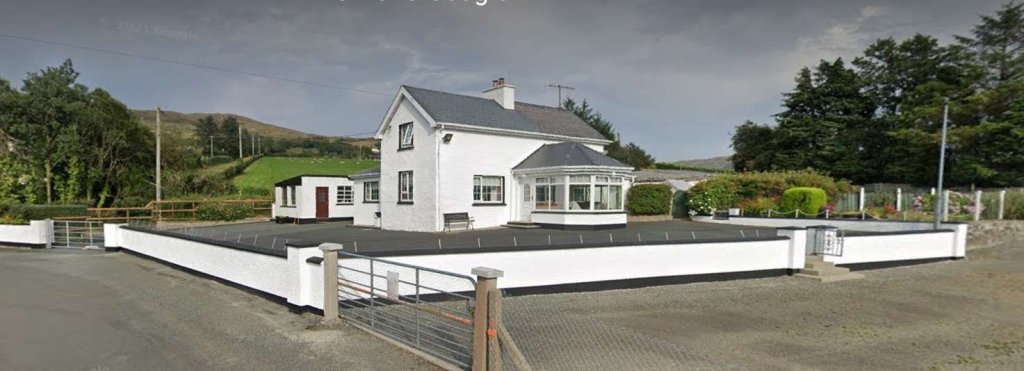
Crossing No. 5, the Keeper’s Cottage sat on the East side of the line, North of the minor road which crossed the line.Crossing Cottage No. 5 as it appeared in August 2021. The original cottage is much extended. The old railway ran across the image left to right (or vice- versa) in front of the cottage. [Google Streetview, August 2021]Looking North along the line of the Burtonport Extension Railway from the location of Crossing No. 5. The original cottage is the two storey section of the building closest to the camera. [Google Streetview, August 2021]The minor road curves sharply to the South on the East side of the crossing and runs roughly parallel to the old railway formation which can be seen running South behind the field gate. [Google Streetview, August 2022]
Being at one of the significant crossings along the line warrants us noting the comments about these crossings made by Bell and Flanders: “These Gates were a regular feature along the route of the line and were much more important than the accommodation crossings. … Whereas accommodation crossings were private accessways for local farmers the Gates were placed where the railway crossed public roads and were always staffed – opened and closed – by railway employees who lived in the adjoining houses.
Accommodation crossing gates [where they existed]were kept open for the railway and closed to the farm tracks until someone needed to cross. Crossing Gates, on the other hand were always kept open for the road and closed to the trains until it was time for a train to pass by.
Being a crossing keeper was a good job as it was a steady income, good living accommodation and, as there were few trains even in the railway’s golden days, the work wasn’t strenuous. But crossing keepers did have to know the railway regulations and any special instructions issued from time to time. Crossing keepers were often the wives of railway gangers who had their length of track to check and maintain each day. As the years went by the gated crossings sometimes became regular, though “unofficial” stopping places for passengers and goods.” [1: p61]
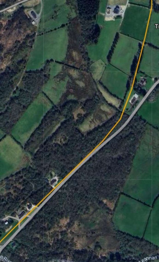
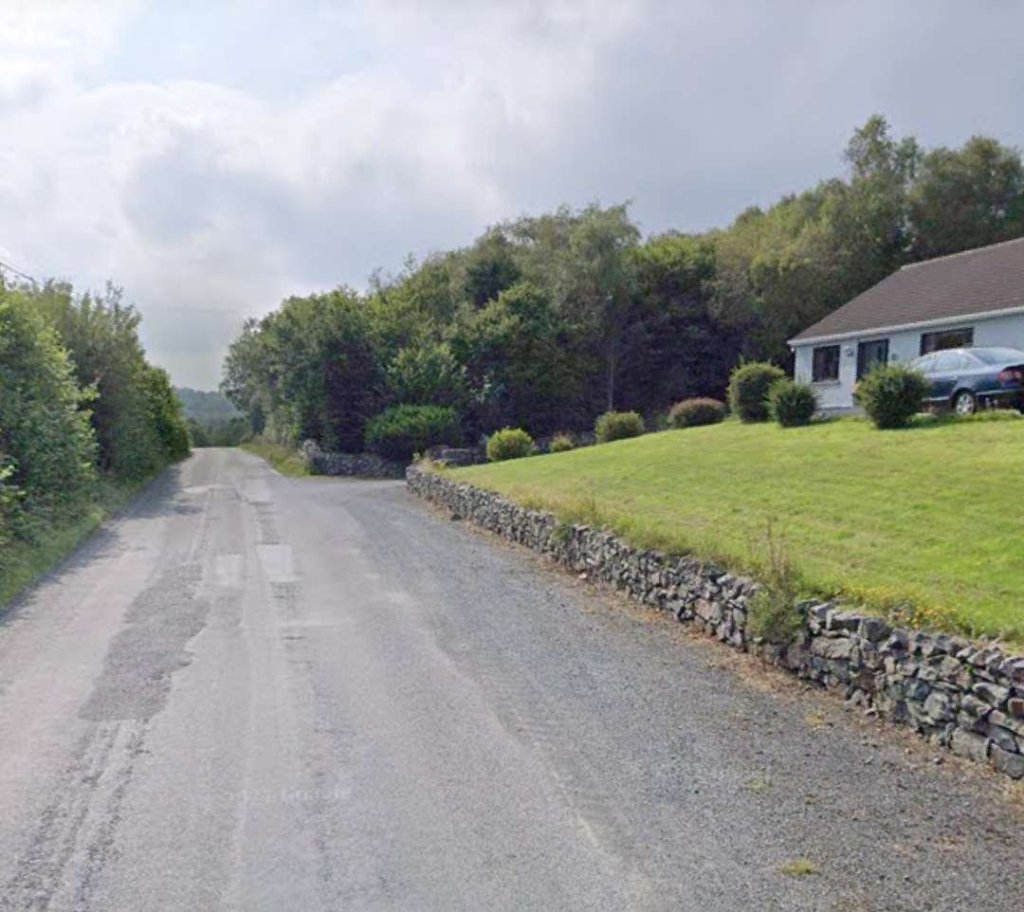
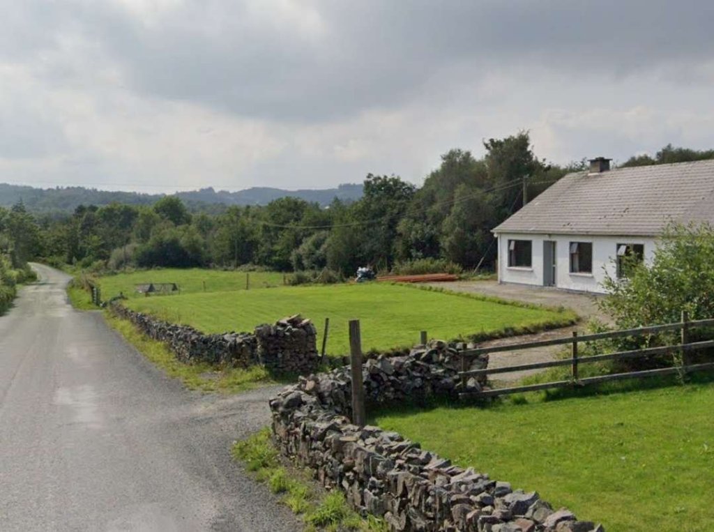
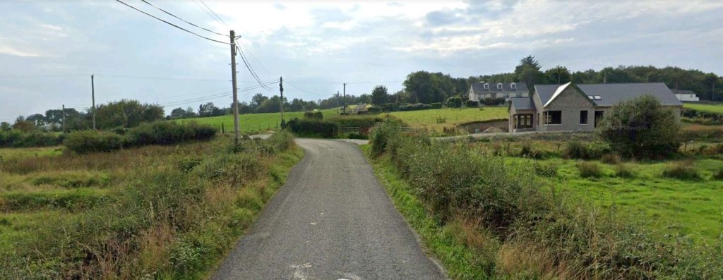
The old line continues in a South-southeast direction alongside the minor road which leads to Treantagh. [2]Both these two images are map extracts from the 25″OSi 1801 survey. Close to Treantagh the old railway turned towards the South, crossing a road bridge in the process.The next RailMapOnline extract shows roughly the same area as the two map extracts above. The route of the old railway continues to be shown by the yellow line. [4]The building on the right of this image is built across the line of the old railway. This image is taken looking South adjacent to Bridgeburn House B&B flagged on the satellite image above. [Google Streetview, August 2021]A short distance to the South, the old railway ran along the verge of the road for a short distance, approximately on the line of the boundary wall before heading through what is now a stand of trees which can be seen on the left of this image. [Google Streetview, August 2021]The line is rising as the road falls away and turns to the left. The trees mentioned above fill the right half of this image. [Google Streetview, August 2021]
A little further to the South the line crossed a different minor road by means of a stone arch bridge.
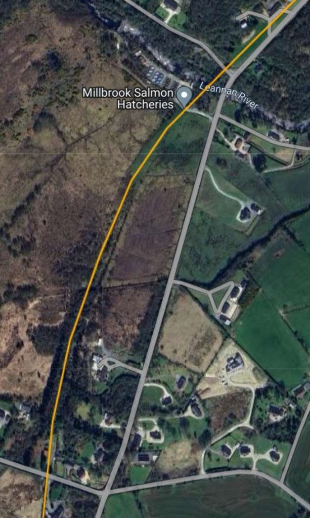
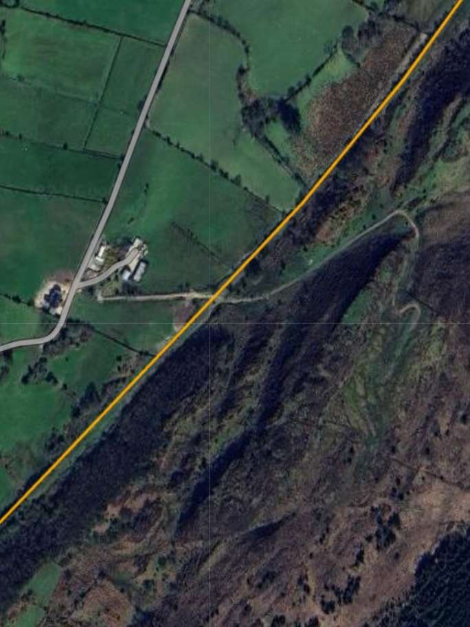
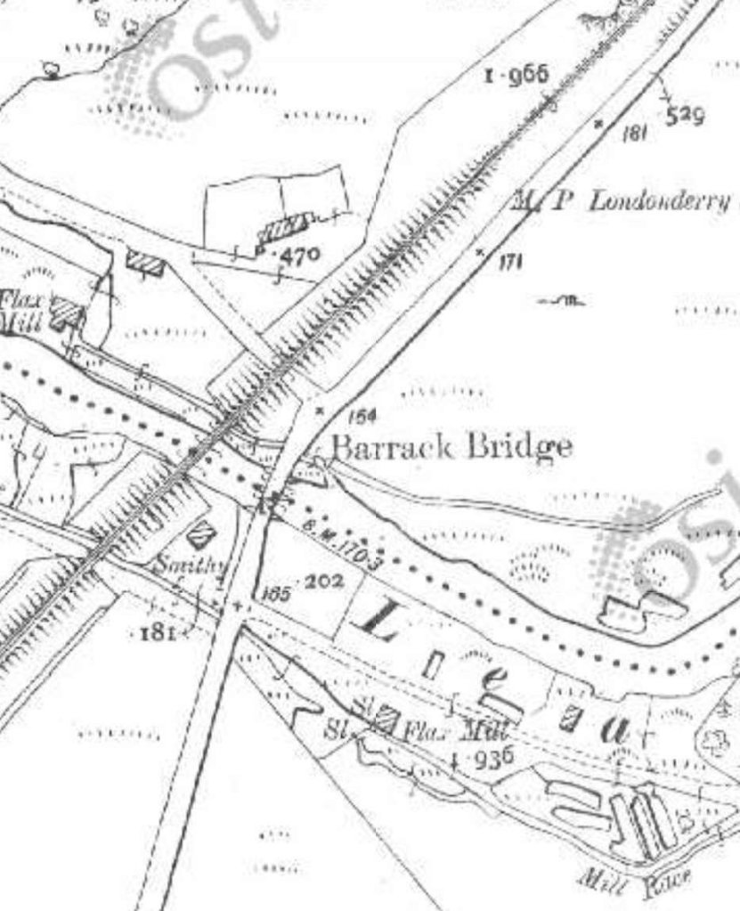
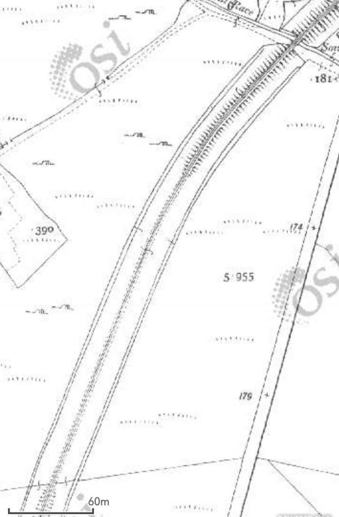
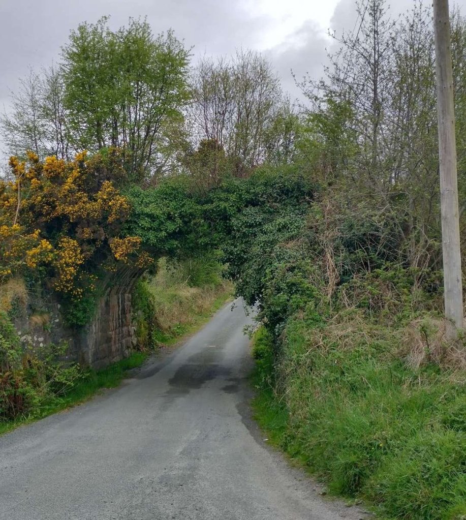
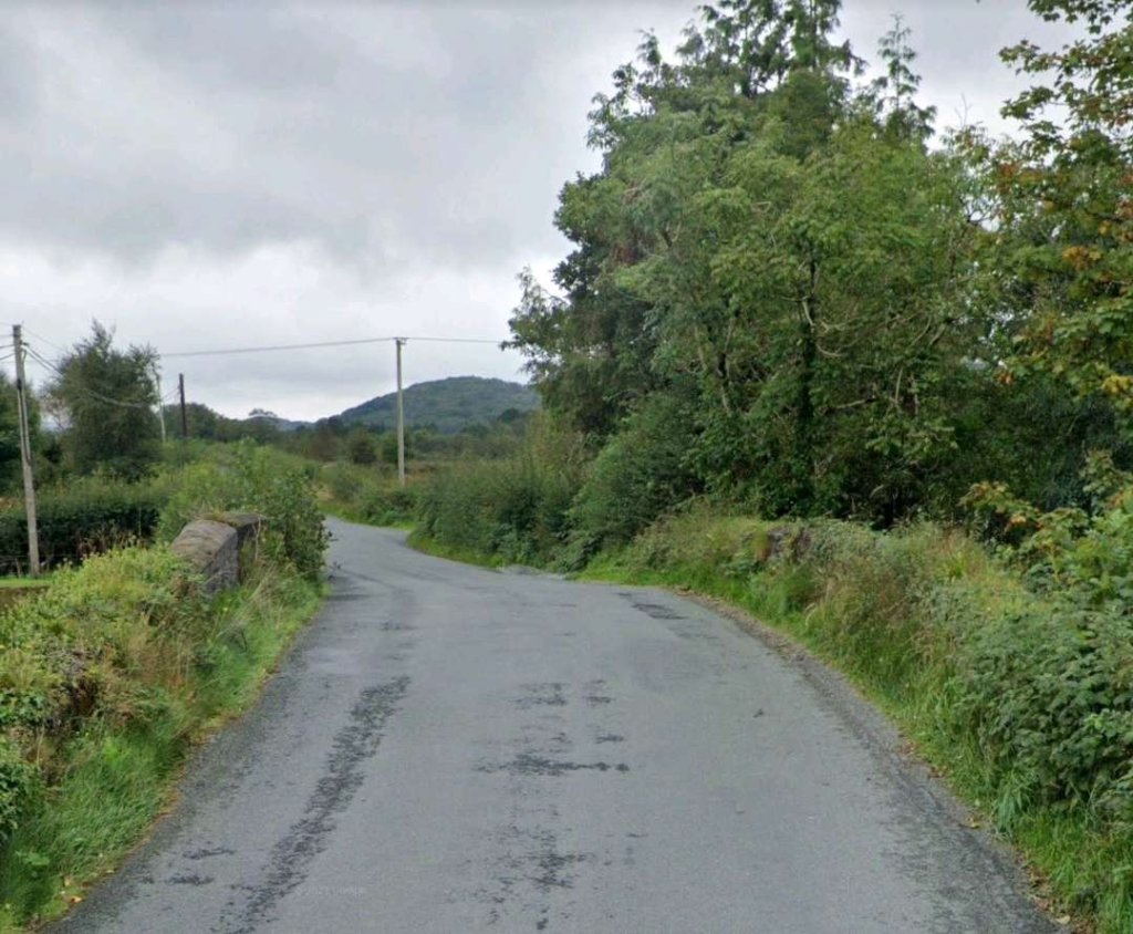
The bridge shown in the satellite images above. The photograph looks along the minor road from the Northeast. [My photograph, 29th April 2023]The line continued to the South, curving round towards the Southwest. [2]The line continues turning to the Southwest, beginning to run alongside another minor road. [2]Road and rail ran in tight formation heading Southwest. [2]This satellite image from RailMapOnline.com covers the length of the old line illustrated on the three extracts from the 25″ OSi mapping of 1901. [4]The route of the old railway is shown on the satellite image above as running through woodland on the North side of the minor road. [Google Streetview, August 2021]The bungalow on the right of this image is approximately on the line of the old railway. [Google Streetview, August 2021]This image shows the next bungalow along the minor road which again sits on what was the old railway formation. [Google Streetview, August 2021]The old railway, while travelling in a Southwesterly direction, was carried over a series of obstacles as this extract from the 25″ OSi 1901 survey shows: a road, a mill-race, the River Lennan, another mill race and then an access road. [2]This and the next map extract show the length of the line North of Churchill (Church Hill) Railway Station. [2]Churchill Railway Station appears at the bottom of this map extract. [2]This satellite image covers the same ground as the map extracts immediately above. [4]Another minor road leading to Milltown Carrick is spanned by a stone arch bridge, which appears at the top-right of the satellite image above. [My photograph, 29th April 2023]Looking Southwest along the minor road crossing the River Lennan at Barrack Bridge. The route of the old railway was only a very short distance to the right of the road at this location. In the summer months, the arch bridge carrying the old railway over the River Lennan is shielded from the road bridge by modern vegetation. However, at the time of our visit in April/May 2023 the vegetation was not carrying its full summer weight. [Google Streetview, August 2021]The railway bridge across the River Lennan is shown in this photograph taken from the road carriageway. [My photograph, 29th April 2023]A very short distance to the Southwest was a viaduct carrying the old railway across an access road and a mill stream. In the 21st century, the road provides access to Millbrook Salmon Hatchery which is noted on the satellite image above. Originally the road served flax mills downstream. [My photograph, 29th August 2023]
The next location that we have access to is the point at which the old railway crossed the next minor road. That location appears both at the bottom of the satellit image above and the top of the next section of the line, both on the OSi mapping and the satellite imagery below: the location of Churchill (Church Hill) Railway Station.
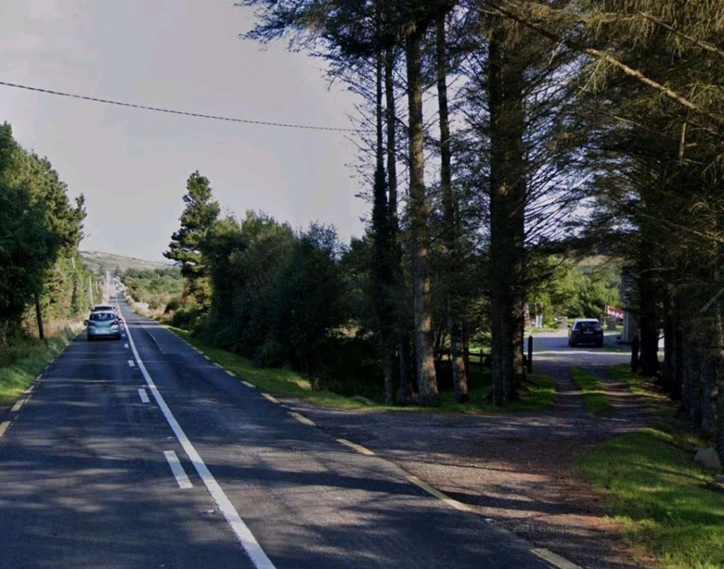
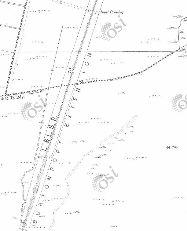
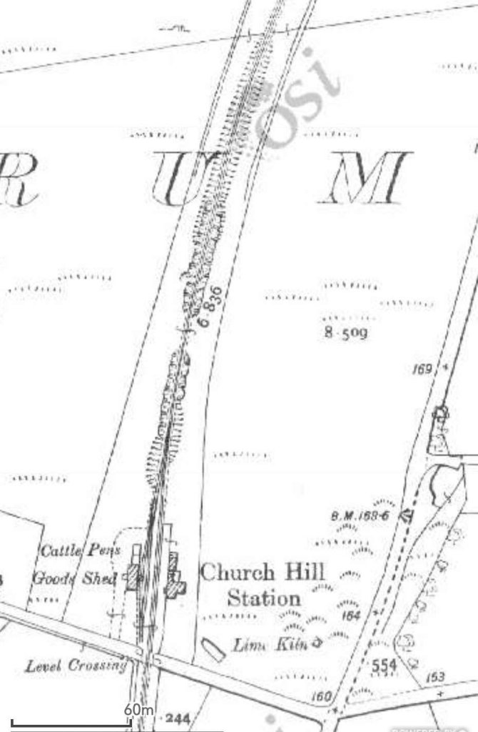
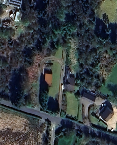
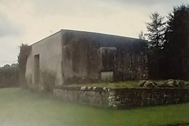
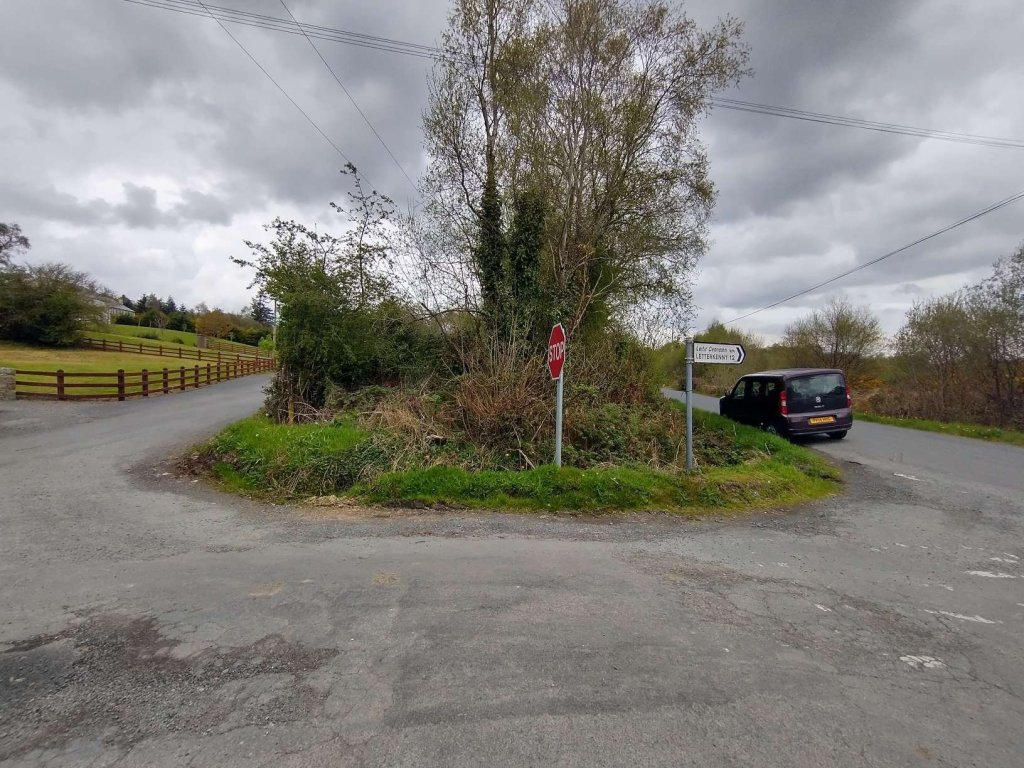
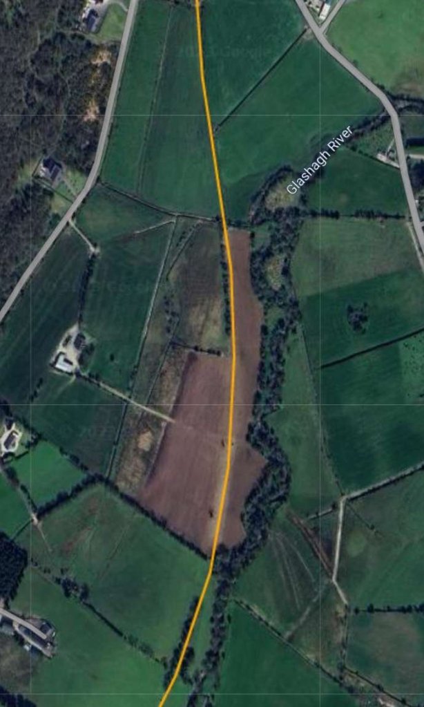
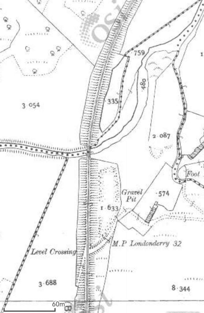
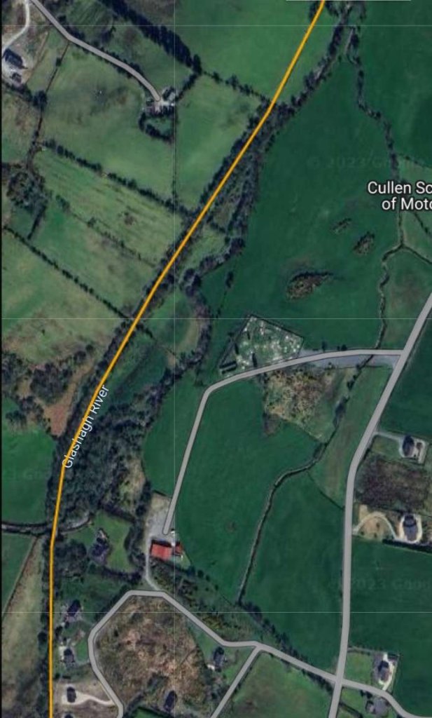
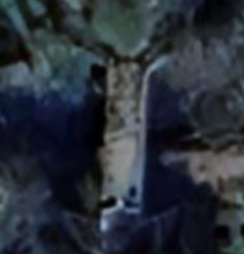
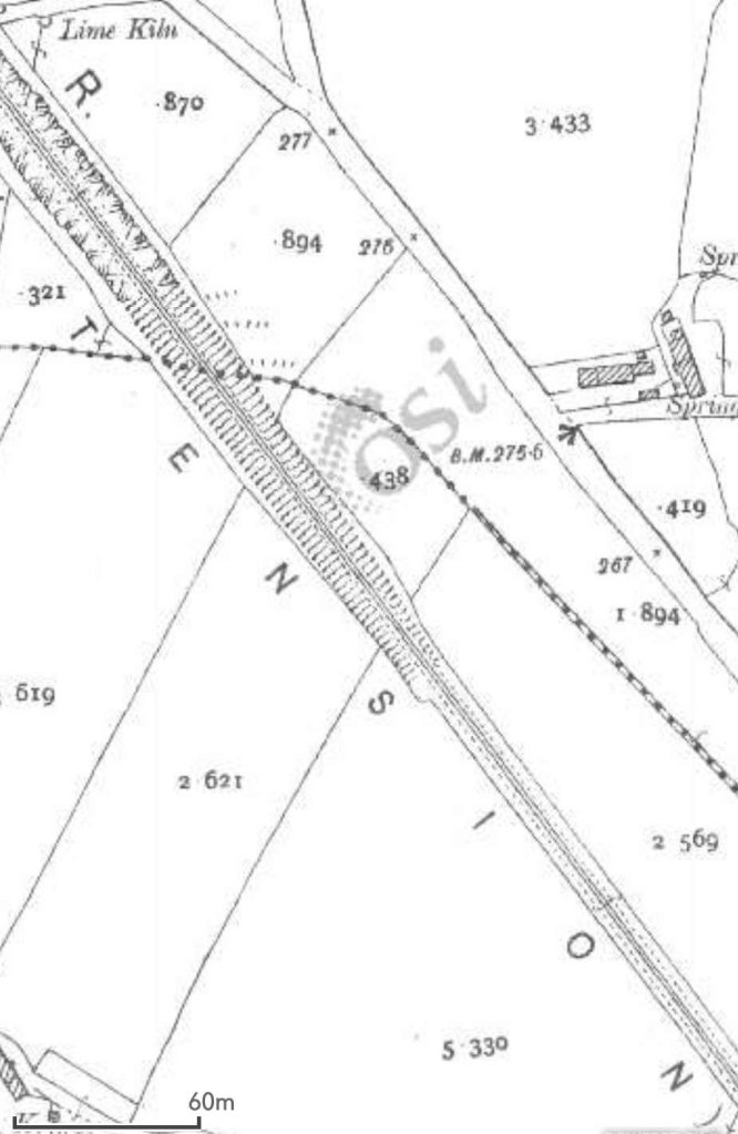
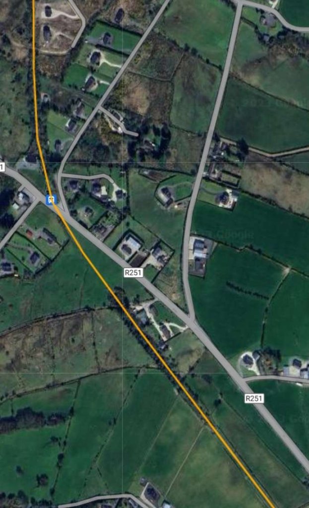
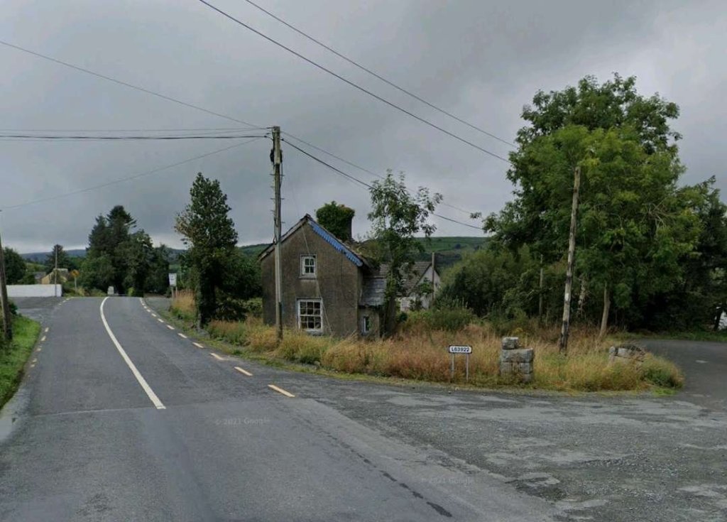
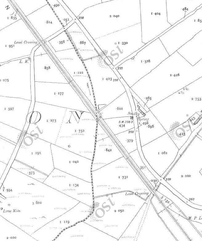
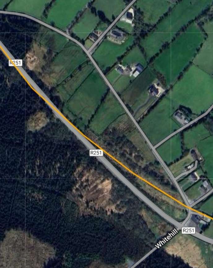
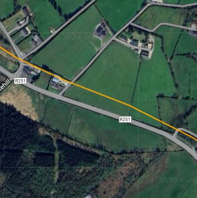
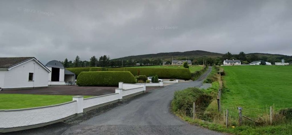
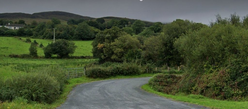
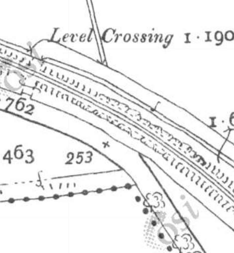
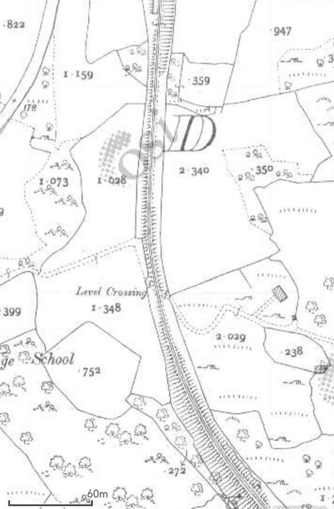
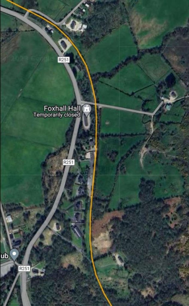
An enlarged map extract of Churchill (Church Hill) Railway Station as shown on the 25″ OSi survey of 1901. The goods shed/store can be seen on the West side of the line, the passenger facility is on the East side of the line. It appears that in 1901, there was no passing loop at the station. [2]The location of Churchill (Church Hill) Railway Station as it appears on Google Earth in 2023. [Google Earth 3rd July 2023] Church Hill Railway Station passenger facilities still stand in the 21st century and are now a private home. This photograph looks at the buildings from the Northwest. [My photograph, 29th April 2023]This is how the buildings appeared at the turn of the 21st century or perhaps a little later. The photograph looks onto the site from the North-northwest. [10: p164]This view from the South looks along Ng the old station platform. The Goods Shed is on the left and the station building on the right. [My photograph, 29th April 2023]The Church Hill Station building as seen from the road which crossed the old line at the South end of the station site. [My photograph, 29th April 2023]The Goods Shed seen from the North. The platform close to the camera was the location of the cattle pens. [10: p164]This next extract from the 25″ OSi mapping shows the old railway heading almost due South as it left Church Hill Railway Station. At the bottom of this extract two roads flank the old railway for a short distance. [2]South of the level crossing the roads diverged from the old railway. [2]This satellite image provided by RailMapOnline illustrates the convergence and divergence mentioned above. It covers the same length of the old railway as the two map extracts above. [4]Looking South along the route of the Burtonport Extension Railway from the road which crossed the old railway at the Southern end of Church Hill Railway Station. [My photograph, 29th April 2023]Looking back North from the level crossing noted above. [My photograph, 29th April 2023]Turning through 180° to look South along the old railway as it headed towards Letterkenny. In a rural context, the road arrangement at this location must be unusual! [My photograph, 29th April 2023]The two map extracts above show the old line curving gently from a South-southeast direction to a South-southwest trajectory and following the Glashagh River. [2]This extract from RailMapOnline.com shows much the same length of line as covered by the two 25″ map extracts above. [4]The three extracts from the 25″ OSi survey of 1901 show the Burtonport Extension curving back towards the South and bridging the Glashagh River. [2]This extract from RailMapOnline.com shows the same length of the old railway. [4]This is the best image that I can provide of the railway bridge crossing the River Glashagh. It can be seen between a quarter and a third of the way up the last image from the bottom, just in from the left margin. [Google Streetview, 4th July 2023]These three map extracts take the old railway through its crossing over the junction between what are now the R251 and the L63922 roads before taking a Southeasterly path. [2]Another extract from the RailMapOnline.com satellite imagery which covers the same length of the old line as the three 25″ map extracts above. Note both the location of Crossing No. 3 and that of the accommodation bridge to the Southeast. [4]The junction between the R251 and the L63922, looking Northwest back along the route of the old railway towards Church Hill Railway Station. The gatekeeper’s cottage is in a state of decay, parts of two of the gateposts remain adjacent to the road number sign for the more minor road. This location was Crossing No. 3 on the Burtonport Extension Railway. [Google Streetview, August 2021]The road that is now the R251 used to curve round to cross the old railway at right-angles. That curve is visible as th edge of the tarmac highway in the modern pictures of the junction. [2]This is a wide angle image of the same crossing, also looking Northeast. This image allows the full location of the crossing to be seen. The railway passed to the right of the crossing keeper’s cottage, crossed what is now the R251 at an angle and ran along the line of the trees on the left of this image. Google Streetview, August 2021]Walking a little to the Northwest, this image looks through the same crossing but is taken looking Southeast. The ruined crossing keeper’s cottage is on the left. The old railway formation passes behind the cottage and crosses the road, heading away along the line of trees/bushes to the right of the road, behind the first telegraph pole. [Google Streetview, August 2021]
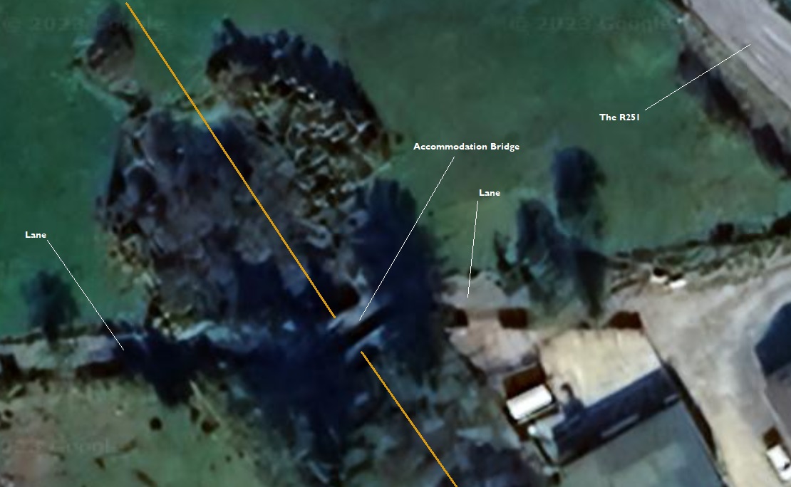
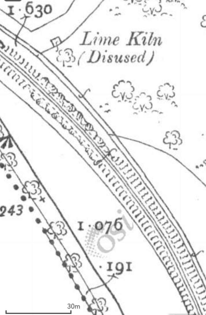
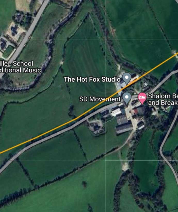
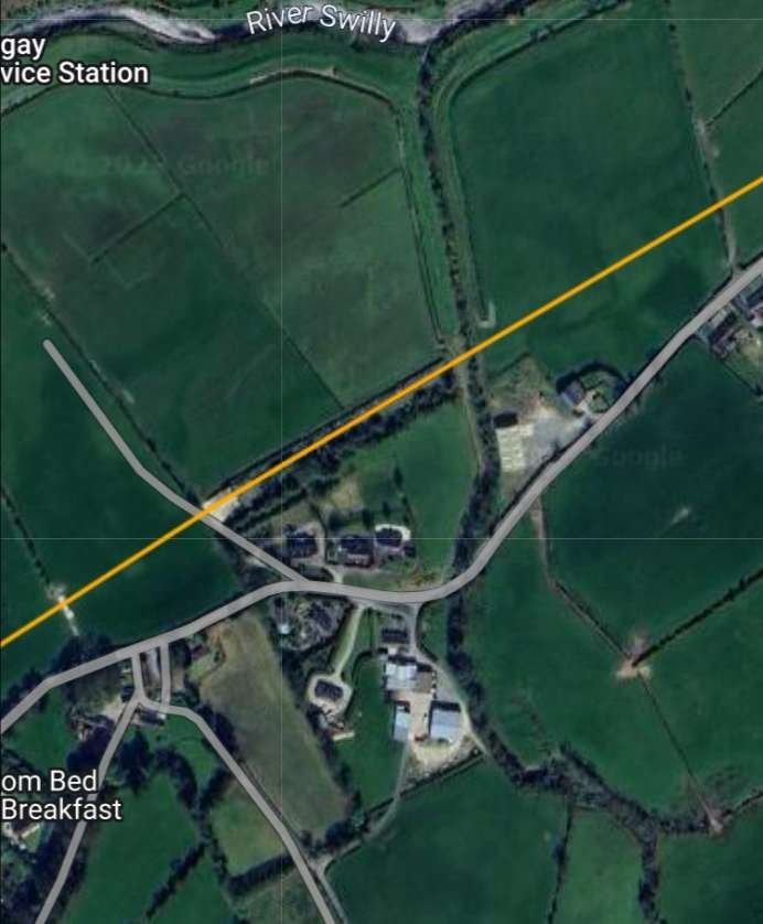
Around 200 to 300 metres Southeast of the crossing the old line entered a cutting as the land around it rose. Shortly after it entered the cutting it was bridged by a lane. Both the bridge and the lane appear to remain today.
The cutting and the accommodation bridge mentioned above are shon on this enlarged map extract from the OSi survey of 1901. The road running from the centre-top tp close to the bottom right is now the R251. [2]The accommodation bridge to the Southeast of Crossing No. 3, as it appears on Google Earth. [Google Earth, 5th July 2023]
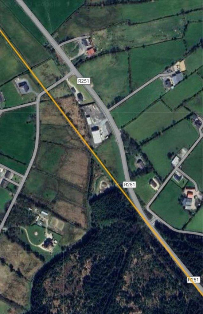
A further 700 to 800 metres to the Southeast the old railway crossed a minor road at level. This can be seen in the images below. The R251 and the old railway route run parallel to each other for a distance before the road drifts closer to the old railway and finally runs on the formation of the Burtonport Extension Railway for
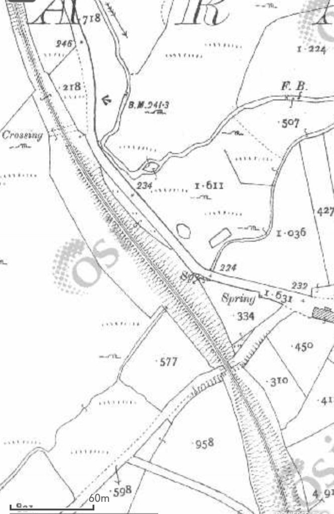
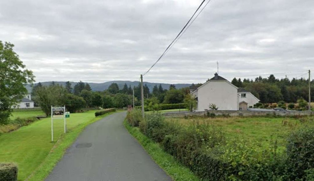
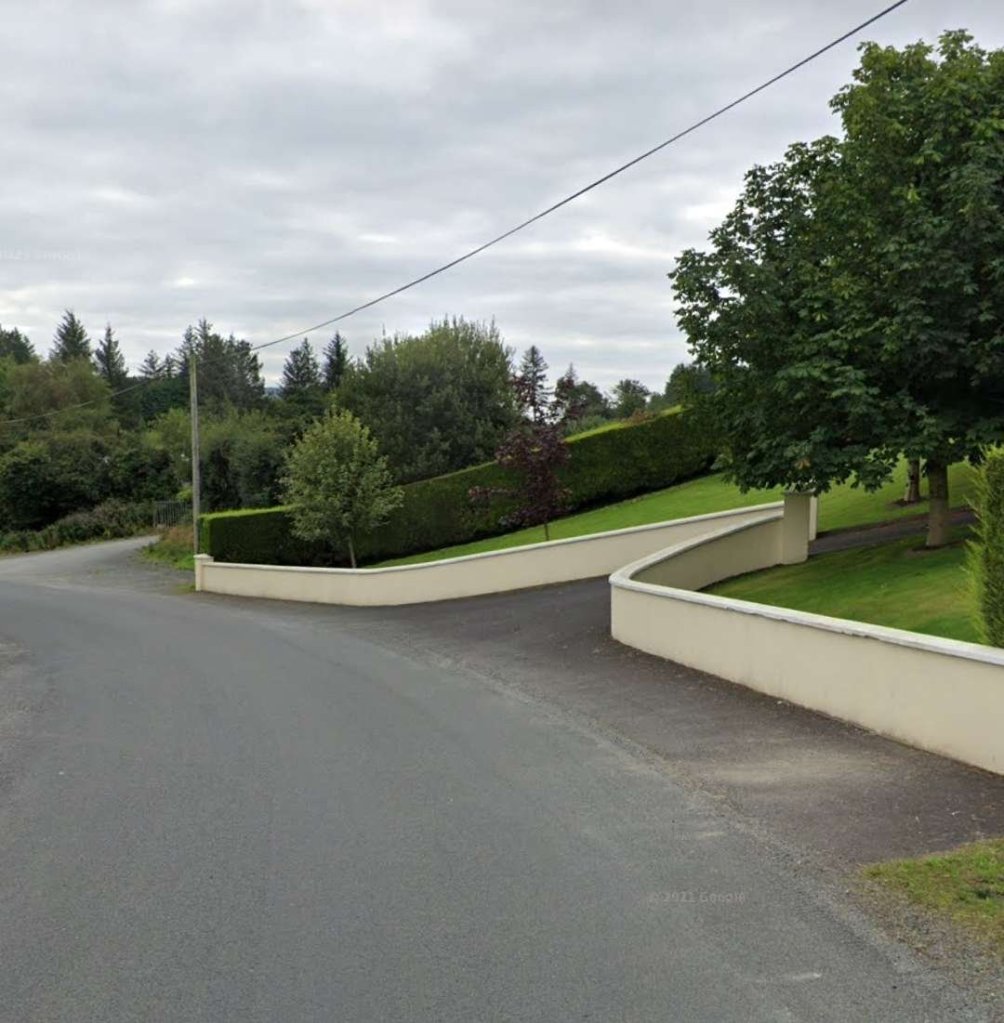
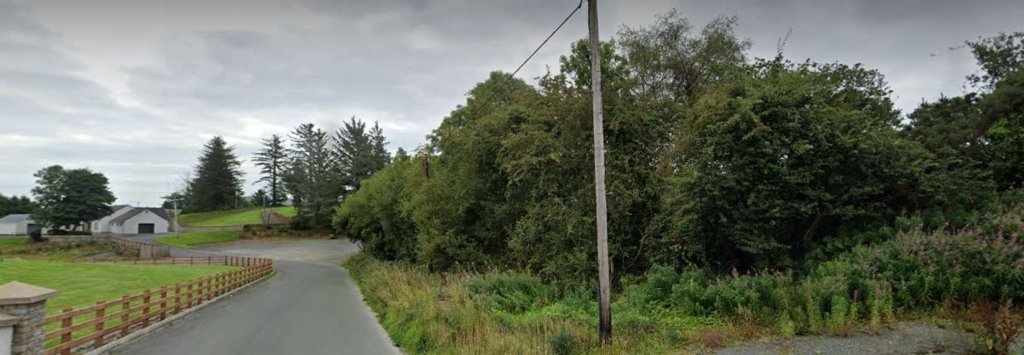
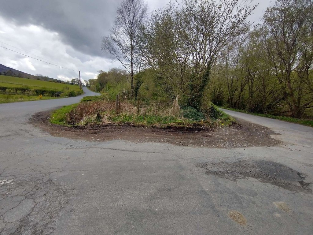
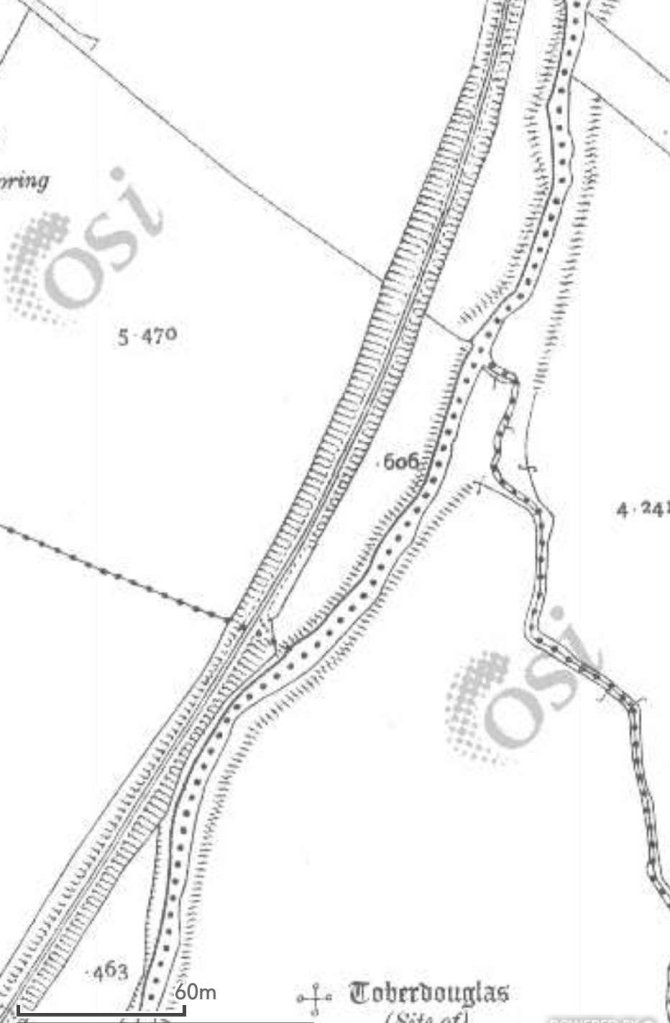
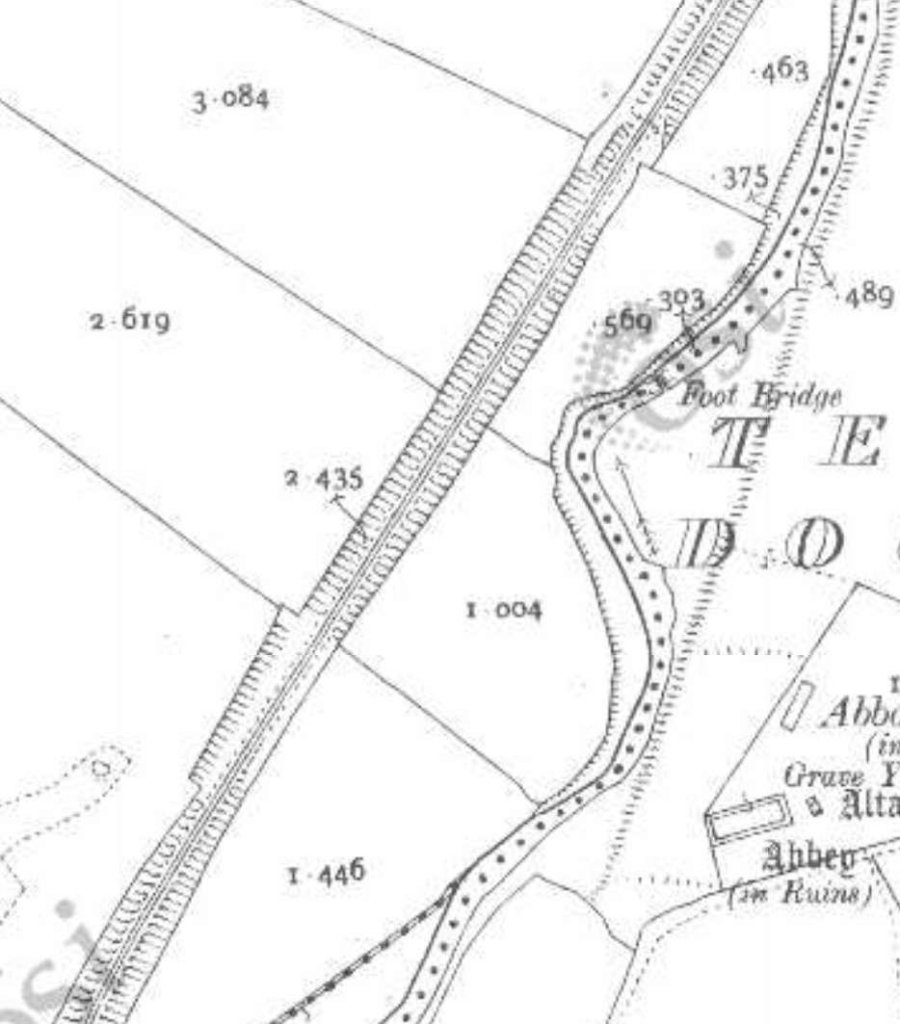
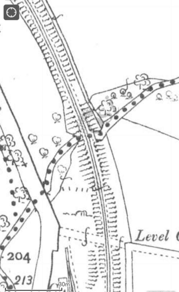
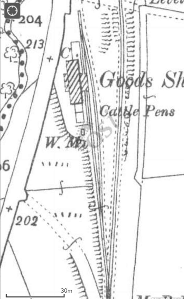
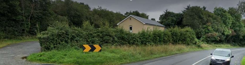
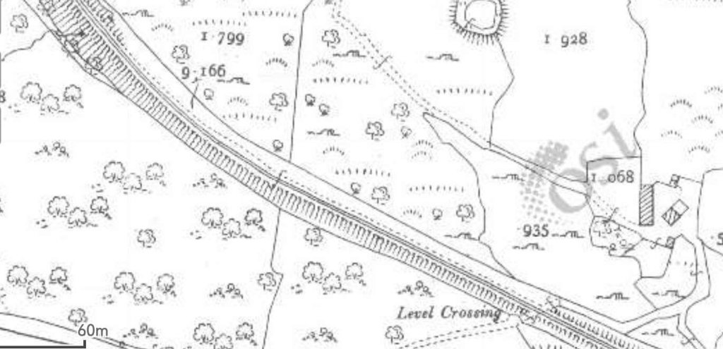
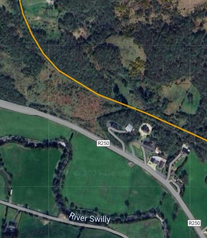
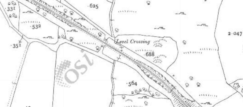
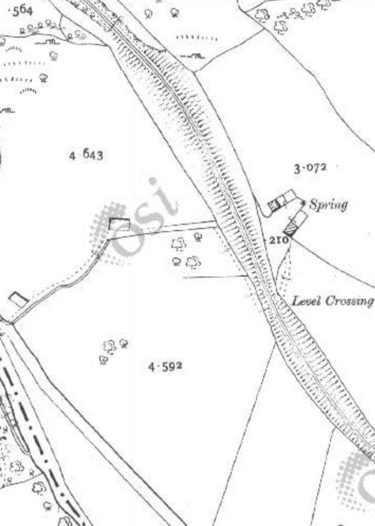
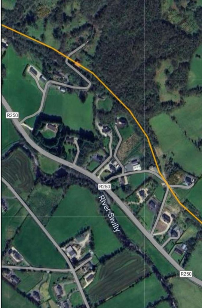
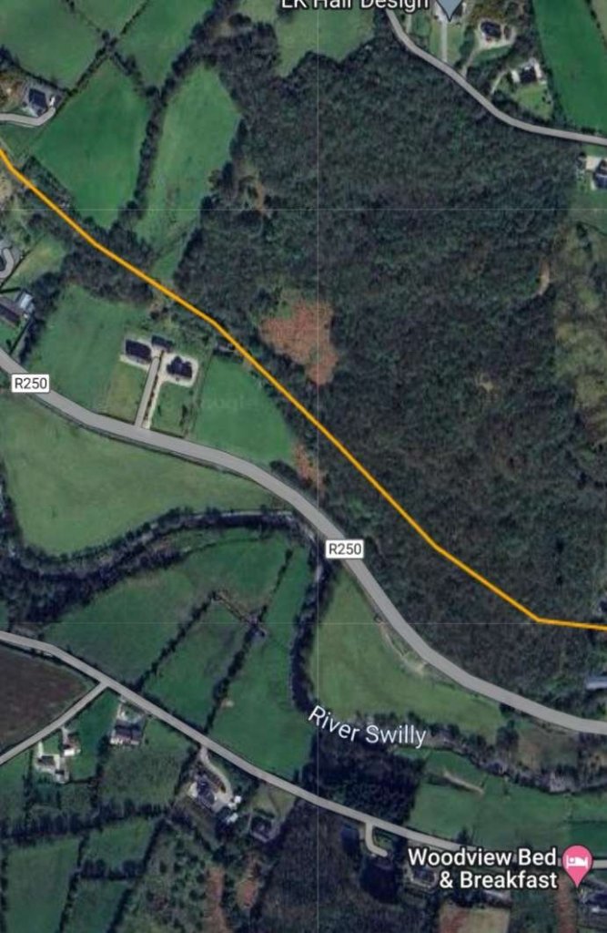
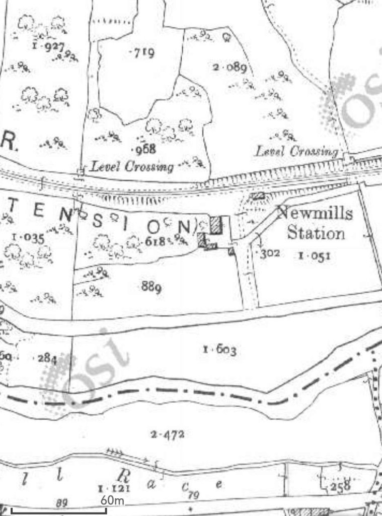
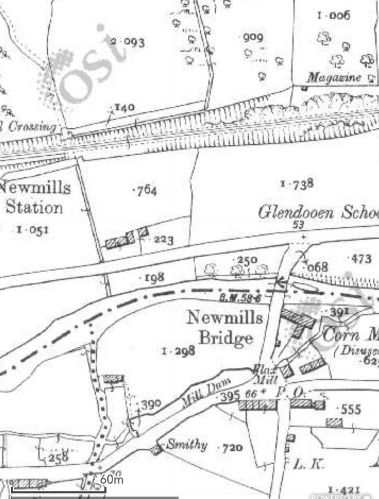
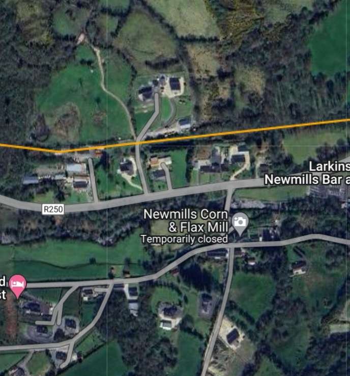
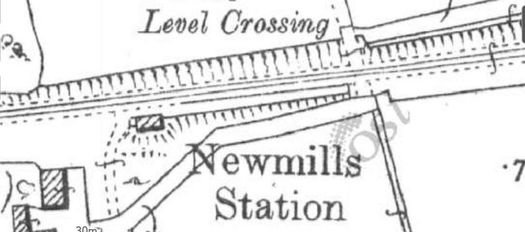
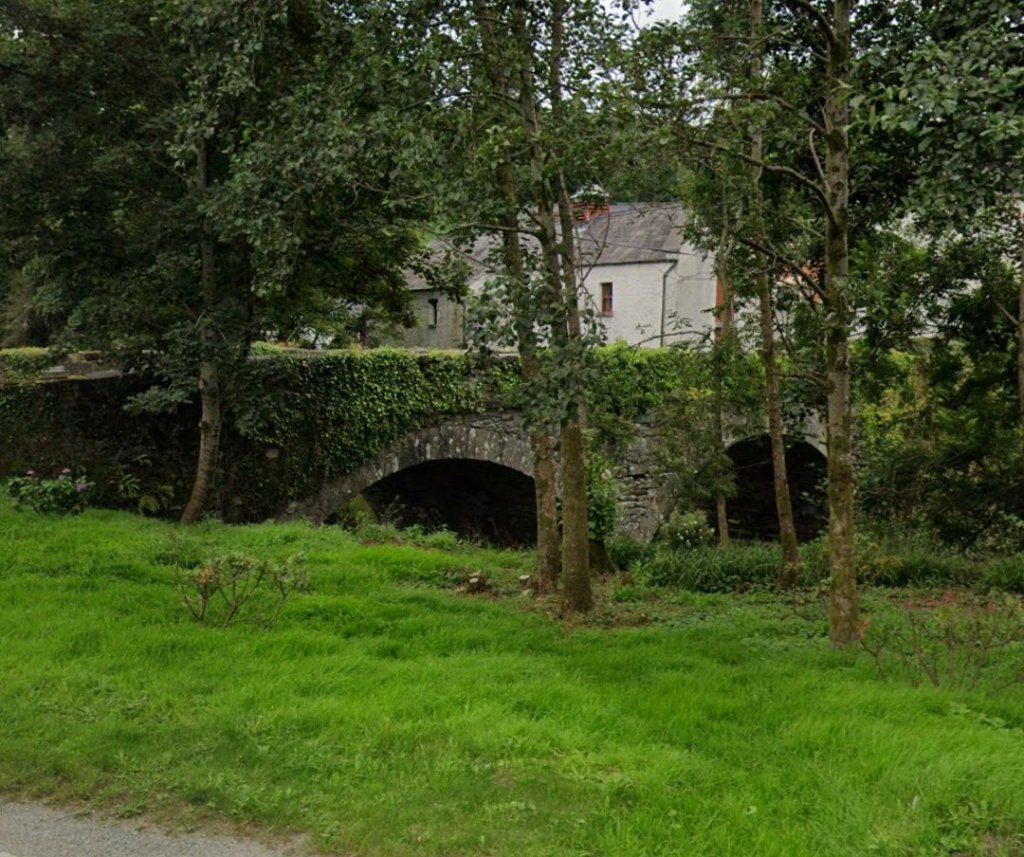
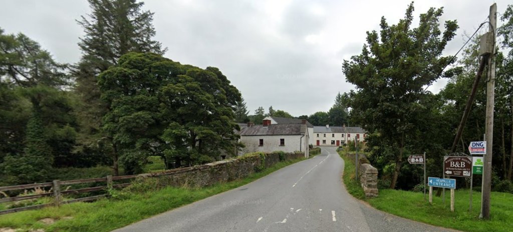
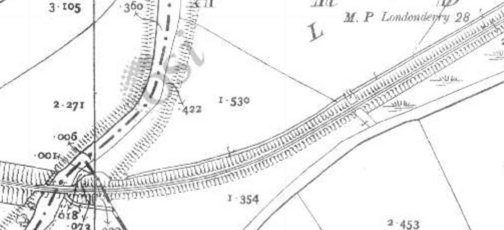
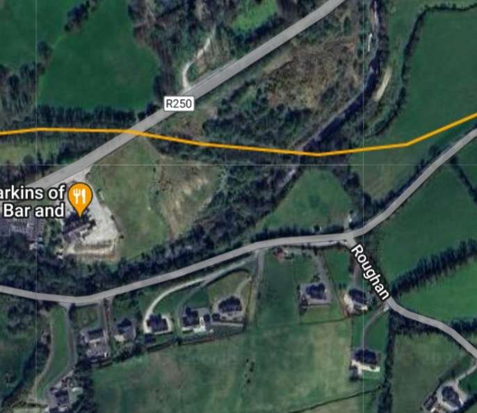
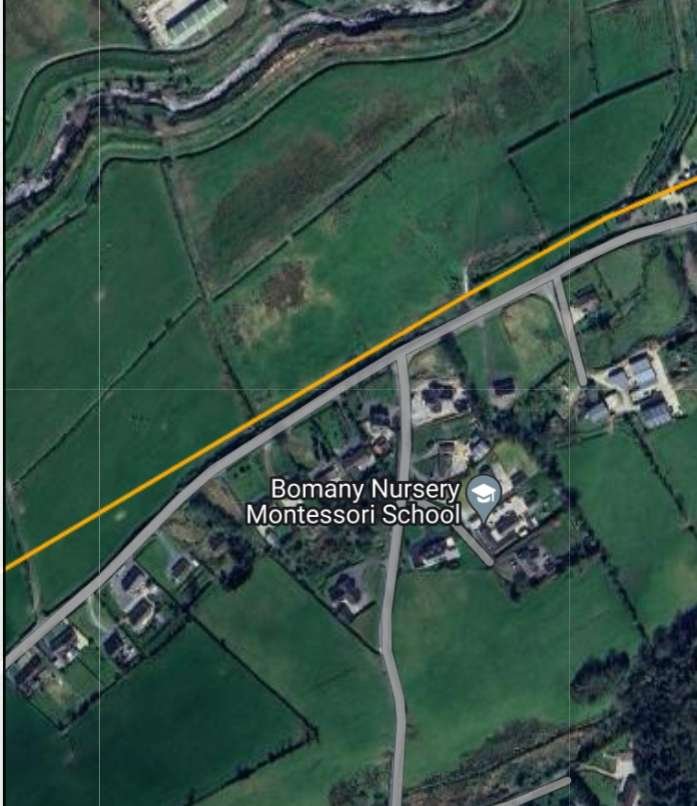
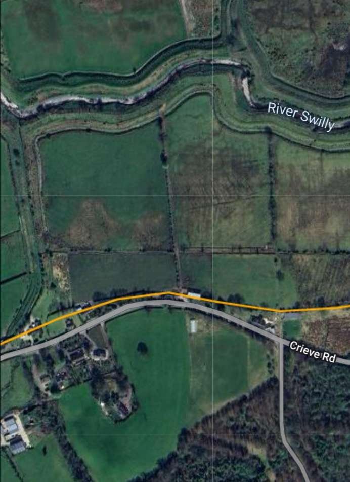
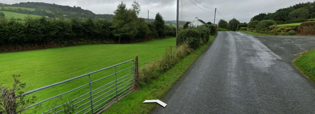
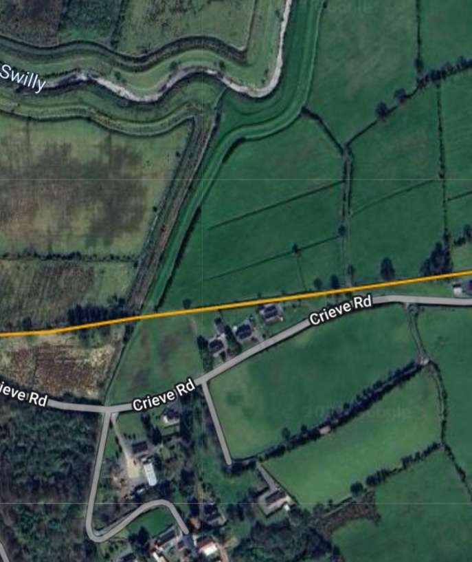
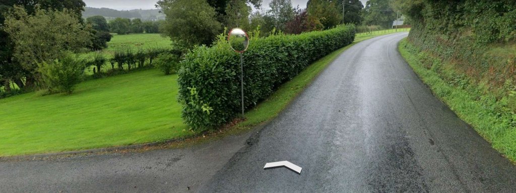
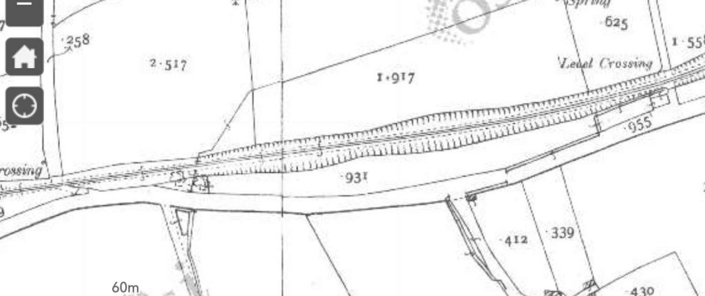
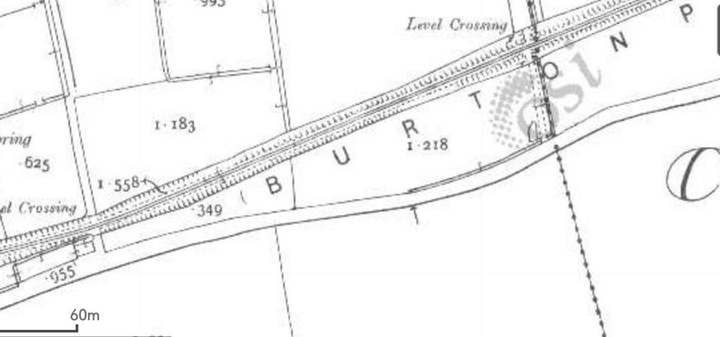
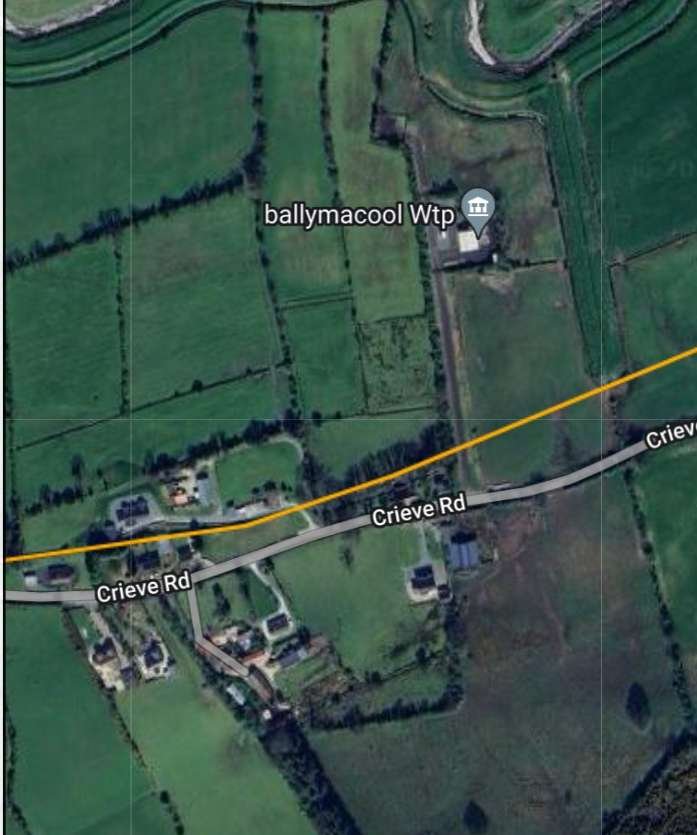
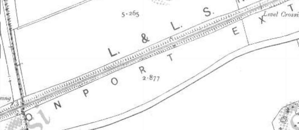
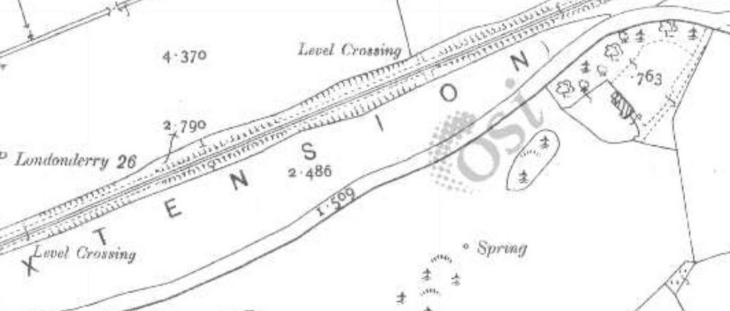
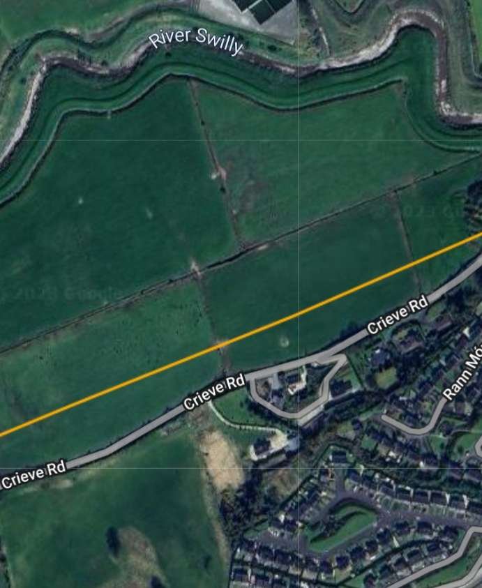
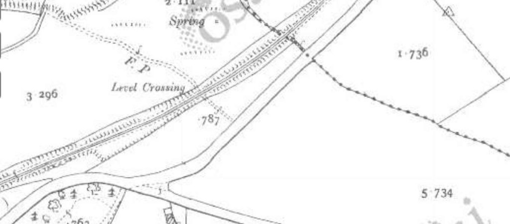
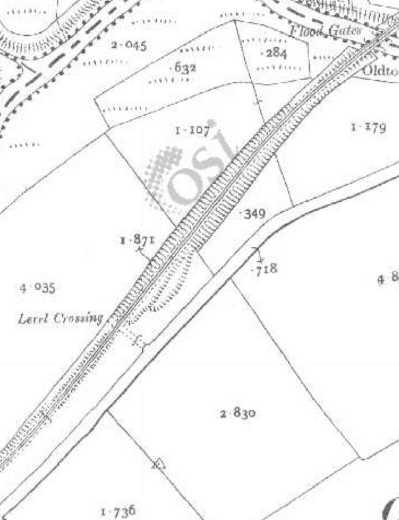
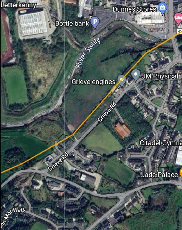
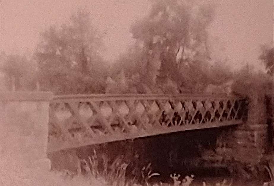
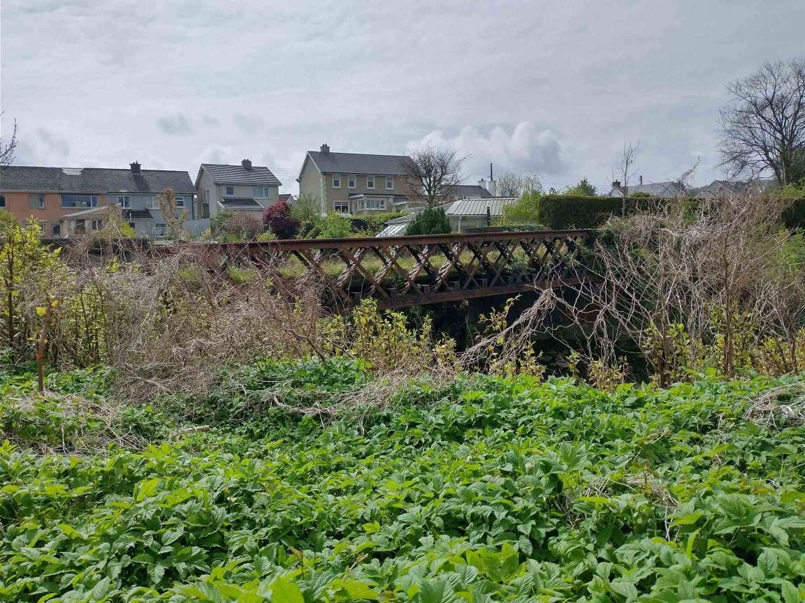
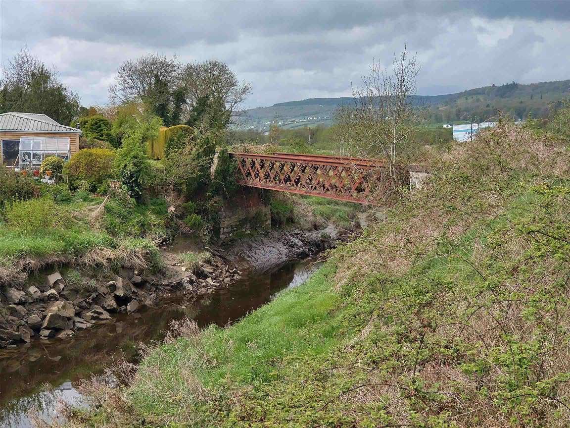
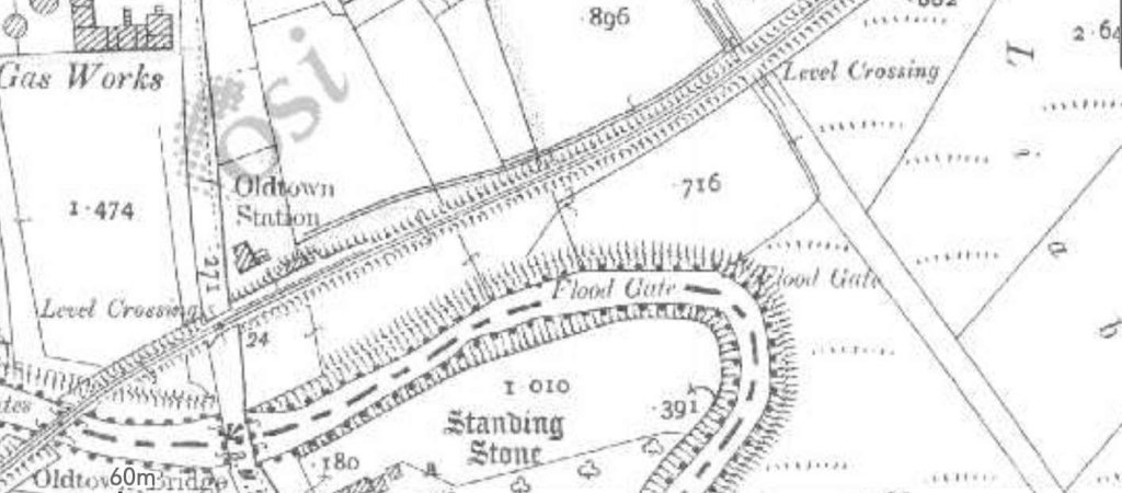
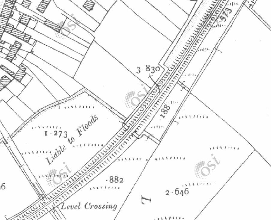
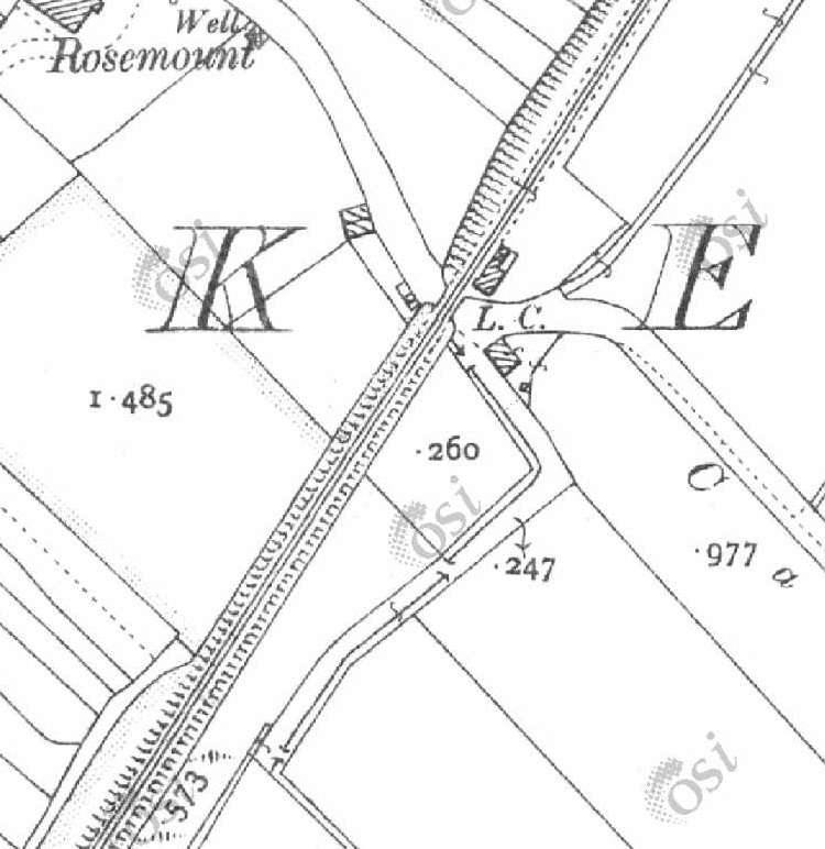
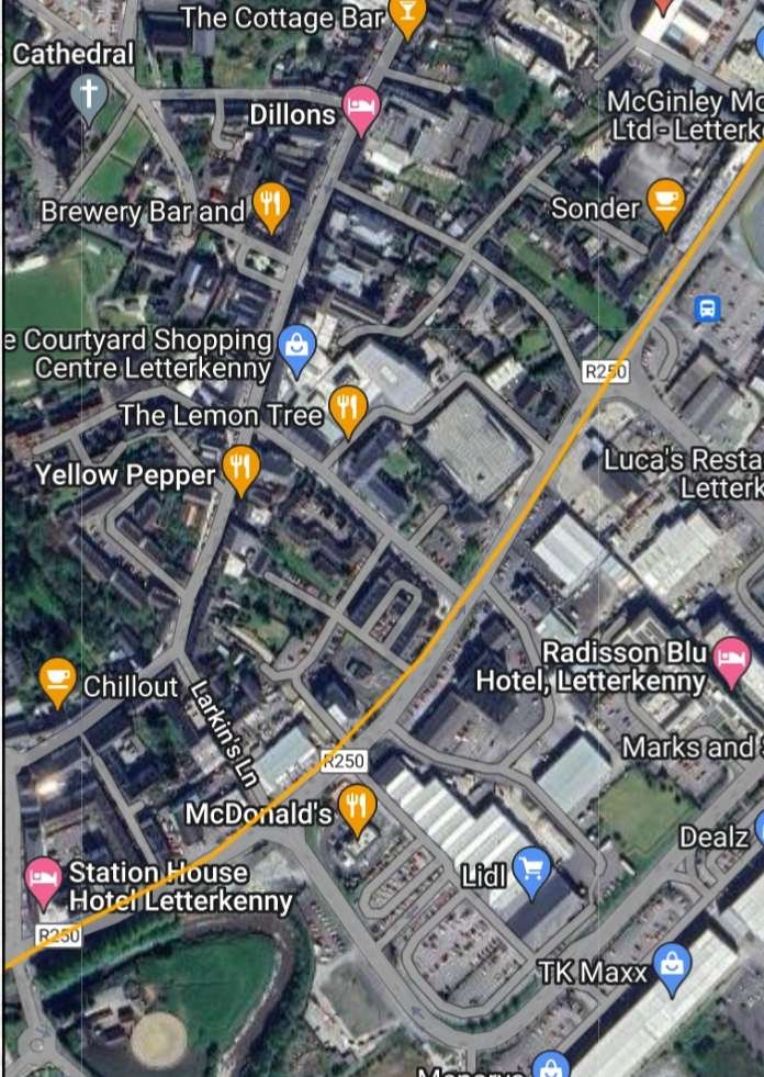
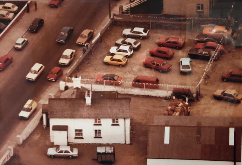
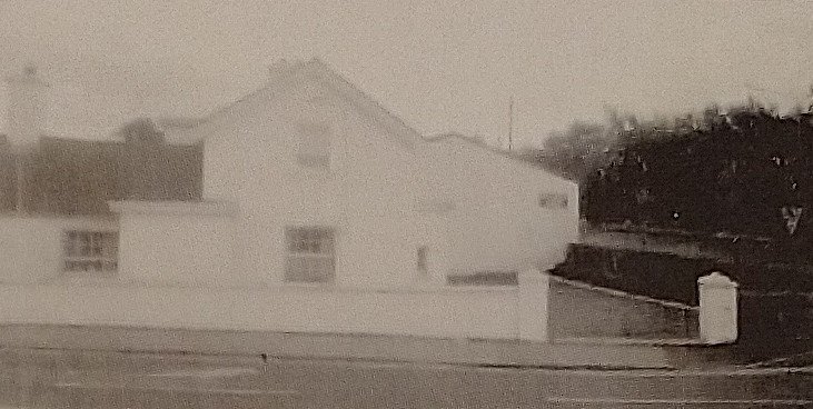
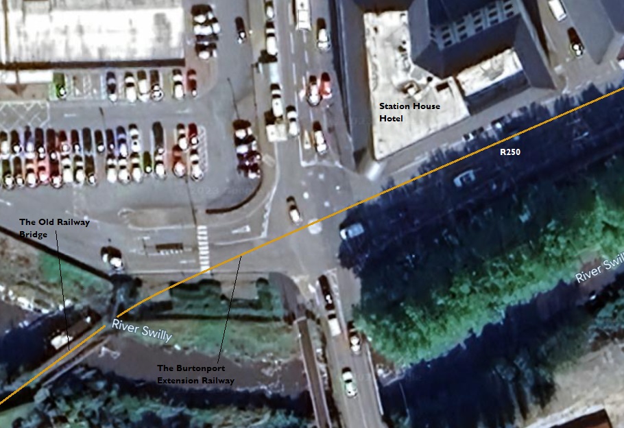
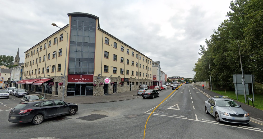
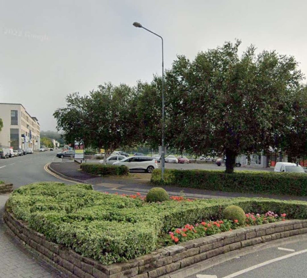
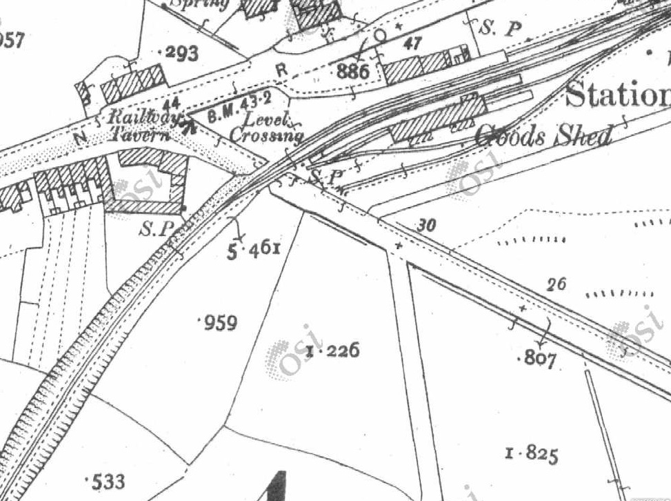
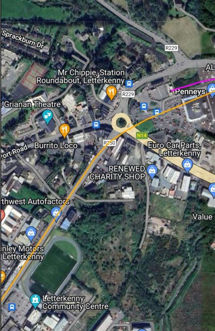
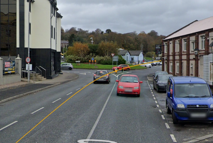
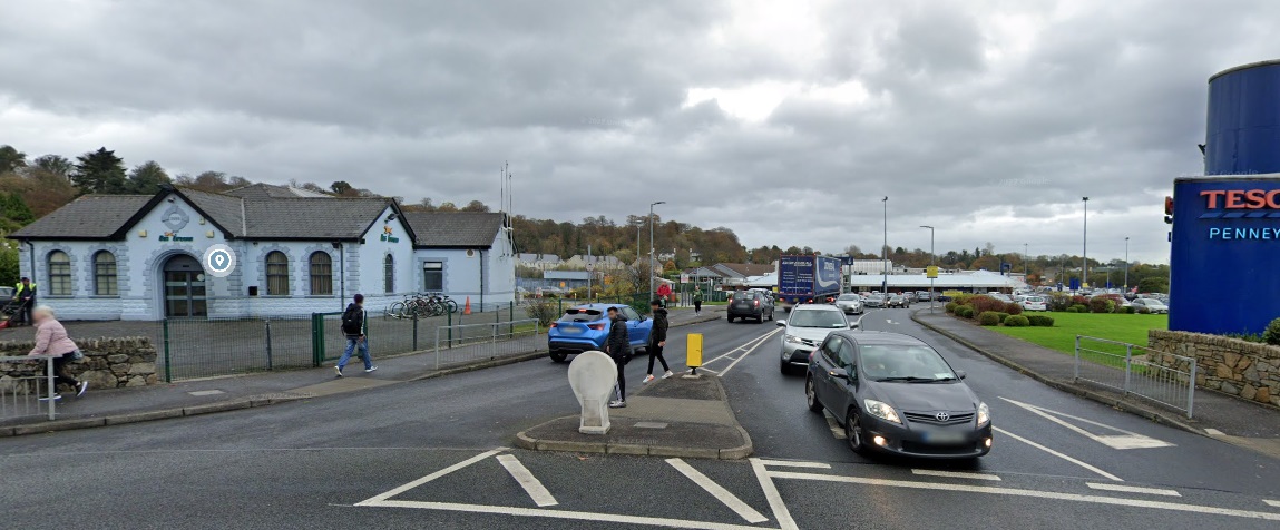
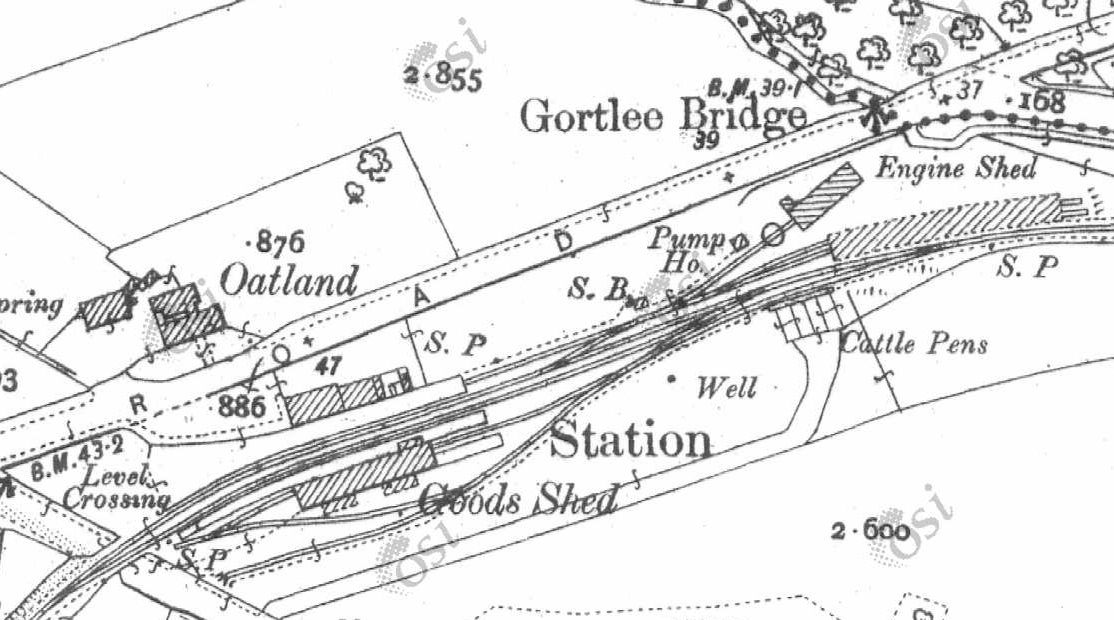
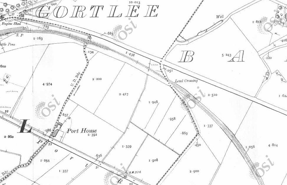
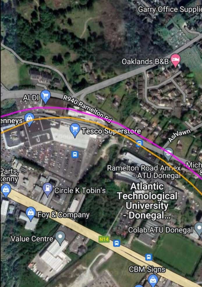
This next extract from the 25″ OSi survey shows the old road and the railway coming very close (bottom-right and then the road heads away again from the old railway line. [2]Google Maps moderna satellite imagery which is used by RailMapOnline shows the R251 leaving the old road alignment and then running Southeast along the old railway formation. [4]Looking Southwest along the minor road referred to above. The old railway ran along the line of the fireld boundary and bushes which can be seen on the right of this image. It crossed the road and then ran on in front of the hadge/bushes seen on the left of the image. [Google Streetview, August 2021]The view Northeast across the old railway line formation, looking along the same road. The Burtonport Extension Railway ran behind the bush shown on the left of this image, crossed the road and continued on the same bearing. {Google Streetview, August 2021]The road and the old railway formation become closely aligned at the tree line ahead. The old formation can still be picked out running into this photograph from the right. [Google Streetview, August 2021]Hopefully this enlarged extract from Google Earth shows clearly how the road has been moved to follow the old railway formation. The red line is the old road. The yeallow line is the old railway. The R251 is shown as the wide grey route. [Google Earth, 6th July 2023]These two map extracts cover the length of the old railway as far as Crossing No. 2, which can be seen in the bottom-right quadrant of the lower image. [2]This is the same length of line as shown on the two 25″ map extracts above. [4]An enlarged extract from the 25″ OSi survey of 1901 shows the old road crossing the railway at Crossing No. 2. The crossing keeper’s cottage is at the centre of this image, to the Southeast of the level crossing. [2]Looking back along the old railway towards Crossing No. 3. The line ran to the right of the tree in the foreground. [Google Streetview, August 2021]Turning through 180° this image shows the crossing keeper’s cottage. The line ran to the left of the cottage approximately through the shed at the left of the image. [Google Streetview, August 2021]The crossing keeper’s cottage as seen, in 2021, from the R251. [Google Streetview, August 2021]These three map extracts show the line continuing towards Foxhall Railway Station in a Southeasterly direction. [2]This single extract from RailMapOnline.com covers the same length of the old railway as the three map extracts above. [4]A view North from the R251 towards the route of the old railway. The railway ran approximately on the line of the second hedge in the image. [Google Streetview, August 2021]Looking Northeast from the R251. The old railway crossed this side road immediately before it turned round to the right. [Google Streetview, August 2021]Three extracts from the 25″ OSi survey take the old railway to the northern approach to Foxhall Station. [2]These two extracts show the Foxhall Station site. [2]South of Foxhall Station the line curved gradually round to a Southeasterly direction. [2]This RailMapOnline.com satellite image covers the same length of the old railway as do the six map extracts above. [4]The Goods Shed at Foxhall Station served as a village community centre after the demise of the Burtonport Extension Railway. It is seen here from the R251. [Google Streetview, August 2021]We are now in the valley of the River Swilly and heading for Letterkenny there are just two more stations before Letterkenny Railway Station, Mill ….. Station and Old Town Station. At this point the line was travelling in a Southeasterly direction to the North of the road which became the R250. The River Swilly is beyond the road to the South. [2]This extract from the RailMapOnline.com satellite imagery shows the route of the old railway, the R250 and the River Swilly and covers nearly the same length of railway as the map extracts above. [4]These two map extracts show the line continuing Southwest down the Swilly valley. [2]This RailMapOnline.com satellite image covers much the same length of the old railway as the map extracts above. [4]A further two map extracts has the River Swilly, the R250 and the Burtonport Extension Railway in close order still heading Southeast. [2]This satellite image mage covers a similar length of line to the two map extracts above. [4]Two more extracts take the line as far as Newmills Station and the cluster of buildings around Newmills Bridge – Flax Mill, Corn Mill and associated buildings. [2]Newmills and the location of Newmills Station in the 21st century. [4]A closer view of Newmills Station which was effectively no more than a halt. [2]Newmills Bridge seen from the R250. The mills are hidden beyond the trees. [Google Streetview, August 2021]The mills at Newmills seen from the R250. [Google Streetview, August 2021]Two more map extracts show the old railway bridging both the R250 and the River Swilly. [2]Again this satellite image covers much the same area as the two map extracts above. [4]Looking Northeast on the R250 at the remaining bridge abutment on the North side of the road. [Google Streetview, August 2021]A little further to the East, this view shows trees and undergrowth on the line of the old railway embankment on the South side of the R250. The bridge abutment on the South side of the road would have been off the image to the right but will have been removed when the road was improved. [Google Streetview, August 2021]A single map extract shows the line travelling Northeast towards Letterkenny. [2]This RailMapOnline.com satellite image takes the route of the old line to the same point as the map extract above. [4]The old railway ran on the North side of the minor road between Newmills and Letterkenny, effectively just beyond the hedge line. [Google Streetview, August 2021]These two map extracts show the line heading on Northeast towards Letterkenny. [2]This satellite image covers the same ground as the two map extracts above. [4]These two map extracts show the old railway and the adjacent road back immediately next to each again. [2][4]In this image, taken 200 metres or so to the West of the side road shown in the above satellite image, the route of the old railway was immediately to the left of the hedge line. [Google Streetview, August 2021]These three map extracts see the old railway running East through Mile Point 27. [2]Crieve Road and the old railway route run West to East across this satellite image which covers a similar length of line as the three map extracts above. [4]Further Northeast, the boundary of railway land can be discerned, the parallel hedges to the left of the road delineate the route of the old railway. [Google Streetview, August 2021]The old line and Crieve Road come close to each other again. [2]Another satellite image which covers the same area as the map extract above. [4]This is the view Northeast at the right quarter point of the satellite image above. The hedge which runs in from the left side of the image marks what was the boundary of railway land. [Google Streetview, August 2021][4][4]These two further map extracts show the old railway heading Northeast towards Letterkenny. The bridge crossing the River Swilly at Letterkenny Old Town can be seen in the top-right of the lower of these two extracts.. [2]This satellite image covers the same length of the old railway as the two map extracts above. There is a marked encroachment of the built up area of Letterkenny! [4]The Burtonport Extension Railway crossed the River Swilly at Letterkenny Old Town on a substantial girder bridge which had stone abutments. This picture was probably taken in the late 1980s. By this time it had not been in use for around 40 years. [1: p60]A similar view of the bridge in 2023. [My photograph, 29th April 2023]Another view of the railway bridge, this is taken from the East, from the modern road bridge over the River Swilly. These two pictures show a bridge that is continuing to bear up to the effects of the environment in 2023, some 75 or so years after the closure of the Burtonport Extension Railway. [My photograph, 29th April 2023]After crossing the River Swilly, trains crossed a level crossing which protected the Western approach to Old Town Station. Old Town Station was a halt rather than a Station, it had a short single platform adjacent to the level crossing on the road South out of Letterkenny Old Town. [2]These two map extracts show the old railway line heading Northeast outside the old limits of Letterkenny Town. The level crossing in the middle of the second extract was provided with a crossing keeper’s cottage. The location of the cottage is now a car park. [2]Letterkenny has developed considerably since the 25″ OSi survey was undertaken at the beginning of the 20th century. The line heading Northeast from Old Town station was once in fields but is, in the 21st century, overwhelmed by modern development. The formation of the Burtonport Extension Railway appears now to be the route of the R250 which runs round the South side of the town centre. This extract from RailMapOnline.com’s satellite imagery covers roughly the same length of line as the three map extracts immediately above. [4]This is an aerial view from the 1980s of the former Oldtown Railway Station House. In 2005 it was knocked down and rebuilt, opening first as the Ramada Encore Hotel in 2006 before officially being renamed in 2010 as the “Station House Hotel.” This image was shared on the Letterkenny History Facebook Page on 1st July 2023. [11]This photograph of Old Town Station building also comes from the 1980s when it was a private dwelling. The photograph is taken from the road before the new R250 was built along the old railway formation. [1: p59]Google Earth provides this satellite image of the old railway bridge over the River Swilly and the Station House Hotel which stands on the site of the old Station House which served Old Town. [Google Earth, 10th July 2023]This view looks Northeast from the line of the Burtonport Extension Railway and shows the modern Station House Hotel which sits on the site of Old Town Station building which was demolished as noted above. The yellow line is an approximation to the route of the old railway which might have run a little closer to the modern hotel. [Google Streetview, November 2022]The view Northeast from the R250 towards the location of the crossing-keeper’s cottage, which is shown at the bottom of the map extract below. I have been unable to find a picture of the old railway building. [Google Streetview, November 2022]Three extracts from the 25″ OSi survey of 1901 show the length of the line from the final crossing-keeper’s cottage on the Burtonport Extension Railway to Letterkenny Railway Station. [2]The final approach to the location of Letterkenny Railway Station as shown by RailMapOnline.com. The pink line entering from the right is the Co. Donegal Railways line to Strabane. [4]Looking Northeast along the R250 in November 2022 at what would have been the station throat. The approximate line of the old railway is shown in yellow. The sky-blue building at the centre of the image is the old Co. Donegal Railways station building now in use as a bus station. [Google Streetview, November 2022]Looking East-northeast into the site of what was the L&LS Railway Station in Letterkenny. The sky-blue building, as we have already noted, was once the Co. Donegal Railways Station building. [Google Streetview, November 2022]Letterkenny Station in 1901, before the arrival of the Co. Donegal Railways line from Strabane. When the Co. Donegal Railways line from Strabane arrived at Letterkenny, the road running diagonally across the map extract had to be moved over to accommodate the new Station. [2]At a smaller scale, this extract from the 25″ OSi Survey of 1901 shows the line to the East of Letterkenny as it heads away towards Derry. [2]Letterkenny Railway Station area and the line to the East as shown by RailMapOnline.com. As noted above, the pink line is the route of the Co. Donegal line to Strabane. [4]
Ernie’s Railway Archive on Flickr has a range of photographs of the L&LS Letterkenny Railway Station site from the 1950s, the links are embedded here below, click on each link to see the image in Ernie’s Railway Archive on Flickr:
https://flic.kr/p/2nMqBvu – The L&LSR Station site from the East in 1952. The carriage shed is closest to the camera on the right of the image. The locomotive shed and turntable are hidden behind the carriage shed. At the centre-top of the image, the Goods Shed can be seen.
https://flic.kr/p/2nM8xYs – The Goods Yard of the L&LSR in 1952. Beyond wagons L&LSR No. 124 and L&BER No. 73 the Goods Shed and the passenger station building can be seen.
https://flic.kr/p/2nWyB5y – The L&LSR Goods Yard in 1952. The side elevation of the Goods Shed is visible beyond the wagons in the yard. Prominent in the picture is L&LSR Wagon No. 71.
https://flic.kr/p/2nCR8dg – L&LSR No. 12 is featured in this image from 1952. No. 15 is just poking its nose into the shot on the left.
https://flic.kr/p/2kHNdD9 – L&LSR No. 8 is being turned on Letterkenny’s turntable on 27th June 1952.
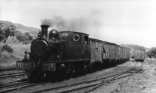
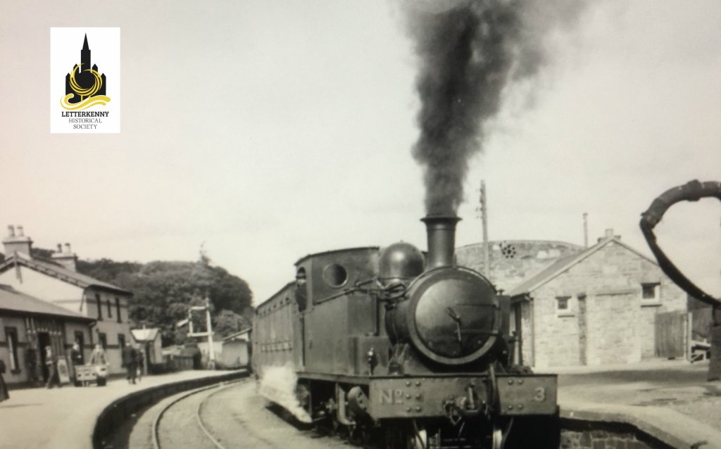
https://flic.kr/p/BWoyiF – L&LSR No3 at Letterkenny. On the left, the image is framed by the wall of the Goods Shed. The crossing gates at the West end of the station are visible beyond No. 3’s train. The passenger facilities are on the right. Note the coach acting as a brake van for the train. (c) JW Armstrong/ARPT
https://flic.kr/p/BvajsP – L&LSR No. 12 in the Engine Shed at Letterkenny, (c) JW Armstrong/ARPT
https://flic.kr/p/2ma5Lo3 – The L&LSR Station at Letterkenny on 1st July 1959 after the rails had been lifted. The Goods Shed door is closed (on the left) and the station buildings are on the right.
https://flic.kr/p/2k1hGvQ – The L&LSR operated a daily goods service by lorry after the closure of the line. A company rail lorry bearing the number plate IB7024 is shown standing where trains would once have passed, adjacent to the station building at Letterkenny. The photograph was taken on 23rd August 1954.
Other photographs of Letterkenny’s L&LSR railway station can be found on Flickr or elsewhere on line:
This image shows 4-6-0T No. 3, probably, in the Yard at Letterkenny station. No. 3 was built by Barclay in 1902. The image was shared by ‘Trainiac’ on Flickr and noted as being in the Public Domain. [12]
Dave Bell & Steve Flanders; The Londonderry & Lough Swilly Railway: A Visitor’s Guide; County Donegal Railway Restoration Society, The Donegal Railway Heritage Centre, Donegal.
8 thoughts on “The Burtonport Extension of the L&LSR (Londonderry and Lough Swilly Railway) – Part 4 – Barnes Gap to Letterkenny. …”
John Sawyer
Wonderful, if there was ever a competition for a railway that never remotely lived up to its promoters expectations, congested districts notwithstanding, the Letterkenny and Burtonport Extension Railway must be a serious contender. Thanks for your determination in tracing it’s remains.
Rodger. Thank you for all the extensive work you did on this line. It is excellent. I was wondering if is possible to walk along parts of the line?? Thank you Jim.
Hi Jim there are significant lengths of the Extension Railway which are walkable and some which can be followed by bike or car. The first 6 kilometres out of Burtonport are cycleway/footpath. The is some wandering which can be done on foot between there and Falcarragh Railway Station. From Falcarragh to Muckish is another cycleway/footpath. Some further bits and pieces of the line to Letterkenny can be walked but I am not sure whether they are legally footpaths. In Letterkenny the line is under the R250. I hope this helps.


Wonderful, if there was ever a competition for a railway that never remotely lived up to its promoters expectations, congested districts notwithstanding, the Letterkenny and Burtonport Extension Railway must be a serious contender. Thanks for your determination in tracing it’s remains.
It is kind of you to say so, John.
Rodger. Thank you for all the extensive work you did on this line. It is excellent. I was wondering if is possible to walk along parts of the line?? Thank you Jim.
Hi Jim there are significant lengths of the Extension Railway which are walkable and some which can be followed by bike or car. The first 6 kilometres out of Burtonport are cycleway/footpath. The is some wandering which can be done on foot between there and Falcarragh Railway Station. From Falcarragh to Muckish is another cycleway/footpath. Some further bits and pieces of the line to Letterkenny can be walked but I am not sure whether they are legally footpaths. In Letterkenny the line is under the R250. I hope this helps.
Hi Rodger Many thanks for this information. I plan to explore the line out of Burtonport soon – although I have not told my wife yet! Thank you
Jim
I am staggered at the amount of work you have put into this magnum opus.
Congratulations!
Thank you Pedr.
Pingback: The L&LSR once again – a perspective from the 19th century! – The Railway Magazine, November 1899. | Roger Farnworth