
What happened to the proposed extension to the Killybegs branch of the Co. Donegal Railways to Teelin Pier?
The short answer is that it did not really get beyond the imaginations of a few folk in the Glean Cholm Cille (Glencolumbkille) and Carrick area of Co. Donegal.
There was a government scheme which provided support to fishermen in the area, first in the Congested Districts Board establishing Teelin as the principal fish-curing station and then in supplying fisherman with large fishing smacks (and associated gear). [1]
Local parties could not countenance this investment going to waste for the want of a short railway extension from Killybegs. Revd C. Cunningham of Glencolumbkille expressed the feeling of a meeting of the Glencolumbkille and Kilcar Industrial Committee, held at Carrick, Co Donegal when he said that “with such efforts being made to make Teelin a fishing centre of unequalled importance with a fleet of first class fishing vessels, it was sad to reflect that the rich harvest which would naturally be expected from the broad Atlantic shall be in a great measure fruitless through the want of this short extension.” [1].
He went on to argue at that meeting that should the extension from Killybegs to Teelin be made “not only would existing industries be re-invigorated but others would be developed, and thus the people instead of having, in case of failure of crop, to appeal for relief to the Government, would become self-supporting, happy and independent.” [1]
It seems that the authorities turned a deaf ear to the appeals of local people. The reason given in histories of the line, for the failure to extend the line beyond Killybegs is that the topography would have required serious civil engineering features making it too expensive to construct. [1]
However, some maps of the Co. Donegal Railways show a dotted line between Killybegs and Teelin Pier, following the coastline. A typical example is shown below. …

But … What if? … What if it had been built soon after the completion of the line to Killybegs? I am given some encouragement in following this flight-of-fancy by the publication in 2022 of the Donegal Railway Heritage Trail by the Donegal Railway Heritage Centre which seems to show a line from Killybegs to Teelin Pier, not as a possible or proposed line but as a line which seemingly got built. [4]
Is my flight-of-fancy possible?
I guess that I want to be able to imagine a parallel universe in which every proposed railway line not only was built, but remains in operation today.
Is there anything else that might encourage my flight-of-fancy? … I think there might be! Here are a few things to contemplate ….
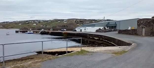
1. Have another look at the photograph at the top of this article which shows Teelin Pier as it was in April 2023 when we visited. What might the substantial stone structure be which sits just in from the right edge of the image, if not the base of a long disused water tower? Might it not be good to imagine one of the Co. Donegal locomotives idling alongside the water tank while it’s crew refill it’s tanks for the long run through to Killybegs and on to Donegal?
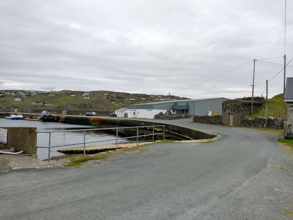
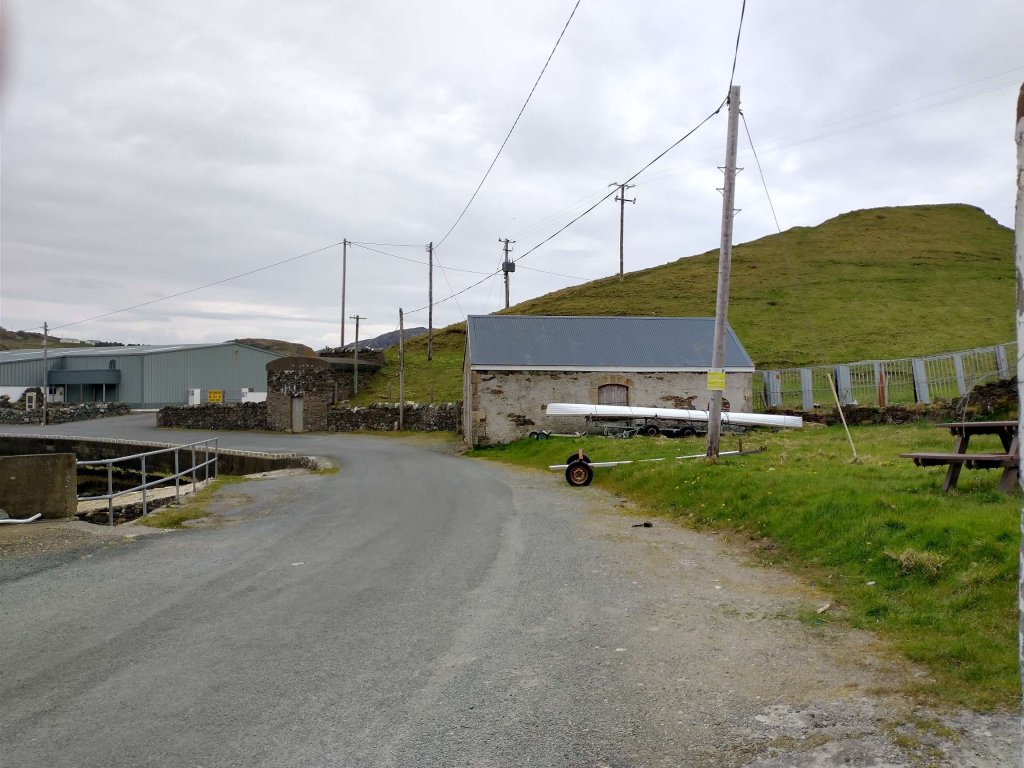
2. And, just peeping into the same image is another building. The photograph below shows that building close to the “water tower” base. What might it be if not an engine shed?
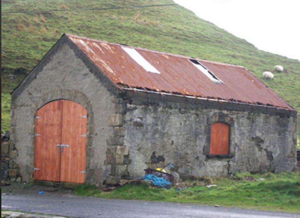
Yep, it does look very much like a typical small engine shed. Might the plastic panels in the corrugated iron roof have marked locations where steam and smoke were allowed to vent as an engine was being prepared, early in the morning, for its next duty on the line?
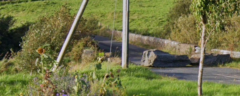
3. Close to the road to Killybegs (R263), to the East of Carrick there is an old stone bridge which clearly carried an earlier incarnation of the R263 but could so easily have carried a 3ft-gauge railway as well! The two images below are taken from Google Streetview …

Please understand, this is just a ‘what-might-have-been’ and understand too that even if it had been true, these little indications of a possible old railway would probably be all that remained in the 21st century.
What I do need to do to complete this short fairytale is to look again at the three possible indications of the presence of an old railway and clarify their actual use, and then to allow Dr. E.M. Paterson a final word …
1. The stone base for a water tank. That might just be what it was, although with no railway connotations. It is more likely that it was an ice house, needed to allow fish catches to be preserved for onward transport. [3]
2. The engine shed. Sadly, the origins of this building are well documented and have nothing to do with any old railway. It is a detached gable-fronted single-bay single-storey former coastguard boathouse, built in 1871, originally associated with Teelin Coastguard Station. Now in use as a private boathouse. When surveyed it was described as having a “pitched corrugated metal roof. Roughcast rendered finish over rubble stone construction with rock-faced ashlar sandstone block-and-start quoins to the corners of the front elevation (north) with dressed margins. Single segmental-headed window opening to the centre of each side elevation (east and west) having rock-faced ashlar sandstone block-and-start surrounds with dressed margins, cut stone sills; openings now blocked. Segmental-headed carriage-arch to the front elevation (north) having rock-faced ashlar sandstone block-and-start surrounds with dressed margins, and with replacement timber double-doors.” [3]
Obvious, really, when you see the same building from a different angle ….

The view, from Teelin Pier, of the two structures discussed above. The use of the building on the right as a boathouse is emphasised by the ramp which would have permitted the launch of a coastguard vessel and which makes the building ideal for its private use today.
3. The stone bridge did indeed carry a previous incarnation of the R263 but never saw use as a railway structure!
Dr E.M.Paterson tells us that Barton’s 1896 map of the Co. Donegal railway network, “drawn on a scale of 4 miles to 1 inch and measuring 30 in by 22 in, shows four probable Government Railways, none of which was built as shown. … [The fourth of these] was a westerly extension of the Killybegs branch … out to the coastal villages of Kilcar and Teelin, where there was a ‘government’ pier. … Had the Killybegs-Teelin extension been constructed, it would have been a spectacular one, reaching into some of Donegal’s wildest scenery and ending near the mighty sea cliffs of Slieve League, which rise 2,000 ft above the Atlantic. It would justifiably have rivalled the Valentia branch and the Mallaig extension of the West Highland Railway.” [5: p31-32]
References
- https://carrickonline.net/history?view=article&id=295:the-story-behind-the-proposed-rail-line-to-teelin-pier&catid=11, accessed on 26th April 2023.
- https://twitter.com/PMacoscair/status/1049570854030454784?t=at2TWDk8-c3LbDi5IUSUGA&s=19, accessed on 26th April 2023.
- https://www.buildingsofireland.ie/buildings-search/building/40909615/staisiun-garda-costa-an-teileann-rinnakill-donegal, accessed on 26th April 2023.
- https://www.govisitdonegal.com/blog/february-2022/donegal-railway-heritage-trail-guide-launched, 26th April 2023.
- Joe Begley, Steve Flanders, E.M. Patterson; The County Donegal Railways Revised Edition; Colourpoint Books, Newtownards, 2014.
