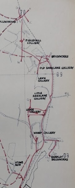
The area covered by this article is the area on the East side of Savage & Smith’s tracing [1: p164] and is as shown in the adjacent extract.
They included the line of the Coalport Branch on their plan (the continuous thin black line with circular dots). The Stirchley Branch was a little to the East of the Coalport Branch. It ran down past the Randlay Brickworks towards Old Park Ironworks which were South of the bottom end of Randlay Pool. Savage & Smith grouped the two ironworks in the vicinity under one title of ‘Stirchley Furnaces’.
It should be noted that the Shropshire Canal pre-dated the Coalport Branch but was on very much the same line as the railway. Small deviations in the alignment remain visible in the 21st century, particularly the length close to Hinkshay Pools and that close to Wharf and Lodge Collieries.
Tramroads on the remainder of the tracing [1:p164] are covered in previous articles, particularly those noted below.

This is the full page referred to. [1: p164]
Earlier articles about the tramways covered on this map can be found at:
Early Tramroads near Telford – Part 4 – Malinslee Part 1
Early Tramroads near Telford – Part 6 – Malinslee Part 2 – Jerry Rails …
Early Tramroads near Telford – Part 7 – Malinslee Part 3
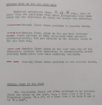
The tramways alongside first the old Shropshire Canal and the later LNWR Coalport Branch were not all operational at the same time. However, Savage and Smith were highly confident of the routes of most of these tramways. Only a few lengths are shown as dotted on these plans. The solid red lines are those which they could locate relatively precisely.
As can be seen on these drawings, the lines associated with the Shropshire Canal Coalport Branch and the later LNWR Coalport Branch railway are shown as solid red. The lines shown with the longer red dashes are translated from the 1836 Shropshire Railway Map. The scale of that map is relatively small – just ½” to a mile. The shorter red dashes denote lines as drawn on the 1833 1” Ordnance Survey. Enlarging from both of these maps leaves room for discrepancies to be introduced.
Savage and Smith highlight many of these lines on a 1″ to the mile map representing tramway additions between 1851 – 1860. During that decade their 1″ plan shows the Shropshire Canal as active to the North of Stirchley but without a northern outlet to the wider canal network. At the southern end of the active canal, the Lightmoor branch to the South of Dawley Magna suggests that much of the movement of goods on the canal was related to the Lightmoor Ironworks and the Lightmoor Brick and Tile Works. Unless there was only local movements during this period, perhaps associated with the Priorslee Furnaces and any other works in that immediate area.


Savage & Smith provide notes about the Tramways/Tramroads close to the line of the LNWR Coalport Branch (and the Shropshire Canal Coalport Branch). They comment: “By 1856, there is a considerable amount of industry along the canal from Hinkshay to Shedshill. The upper reservoir at Hinkshay had appeared before 1833, but the site of the lower reservoir was in 1856 just a small canal basin with a line running to it probably from Langleyfield Colliery. A line from Jerry Furnaces to the ironworks at the rear of New Row crosses it at right angles and a common type and gauge of rail cannot be assumed. This second railway from Jerry Furnaces reverses and continues in to Stirchley Furnaces. … To the north of Stirchley Furnaces the line runs on the west side of the canal on the towpath. There is a branch near Stone Row, perhaps to pits; to Randley Brickworks and perhaps to pits to the north of the brick- works; to Wharf Colliery and Lodge Colliery; past Dark Lane Foundry; to old Darklane Colliery and Lawn Colliery with a branch to old Darklane Brickworks. After a reverse the line carries on to Dudleyhill Colliery and Hollinswood Ironworks ” [6: p166]
The tramroads marked are:
- A: Tramroads in the immediate area of Stirchley Ironworks.
- B: A line to the North of Stirchley Ironworks on the West side of the Canal, on or alongside the towpath.
- C: a branch near Stone Row which probably extended further than shown by Savage & Smith to Wood Colliery to the Northwest of Stone Row.
- D: a looped branch probably serving Wharf Colliery, Darklane Foundry, Lodge Colliery, Little Darklane Colliery and Lawn Colliery.
- E: a short branch to pit heads to the Southwest of Randlay Brickworks, perhaps also serving the Brickworks.
- F: Tramways around Old Darklane Colliery.
- G: a short branch serving the Brickworks at Hollinswood.


By the 1860s, Savage & Smith show that the Shropshire Canal was no longer in use. Between the 1870s and the turn of the 20th century, some further minor additions to the network in the immediate are of Stirchley and just to the South of Oakengates associated with the Priorslee furnaces can be seen on their 1″ to the mile

The later changes to the tramroad/tramway network relate partly to the coming, in 1861, of the Standard-Gauge LNWR railway branch to Coalport. Stirchley and Jerry Furnaces – on the 1876-1900 map, have tramroad links to the railway.


- A: Langley Fields Brickworks, at on e time this line extended Northwest towards St. Leonard’s, Malinslee to serve Little Eyton Colliery.
- B: Langleyfield Colliery.
- C: Jerry Ironworks – serve by two different lengths of tramroad, one at high level and one at low level.
- D: A connection which crossed the old Shropshire Canal to a wharf running alongside the LNWR Branch.
- E: a line connecting Stirchley and Oldpark Ironworks to the network and so providing access to the wharf at D.
- F: access to an ironworks to the Northwest of Hinkshay Row.
- G: A line which curved round the West side of Hinkshay Pools to provide access to another length of wharf alongside the LNWR branch close to Dawley & Stirchley Railway Station. This is not shown on the plan drawn by Savage & Smith.
The lines noted above were all walked when I was looking at the immediate area for an earlier article (https://rogerfarnworth.com/2022/06/15/ancient-tramroads-near-telford-part-4-malinslee-part-1).
The other changes between 1876 and 1900 relate to Priorslee, where tramroads are shown to the Southeast of Priorslee Furnaces. The 6” Ordnance Survey of 1903 shows the bottom arm at this location linking Darklane Colliery to the Furnaces. The upper arm is shown on the 6” Ordnance Survey of 1885 as serving a colliery adjacent to the Lion Inn. The tramroad link to the colliery is not shown on the later survey.


- A: Priorslee Furnaces.
- B: Darklane Colliery.
- C & D: tramroads serving a colliery adjacent to the Lion Inn..
- E: the tramroad access from Priorslee Furnaces.
Telford in the 21st century
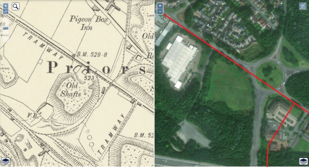
The area covered by these maps has been dramatically altered by the construction of Telford Town Centre. The centre of Telford sits directly over the area covered by this article. This is demonstrated by the side-by-side image provided below. 21st century satellite imagery is set alongside the 1901 Ordnance Survey.

There is nothing to be gained by attempting to walk most of the routes covered in this article. However, some limited areas can still be seen (topographically) roughly as they were. That is true of the Priorslee area, Northeast of the town centre and the area North from Stirchley to the North end of Randlay Pool. Most of the second of these two areas is the subject of earlier articles (https://rogerfarnworth.com/2022/06/15/ancient-tramroads-near-telford-part-4-malinslee-part-1, https://rogerfarnworth.com/2022/06/24/ancient-tramroads-near-telford-part-6-malinslee-part-2-jerry-rails, and https://rogerfarnworth.com/2022/08/11/ancient-tramroads-near-telford-part-7-malinslee-part-3). The remainder of this article focusses on the area around Priorslee Furnaces. (NB: these tramroads really fall into another series but we will pick them up again when we look at the area around Oakengates and Priorslee)


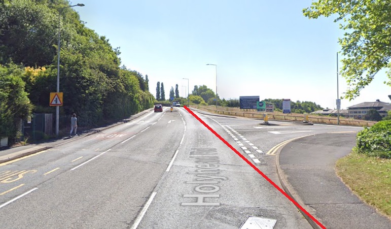




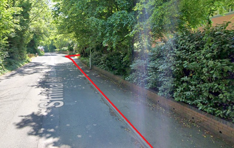

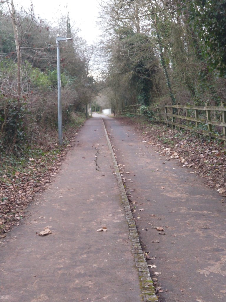


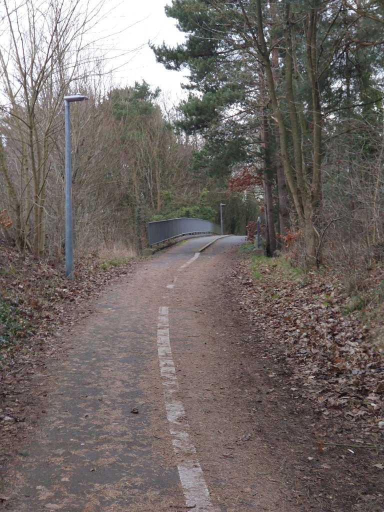
The tramway/tramroad route which led to Darklane Colliery crossed the line of the M54 a short distance to the West of the modern footbridge.




References
- R.F. Savage & L.D.W. Smith; The Waggon-ways and Plateways of East Shropshire; Birmingham School of Architecture, 1965. Original document is held by the Archive Office of the Ironbridge Gorge Museum Trust.
- https://maps.nls.uk/view/101594470, accessed on 1st February 2023.
- https://maps.nls.uk/view/101594308, accessed on 1st February 2023.
- https://maps.nls.uk/geo/explore/side-by-side/#zoom=15.0&lat=52.67809&lon=-2.44688&layers=6&right=ESRIWorld, accessed on 1st February 2023.
- https://maps.nls.uk/geo/explore/side-by-side/#zoom=17.0&lat=52.68634&lon=-2.44238&layers=6&right=ESRIWorld, accessed on 1st February 2023.
- https://maps.nls.uk/geo/explore/side-by-side/#zoom=17.0&lat=52.68432&lon=-2.43633&layers=6&right=ESRIWorld, accessed on 1st February 2023.
- https://maps.nls.uk/geo/explore/side-by-side/#zoom=17.0&lat=52.68130&lon=-2.43190&layers=6&right=ESRIWorld, accessed on 1st February 2023.
- https://streetmap.co.uk/map?x=505180&y=249173&z=0, accessed on 2nd February 2023.
