

This is the second article about the tramroad and railways which served Penrhyn Quarries. The first provided a short history of the line and then followed the tramroad which was first used to replaced pack horses carrying slate and other goods between the quarries and Porth Penrhyn. That article can be found at:
https://rogerfarnworth.com/2022/12/29/the-penrhyn-railway-part-1
The featured image at the top of this second article about the Penrhyn Quarry railways comes from the camera of K.H. Cribb and is included here with the kind permission of his son Russ Cribb.
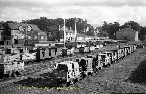
The first picture is an embedded link to a photograph on Ernie’s Railway Archive on Flickr and is general view of Porth Penrhyn looking South towards the port headquarters.
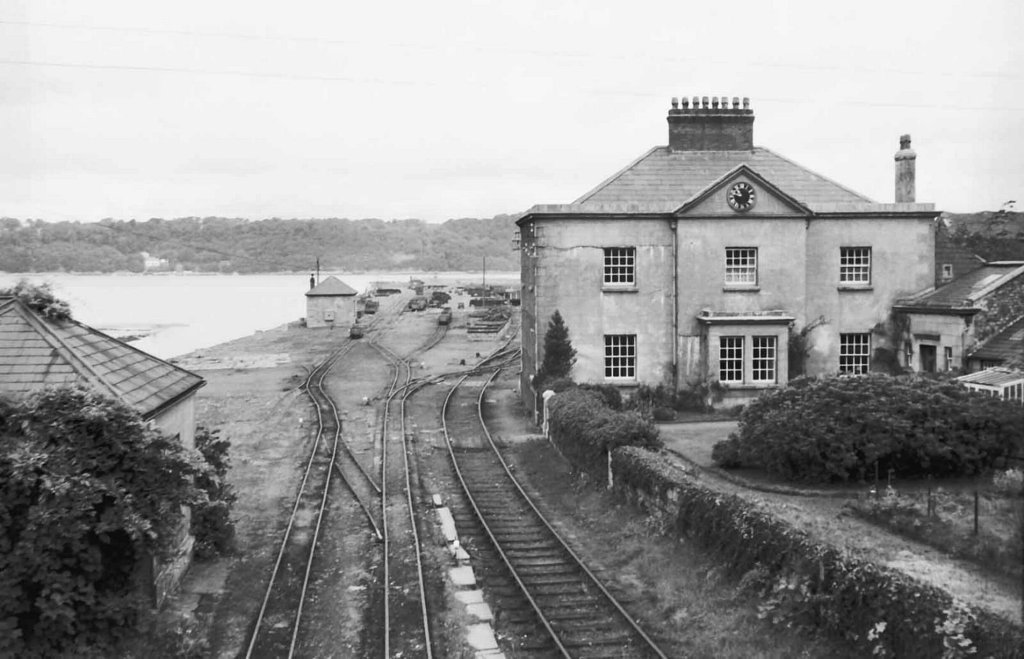
The second image shows the port headquarters in 1961, a few years before final closure of the line. The photograph appears to have been taken from the bridge over the line and looks North into the port area.

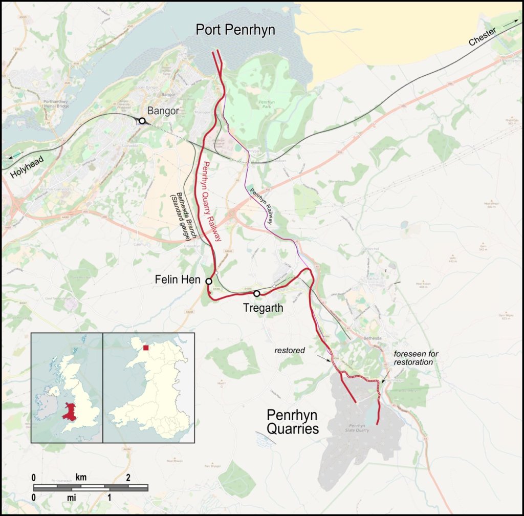
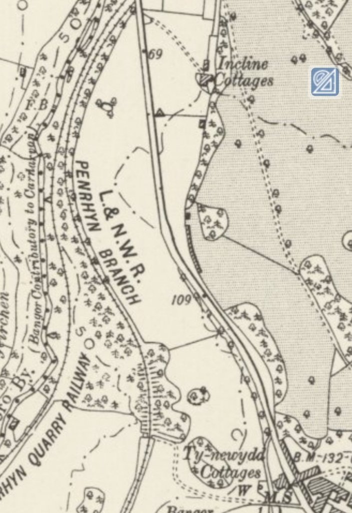
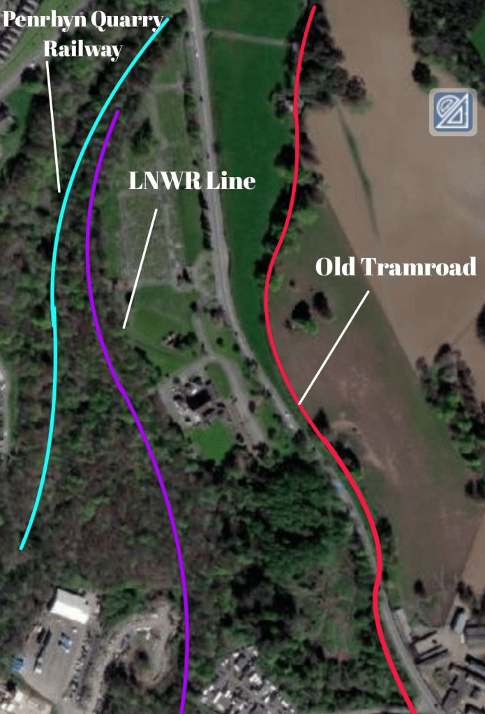
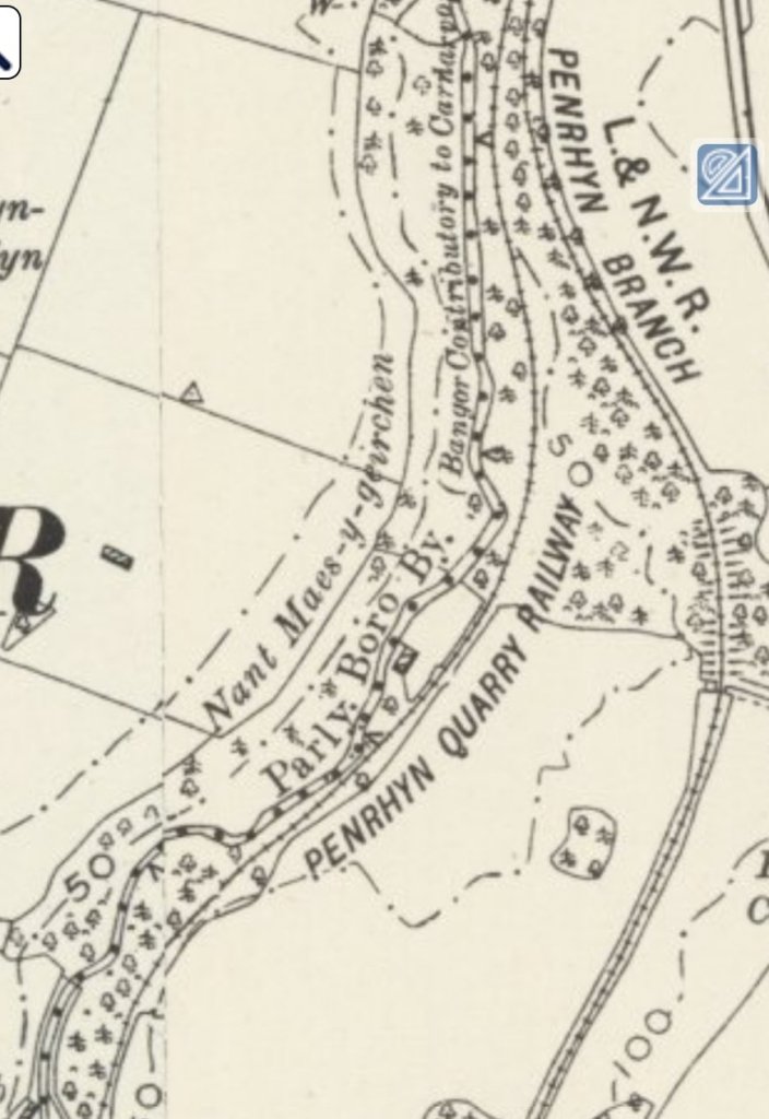
The Penrhyn Quarry Railway (PQR) left Porth Penrhyn running alongside a standard-gauge LNWR branch which also served the port and linked it with the national rail network.

The older tramroad occupied the same formation area as the two later lines of the PQR. The standard-gauge line was built while the horse-drawn tramroad was operating.
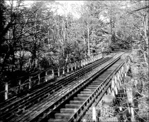
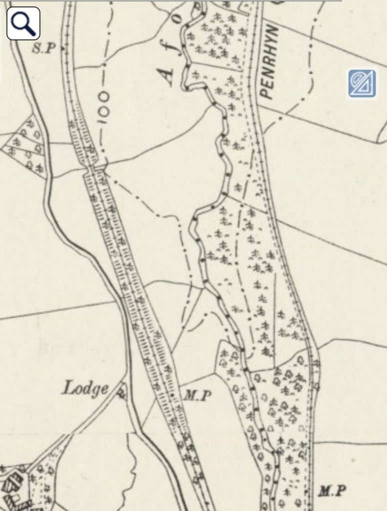
The PQR and the standard-gauge line ran in close proximity for some distance after leaving the port. Both used the same bridges over the Afon Cegin.
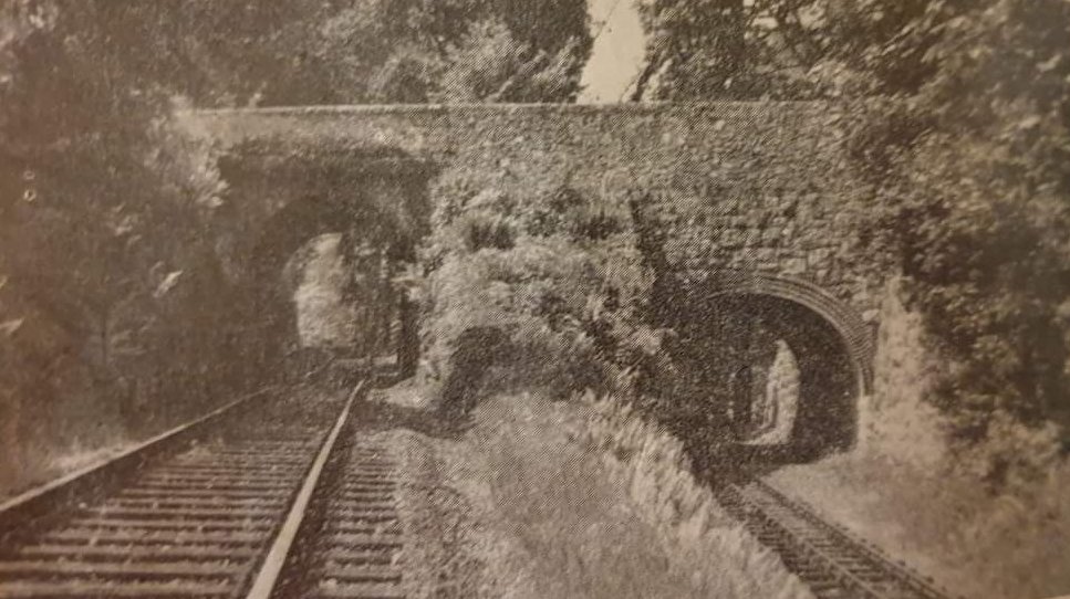
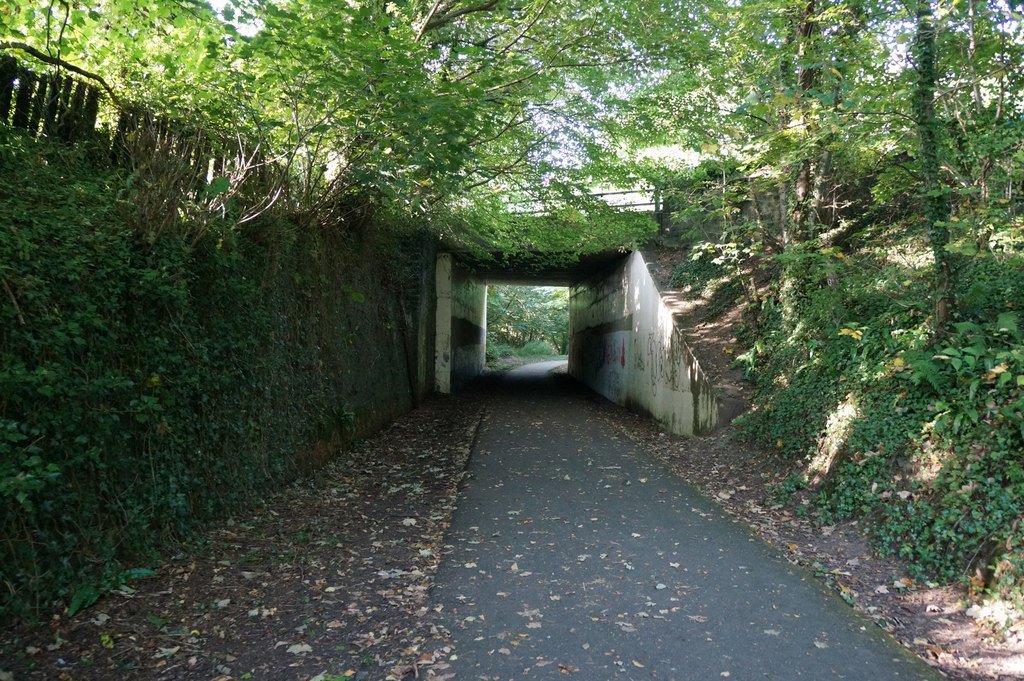
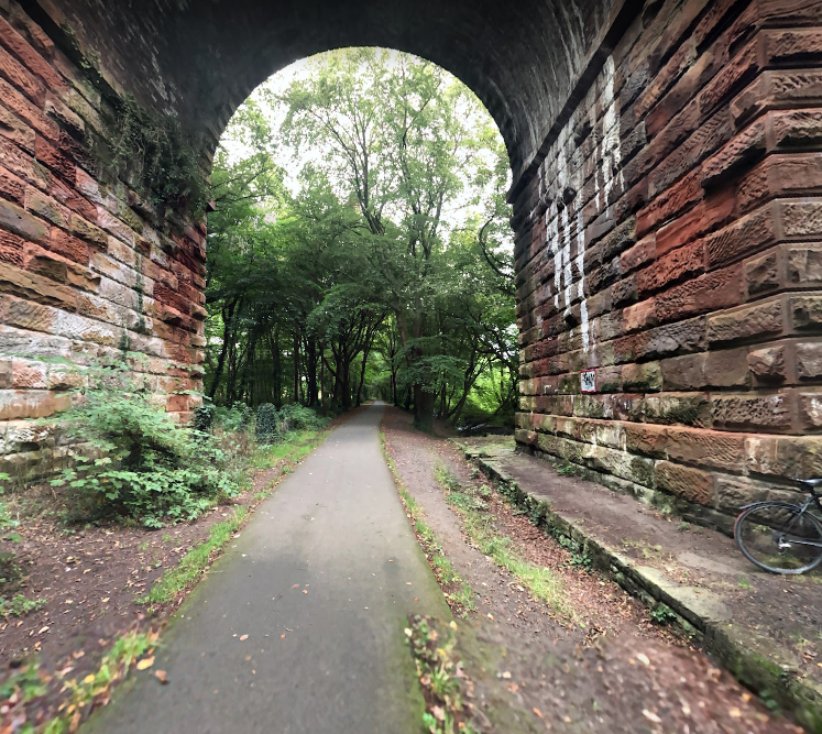
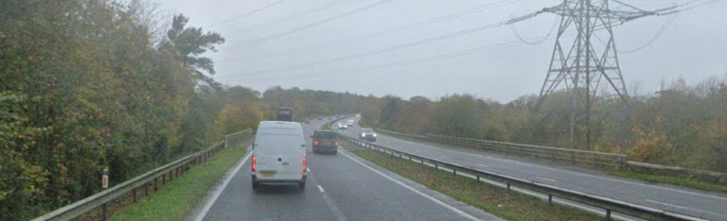
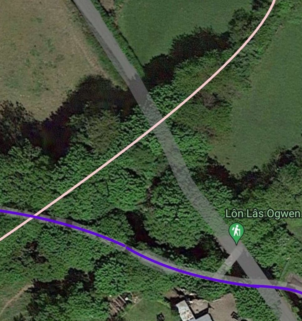
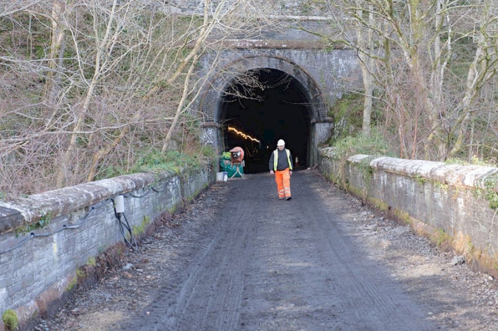
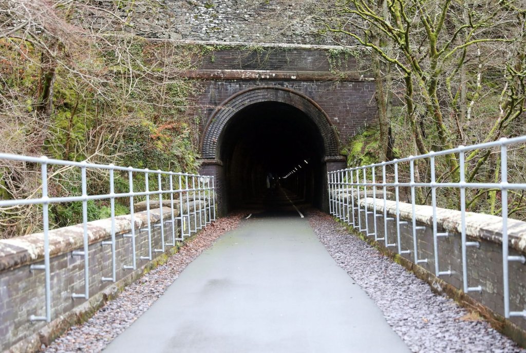
The two railways ran on different gradients after a second crossing of the Cegin. The next photograph shows the two lines passing under the old A5. As illustrated, the Shrewsbury to Holyhead road (A5) crossed the PQR and the standard-gauge line. Each line had its own bore in a tall stone embankment. “The Penrhyn bore being 36ft long and of its basic loading gauge Viz. 15ft wide and 11ft 10in. height from rail to top of arch with 7ft horizontal clearance at the foot of the walls.” [29: p60]
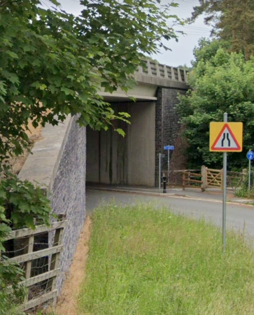
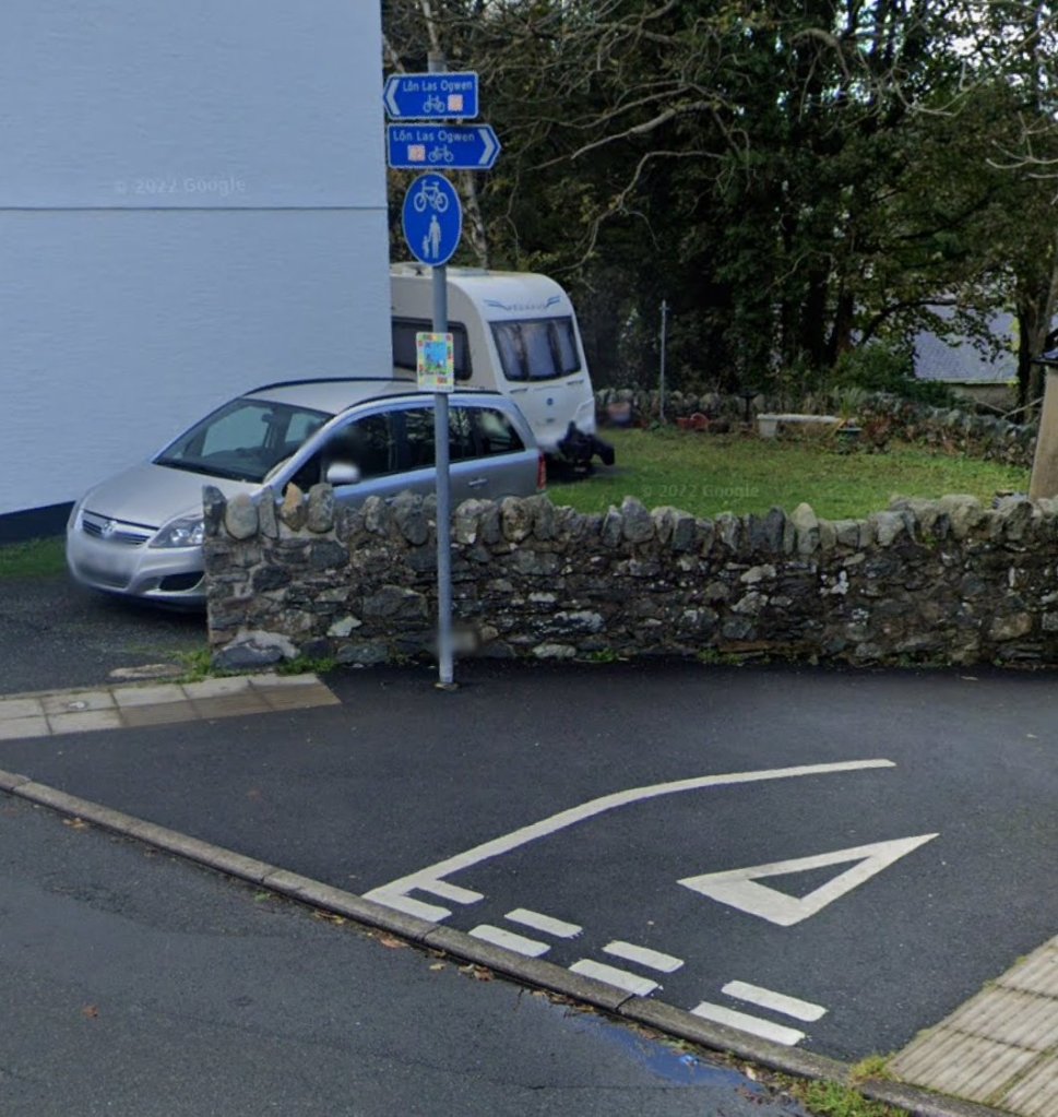
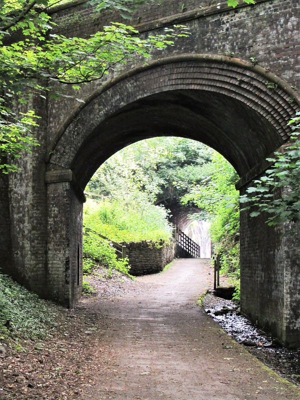
The old structure shown above was later replaced by a more modern structure spanning only the PQR, as shown below. The structure now carries the A5 over the Lon Las Ogwen cycle-route.
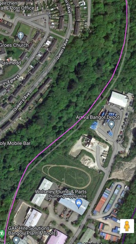
After passing under the A5, the LNWR line rose to join the main Chester to Holyhead line west of Llandygai tunnel. The PQR ran on its own course as it travelled on from the A5 at Maesgierchen.
The old tramroad is covered in the first article in this short series:
The Penrhyn Quarry Railway – Part 1
This article follows the Penrhyn Quarry Railway which was operational from the 1870s. Motive power was given some consideration in the earlier article.
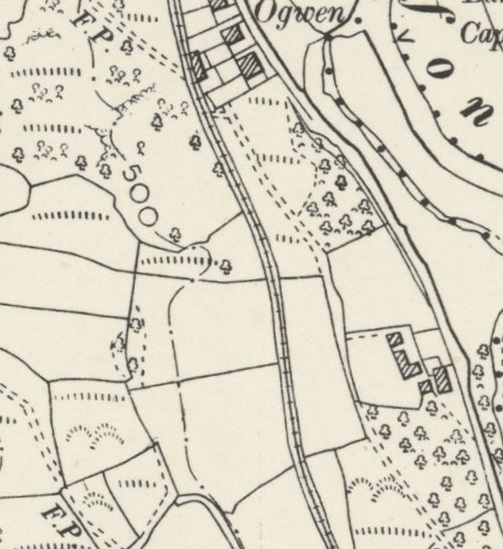
At a gradient of 1 in 209 the PQR left the Nant Maes-y-Geirchen gorge crossed the occupation crossing to Felin-Esgob and approached the fine spectacle of the Chester & Holyhead Railway’s Cegin Viaduct.

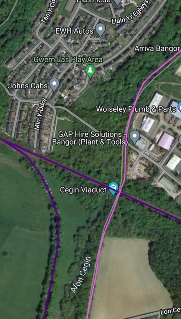
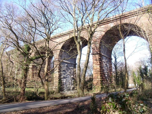
The Cegin Viaduct “has seven semi-circular arches each of 35ft span – it has masonry piers but the stone arches are faced in brick (Ref: Public Record Office, M.T. 27/49.).” [29: p60]
As an aside, The Bethesda Branch which runs along a similar route to the PQR was a 4.25mile (6.8 km) line between Bangor and Bethesda in Gwynedd, North Wales. Its primary purpose was to bring quarried slate down to the main line for onward transport. It existed in competition with the private PQR. It opened in July 1884, and a local passenger service was run as well as trains for the mineral traffic.
Competition with the PQR was healthy and the two lines managed to co-exist until increasing road competition led to the cessation of ordinary passenger services on the branch in 1951; goods traffic and occasional passenger excursion journeys kept the line going until its complete closure in October 1963. [19]
Wikipedia tells us that the line climbed all the way from the main line, rising for much of the way at 1 in 40. Major features on the branch included the Ogwen Viaduct and the Tregarth Tunnel which was 279yards (255metres) long. Apart from the terminus at Bethesda, there were two intermediate stations on the route – at Felin Hen and at Tregarth. [19]
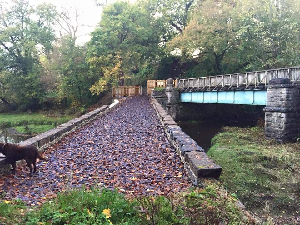
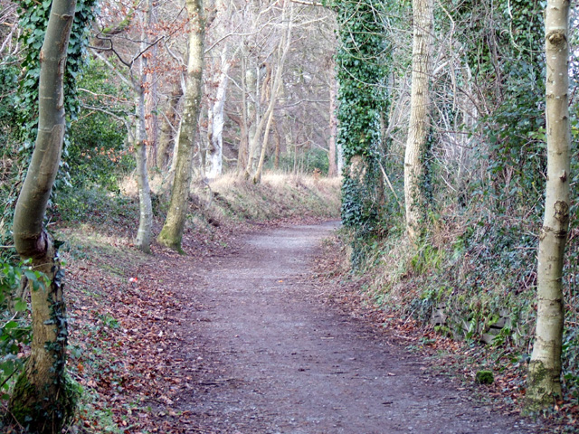
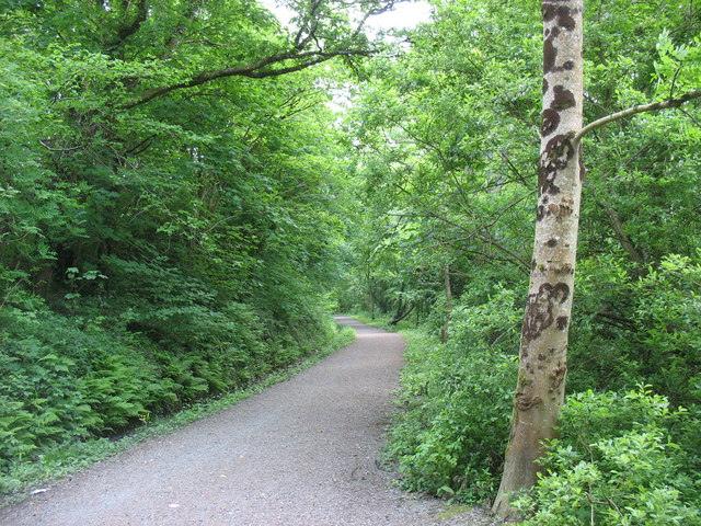
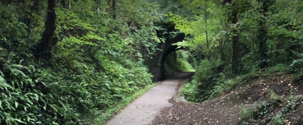
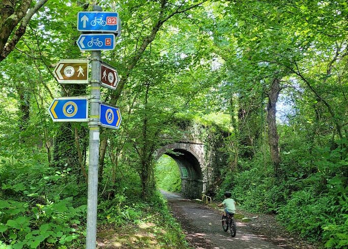
The Bethesda Branch formation now provides a cycle and walking route to Bethesda from Porth Penrhyn – known as the Ogwen Trail, part of the Sustrans 82 cycle-route.
Continuing to look at the Penrhyn Quarry Railway …. we head South from the Cegin Viaduct.
At about 70ft above sea-level, there was a halt for the Workmen’s Train adjacent to Lon Cefn Ty. The bridge here (once just a footbridge) carried the road over the PQR. To the West of the bridge, the Lon Cefn Ty crossed the Afon Cegin by means of a ford (with a footbridge for pedestrians) and then passed under the Bethesda Branch which was on a steep falling grade from its junction with the mainline just to the East of Bangor Tunnel.
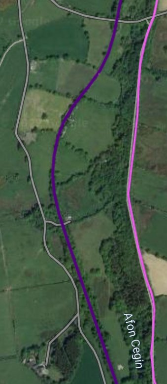
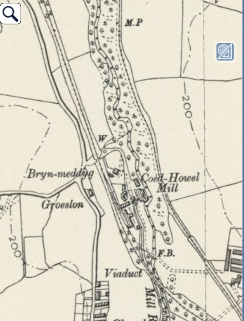
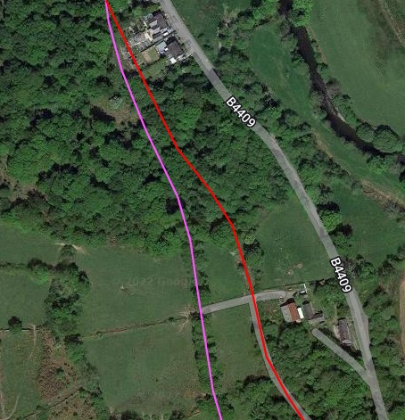
The PQR left the East side of the Afon Cegin and crossed the Glas-yn-Fryn embankment, passing Coed-Hywel-Uchaf Farm on its left then passed 15ft below the LNWR Bethesda Branch by means of an acutely-skewed bridge. Boyd tells us that the LNWR retrieved this bridge from another site and cut it down “to a 31ft span for re-use here; it formed a ‘tunnel’ almost 43 ft long for the narrow gauge and gave generous vertical clearance of 14 ft and 14 ft horizontal!” [29: p59]
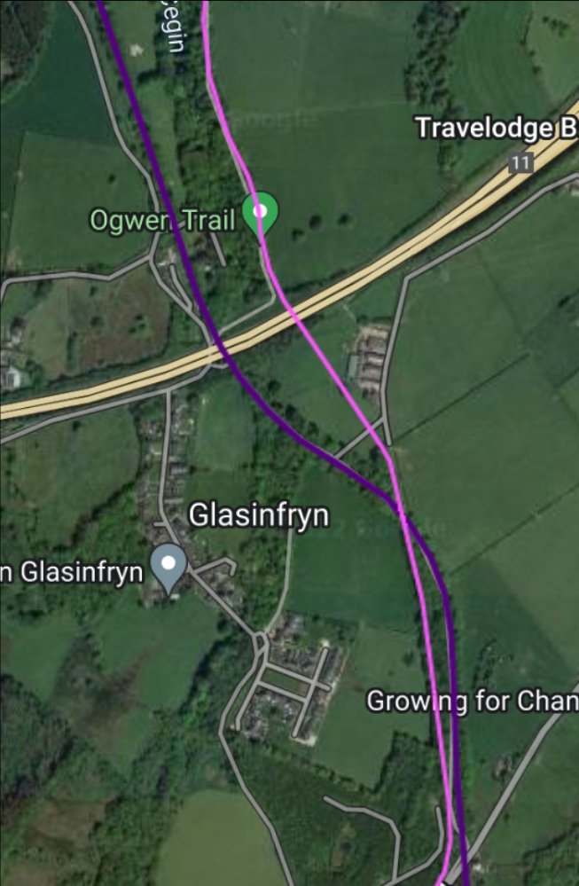

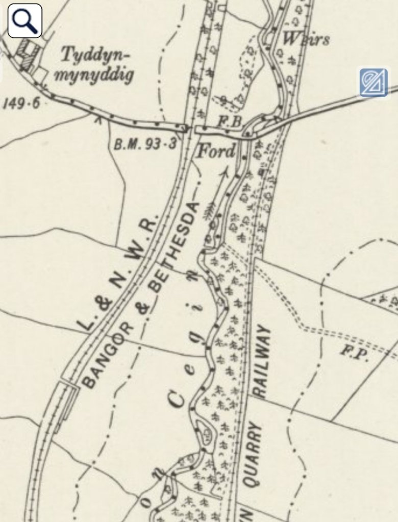
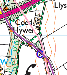
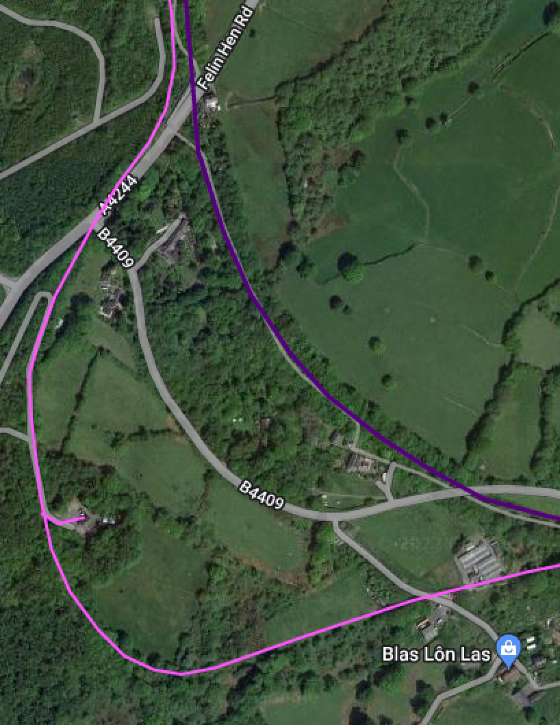
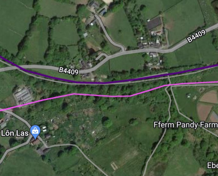
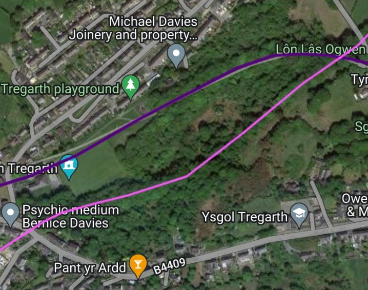
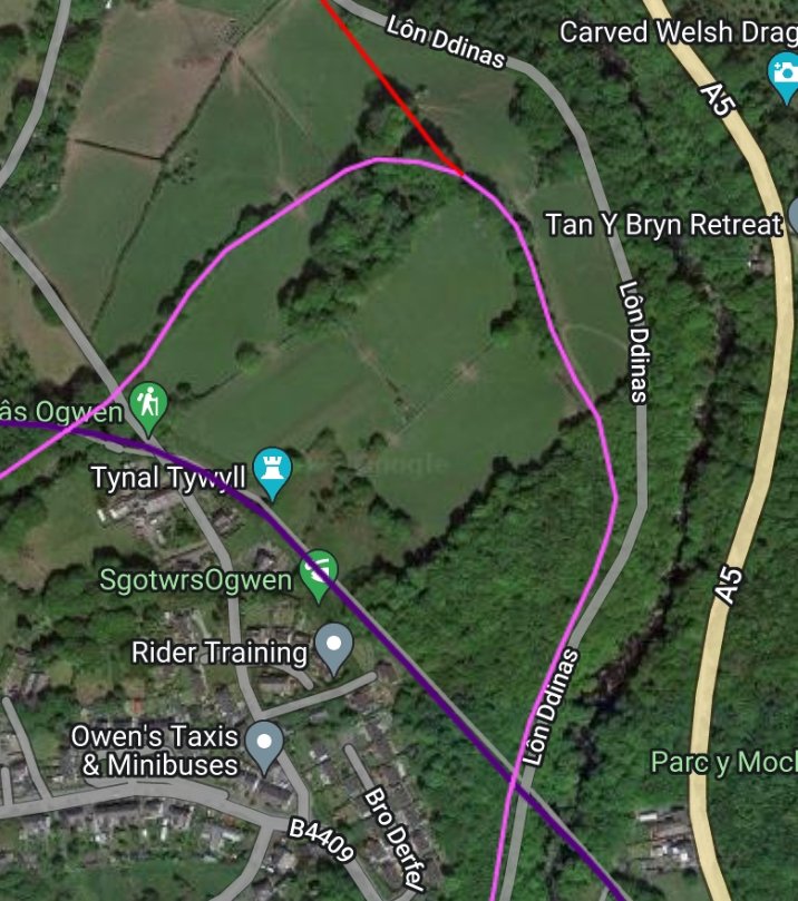
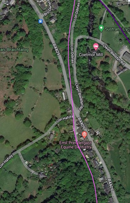
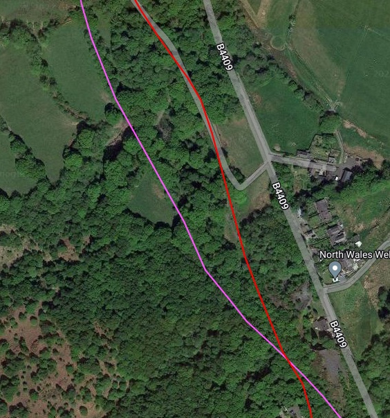
As the satellite image above shows, to the South of the A55, the alignments of the PQR and the LNWR Bethesda branch converged and ran parallel to each other at different levels. Immediately South of the A55, the PQR formation ran across what is now an open field. before passing under the Bethesda branch. On the adjacent map extract, to the East of Glasinfryn. The Bethesda Branch is highlighted in purple and the PQR in pink.
If you follow the link below, you will see a superb picture, © R.K. Walton and held by Amgueddfa Cymru – the National Museum Wales. The photographer is sitting on a locaded slate wagon behind one of the PQR’s locomotives, Blanche or Linda, which was taking a loaded train down the PQR towards Porth Penrhyn in 1959, passing under the Bethesda Branch at this location. ….
https://museum.wales/collections/online/object/861fc496-8fba-3f06-b2ab-ad1a0fd3b59d
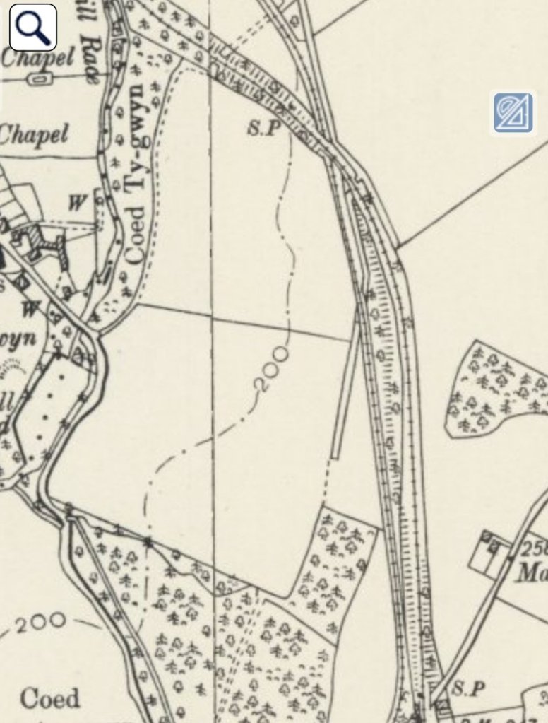
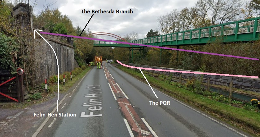
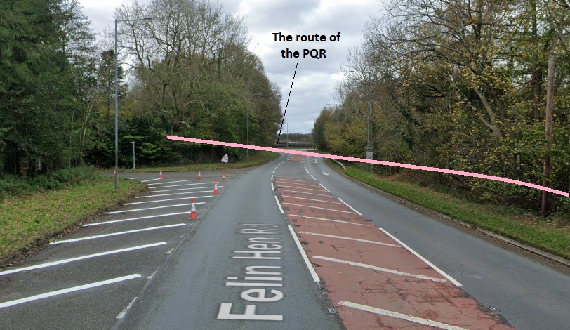
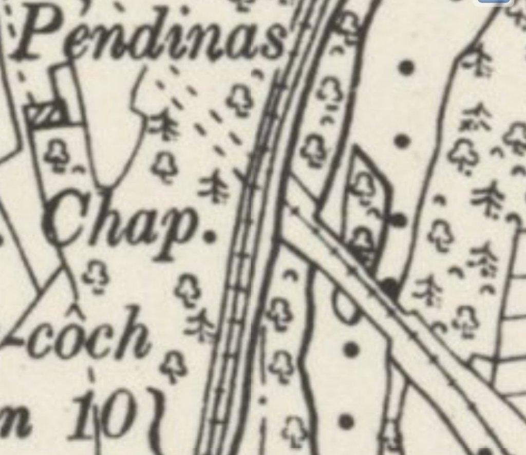
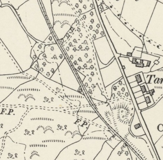
The Bethesda branch Felin-hen station was Immediately to the South of this point. It appears at the top of the 6″ Ordnance Survey map extract below. The PQR can be seen drifting away to the Southwest alongside the A4244 (Felin Hen Road).
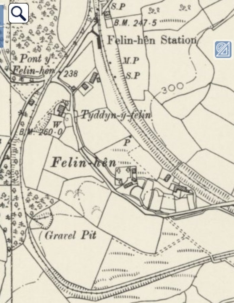
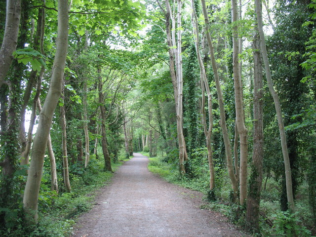
The line curved to the right and then to the left left and crossed the Felin-Hen Road on a 17ft lattice ironwork span and the Felin-Hen stopping point before passing through a heavily wooded area in cutting.
Continuing to curve to the left, trains passed a short siding alongside on the left which did not have a permanent connection to the PQR. This siding served “a small gravel pit and connection was made as required – and probably since 1881 – by a set of portable Spoon Points which were lifted off after use. On Mondays a wagon was manhandled down to here from Coed-y-Parc, pushed through the narrow curved cutting into the working and loaded up as required; output was small being only about 150 tons a year, with 1912-14 being the best period. An embarrassing accident occurred to the Up Workmen’s Train here one Monday morning, when, the Spoon Points having been inadvertently left in position, the train engine tried to enter the gravel pit and was derailed. The Engineer’s diary records the date, 3rd February, 1941, that the engine was CEGIN – an unusual choice – and that the train ‘Arrived Mill 10.30 a.m’.” [29: p59]
The PQR then continued to sweep round in a wide arc towards the East, gaining height as it travelled. Completing the curve to the left the PQR was then running West-northwest and to the North of Moel-y-ci Farm which is now, in the 21st century, the site of a Farm Shop (Blas Lon Las). The route of the PQR crosses the access road to the Farm Shop and gradually converges with the line of the Bethesda branch. There was an overbridge carrying the Moel-y-ci Farm lane.
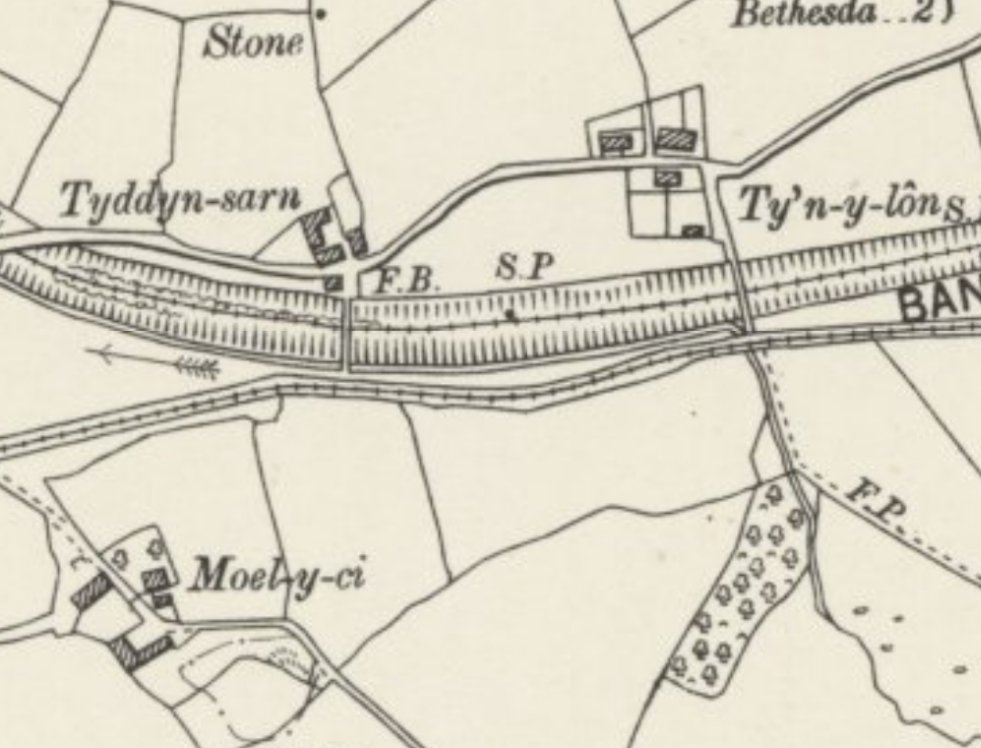
James Boyd says that along this section of the PQR there was a long (250 yard) loop together with a long siding on the North side. “trains passed each other on the right. Unusually, iron railings fenced the route here, whereas elsewhere the ubiquitous estate fence made of slabs stuck into the ground on edge and wired together near the top, was (and is) a feature of the district.“ [42][36: p58]
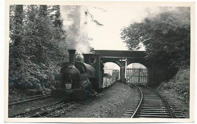
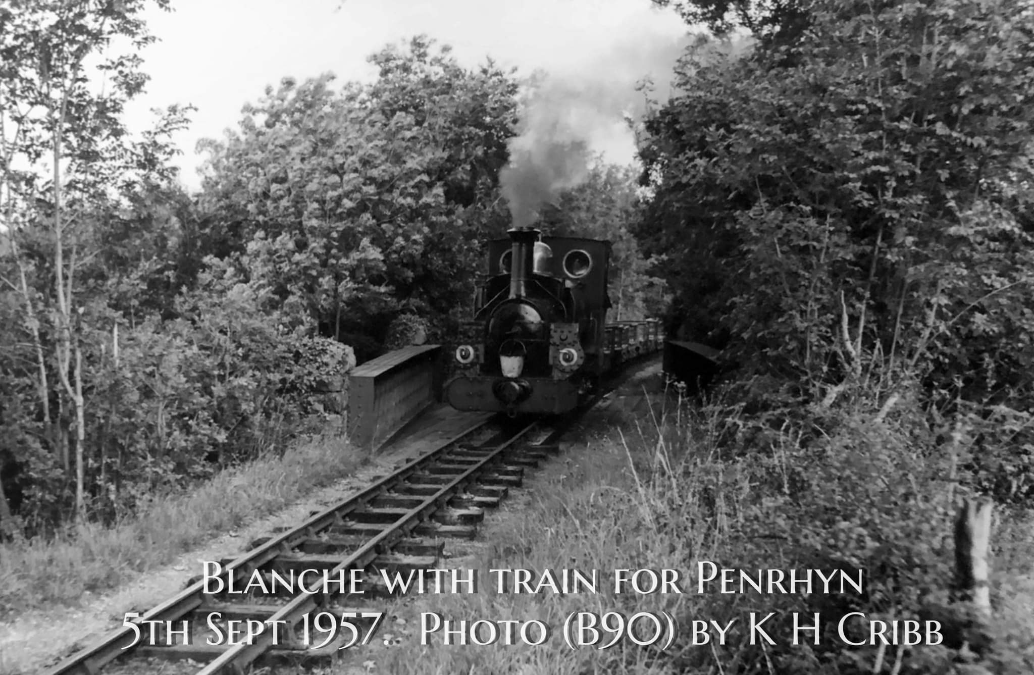
Clicking here will take you to an image of ‘Linda’ on a PQR main line up train a few years before closure in 1961 which includes the slate slab and wire fencing mentioned by Boyd. [40]
“Until the reduction in trade made the running of but one train (from 4th May, 1928) sufficient to move stocks, trains passed here regularly. There was a water tank used by Up trains which stopped if required. … There was no signalling. The loop, Pandy (or sometimes Tyn-y-Lon) was an original stopping point for the Workmen’s Train and boasted one of the four Waiting Huts, but a stone throwing incident during the Great strike so displeased His Lordship that the stop was removed.” [36: p58-59]
The two railways may be running very close together on the map or satellite image but the vertical separation was significant with the LNWR line in deep cutting.
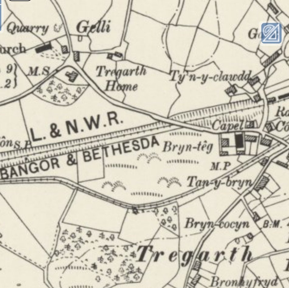
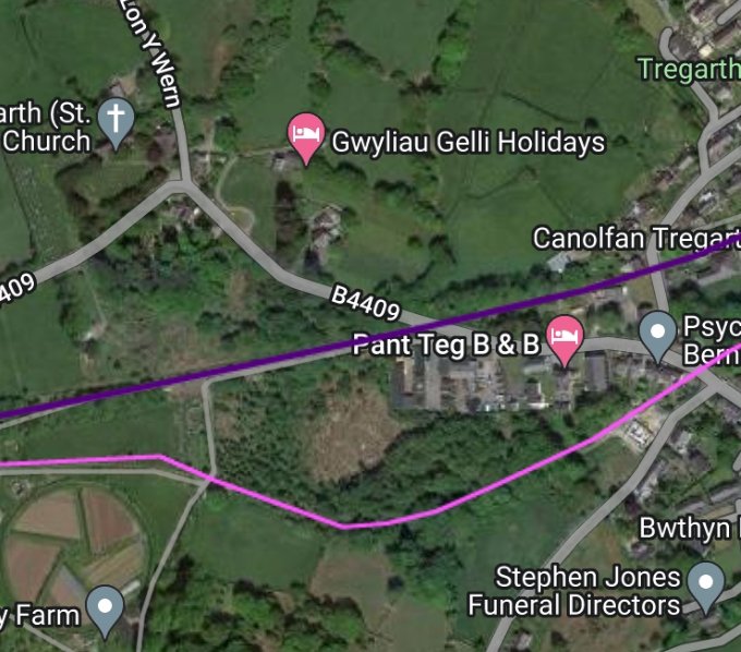
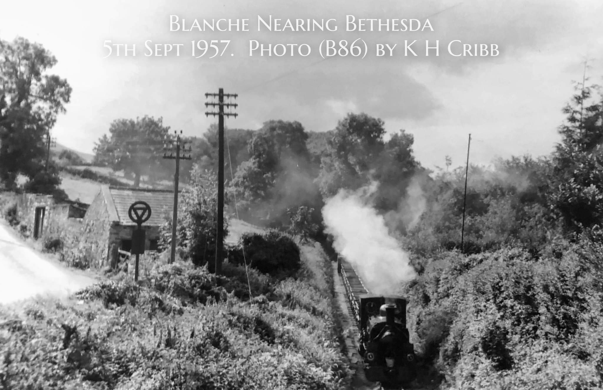
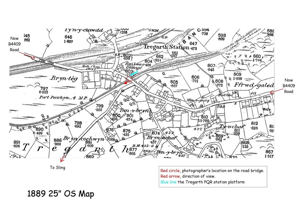
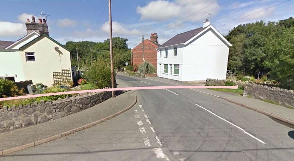
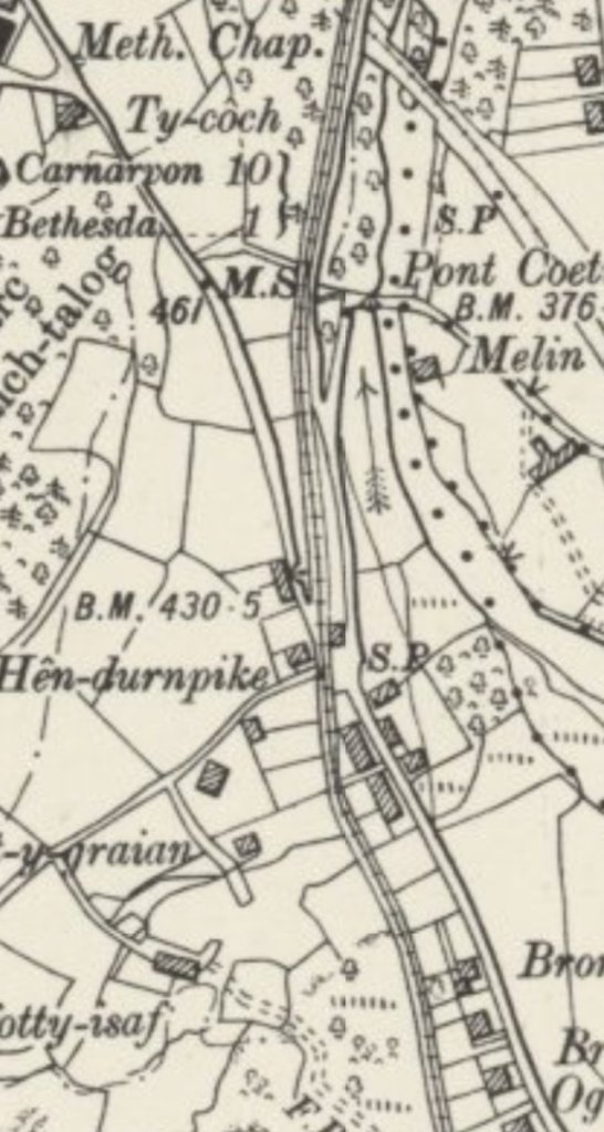
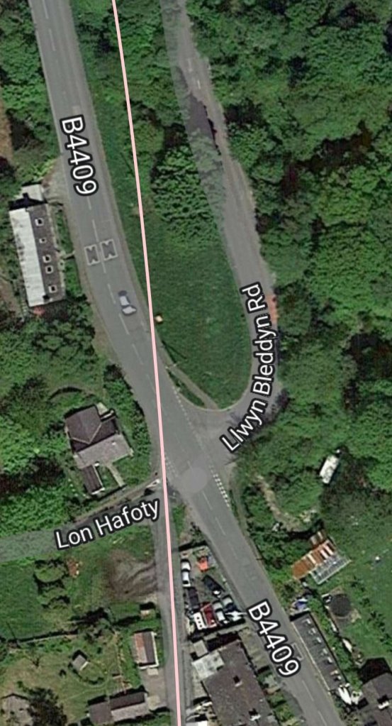
Fortunately, a friend of mine is an absolute mine of information about the railway and he has identified the location. A marked-up copy of the 1889 25″ OS map is attached. The photographer was standing on the bridge over the PQR in Tregarth where the B4409 road crossed the trackbed. To the extreme left of the photo can be seen a pair of double doors in a shed. These can be seen on Google Maps as the image is from 2009 but were recently demolished to make way for a new house.” [Email on 3rd February 2023]
Boyd comments that the Workmen’s Train Halt in Tregarth was behind Shiloh Chapel, it was “linked with the nearby road by footpath and wicket gate. No trains ever seemed actually to stand there, for it was sufficient for the Workmen’s rake to run slowly past as the men jumped on or off!” [36: p58]
It appears from the annotated map extract sent to me by Robin Willis, that the Workmen’s Halt was on the East side of the main road rather than behind Shiloh Chapel. Nonetheless the quote from Boyd remains apposite.
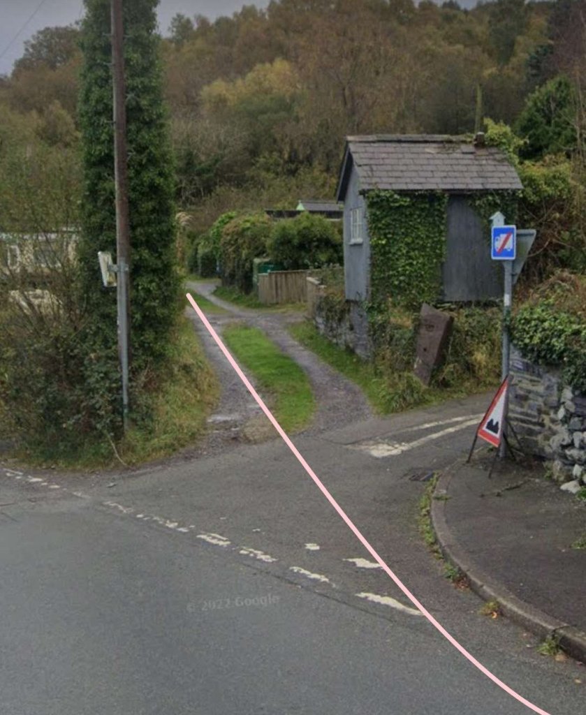
The PQR passed under the main road in Tregarth through what James Boyd describes as “the ‘standard’ form of road overbridge, stone with brick facings.” [36: p58]
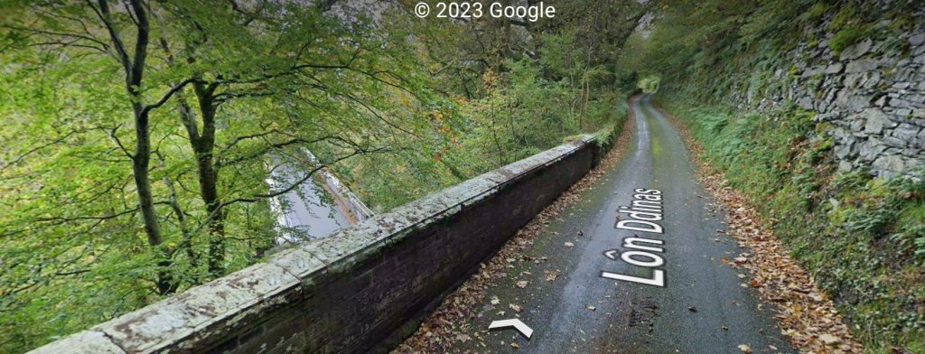
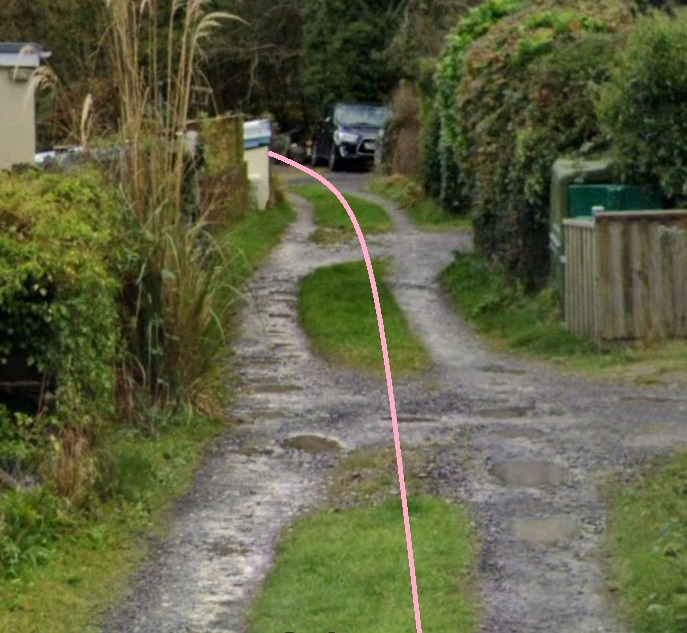
The bridge was a skew single arch structure in brick and was funded by the LNWR.. the Bethesda Branch was 31ft below the PQR at this point. [36: p58] Details of the bridge over the lane can be found below. Immediately below are two pictures taken from road level of the 21st century remains of the bridge over the lane.
After crossing the LNWR, which was in deep cutting, the PQR ran along a very short embankment before bridging the Tal-y-Cae to Hen-Durnpike road which climbed steeply beneath it. The bridge was originally a 25ft timber span (which was replaced in steel) on stone abutments. Just beyond the bridge was the Corrig-Llwydion Workmen’s Train halt, then a shallow cutting followed by an equally shallow causeway. The line was now climbing at 1 in 93 and at approximately 400ft above sea level.
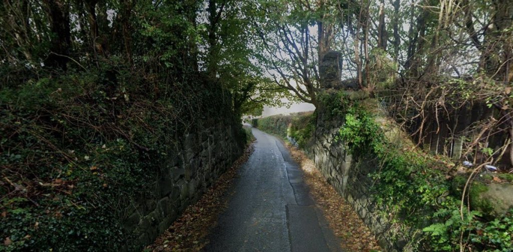
As both the 6″ OS map extract and the satellite image above show, the line turned very sharply to the right round the flanks of Pen-Dinas. Apparently, the tightest radius on the line was at this location (85ft) and the Baldwin locomotives purchased by the PQR were known to derail here on occasions. The line here was supported on low walls. Boyd tells us that the right of way of the PQR widens out at the head of the old Incline. There used to be stabling loops for the Incline at this point. [36: p58]
Between the old tramroad incline and Hen-Durnpike in Bron-Ogwen the newer PQR followed the line of the old Tramroad. Boyd describes this section: “the line was carried on a stone shelf. … Parallel and below, the old road to the Quarry kept company.” [36: p57]
Boyd describes this road crossing as: “a close-walled road and rail intersection with protective tall semaphore signal (its signal hut perched on the walling, the enceinte of successive Mrs. Parry – gatekeepers) and twin road gates, made all the more risky as several roads met hereabouts. The hut, wooden walled and slate roofed, survived the closure. Here the line was 420 ft above sea level, and there were ‘Whistle’ boards on each side of the gates; this was a most dangerous and narrow place, more especially for the road-user! The position of the approaching train could be determined quite exactly by long forewarning of its steam hooter, each main line engine having an individual tone.” [36: p57]

Behind the road crossing and running along the backs of the properties in Bron-Ogwen on the B4409, initially on a shallow grade, then climbing at a gradient of 1 in 36 the PQR reached open land. Here, at first, it ran on a causeway spanning a footpath, and then it passed through a series of rock cuttings, one being only 8ft wide at formation level. [36: p57]
Over open land to the West of the modern B4409 the PQR ran on a high embankment/causeway, 18ft high and 10ft wide. The outer walls of which were formed of stone slabs which were then back filled with earth/arisings from the Quarry.
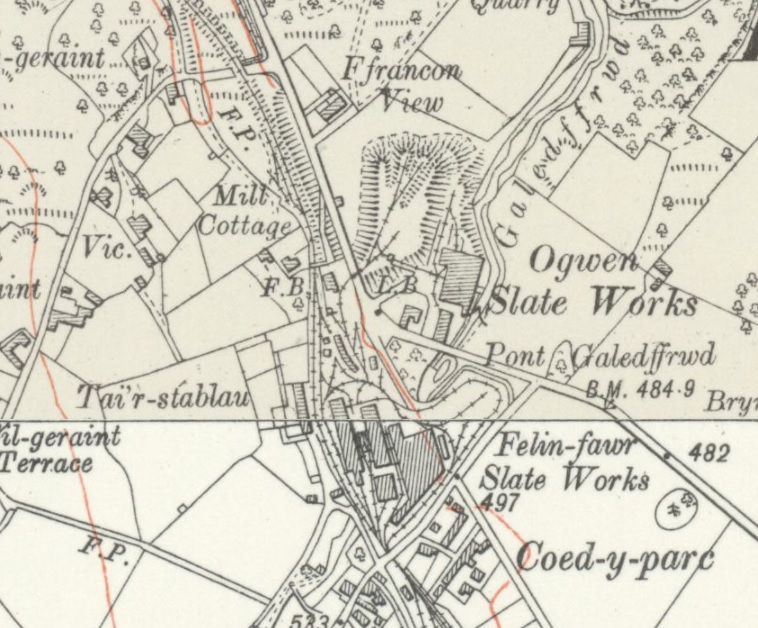
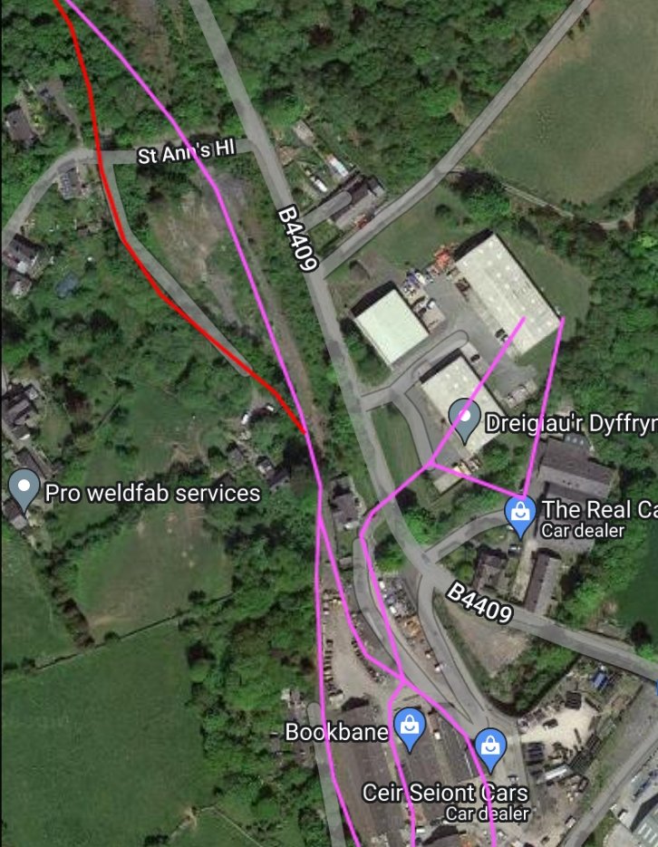
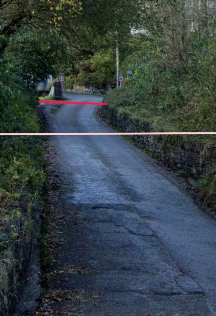
After crossing St. Ann’s Hl the old Tramroad continued on to the South towards the Felin-Fawr Slate Works and the Quarry. The later PQR route and the Tramroad route meet once again just before a footbridge. Felin-Fawr House was just beyond the footbridge to the left and Mill Cottage was on the right. James Boyd notes that the footbridge was constructed by John Foulkes in 1823 and framed wooden gates to close off access along the line to the Slate Works.[36: p55]
A short distance beyond the footbridge the trains reach the summit of the line. At that point they had climbed 550ft from Porth Penrhyn. [36: p56]
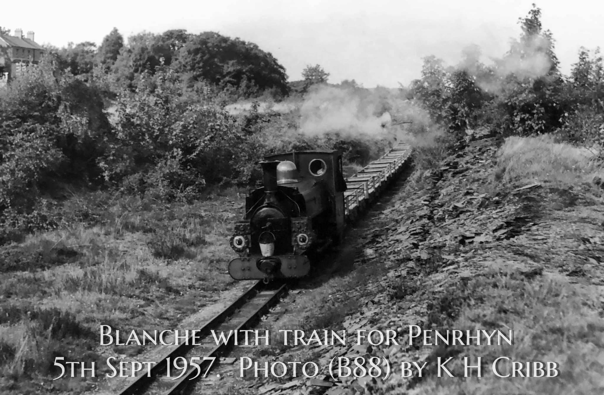
The summit was close to a point where a standpipe was on the retaining wall which ran down the West side of the Slate Works site, to the right of the line. It was along this length of the line that loaded slate trains were prepared for their journey down to the port.
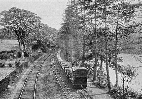
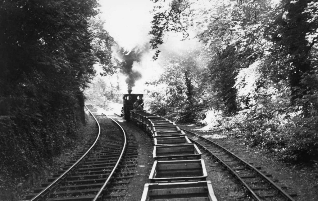
The mainline stayed close to the wall which can still be seen on site in 21st century. The photograph below shows a port-bound slate train being prepared to for the journey North with ‘Linda’ in charge.
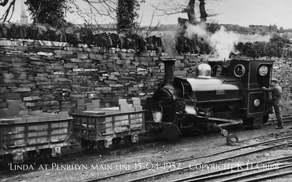
Photo (B12) © K H Cribb and included here by kind permission of his son Russ who shared the photograph on the Narrow Gauge Enthusiasts Facebook Group on 9th November 2023. [45]
To the East of the mainline there were three sidings between it and the original slate-slab mill. One of these sidings was increasingly used for locomotives which had been taken out of service. The mainline continued South beyond the slab mill and then, once it has been built in 1900, under an overbridge which, like the footbridge’ was gated to control access to the site of the Quarry. Beyond the overbridge were the main sidings where slate wagons were marshalled either for their journey to the coast (if they were full).
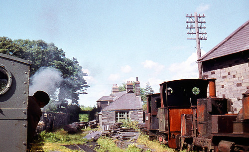
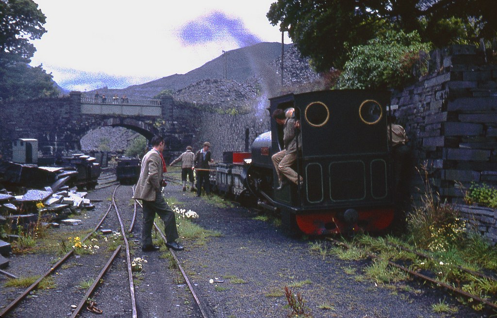
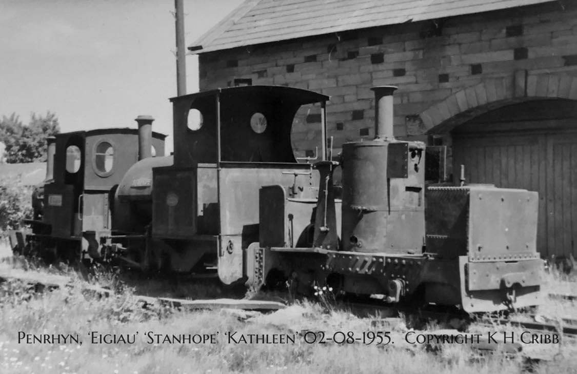
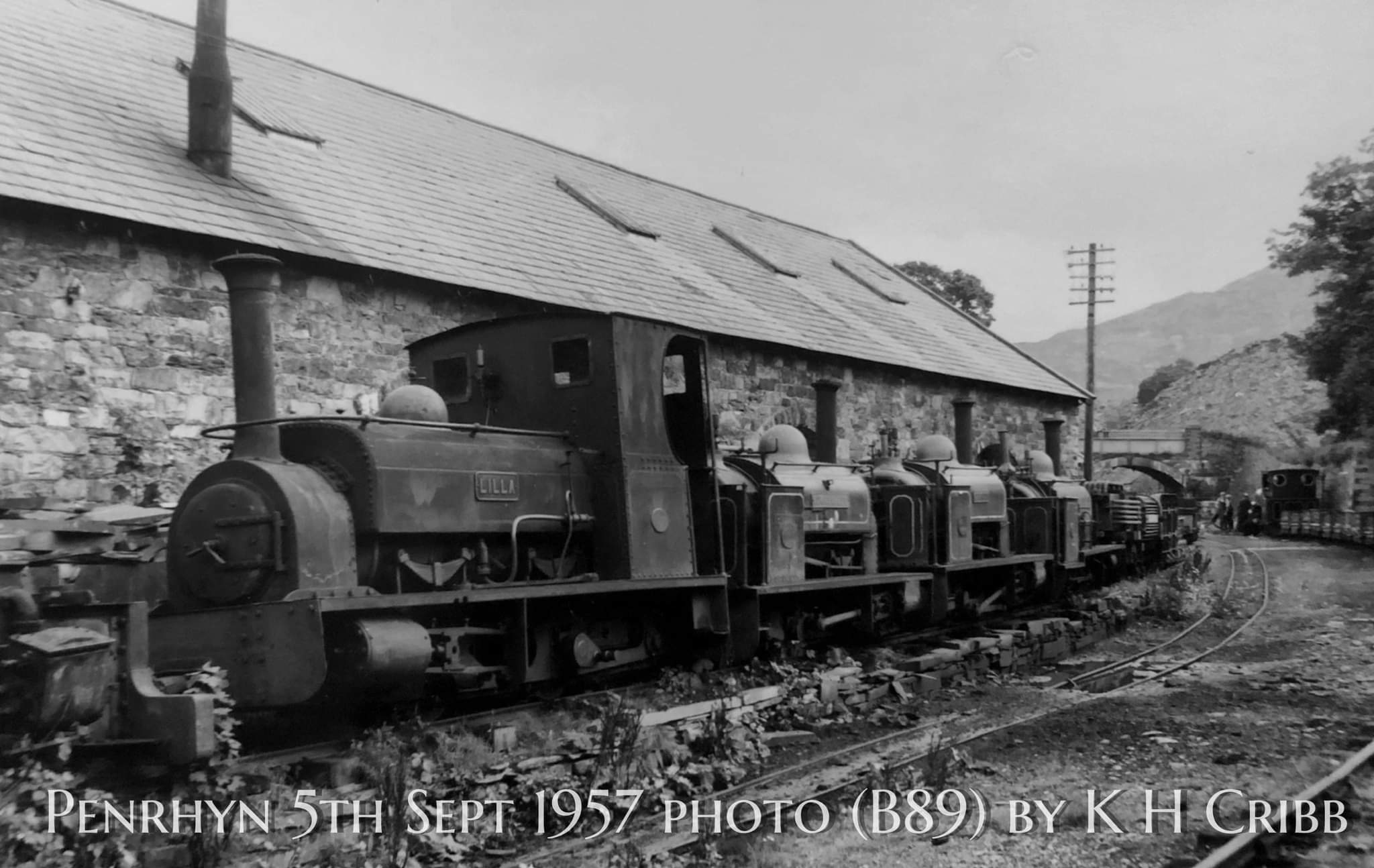
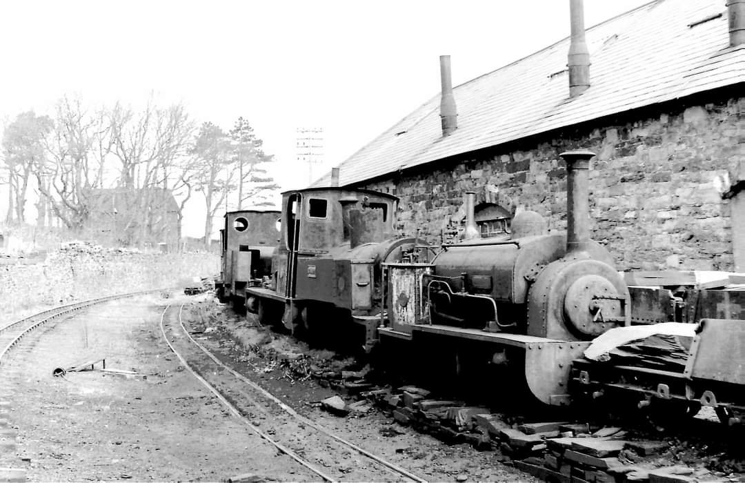
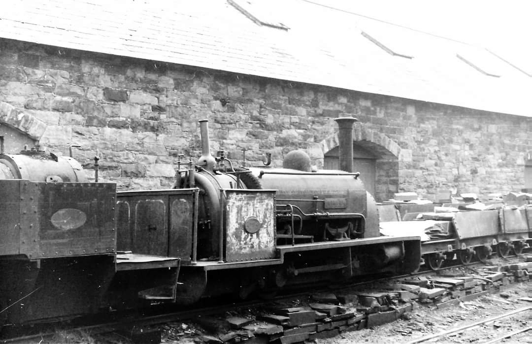
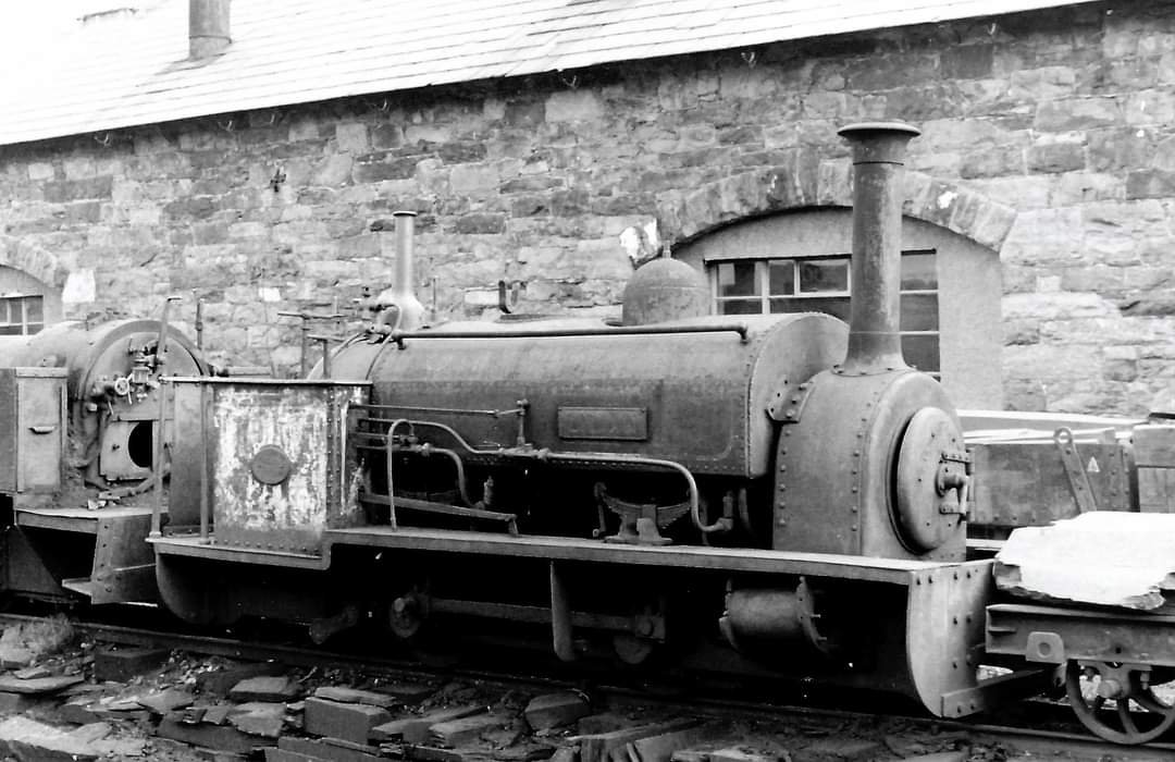
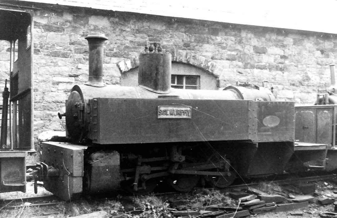
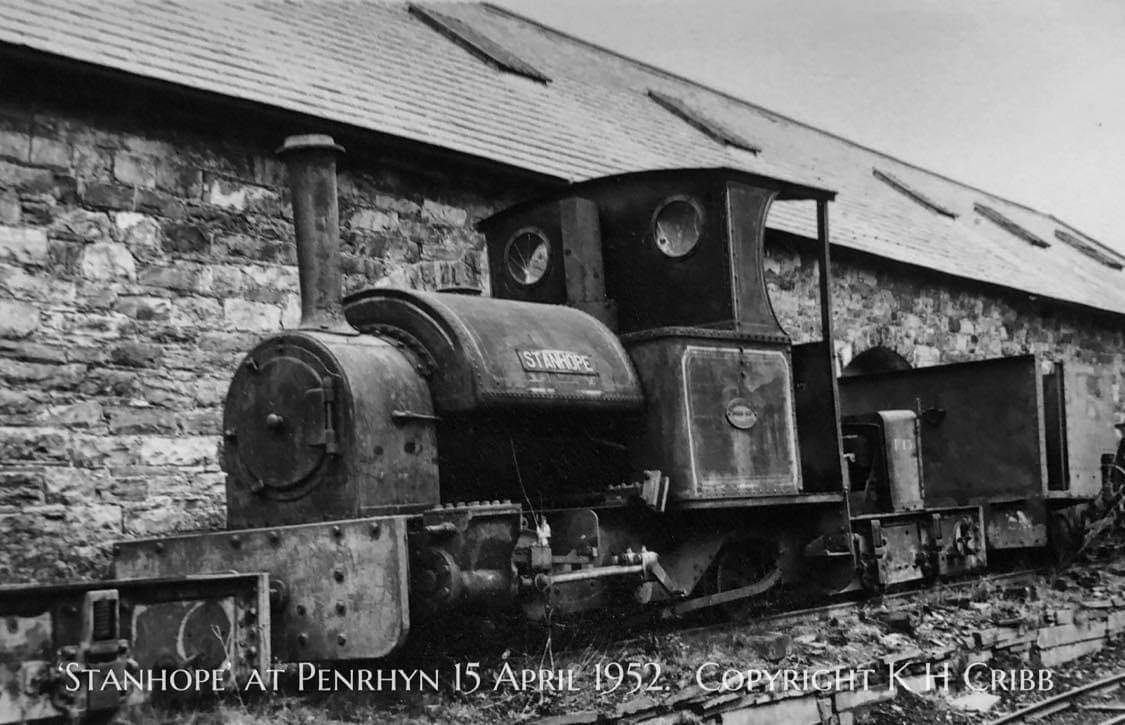
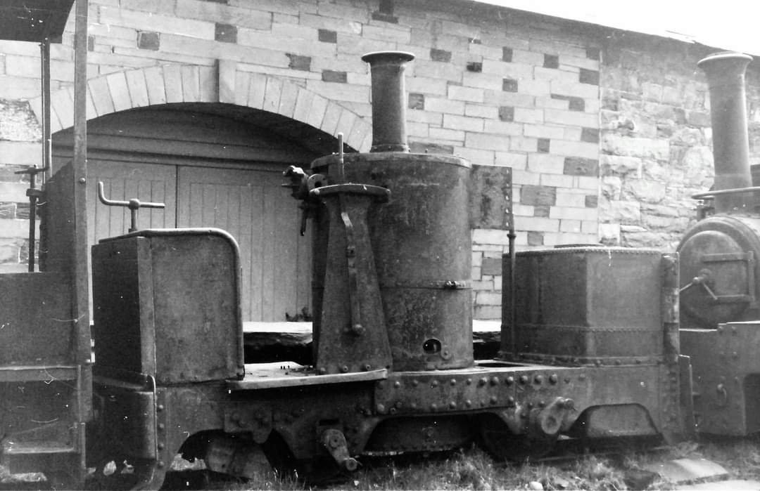
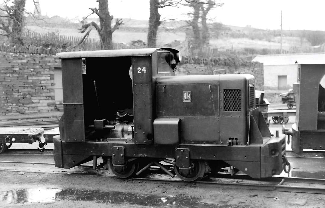
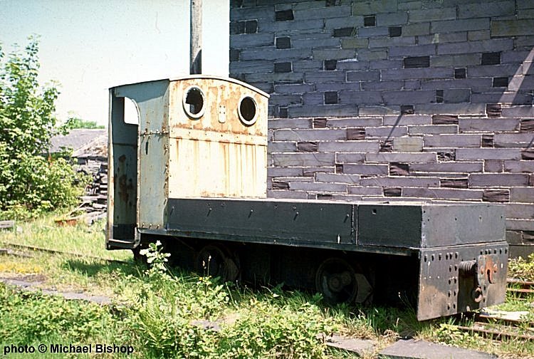
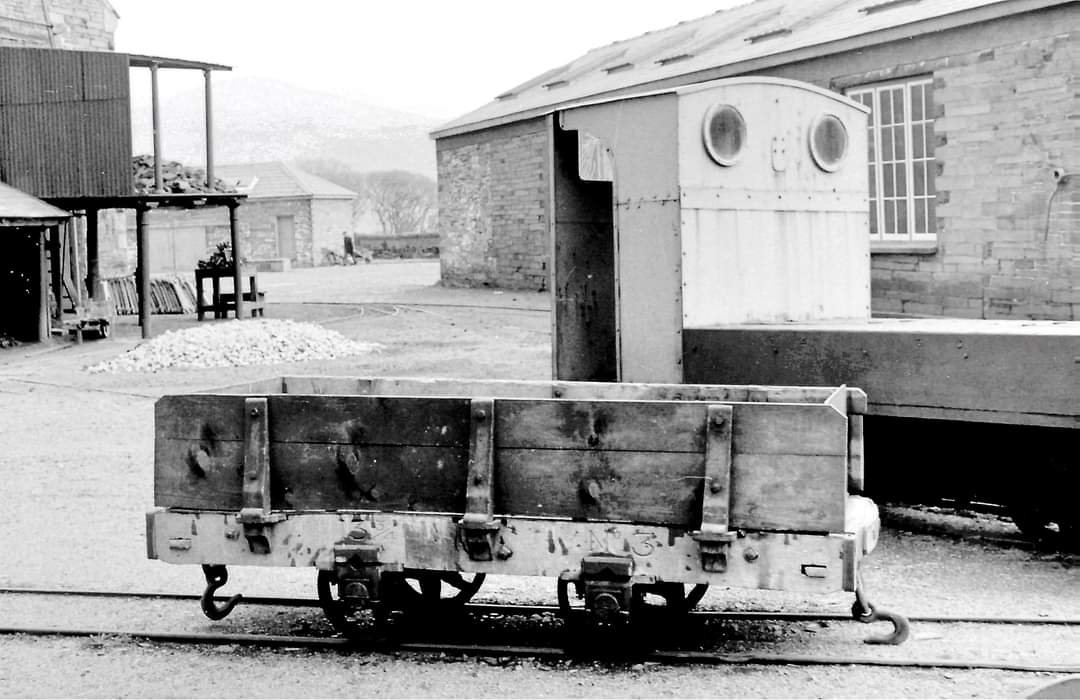
We finish this portion of our journey with a look at some of the locomotives which were stored at Felin-Fawr and some of the rolling stock in the immediate area.
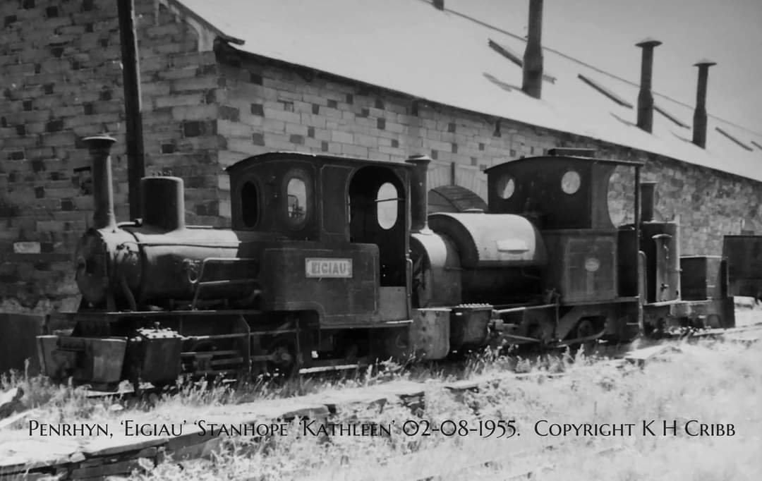
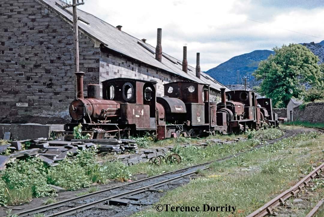
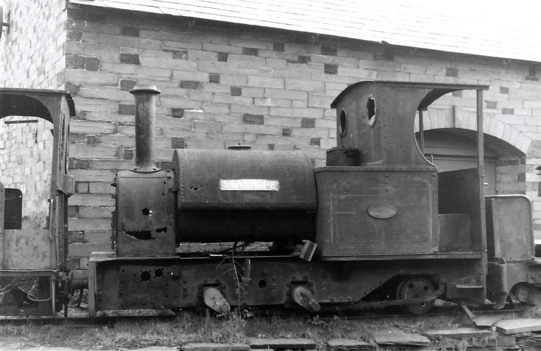
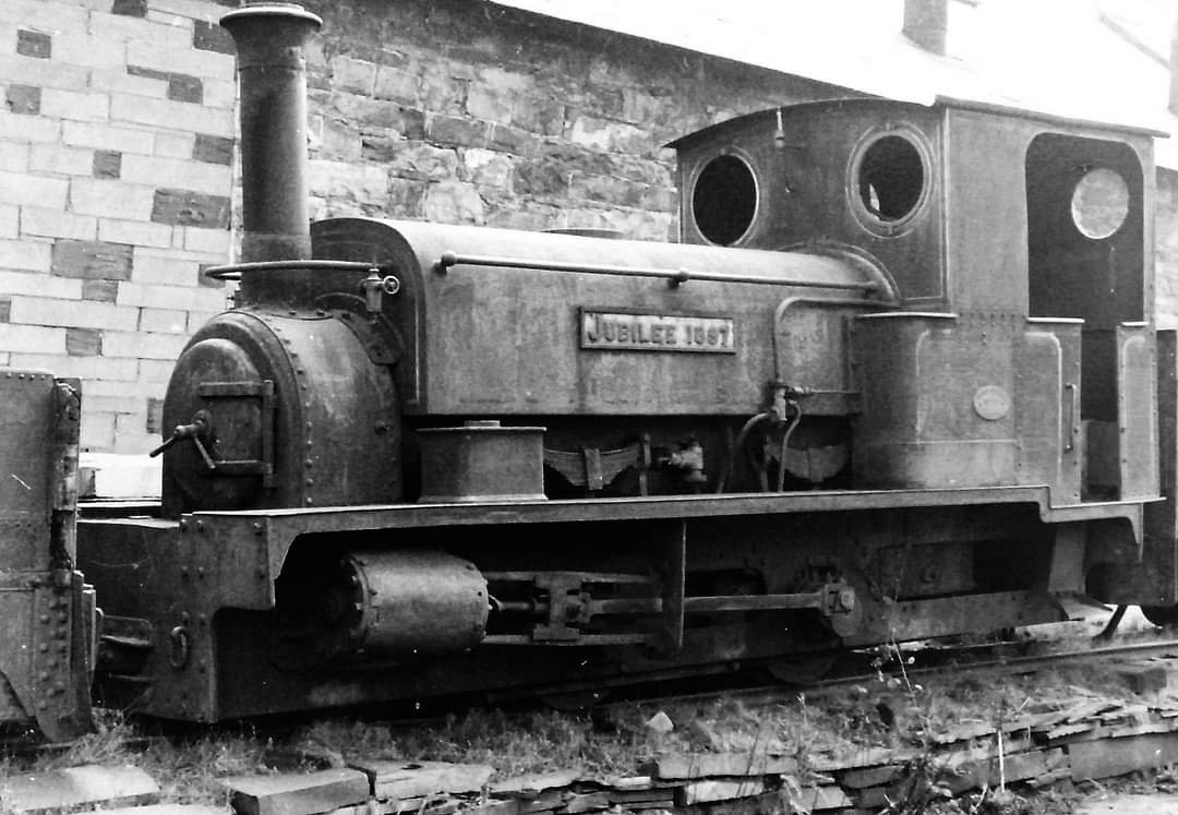
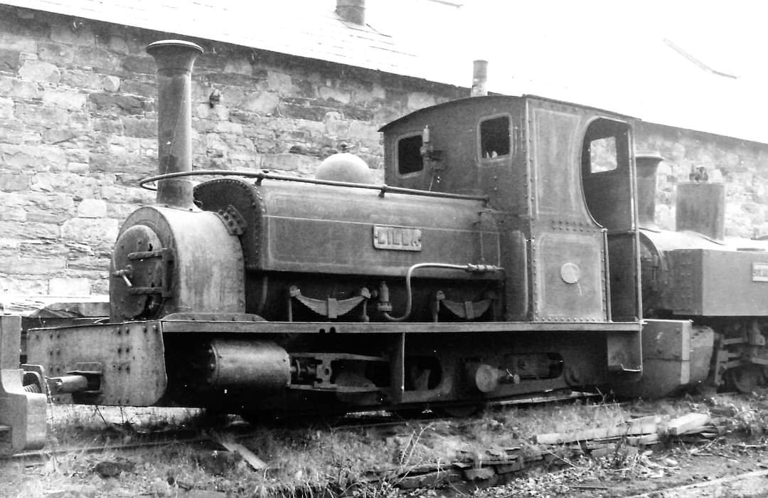
Terry Dorrity writes of the photograph above: “This was the bitter-sweet sight that met visitors to the Coed y Parc Penrhyn Works at Bethesda in Snowdonia. The sad line of withdrawn locomotives resting and rusting, apparently beyond saving, in a sort of mini Barry scrapyard must have encouraged many a daydream but fortunately every one of them, except SKINNER, has been preserved.” [47]
The Locomotives are: “EIGIAU; STANHOPE; the de Winton, KATHLEEN; JUBILEE 1847; frames wheels and part of the cab of SKINNER; LILLA, and SGT MURPHY await their fate with LILLIAN, which was next in line but out of sight.” [47]
Terry Dorrity continues: “EIGIAU is an Orenstein and Koppel 0-4-0 well tank built in 1912 (works number 5668) which was originally supplied to C L Warren contractors in Cheshire and named SUNLIGHT. In 1916 it was sold to the Aluminium Corporation of Dolgarrog for use in building Cowlyd reservoir and renamed EIGIAU after a lake in Snowdonia. It became a Penrhyn locomotive in 1928. It was taken out of service in 1949 and was bought for preservation by Mr G J Mullis and removed in pieces to Droitwich in January and February 1963 and restored to working order. It ran at Bressingham Gardens for some time but it is now part of the Bredgar and Wormshill Light Railway collection.” [47]
A number of photos taken by Barry Fitzpatrick, Ron Fisher and Ken Cribb, included here follow, all of locos on the line at Felin-Fawr. All pictures used by permission of the photographers or, in Ken’s case, with permission from his son Russ.


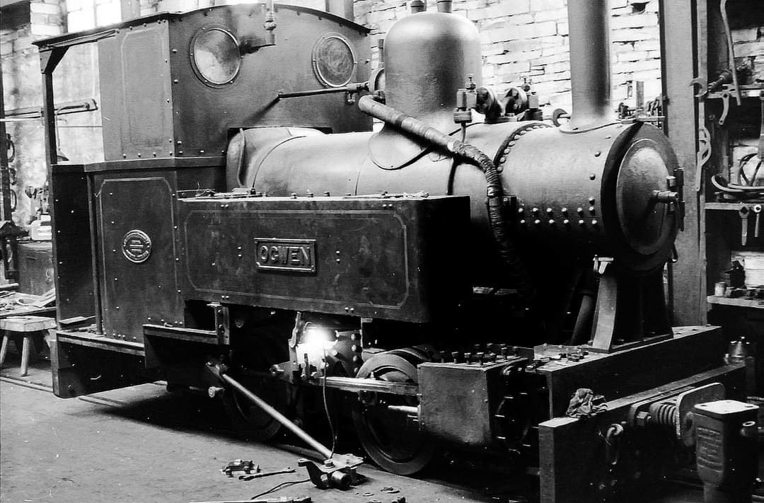
These next two pictures were taken inside the workshops.
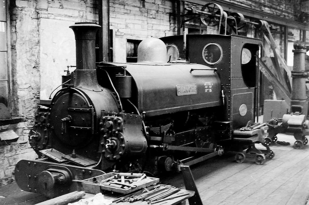
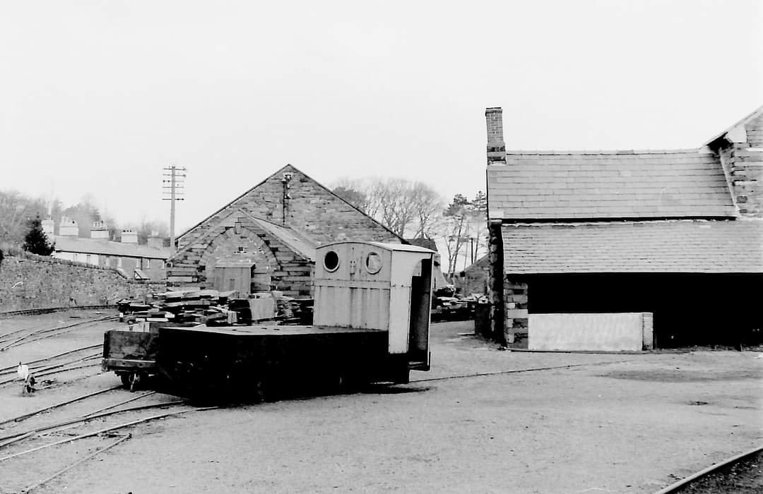
A few further pictures of items of rolling stock at Felin-Fawr. These photographs were taken in 1962, 1963 and 1967.
References
- https://historypoints.org/index.php?page=porth-penrhyn-bridges-bangor, accessed on 29th December 2022.
- https://m.facebook.com/groups/417502465072892/permalink/529969163826221, accessed on 28th December 2022.
- https://historypoints.org/index.php?page=old-cegin-railway-bridges-near-bangor, accessed on 29th December 2022.
- https://en.m.wikipedia.org/wiki/Penrhyn_Quarry_Railway, accessed on 27th December 2022.
- https://maps.nls.uk/geo/explore/#zoom=16.0&lat=53.22458&lon=-4.11050&layers=6&b=1, accessed on 28th December 2022.
- https://maps.nls.uk/geo/explore/#zoom=16.1&lat=53.22305&lon=-4.11369&layers=6&b=1, accessed on 29th December 2022.
- https://www.railmaponline.com/UKIEMap.php, accessed on 30th December 2022.
- https://maps.nls.uk/geo/explore/#zoom=16.3&lat=53.21826&lon=-4.11724&layers=6&b=1, accessed on 30th December 2022.
- https://maps.nls.uk/geo/explore/#zoom=16.3&lat=53.21392&lon=-4.11798&layers=6&b=1, accessed on 30th December 2022.
- https://maps.nls.uk/geo/explore/#zoom=16.3&lat=53.20751&lon=-4.11986&layers=6&b=1, accessed on 30th December 2022.
- https://maps.nls.uk/geo/explore/#zoom=16.3&lat=53.20311&lon=-4.11783&layers=6&b=1, accessed on 30th December 2022.
- https://maps.nls.uk/geo/explore/#zoom=16.0&lat=53.19744&lon=-4.11425&layers=6&b=1, accessed on 30th December 2022.
- https://maps.nls.uk/geo/explore/#zoom=16.0&lat=53.19212&lon=-4.11133&layers=6&b=1, accessed on 30th December 2022.
- https://maps.nls.uk/geo/explore/#zoom=16.0&lat=53.19052&lon=-4.10407&layers=6&b=1, accessed on 30th December 2022.
- https://maps.nls.uk/geo/explore/#zoom=16.0&lat=53.19173&lon=-4.09659&layers=6&b=1, accessed on 30th December 2022.
- https://maps.nls.uk/geo/explore/#zoom=16.0&lat=53.19282&lon=-4.08909&layers=6&b=1, accessed on 30th December 2022.
- https://maps.nls.uk/geo/explore/#zoom=16.0&lat=53.19380&lon=-4.08241&layers=6&b=1, accessed on 30th December 2022.
- https://commons.wikimedia.org/wiki/File:A_view_of_the_viaduct_carrying_the_railway_track_over_Afon_Cegin,_Llandegai_-_geograph.org.uk_-_2297711.jpg, accessed on 30th December 2022.
- https://en.wikipedia.org/wiki/Bethesda_branch_line, accessed on 30th December 2022.
- https://www.geograph.org.uk/photo/110406, accessed on 2nd January 2023.
- https://www.geograph.org.uk/photo/813242, accessed on 2nd January 2023.
- https://www.geograph.org.uk/photo/813245, accessed on 2nd January 2023.
- https://tentop.co.uk/family-friendly-cycle-from-bangor-to-tregarth, accessed on 2nd January 2023.
- https://maps.nls.uk/geo/explore/#zoom=17.8&lat=53.19062&lon=-4.08136&layers=6&b=1, accessed on 3rd January 2023.
- https://www.ogwentrail.co.uk/archive/tregarth-tunnel-developments, accessed on 3rd January 2023.
- https://www.dailypost.co.uk/news/north-wales-news/gallery/gallery-tynal-tywyll-in-tregarth-22744539, accessed on 3rd January 2023.
- https://maps.nls.uk/geo/explore/#zoom=16.2&lat=53.18896&lon=-4.08235&layers=6&b=1, accessed on 3rd January 2023.
- https://maps.nls.uk/geo/explore/#zoom=17.0&lat=53.18437&lon=-4.08030&layers=6&b=1, accessed on 3rd January 2023.
- https://maps.nls.uk/geo/explore/#zoom=17.0&lat=53.18107&lon=-4.07799&layers=6&b=1, accessed on 3rd January 2023.
- https://maps.nls.uk/geo/explore/#zoom=17.0&lat=53.17791&lon=-4.07503&layers=6&b=1, accessed on 3rd January 2023.
- https://m.facebook.com/groups/417502465072892/permalink/951135008376299, accessed on 2nd January 2023.
- https://m.facebook.com/groups/narrowgauge/permalink/2300296016649080, accessed on 3rd January 2023.
- https://m.facebook.com/groups/narrowgauge/permalink/2300296016649080, accessed on 3rd January 2023.
- https://www.facebook.com/groups/narrowgauge/permalink/6666183926726912, accessed on 6th January 2023.
- https://flic.kr/p/bss3ND, accessed on 22nd January 2023.
- J.I.C. Boyd; Narrow Gauge Railways in North Caernarvonshire, Vol.II, The Penrhyn Quarry Railways; The Oakwood Press, Usk, 1985.
- https://flic.kr/p/27HkcTe and https://mikehardisty.wordpress.com/2019/12/01/ogwen-valley-trail, accessed on 10th January 2023.
- https://www.flickr.com/photos/train-pix/5559300185/in/album-72157626307752104, embedded in this article on 22nd January 2023.
- https://m.facebook.com/groups/418992338717208/permalink/1139980376618397, accessed on 28th December 2022.
- https://www.festipedia.org.uk/wiki/Penrhyn_Quarry,_Bethesda, accessed on 14th January 2023.
- https://www.dailypost.co.uk/news/north-wales-news/gallery/look-nostalgic-pictures-show-north-7946482, accessed on 8th January 2023.
- James Boyd’s note: “Originally held by heather roots twisted into a rope, this form of fence is said to have originated in France.”
- https://flic.kr/p/2nSJxFS, embedded in this article on 22nd January 2023.
- https://flic.kr/p/9tfMN6, accessed on 22nd January 2023.
- https://www.facebook.com/photo?fbid=10208680298081618&set=gm.6666183926726912, accessed on 23rd January 2023.
- https://www.facebook.com/groups/narrowgauge/permalink/6670527566292548, accessed on 6th January 2023.
- https://www.facebook.com/groups/narrowgauge/permalink/3797233390288661, accessed on 7th January 2023.
- https://m.facebook.com/groups/narrowgauge/permalink/5202311949780791, accessed on 5th January 2023.
- https://flic.kr/p/9siVrJ, accessed on 23rd January 2023.
- https://m.facebook.com/groups/narrowgauge/permalink/5193673200644666, accessed on 6th January 2023.
- https://m.facebook.com/groups/narrowgauge/permalink/5180454721966514, accessed on 6th January 2023.
- http://www.penmorfa.com/Slate/Penrhyn-1967.htm, accessed on 8th January 2023.
- https://en.wikipedia.org/wiki/Great_Bush_Railway, accessed on 23rd January 2023.
- https://www.flickr.com/photos/train-pix/5559877382, accessed on 22nd January 2023.

Picture of Hen Durnpike crossing keeper Sam Davies
Picture of Blanche unknown location could be between St Annes Bridge and Felin Fawr
Thank you, Martin. I will let your comments speak for themselves!
It is good to know the name of the crossing keeper at Hen Durnpike.
If you are right about the location of Blanch, then I have it out of sequence.
I appreciate you taking the trouble to make contact.
Kind regards
Roger
An interesting approach, I look forward to seeing your third installment on the subject of the internal Penrhyn quarry tramways etc. (unless I have missed it!) The physical development of the quarry and its technology is one of my interests, along with the Ffestiniog Quarries, and Dinorwic. Which reminds me I must check back and see which installments etc. on Telford’s tramways and railways I have missed- I was keeping an eye on them as I live there, but have become buried (metaphorically) in Slate of recent date. Please keep up the good work (as well as your Good Work, of course).
Kind regards, Graham Isherwood
Hi Graham, thank you. You have not missed the third installment it is part written, but other priorities have relegated it. Sorry. It will get there in the end… the quarry track layout is complex!