The Burtonport Extension of the ‘Londonderry & Lough Swilly Railway’ – Part 1

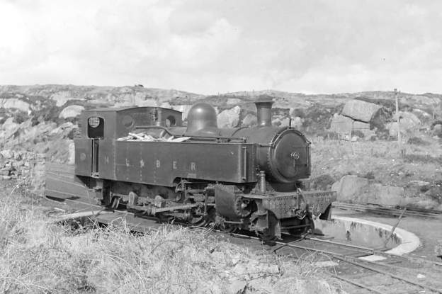
The featured image shows No. 14 on the turntable at Burtonport. The photograph was taken in April 1940 and was shared by Joe Begley on the Burtonport Heritage Facebook Group on 21st October 2020. [15]

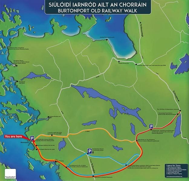
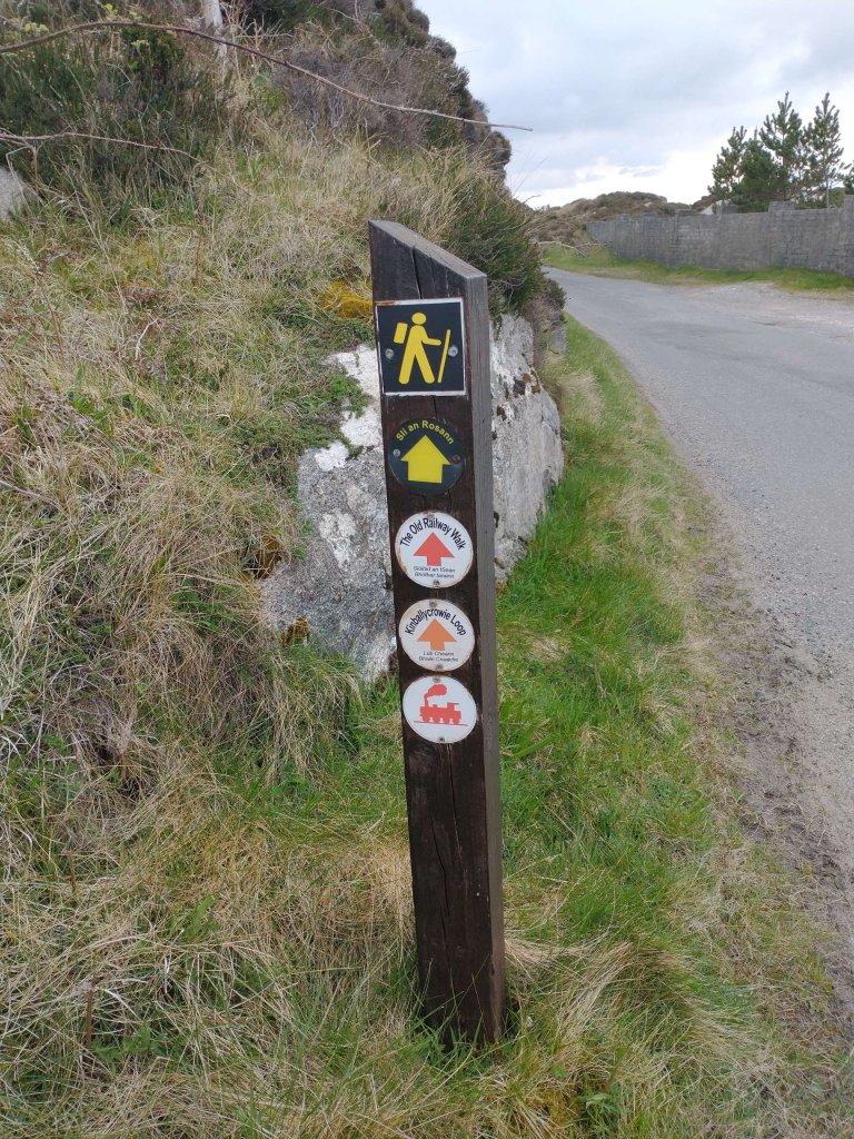
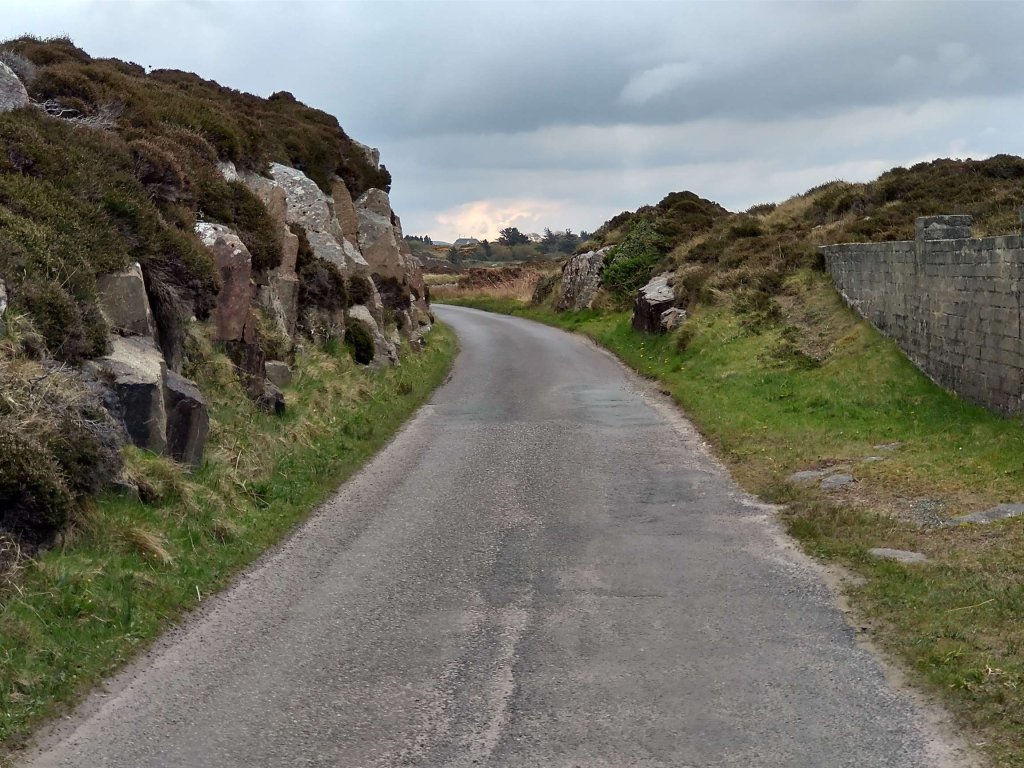
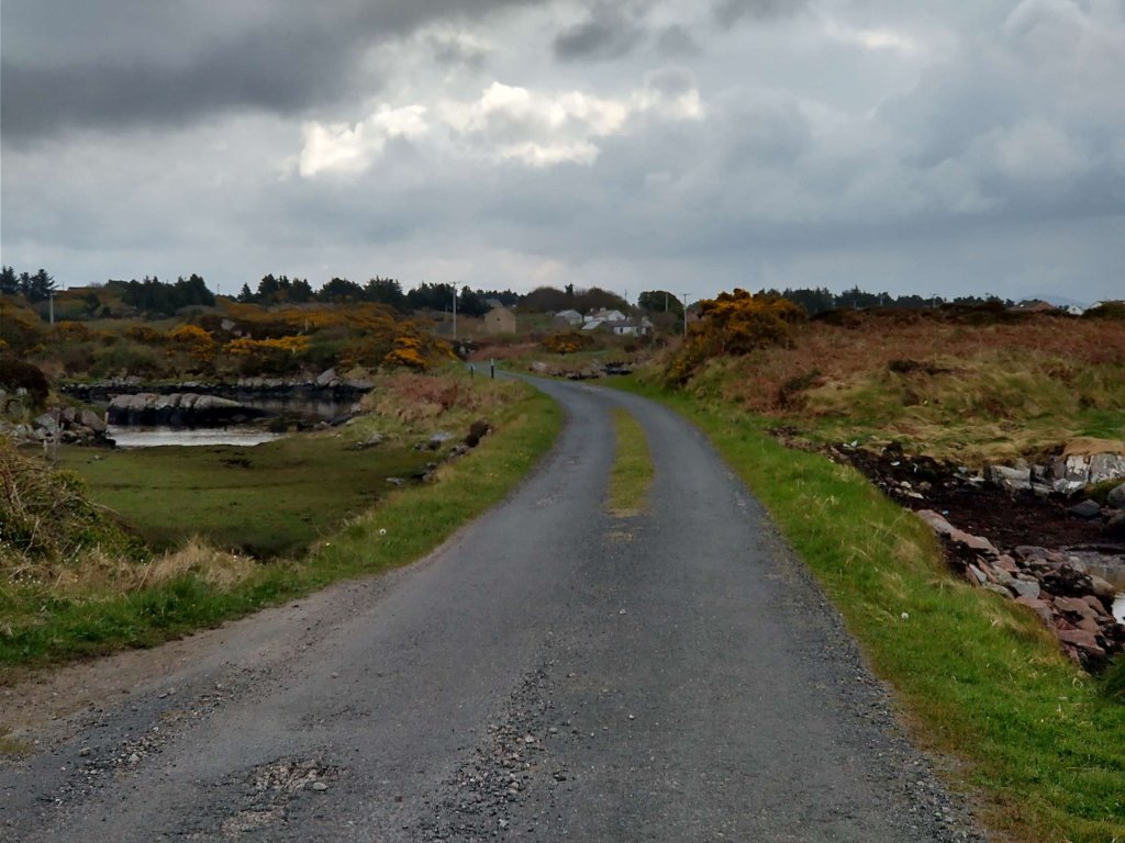
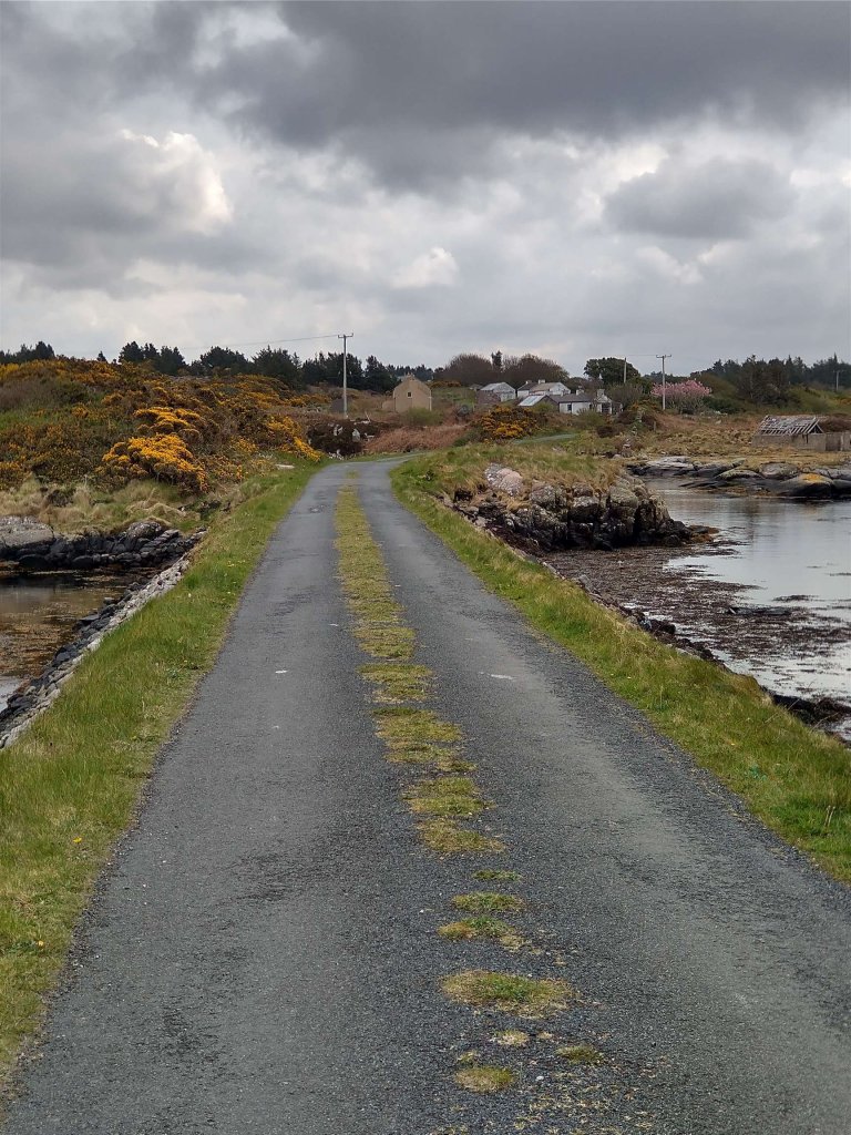
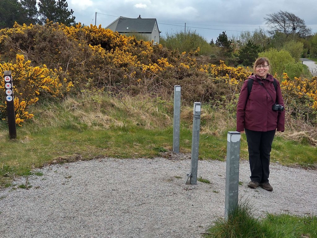
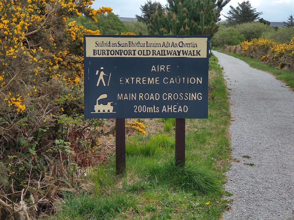
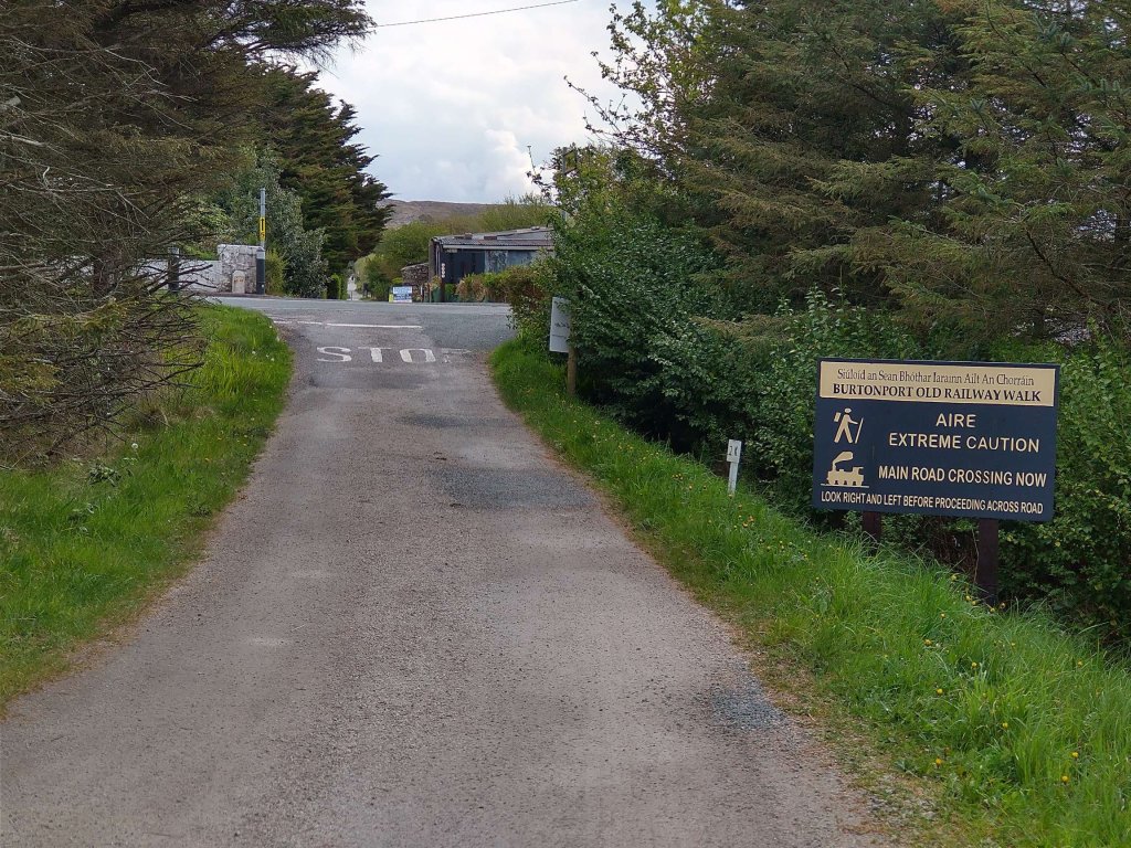
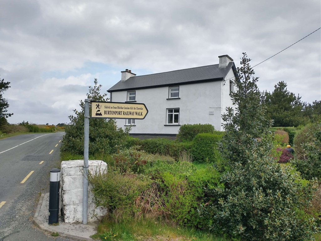
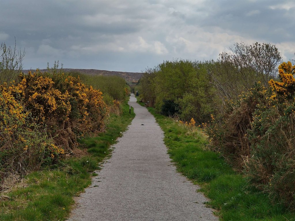
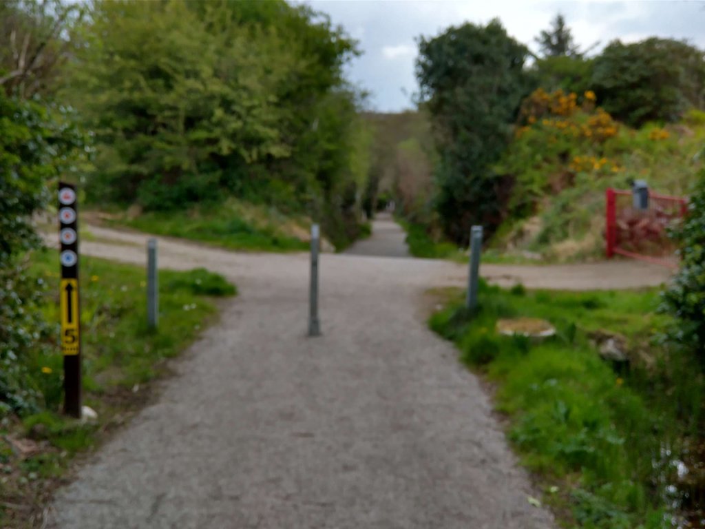
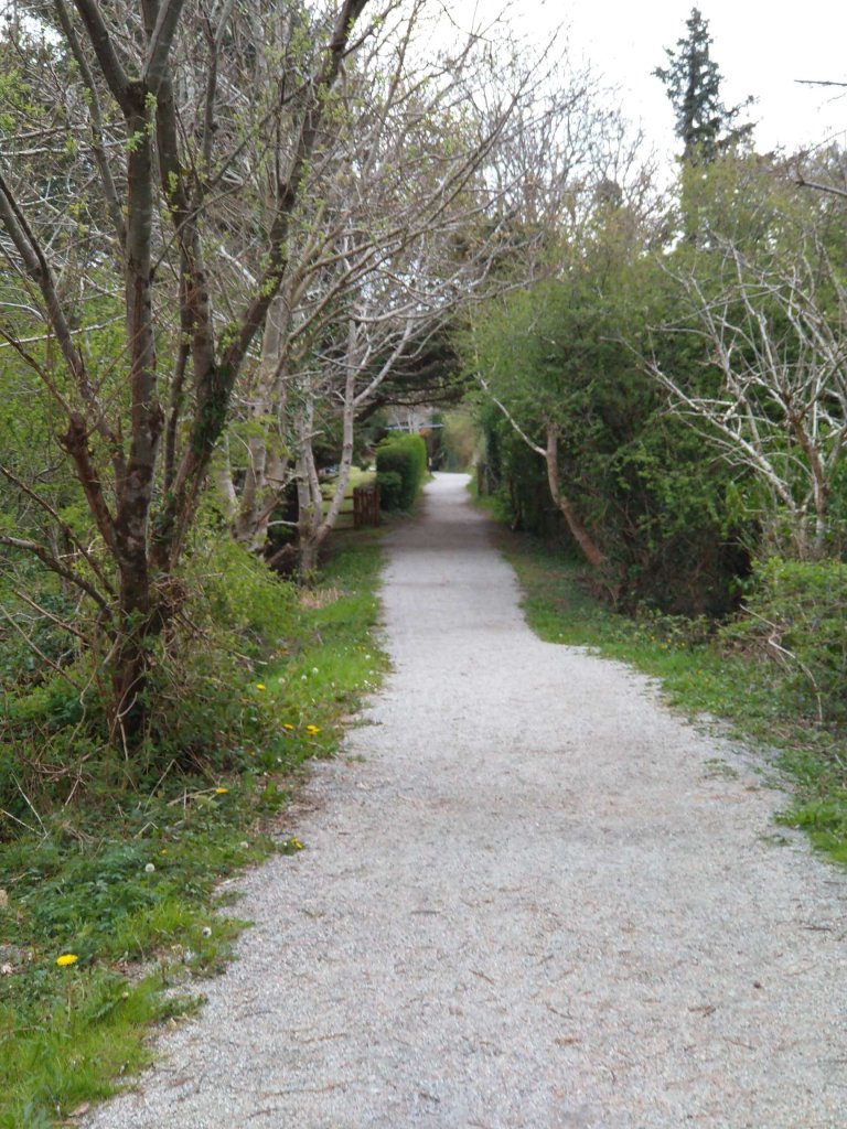
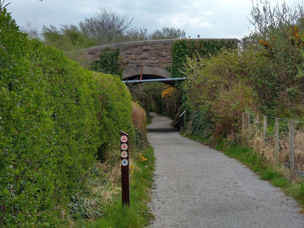
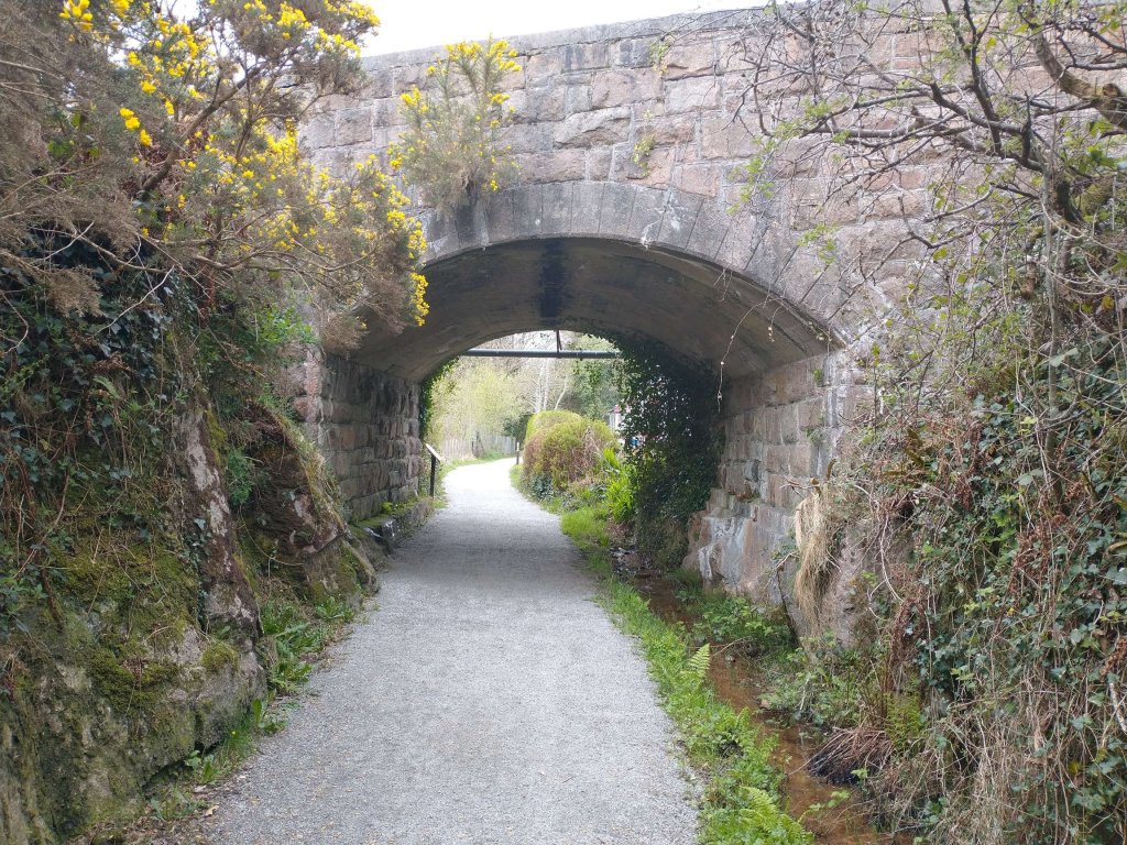
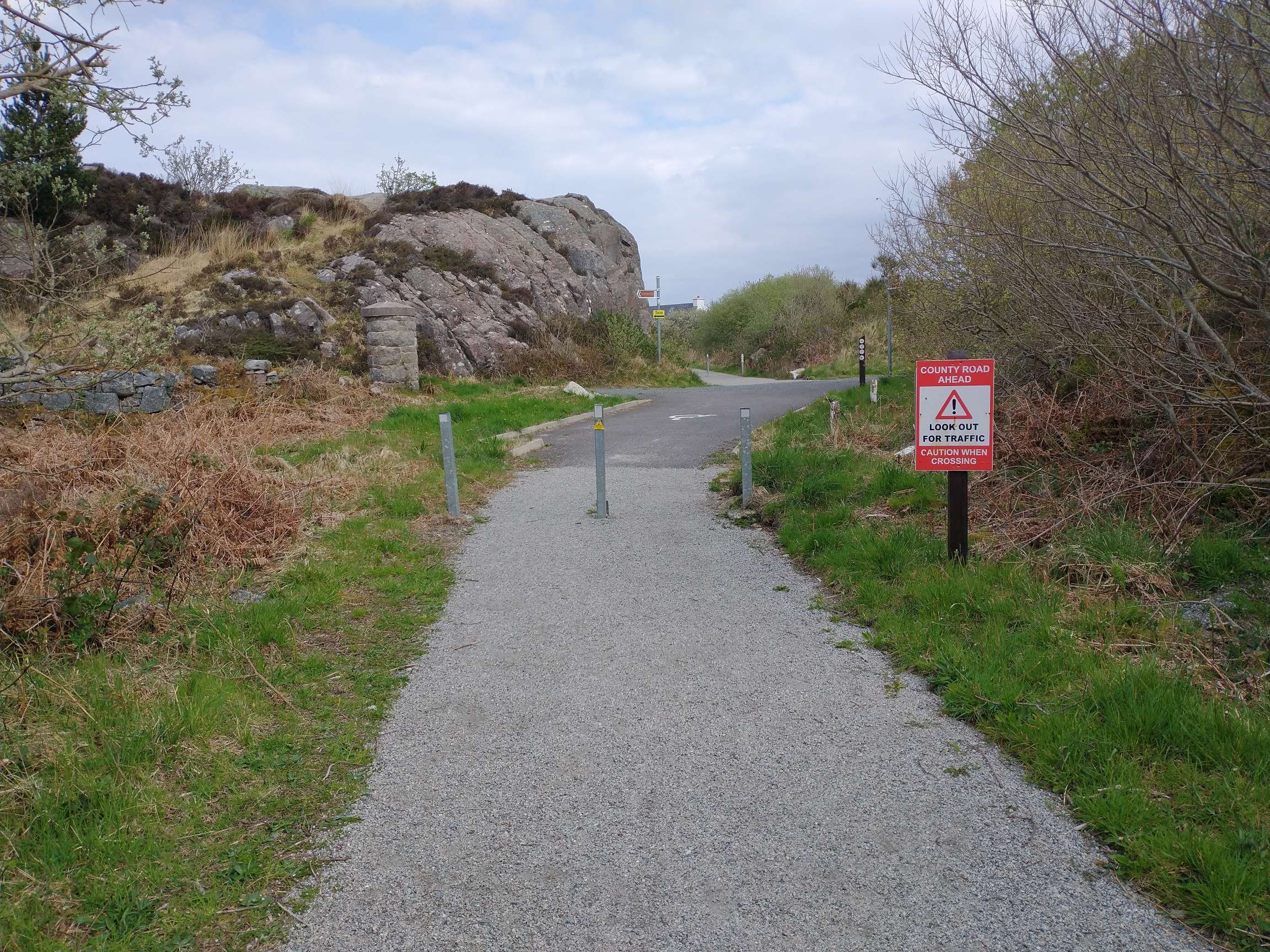
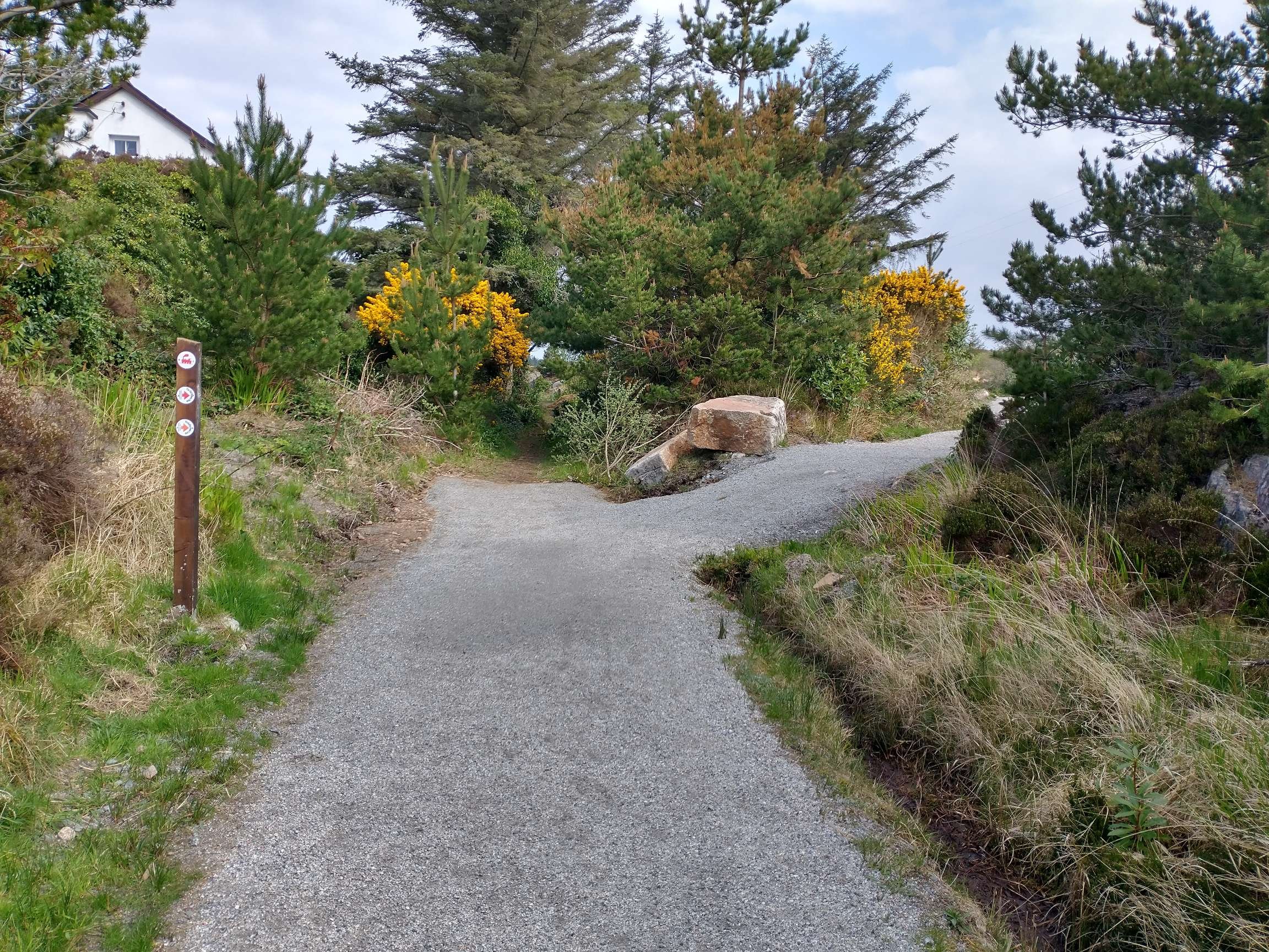
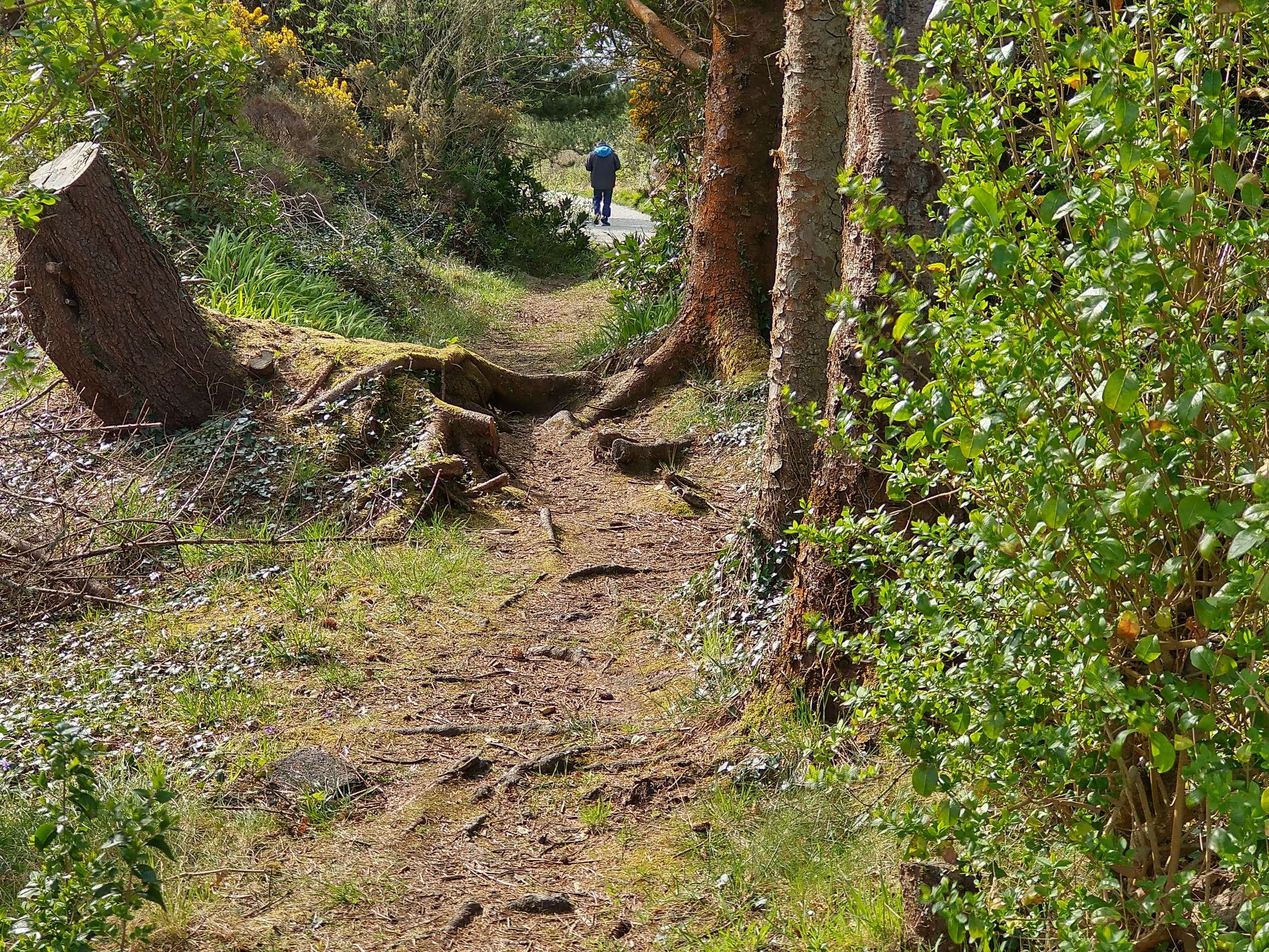
In April 2023 we stayed close to Burtonport, adjacent to Loch Meela, in Co. Donegal. On the first full day of our stay, we walked the Burtonport Old Railway Walk. [1] A 6km length of the Burtonport extension of the Londonderry & Lough Swilly Railway has been made into an accessible path. The weather was great and the walk very enjoyable. We were impressed by the investment in the walk made by the local community and Donegal County Council.

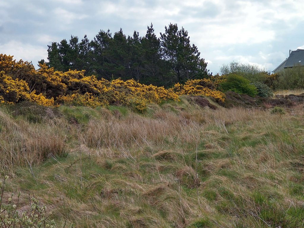
After the closure of the line it seems that it remained undisturbed for many years. Apparently, in 2009, however, “there was a heavy snowfall, and some of the old railway line was cleared to access water mains that needed repairing. The remaining section was later cleared and gradually developed as a walkway with the support of the local community. A massive effort has gone into creating this beautiful and peaceful walk.” [1]

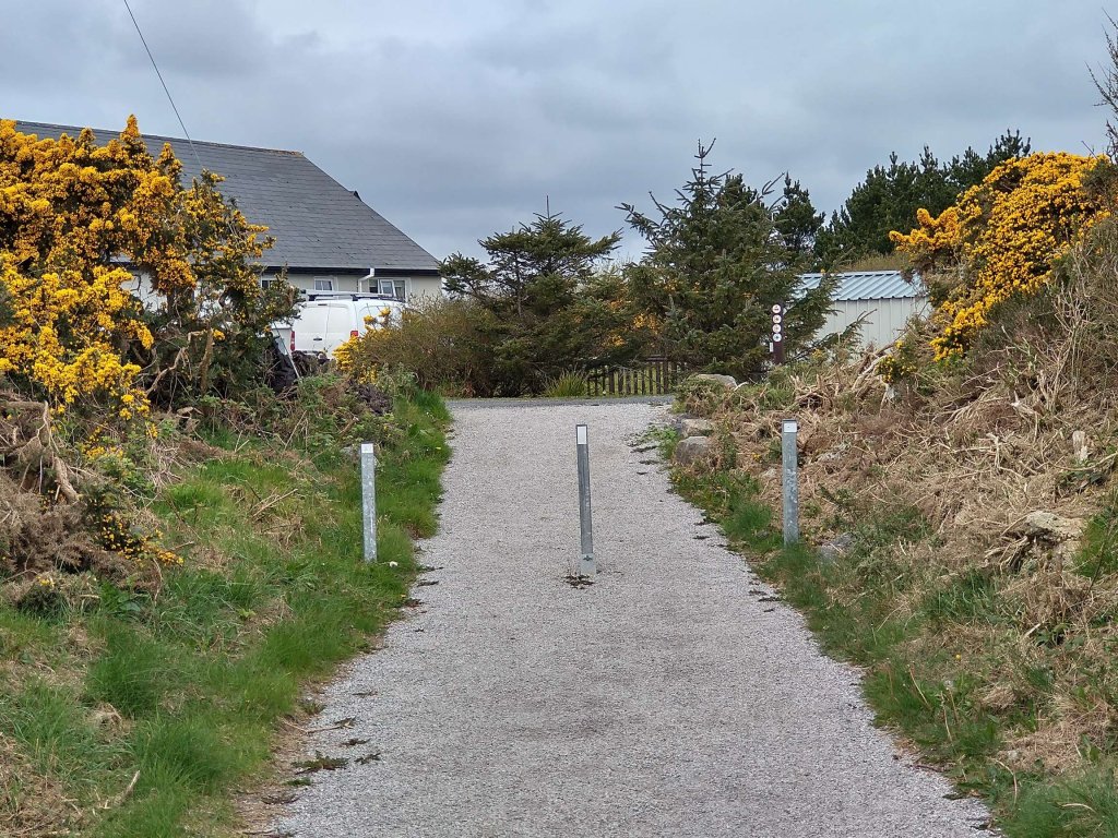
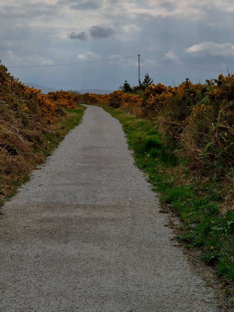
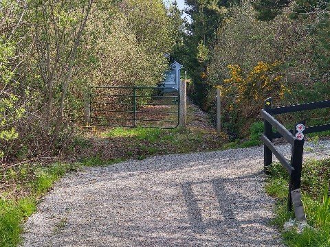
This first length of the old railway extends from Burtonport as far as Kincasslagh Road Station and, apart from a short length close to the latter, can be walked with relative ease.

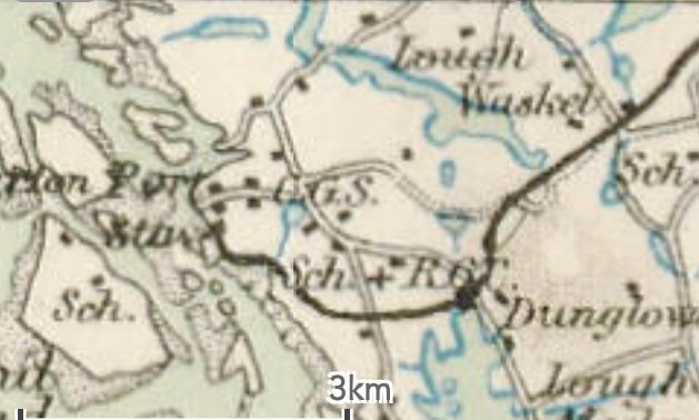
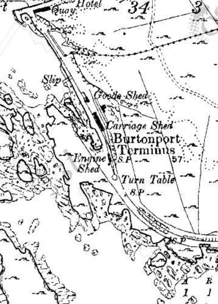
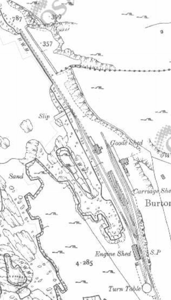
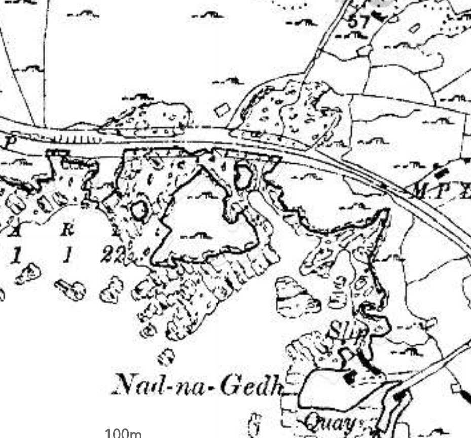
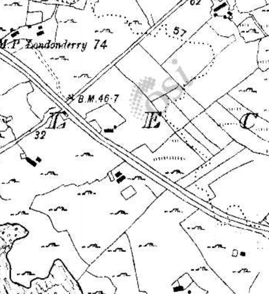
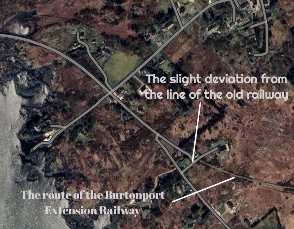
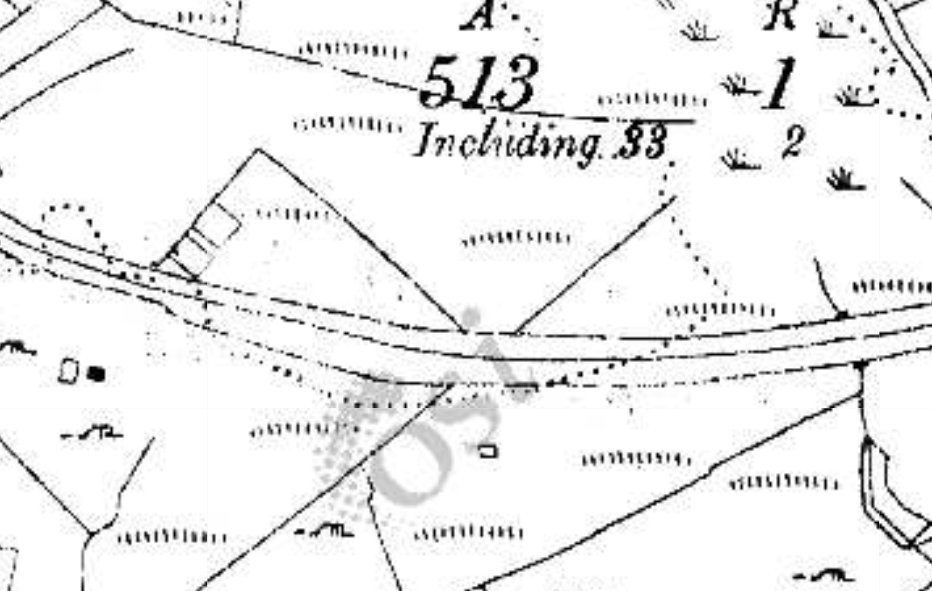
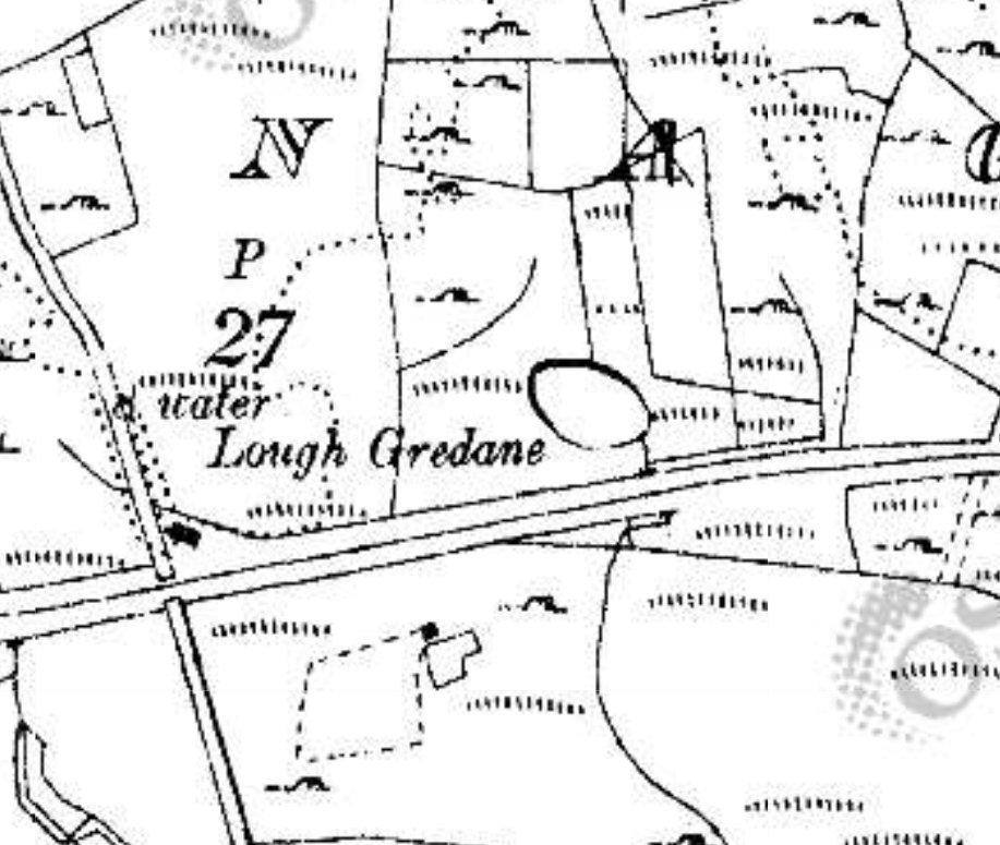
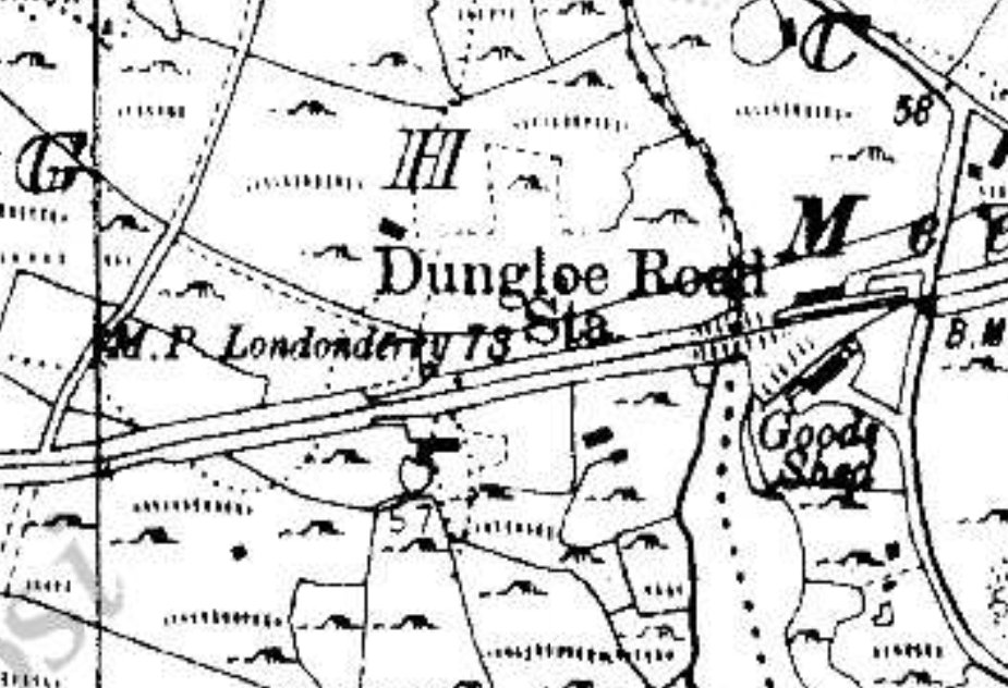
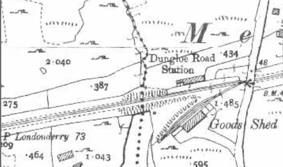
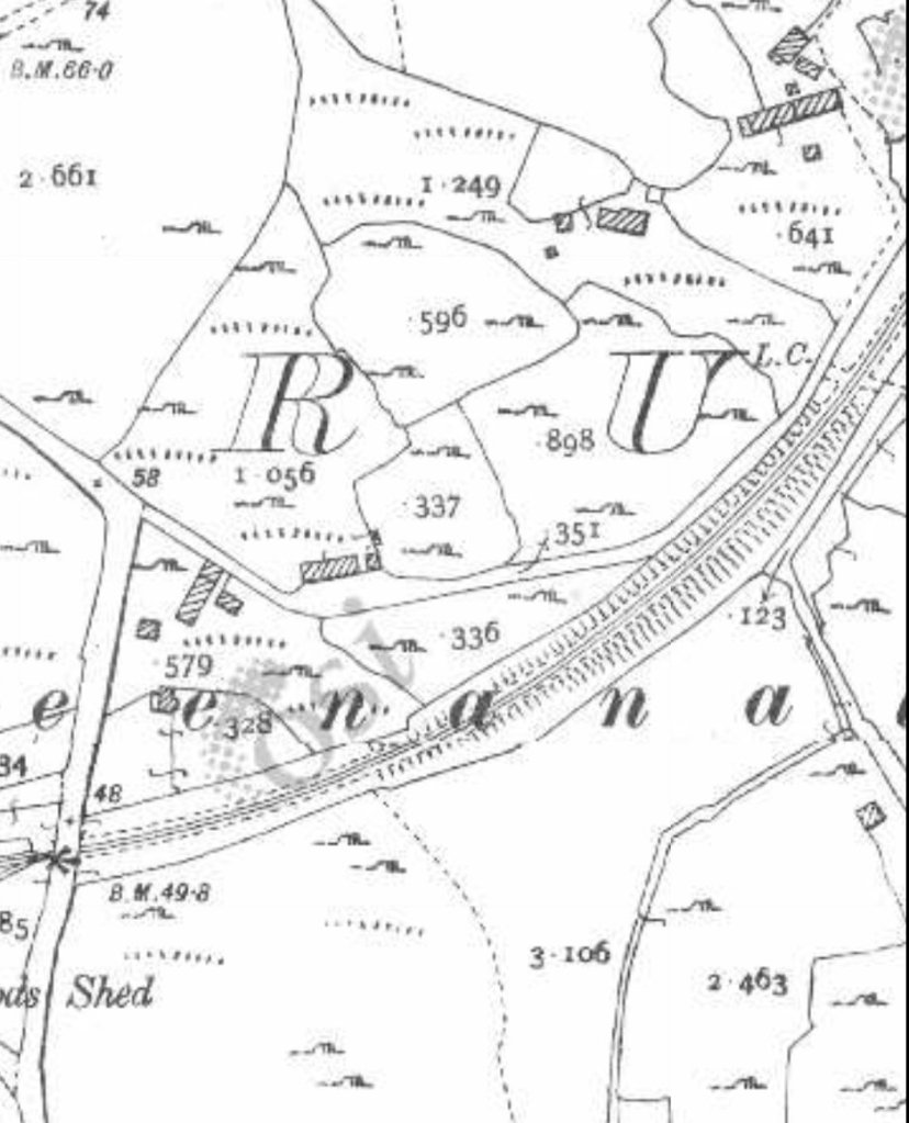
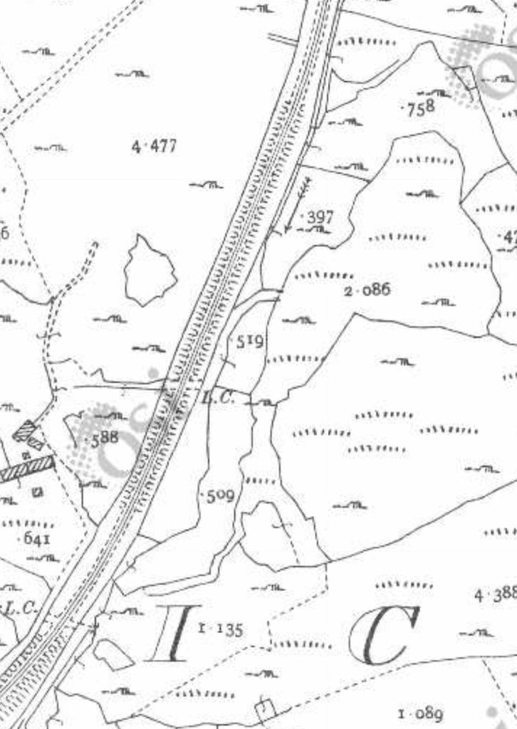
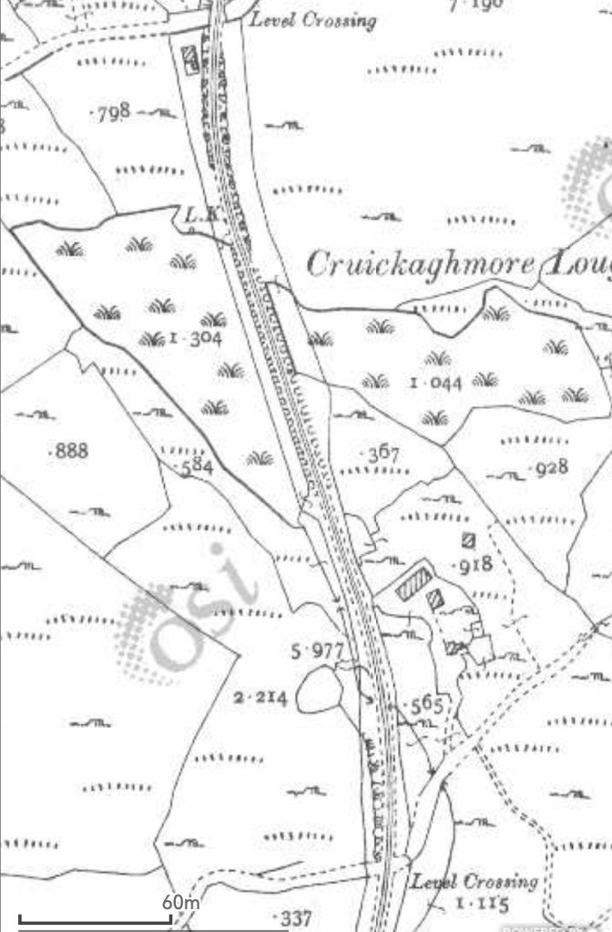
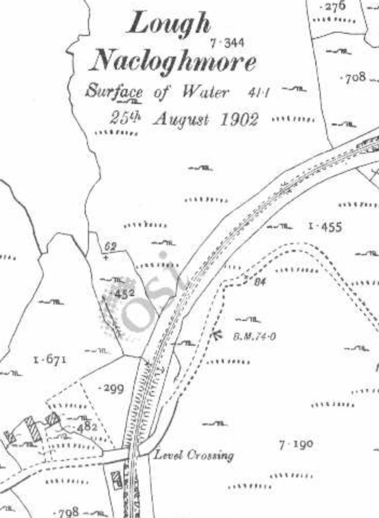
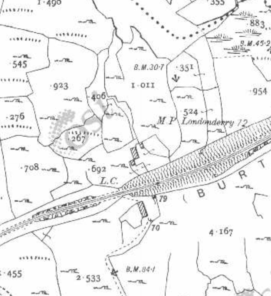
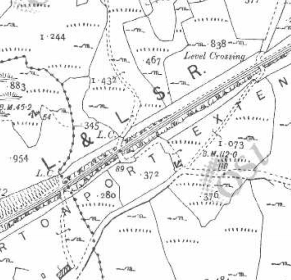
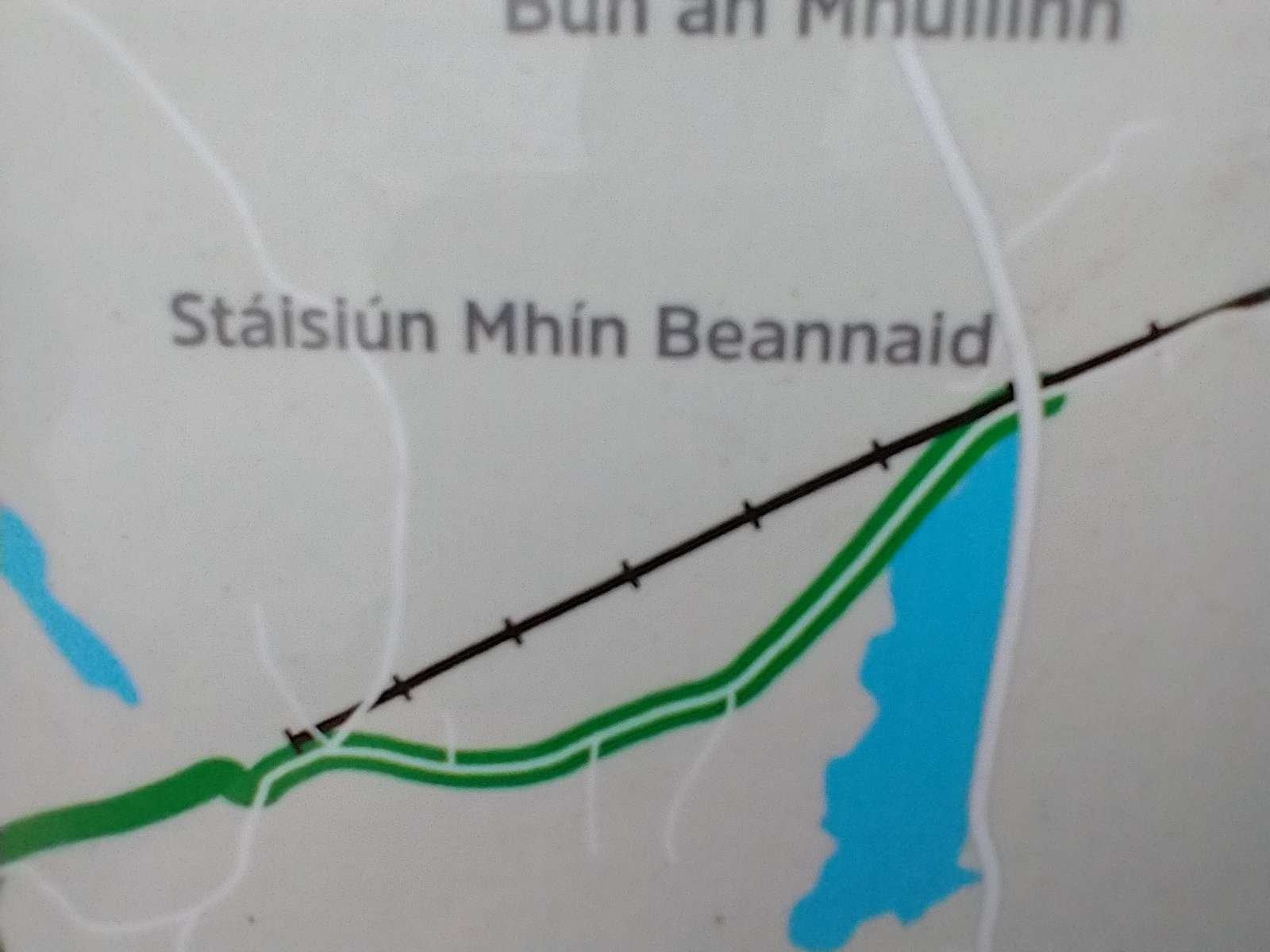
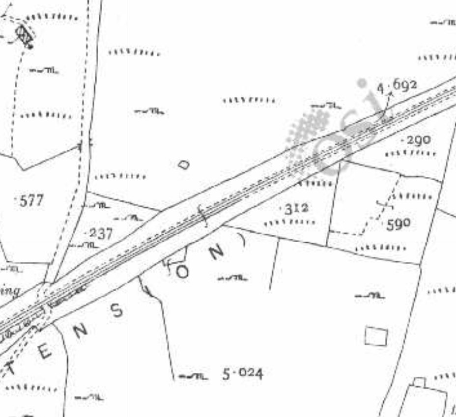
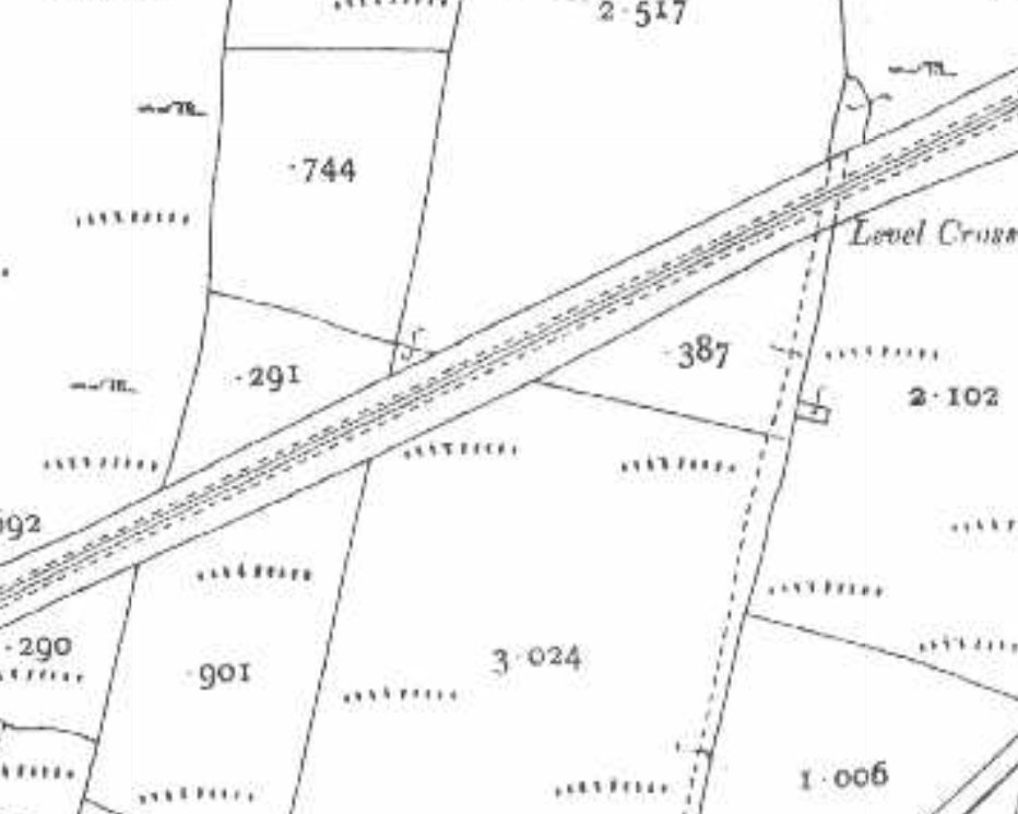
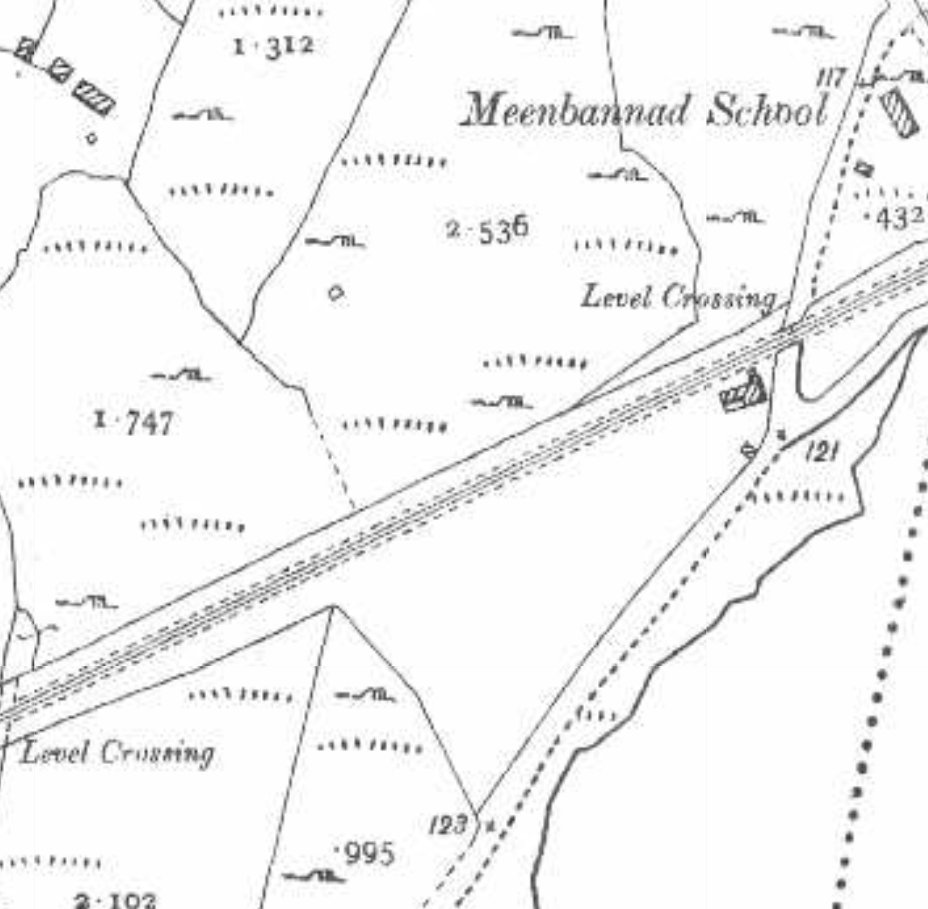
The route of the old railway between Burtonport and Kincasslagh Road Station as shown on historic mapping provided by the Ordnance Survey of Ireland dating from the early 1940s. The latter station was located to the East of Lough Waskel, to the top right of this map extract. [6]
The map displayed on the information board in Burtonport shows the length of the old railway covered in this first article. [My photograph, 23rd April 2023]

The whole of the Burtonport Extension features in a guide written in the late 1980s by Dave Bell & Steve Flanders. [2] In that guide, they provide a series of relatively low resolution monochrome photographs of the railway in operation and as they found it in the 1980s. This article is the first in a series looking again at the line and what can be found along its route.

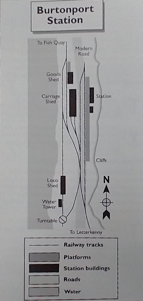
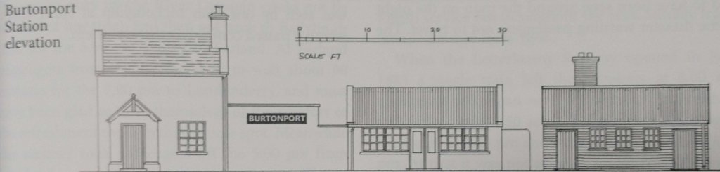
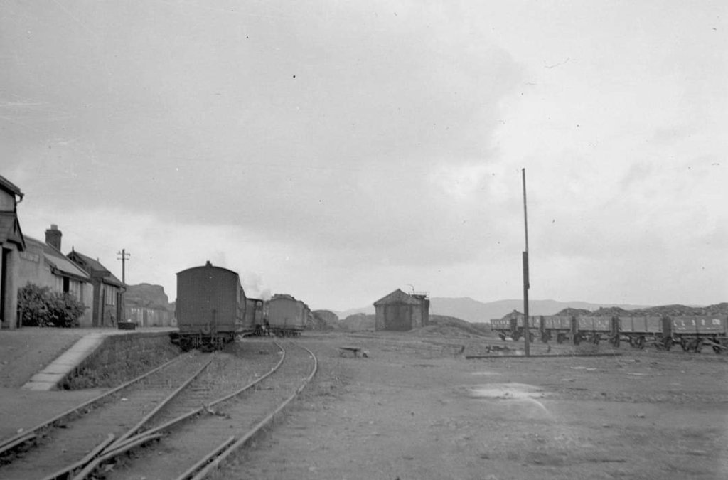
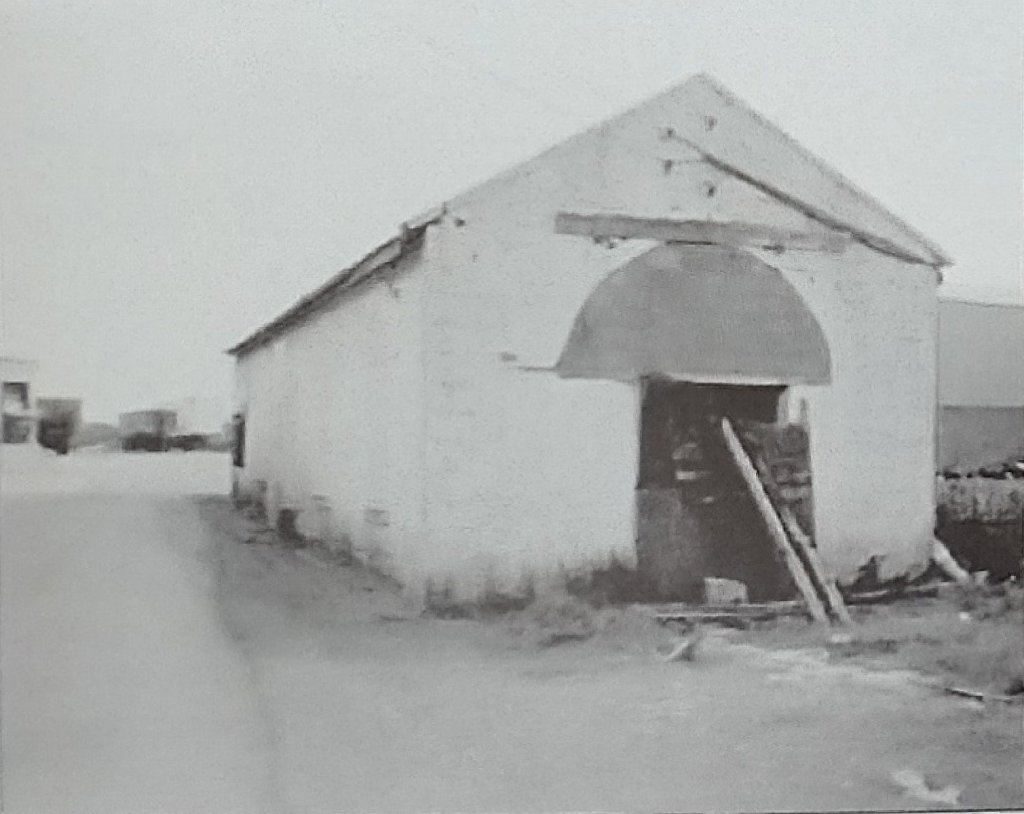
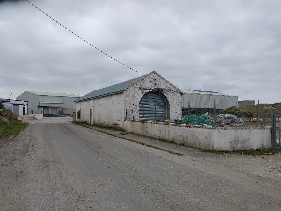
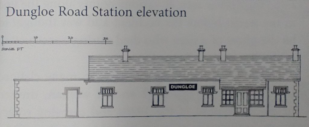
At Burtonport, Bell and Flanders provide a station plan and a number of photographs from before closure and at the time of their survey.

A schematic plan of Burtonport Railway Station. [2: p84]
Burtonport Railway Station Elevation, as shown by Begley, Flanders and Patterson. [10: p113]
The historic 6″ mapping provided by the Ordnance Survey of Ireland shows that the station was not aligned North-South but a little more to a North-northwest-South-southeast axis. Immediately beyond the Station throat the line curved away to the East. [6]
The historic 25″ mapping provided by the Ordnance Survey of Ireland shows the station layout more clearly. [6]
A first length of the Burtonport Old Railway Walk as it appears on Google Maps. [Google Maps, 27th April 2023]
Burtonport Railway Station viewed from the South in around 1960. At this date the station building, platform and goods shed all appear to be in reasonable condition. Two cars are parked on the former railway formation. This image is the last of a series of images in Jim McBride’s recent book, “The Lough Swilly Remembered,” © HMRS (Eric S. Russell, LNWR Society). [9: p64]
Burtonport Railway Station in July 1971 viewed from the South, © Peter Leigh and scanned by Roger Geach it was originally forwarded to Jim McBride (on behalf of the Donegal Railway Heritage Centre). The image was shared on the Londonderry & Lough Swilly Railway L&LSR Facebook Group by Colm McDaid on 25th October 2021. In 1971 much of the infrastructure, except the trackwork remained in reasonable condition. The turntable well is in the left foreground, the water tower and engine shed feature centre-stage and the station building and platform can be made out on the right side of the image. [3]

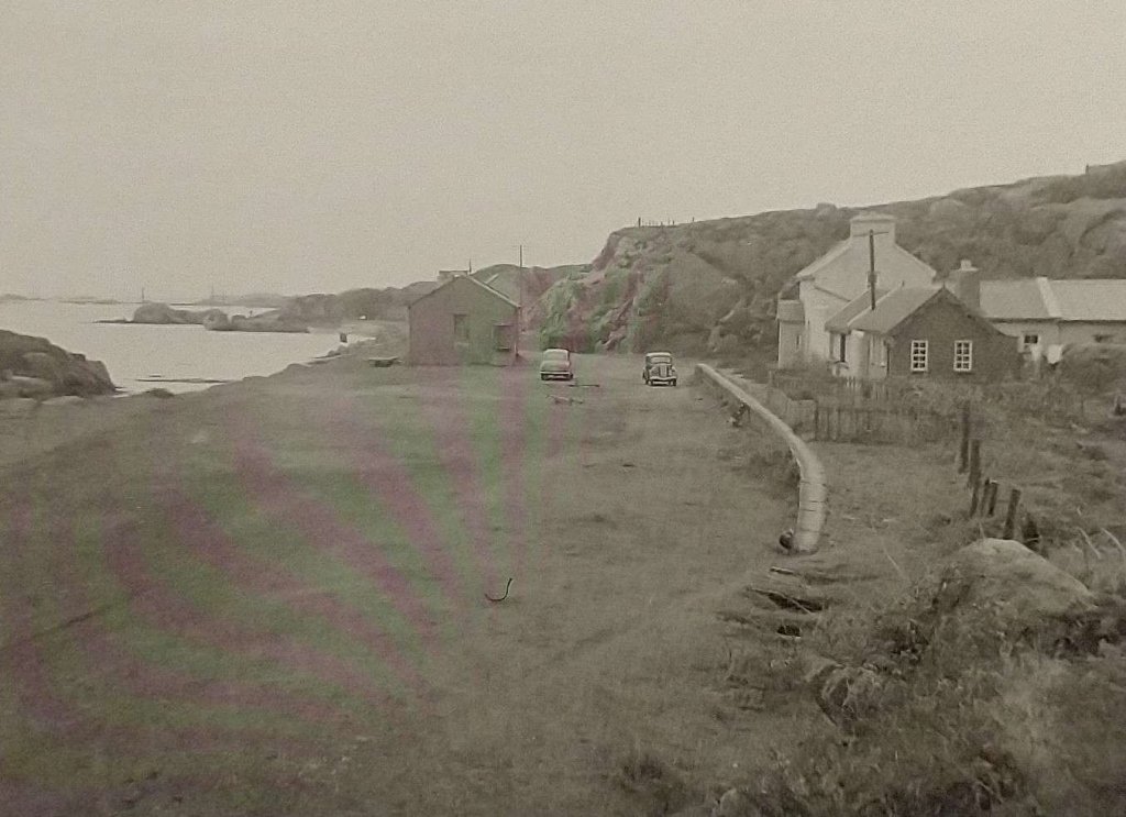
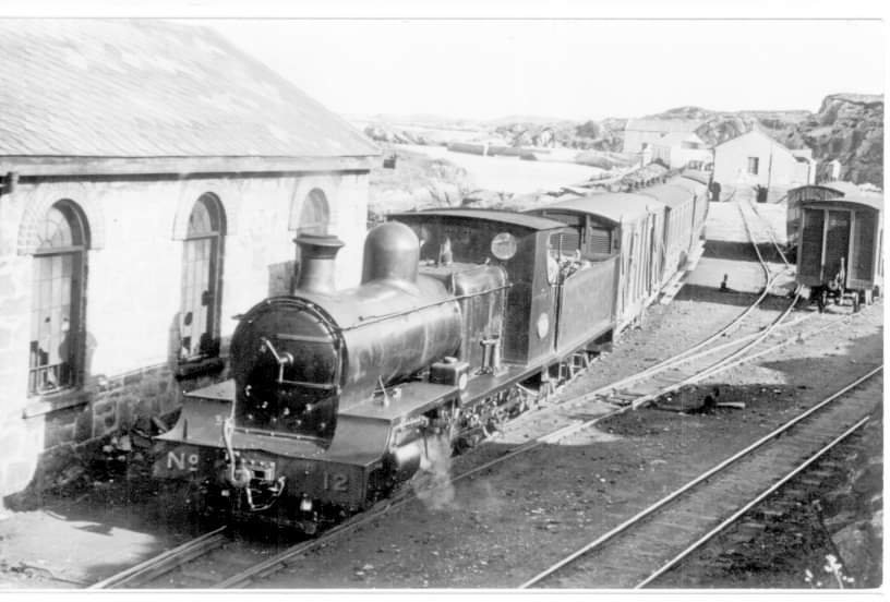
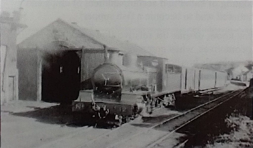
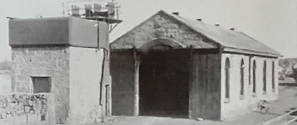
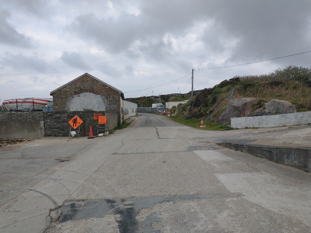
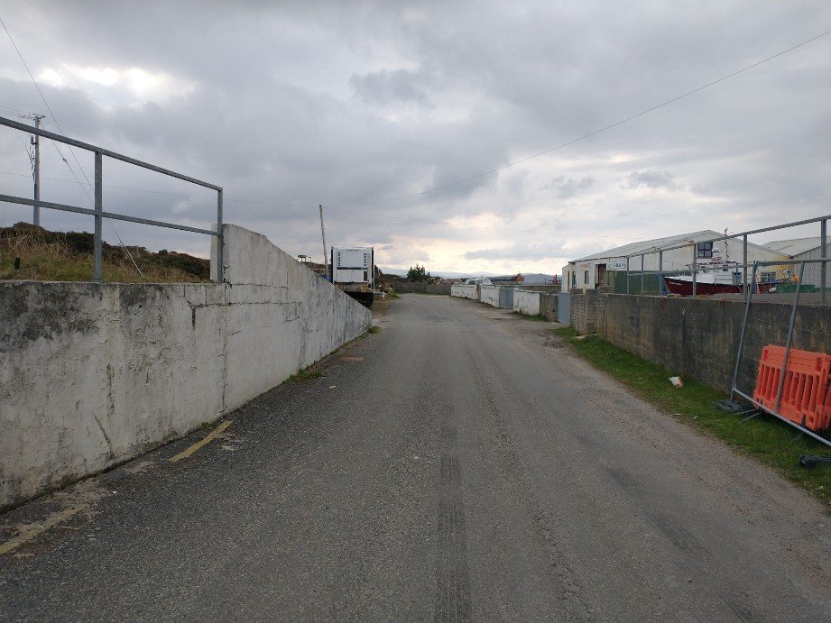
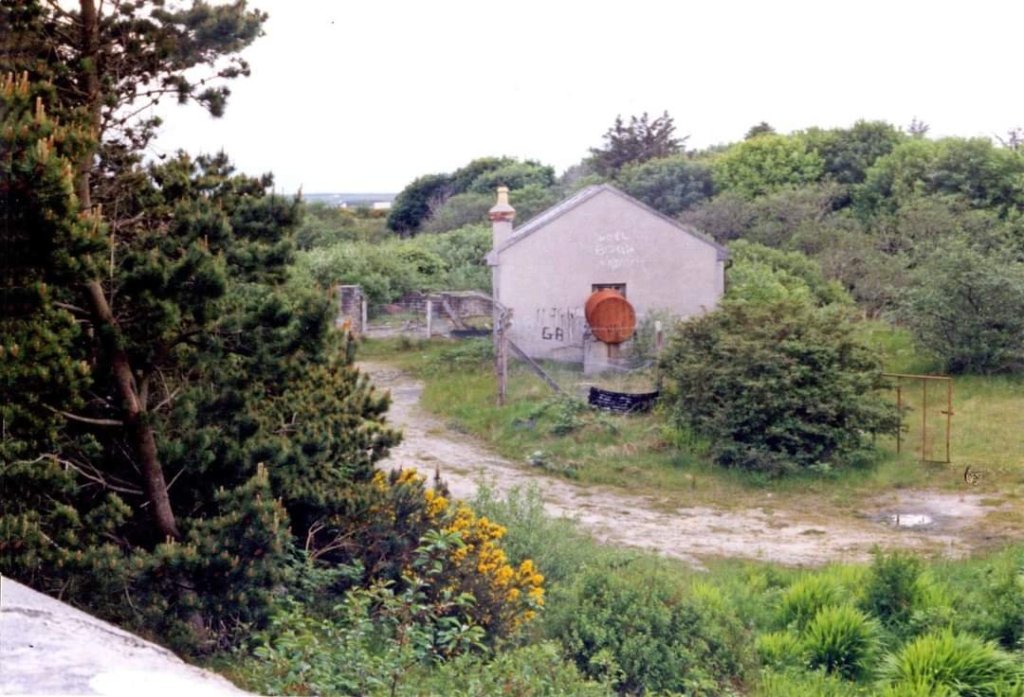
Bell and Flanders describe arriving at the station from the South in the 1980s by car, the old trackbed now being a narrow road: “You drive through a small cutting before entering the railway’s terminus at Burtonport. … Just before the station itself you drive through a fish processing plant then, suddenly, on the left, you can see the engine shed, recognisable by its characteristic round-top windows and door.” [2: p83]

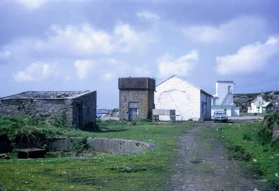
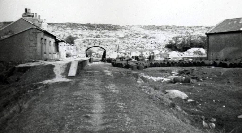
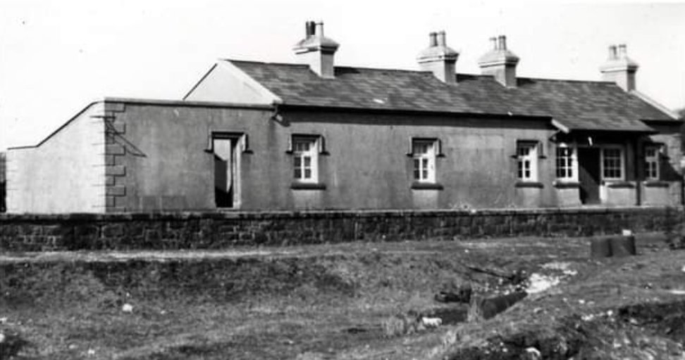
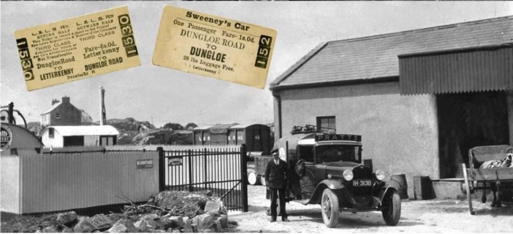
They go on to describe the station as they found it on their visit: “In the middle distance is the terminus station itself with a length of platform still in existence on the right-hand side of the road. The station house and offices still stand but are now derelict. They and the [engine] shed are now the only railway structures left at Burtonport. … Originally a siding ran along the quayside so that fish vans could be loaded directly from the fishing boats. Burtonport is still an important centre for Ireland’s fishing industry but today refrigerated articulated lorries haul the catches to their markets. It’s also from here that the ferry service runs to Aran Island, known as Arainn Mhór, Big Aran.” [2: p84]

A view of Burtonport Railway Station from the North while still in use, although some tracks appear to have been removed, © H.C.A. Beaumont and shared on the Londonderry & Lough Swilly Railway L&LSR Facebook Group by Jonathan Beaumont on 17th November 2021. [4]
The old railway station platform edge is still visible beneath the palisade fencing in April 2023. [My photograph, 23rd April 2023]
Locomotive No. 12 at Burtonport in 1937, readying its train for departure, © H.C. Casserley, shared on by the Donegal Railway Heritage Centre on their Facebook page on 9th June 2020. [5]
A low resolution copy of a print showing Loco No. 12 leaving Burtonport with the 8.30am to Derry sometime in 1937, heading South past the engine shed, © H.C. Casserley reproduced by Bell and Flanders. [2: p83]
A similar low resolution view of the water tower and engine shed. [2: p84]
A 1980s view of the engine shed with what look like palleted loads stored close to its end wall, © Dave Bell & Steve Flanders. [2: p83]
The engine shed viewed from the South in April 2023. The remnants of the station platform can be seen in the distance to the right of the engine shed. [My photograph, 23rd April 2023]
A view of the North end of the engine shed in the 1980s in a South-facing view, © Dave Bell & Steve Flanders. [2: p84]
The engine shed viewed from the North in April 2023. [My photograph, 23rd April 2023]

A number of other photographs of Burtonport Railway Station site can be found on Flickr by following these links:

The road South of the engine shed follows the formation of the old railway line. [My photograph, 23rd April 2023]
The route of the old railway is now very well signed for walkers. [My photograph, 23rd April 2023]
The historic 6″ mapping provided by the Ordnance Survey of Ireland shows the line curving first to the East and then towards the Southeast. [6]
As it ran South and East sway from Burtonport Railway Station, the line stayed close to the rocky shore, alternating between rock cuttings and embankments. [My photograph, 23rd April 2023]
At some locations embankments have become causeways with water on each side. [My photograph, 23rd April 2023]
The old railway formation now covered in tarmac and running across another short causeway. [My photograph, 23rd April 2023]
The historic 6″ mapping provided by the Ordnance Survey of Ireland shows the line continuing in a Southeasterly direction, before beginning to curve to the East. Southeast of Mile Point 74 on the line we encounter the first gatekeeper’s cottage which can be made out on the South side of the crossing adjacent to the benchmark. [6]
A second length of the route as it appears on Google Maps. [Google Maps, 27th April 2023]
Crossing keeper’s cottage No. 24 is the first encountered after leaving Burtonport Railway Station. The original was damaged by fire but it was refurbished after the fire largely to match the original. [10: p172][My photograph, 23rd April 2023]
A short distance beyond Crossing No. 24 the modern footpath has to leave the old railway formation which, for a short distance is in private hands. The route of the old line runs through the flowering gorse ahead and to the left of the modern house beyond. [My photograph, 23rd April 2023]
The view of the old line from the footpath diversion. It runs on shallow embankment which is now overgrown with gorse. [My photograph, 23rd April 2023]
The old formation is quickly regained after the short diversion. This photograph looks back toward Burtonport across the land in private ownership. [My photograph, 23rd April 2023]
Looking ahead along the footpath which follows the old railway. [My photograph, 23rd April 2023]
The historic 6″ mapping provided by the Ordnance Survey of Ireland shows the line curving through East and then East-northeast. [6]
Crossing points where access across the old railway could be expected were marked either by stone pillars or, as here, by large timber baulks. [My photograph, 23rd April 2023]
The historic 6″ mapping provided by the Ordnance Survey of Ireland again shows the line heading East-northeast and then East. To the left of the map extract is what is now the main road (R259) between Burtonport and Dungloe which crossed the line at level. [6]
A third length of the walk as it appears on Google Maps. The crossing at the R259 is at the centre of the satellite image. [Google Maps, 27th April 2023]
The first warning sign of the approach to the main road. [My photograph, 23rd April 2023]
The approach to the R259. [My photograph, 23rd April 2023]
Gatehouse No. 23 as it appears in the 21st century. When the railway was in operation this was not the main route between Dungloe and Burtonport. As we will see, the more important road at the beginning of the 20th century warranted the construction of a bridge over the railway adjacent to Dungloe Road Railway Station. [My photograph, 23rd April 2023]
The route of the old line heading away from the R259. [My photograph, 23rd April 2023]
A minor track crosses the route of the old railway. This track appears on the early 6″ OSi map extract and on the satellite imagery below on the approach to Dungloe Road Station.
The historic 6″ mapping provided by the Ordnance Survey of Ireland again shows the line heading East-northeast and shows Dungloe Road Station at its Eastern edge. Detail at the station site is rather lacking. [6]
The historic 25″ mapping provided by the Ordnance Survey of Ireland again shows Dungloe Road Station and the bridge immediately to its East. There was no run-around facility for passenger trains but a reasonable provision was made for goods. The Goods Shed has its own siding with a short loop to aid shunting. [6]
The satellite imagery shows the route of the old railway line but at this scale it can at times be difficult to make out. The roads are highlighted on Google Maps and so are easier to make out than the route of the old railway. The route of the railway appears as a narrow beige line entering the Western edge of the image which increasingly is surrounded by trees as it travels East. The station is immediately to the left of the road shown towards the right side of the image. [Google Maps, 27th April 2023]
Dungloe Road Railway Station Elevation, as shown by Begley, Flanders and Patterson. [10: p113]
Approaching Dungloe Road Railway Station site along the old track bed in April 2023. [My photograph, 23rd April 2023]
Dungloe Road Station as it appeared immediately after the lifting of the railway tracks in the early 1940s. Beyond the station building is the road overbridge and to the right of the image the goods shed can be seen. This image was shared by on the Burtonport Old Railway Walk Facebook page on 26th November 2011. [7]
An April 2023 view along the formation of the old railway at approximately the same location as shown in the monochrome image immediately above. The hedge follows the line of the platform edge. The station building is substantially the same as when it was in use as a public facility. [My photograph, 23rd April 2023]
Dungloe Road Station building viewed from the South in the early 1940s after the track had been lifted. This image was shared by Patrick Boner on the Burtonport Heritage Facebook Group on 30th March 2015. [8]
An earlier view of the Dungloe Road Goods Shed, taken from the South. This image was shared by Patrick Boner on the Burtonport Heritage Facebook Group on 30th March 2015. [8]
Dungloe Road Railway Station: the view towards Burtonport in the last years of the 20th century. The Goods Shed is on the left, the passenger station building on the right. [2: p82]
Dungloe Road Railway Station Goods Shed as it appeared in June 1995, © Andy Cundick. The goods shed, looking rather dilapidated in this and the next image, is now a fine private dwelling as can be seen below. This image was shared on the Burtonport Heritage Facebook Group by Joe Begley on 4th July 2014. [11]
Dungloe Road Railway Station Goods Shed as it appeared in June 1995, © Andy Cundick. The goods shed, looking rather dilapidated in this and the previous image, is now a fine private dwelling as can be seen below. This image was shared on the Burtonport Heritage Facebook Group by Joe Begley on 4th July 2014. [11]
The same view in the 2020s as taken by the Google roving camera. The Goods Shed is much changed. [Google Streetview, April 2023]
Dungloe Road Railway Station: the view of what was the passenger station building from the road to the North of the overbridge in the last years of the 20th century. The subsequent growth of vegetation makes the image impossible to replicate in 2023 without significant trespass onto private land. [2: p82]
The road overbridge seen from the West in the late 20th century. [2: p83]
The road bridge again seen from the West on the footpath on the old railway formation in 2023. [My photograph, 23rd April 2023]
Dungloe Road Railway Station site viewed from the South. The camera is on the road which crosses the old railway route on the overbridge noted above. The bridge parapets can be seen the right of the image. On the left of the image is the old goods shed which has been transformed into a modern home. To the right of the old goods shed, the passenger facilities can be made out among the trees. [Google Streetview, April 2023]
The same bridge viewed from the Southeast in theater years of the 20th century. [2: p83]
The view of the bridge from the East in April 2023, looking along the old trackbed. The Railway Station is just beyond the bridge. [My photograph, 23rd April 2023]
The historic 25″ mapping provided by the Ordnance Survey of Ireland again shows the line heading East-northeast and then turning towards the North. One crossing point is marked L.C. towards the right edge of the map extract. [6]
The historic 25″ mapping provided by the OSi again shows the line heading North-northeast. The crossing point noted on the last map extract appears again to the left of this image. A further crossing point is marked L.C. towards the centre of the extract. [6]
The historic 25″ mapping provided by the Ordnance Survey of Ireland again shows the line heading North. A more significant crossing point is marked ‘Level Crossing close to the bottom of this extract. [6]
This satellite image covers the same length as the three OSi map extracts above. At the very top of this image, crossing keeper’s cottage No. 22 can be made out alongside a very short diversion of the footpath from the line if the old railway. [Google Maps, 28th April 2023]
The approach from the South to the Level Crossing shown at the bottom of the map extract above. [My photograph, 23rd April 2023]
This photograph is taken looking North towards the top of the OSi map extract above. The crossing keeper’s cottage peeps out above the vegetation in the top left of the image. Trees have encroached onto the line of the old railway and the modern footpath has been diverted over a very short distance. [My photograph, 23rd April 2023]
Looking South along the line of the old railway from close to the crossing keeper’s cottage. The diverted path is off to the right of the photo. [My photograph, 23rd April 2023]
Crossing keeper’s cottage No. 22. [My photograph, 23rd April 2023]
The old railway is shown curving round to the East as it travels on from crossing keeper’s cottage No.22. Lough Nacloghmore is Northwest of the line. This is another extract from the 25″ OSi mapping. The level on the Lough was taken on 25th August 1902. [6]
This satellite image covers the length of the old railway from Crossing Keeper’s Cottage No. 22 Northeast to the point where the modern footpath leaves the route of the old railway, just to the West of the crossroads shown in the top-right of the image. This includes the area cover by the map extract above and the next two map extracts below. [Google Maps, 28th April 2023]
Looking Northeast along the line of the old railway from a point adjacent to crossing keeper’s cottage No. 22. [My photograph, 23rd April 2023]
The stone pillars shown in this photo are typical of those used along the line to mark crossing points. [My photograph, 23rd April 2023]
Continuing Northeast this next extract from the 25″ OSi mapping shows another accommodation crossing (marked L.C.) and shows the line on high embankment from that point East. [6]
Further to the Northeast, this extract from the historic 25″OSi mapping shows the line running straight through three further crossing points.At the first of these the modern footpath leaves the line of the old railway and follows the road to its South side. [6]
The old railway continues Northeast but across private land the footpath route follows the road which runs bottom-left to middle-right of this satellite image. [Google Maps, 28th April 2023]
The topography changes again and the line runs on embankment over the length beyond the Level Crossing shown on this next map extract. From a point just inside the left edge of this extract, the route of the old line enters what, in the 21st century, is private land the footpath is diverted away from the line and follows the road running East in the bottom part of the map extract. [6]
Looking Northeast, this is the point at which the footpath leaves the line of the old railway. A modern home is built across the line ahead. [My photograph, 23rd April 2023]
The footpath diversion from the display board adjacent to Crossing Keeper’s Cottage No. 21. [My photograph, 23rd April 2023]
Looking ahead, Northeast, along the old railway, it’s route passes between the four stone bollards, which mark the crossing point shown on the map extract below, and then follows the line of gorse bushes toward the right edge of the photo. [My photograph, 23rd April 2023]
Further to the Northeast, this extract from the historic 25″OSi mapping shows the line running straight through the landscape at the same level as the surrounding land. This length of the railway is in private hands in the 21st century. [6]
A further crossing point is shown on this next map extract, this length is also in private hands. [6]
A further level crossing is marked at the top-right of this next extract adjacent to Meenbannad School. At the time that this part of the 6″ and 25″ OSi mapping was surveyed there was only a crossing cottage (No. 21) at this location. It was ultimately chosen as the location of an additional railway station/halt which was built in 1913. [6][10: p113]

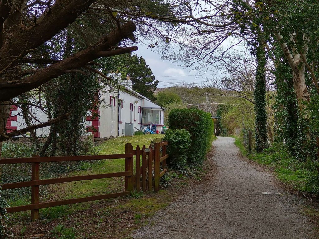
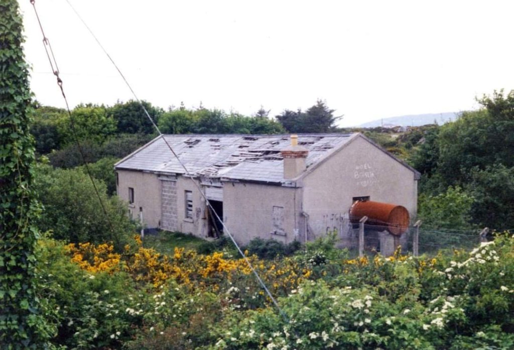
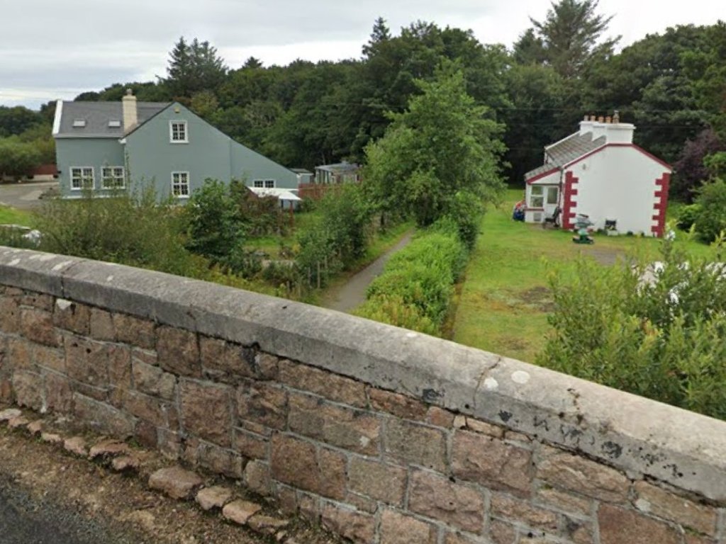
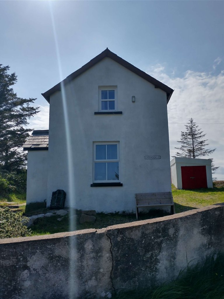
Kincasslagh Railway Station and Crossing Keeper’s Cottage No. 21 are now in private hands. This article finishes with some older pictures of the site and some taken in 2023.

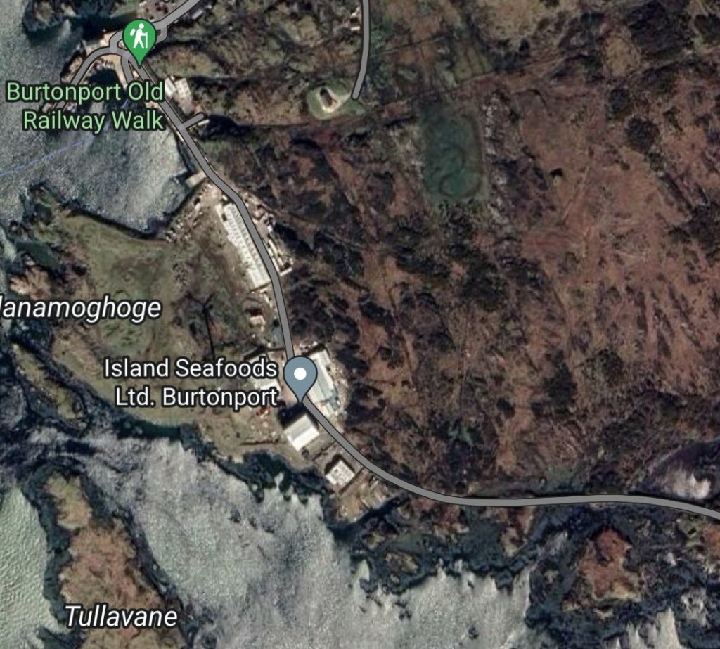
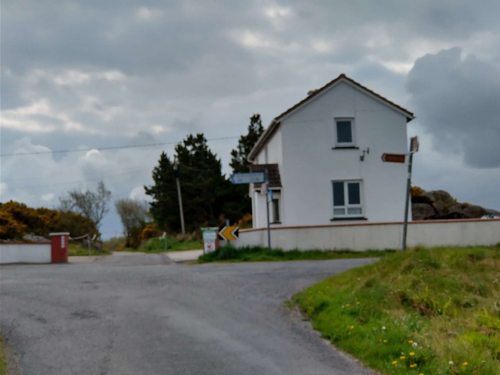
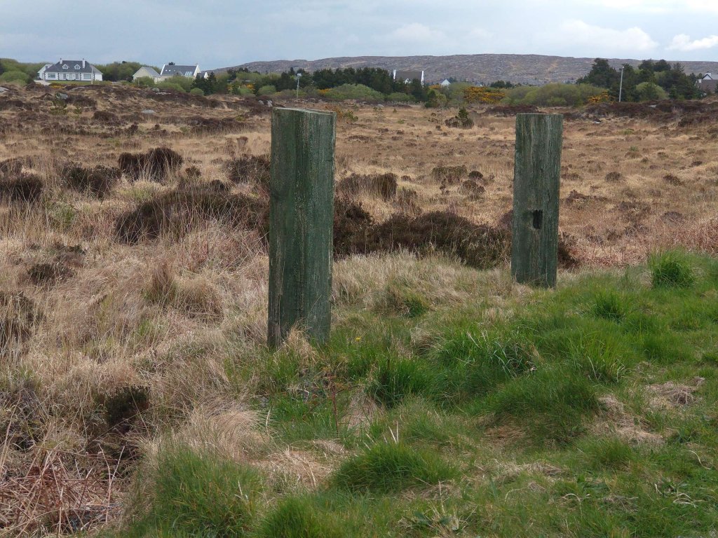
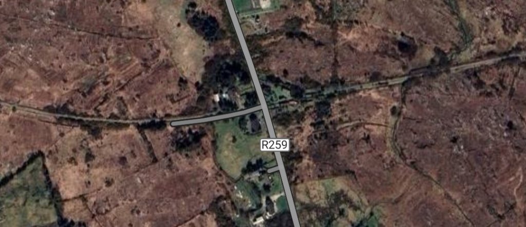
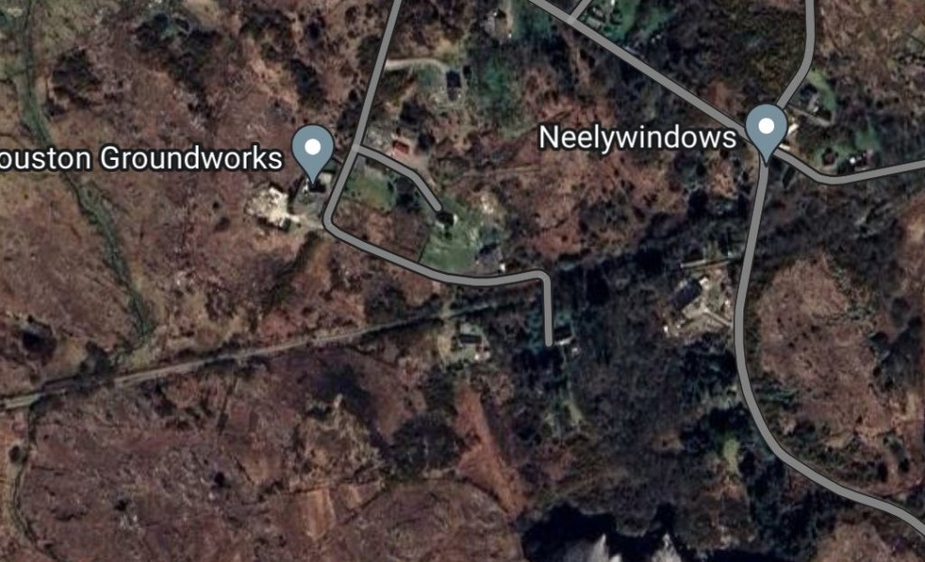
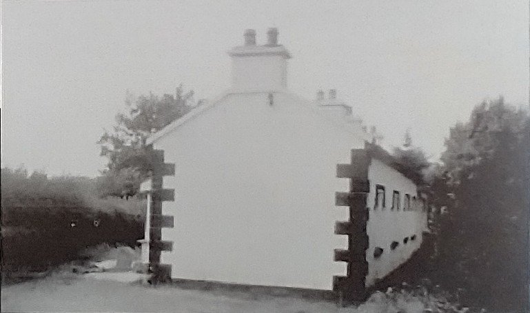
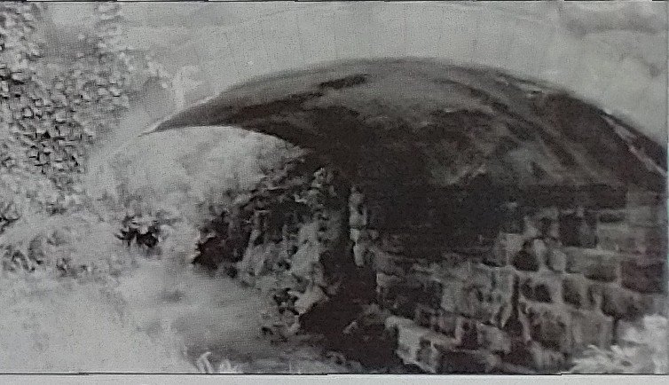
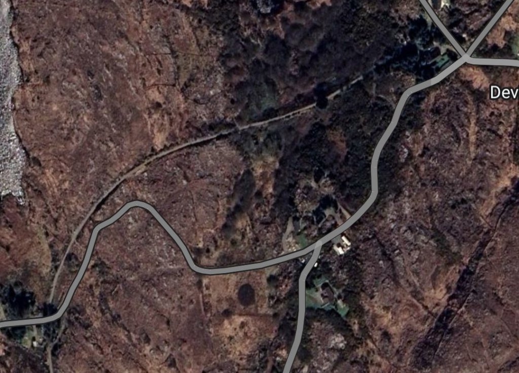
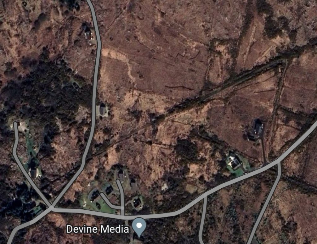
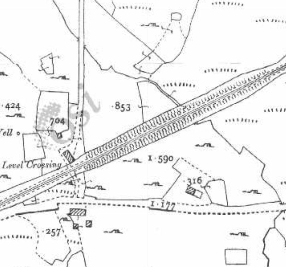
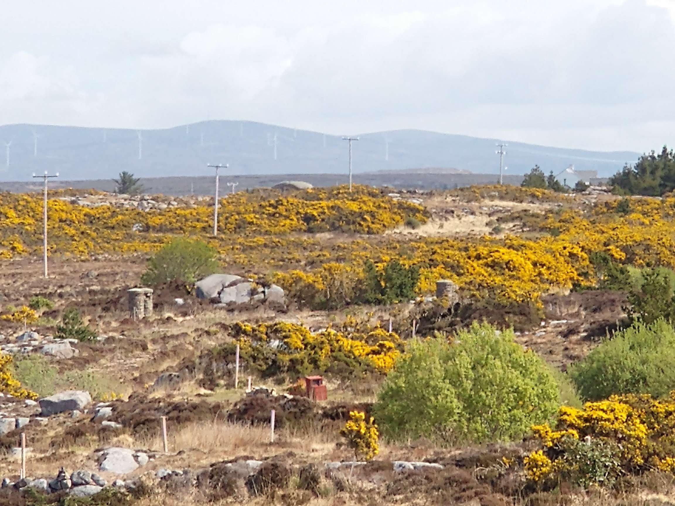
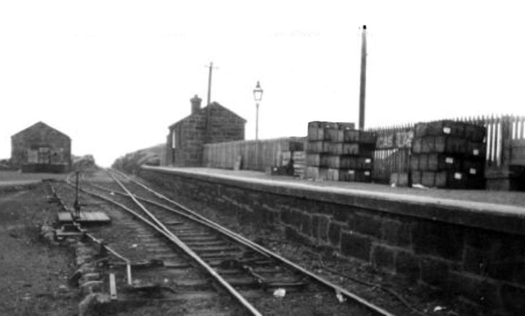
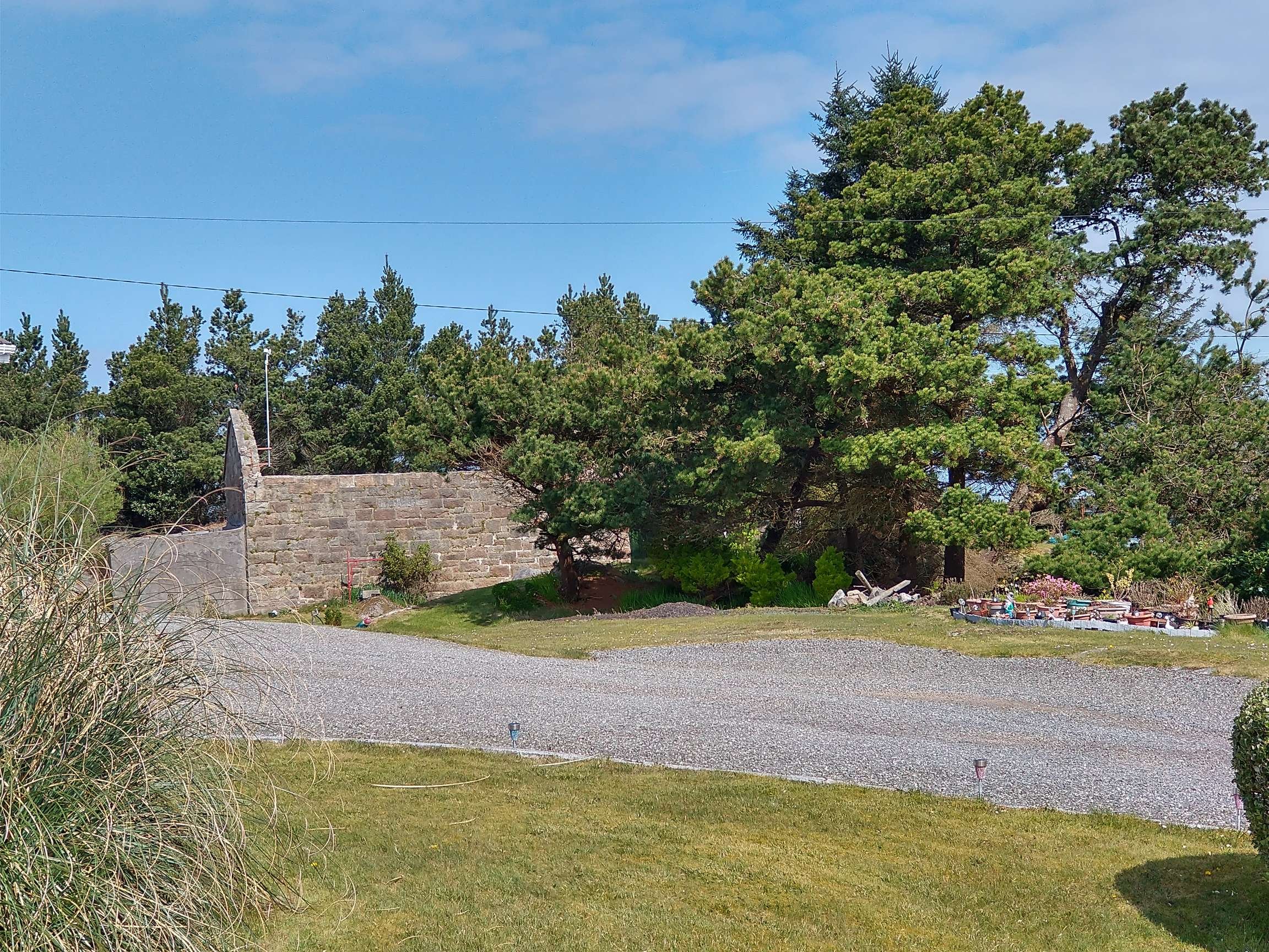
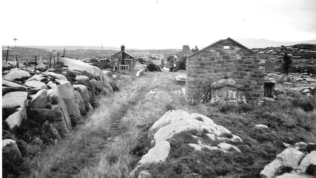
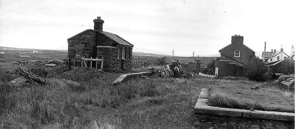
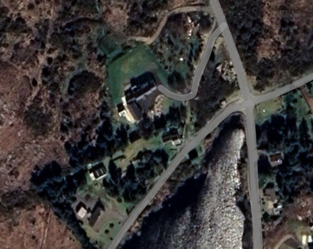
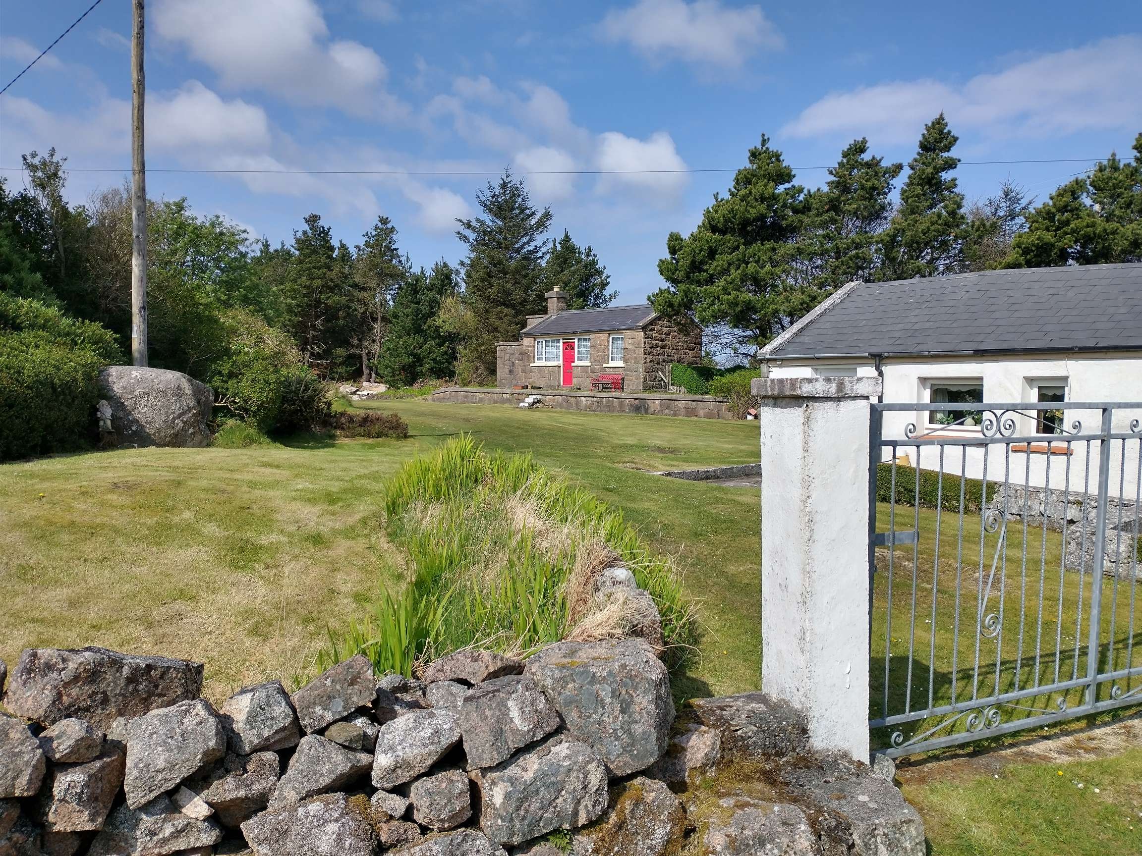
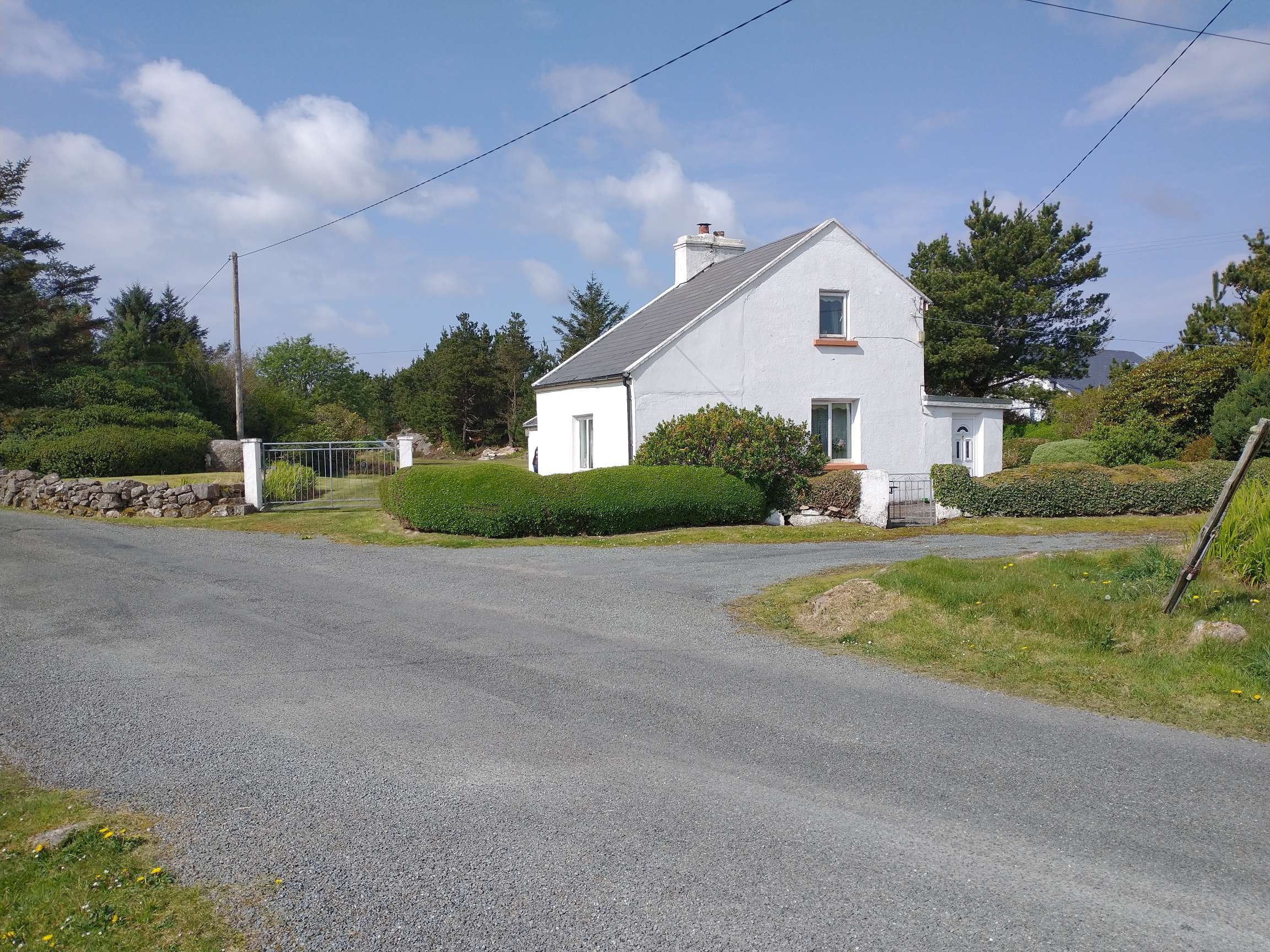
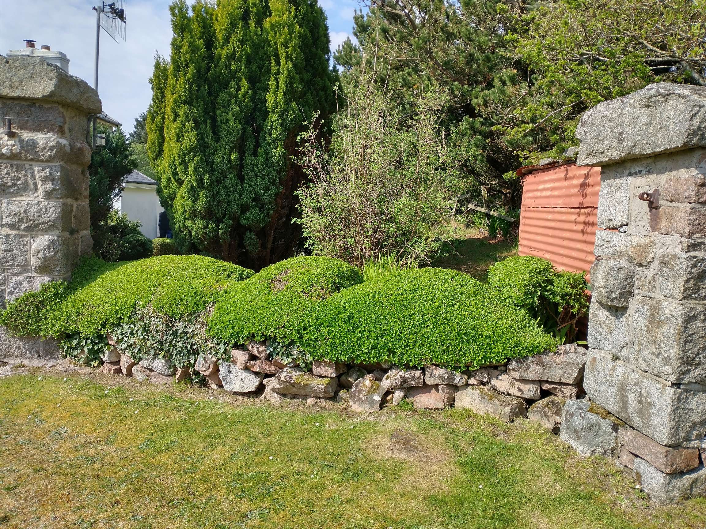
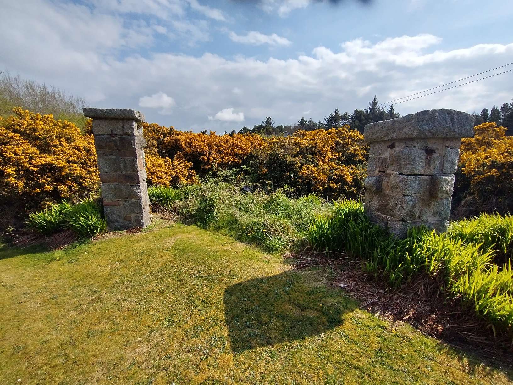
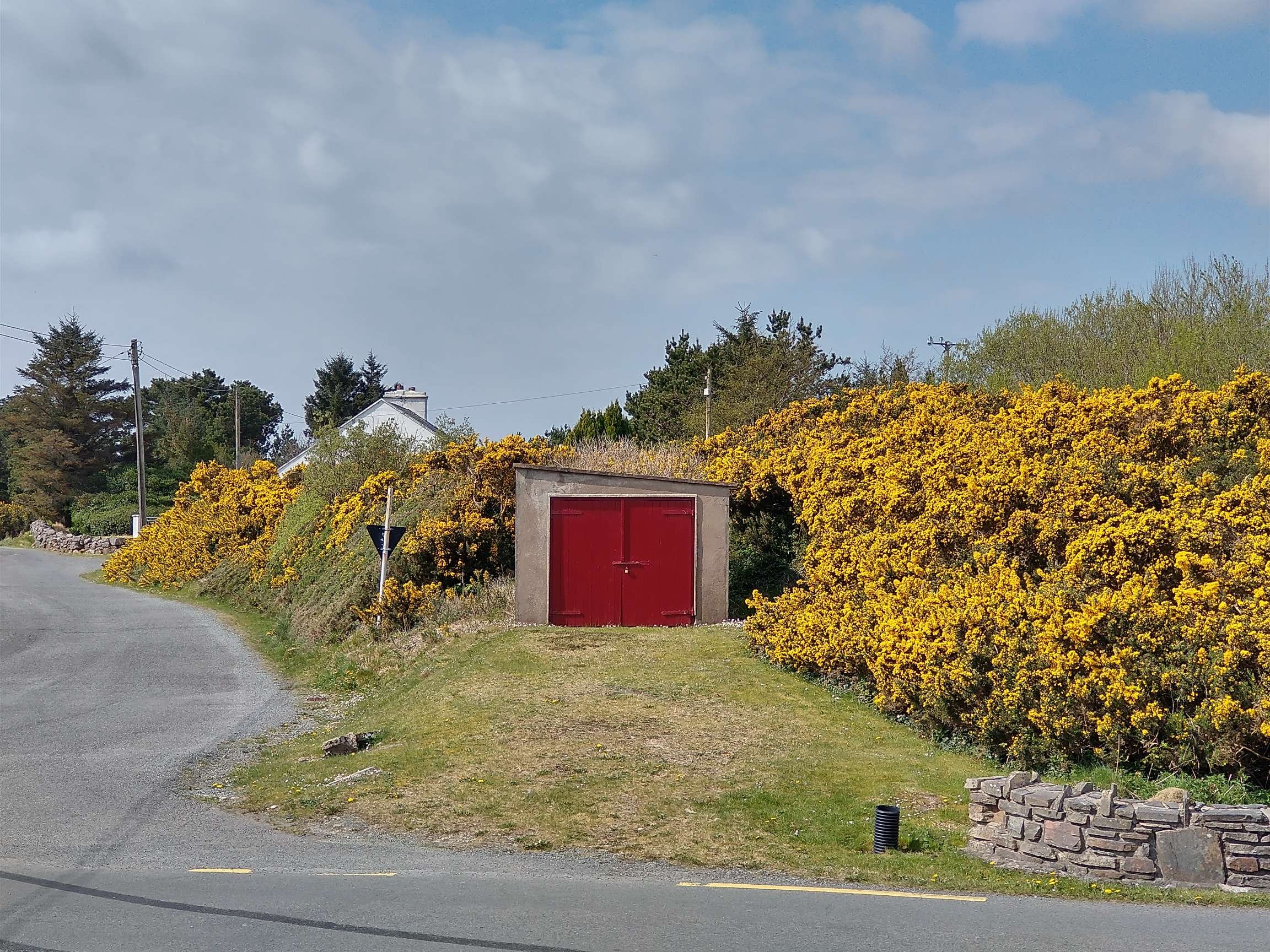
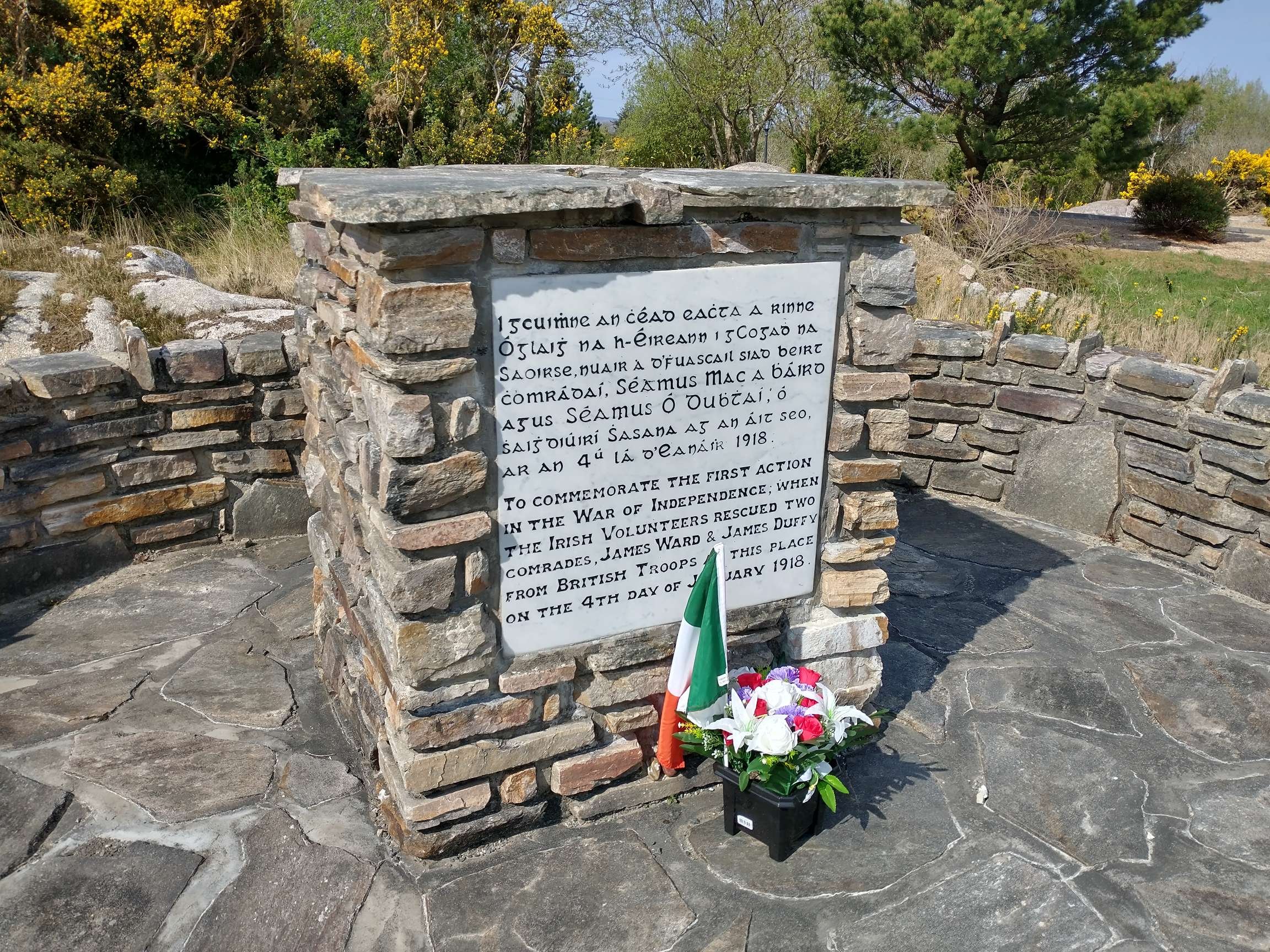
Kincasslagh Railway Station looking Southwest along the line towards Burtonport The Goods Shed is to the left and the passenger facilities are towards the end of the platform on the right. The station was built in 1913 and closed with this length of the line in 1940. This image was shared on the Burtonport Heritage Facebook Group by Patrick Boner on 15th February 2013. [12]
The remains of the Goods Shed in the 21st century, seen from the public road to the South. [My photograph, 23rd April 2023]
A 1959 view through the site of Kincasslagh Railway Station from Southwest of the Goods Shed seen in the right foreground. The Crossing Keeper’s Cottage is partially masked by the Goods Shed and the passenger facilities are on the left. This photo was taken in May 1959 by Michael Davis and was shared by Patrick Boner on the Burtonport Heritage Facebook Group on 1st September 2018. [13]
A view looking Northeast through the site of the station from the location of the goods shed. The passenger building is on the left and crossing keeper’s cottage on the right. The photograph was taken in 1965 by Michael Davis and was shared by Patrick Boner on the Burtonport Heritage Facebook Group on 3rd September 2018. [14]
This satellite image is at a slightly larger scale than similar images above it shows the location of what was Kincasslagh Railway Station. [Google Maps, 28th April 2023]
The passenger station building and platform as they appear in the 21st century. The site is very well maintained. [My photograph, 23rd April 2023]
Crossing Keeper’s Cottage No.21. [My photograph, 23rd April 2023]
The view from what used to be the Level Crossing, looking Southwest into the site of the station. [My photograph, 23rd April 2023]
Turning through 180°, this is the view Northeast from the old level crossing location. The modern road is ahead beyond the gorse bushes.
The view Southwest from the modern road. The Crossing Keeper’s Cottage is just visible above the gorse. The garage is on the line of the old railway. [My photograph, 23rd April 2023]
This is a memorial adjacent to the line of the old railway to the first action in the War of Independence. [My photograph, 23rd April 2023]

The next article in this short series can be found on this link:

The Burtonport Extension of the ‘Londonderry & Lough Swilly Railway’ – Part 2

References

  1. https://emmafcownie.com/2019/12/15/the-burtonport-old-railway-walk-donegal-ireland, accessed on 23rd April 2023.
  2. Dave Bell & Steve Flanders; Donegal’s Raulway Heritage Guide No. 2, The Londonderry & Lough Swilly Railway: A Visitor’s Guide to the old railway and all the bits that can still be seen; County Donegal Restoration Society, Donegal Town, Co. Donegal, 198…
  3. https://m.facebook.com/groups/788818974978955/permalink/1178313109362871, accessed on 25th April 2023.
  4. https://m.facebook.com/groups/788818974978955/permalink/1193387747855407, accessed on 24th April 2023.
  5. https://m.facebook.com/story.php?story_fbid=pfbid0KVungzAVHUePoRjDphqZ3topTijYW7y56LuREeDGJRBMWv2g7pEtfcMPQhGGW9UVl&id=1223882780981294, accessed on 24th April 2023.
  6. https://osi.maps.arcgis.com/apps/webappviewer/index.html?id=bc56a1cf08844a2aa2609aa92e89497e, accessed on 25th April 2023.
  7. https://m.facebook.com/burtonportrailway/photos/a.272196396164954/272197266164867/?type=3, accessed on 25th April 2023.
  8. https://m.facebook.com/groups/burtonportheritage/permalink/683856108385937, accessed on 25th April 2023.
  9. Jim McBride; The Lough Swilly Remembered; County Donegal Railway Restoration CLG, 2021. Illustrations from this book are reproduced here with the kind permission of Jim McBride.
  10. Joe Begley, Steve Flanders & E.M. Patterson; The Lough Swilly Railway: Revised Edition; Colourpoint Books, Newtownards, 2017.
  11. https://m.facebook.com/groups/burtonportheritage/permalink/548660425238840, accessed on 27th April 2023.
  12. https://m.facebook.com/groups/burtonportheritage/permalink/339803386124546, accessed on 28th April 2023.
  13. https://m.facebook.com/groups/burtonportheritage/permalink/1648247588613446, accessed on 28th April 2023.
  14. https://m.facebook.com/groups/burtonportheritage/permalink/339803386124546, accessed on 28th April 2023.
  15. https://m.facebook.com/groups/burtonportheritage/permalink/3138712962900227, accessed on 28th April 2023.

6 thoughts on “The Burtonport Extension of the ‘Londonderry & Lough Swilly Railway’ – Part 1

  1. Pingback: The Burtonport Extension of the ‘Londonderry & Lough Swilly Railway’ – Part 2 | Roger Farnworth

  2. Pingback: The Burtonport Extension of the L&LSR (Londonderry & Lough Swilly Railway) – Part 3 – Cashelnagor Railway Station to Barnes Gap | Roger Farnworth

Leave a comment

This site uses Akismet to reduce spam. Learn how your comment data is processed.