
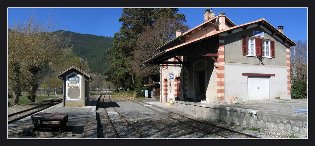
We resume our journey at the Station in Barrême. The first picture shows it on a glorious day and in its best light!
The station at Barrême. [4]

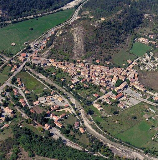
An aerial overview of Barreme with the Station visible to the bottom left of the image, (c) Marc Heller. [12]
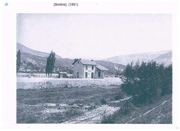
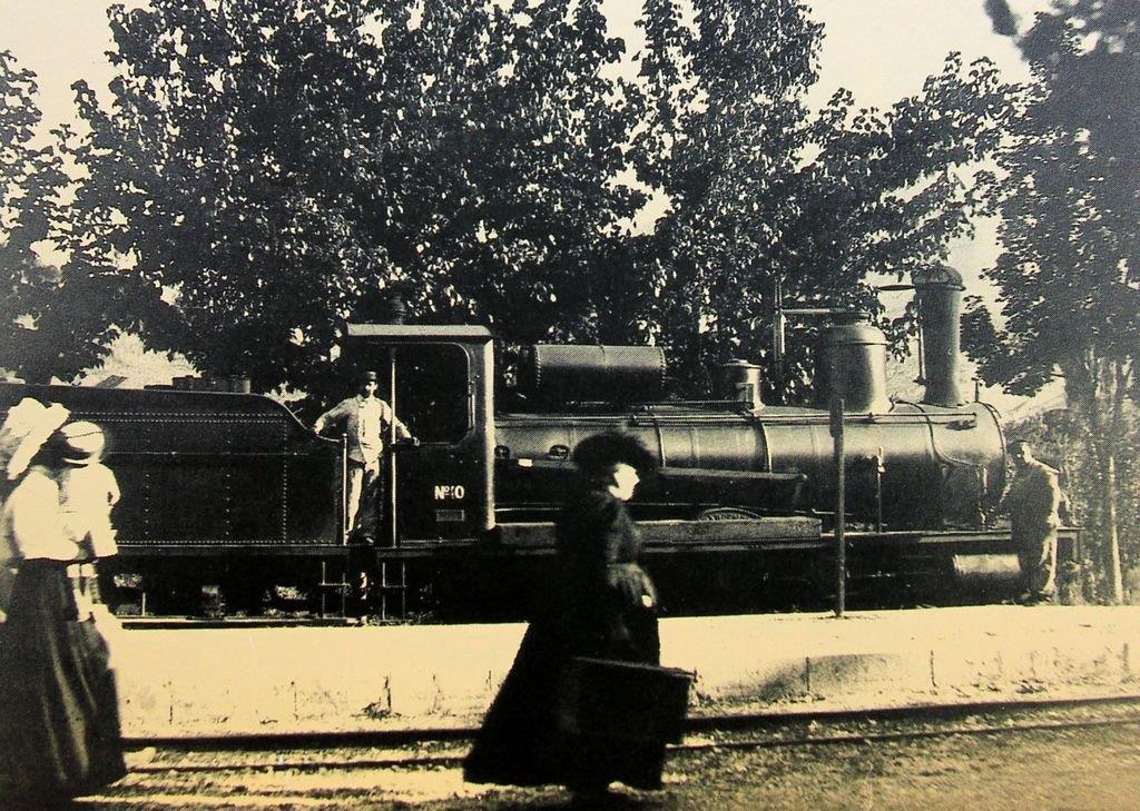
The Station appears quite lonely in 1891! [7]
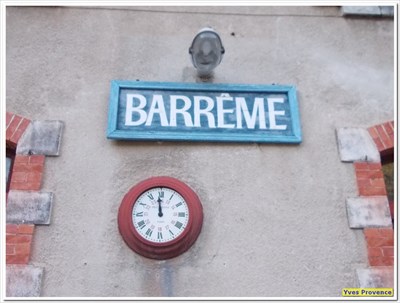
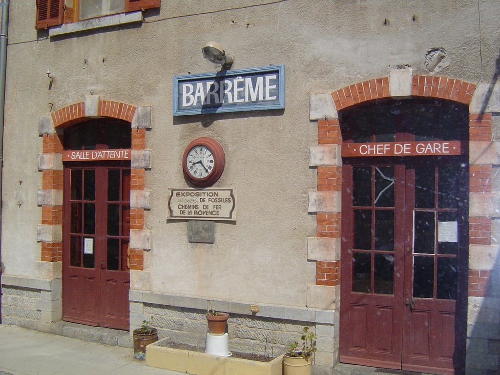
Two views of the station clock. [1][8]
The Station as approached from Digne. [2]
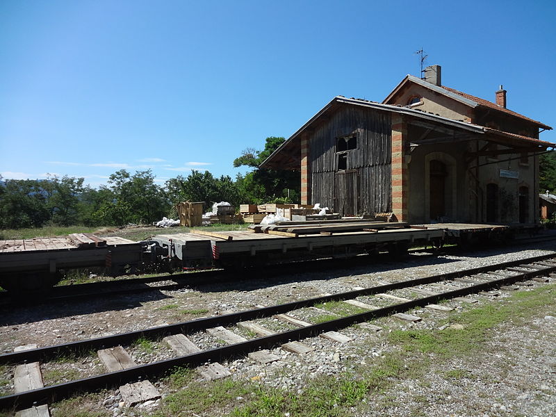
La gare de Barrême, (c) Yves Provence. [1]
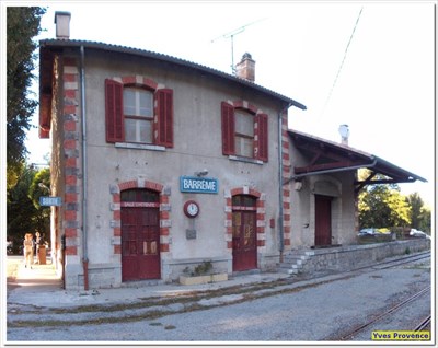
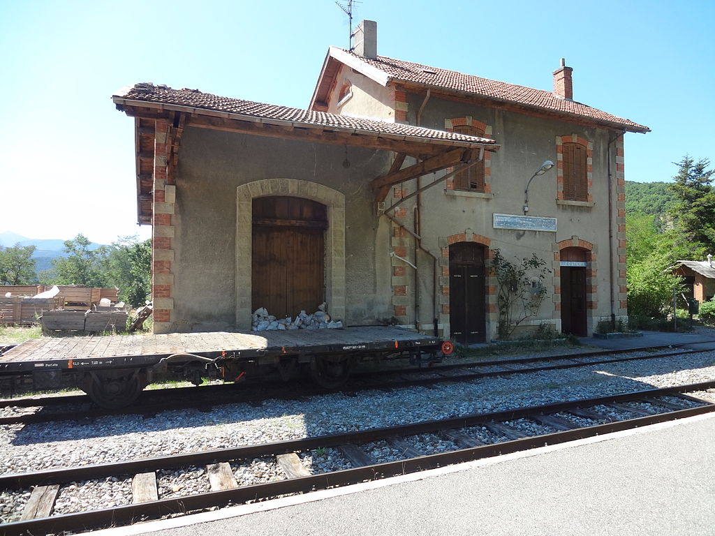
La gare de Barrême, (c) Yves Provence. [1]
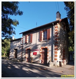
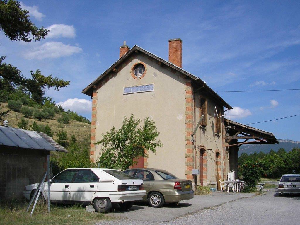
La gare de Barrême, (c) Yves Provence. [1]
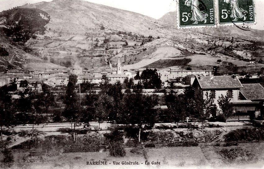
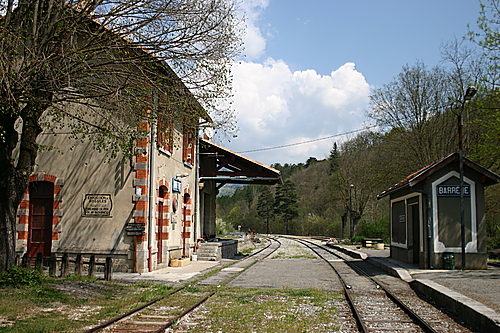
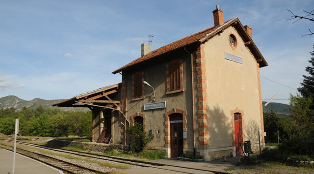
General View of the Station. [3]
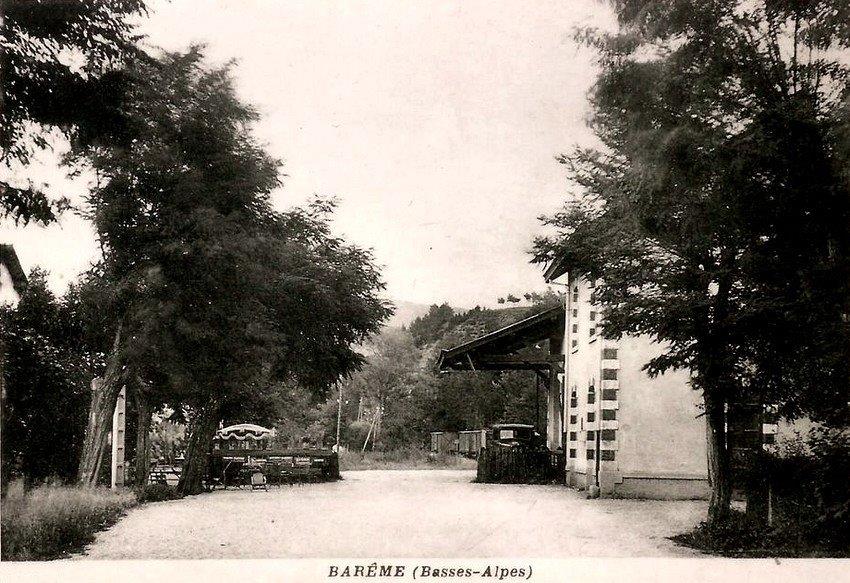
The station courtyard. [3]
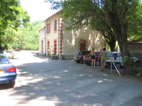
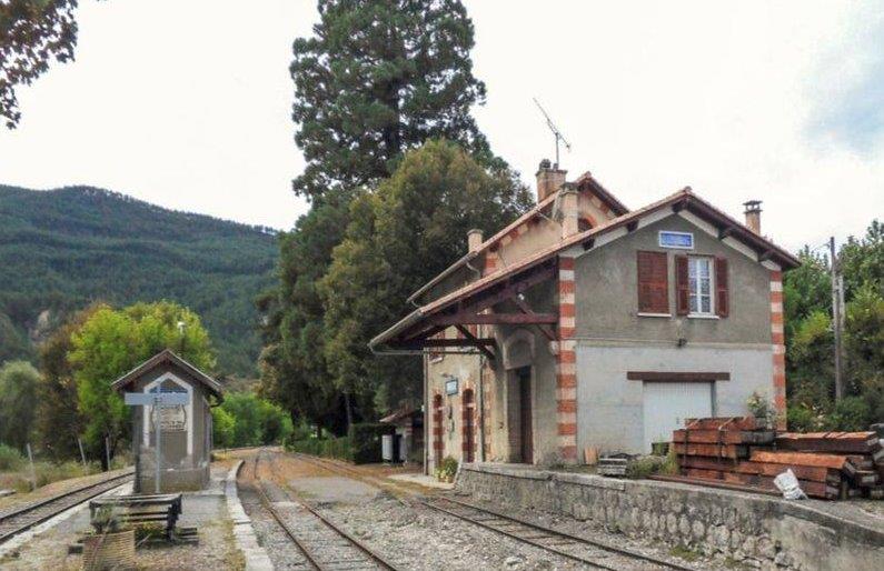
The station courtyard in 21st Century. [5]
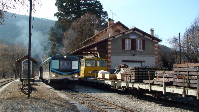
Barreme Station with Autorail travelling towards Nice and a construction train brought by the DU-102 draisine, (c) La bête de Calvi. [6]
A very similar view without the trains! [10]
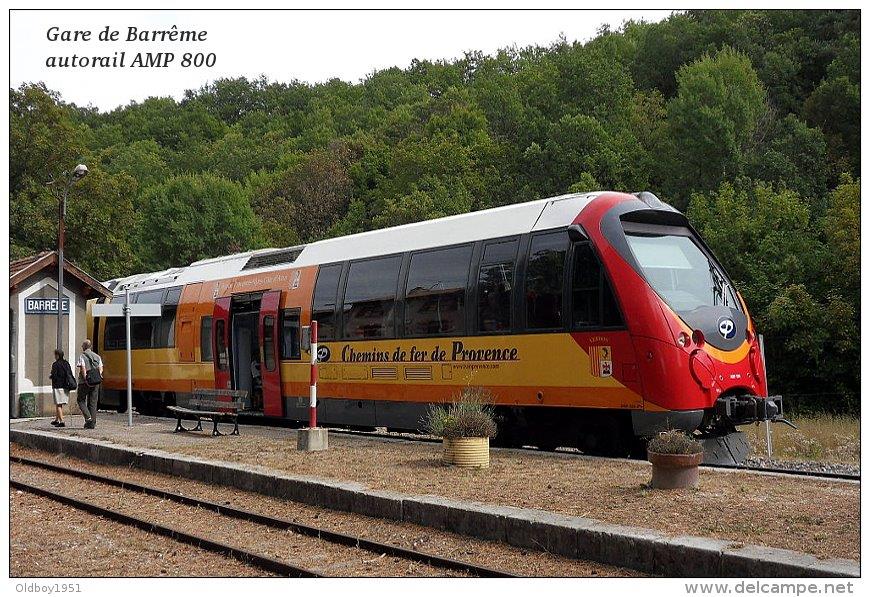
Modern traction at Barrême. [9]
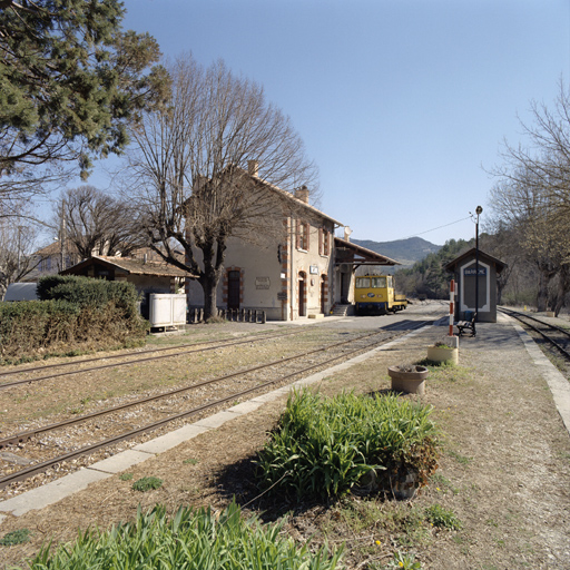
A view from the South, (c) Marc Heller. [11]
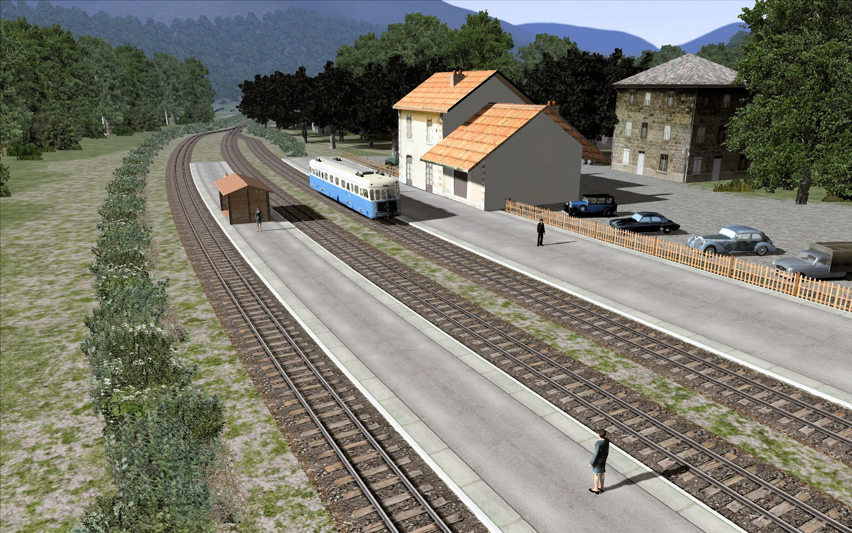
The station on the rail-simulator. [31]
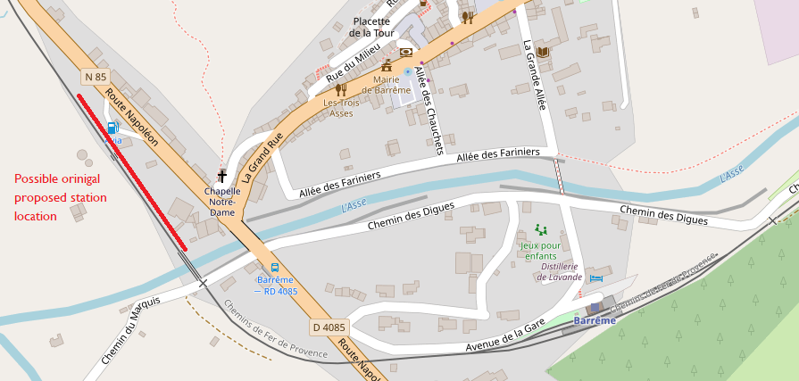
As an interesting aside, research on line suggests that the final location of Barreme station was not the location originally intended. I have found a sequence of drawings which seem to locate the station to the north-west of the present location further along the Nice -Digne line, beyond the bridge in the village centre. It is possible that I have misunderstood the drawings, but it seems that there was another location planned and that the station would have had larger facilities if the original plans went ahead. That location is shown in red on the plan below.
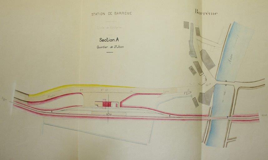
Plan of originally proposed railway station. [12]
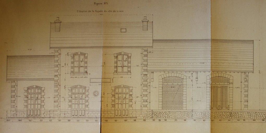
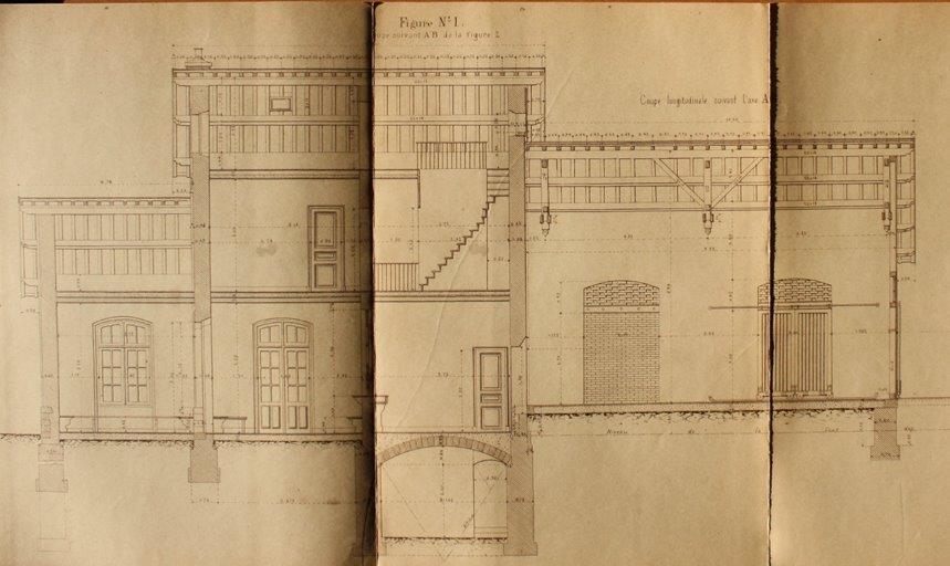
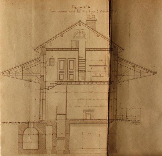
Three images (immediately above] showing the plans for the originally proposed station buildings on the first planned site of the station. [12]
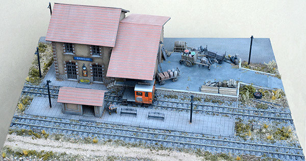
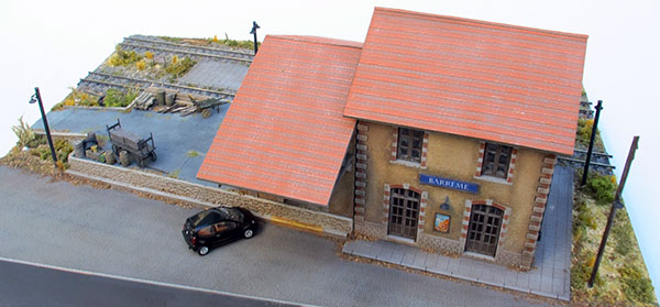
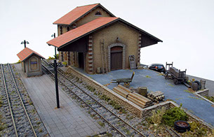
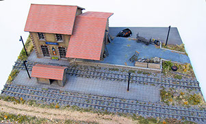
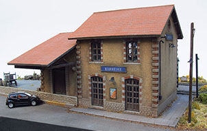
A further interesting aside is the fact that Barreme Station has been used as the source for a model by Aubertrain (http://aubertrain.com/modules.html). These next few pictures give a sense of the quality of the model. [16] The diorama is 602 x 400 x 250 mm in size.

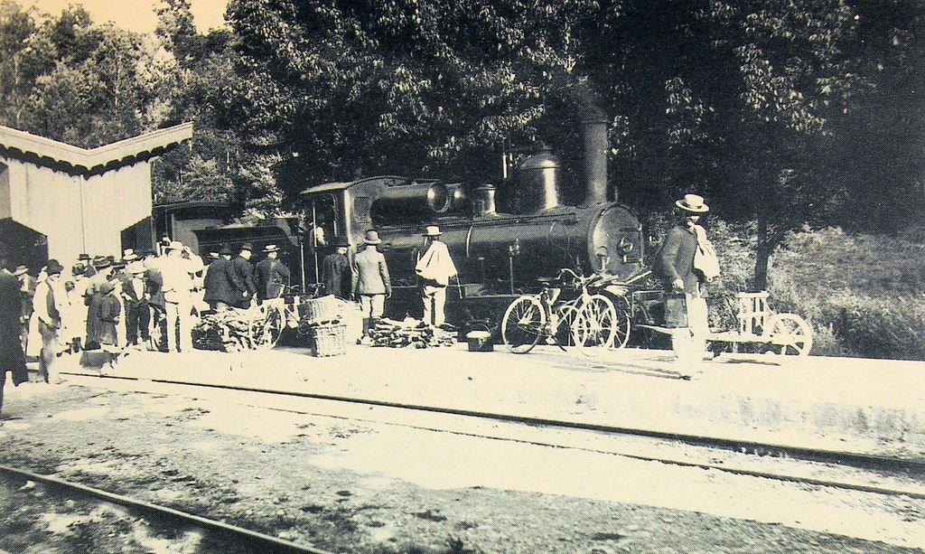
These last two pictures can be found on the site, “http://dignois.fr/Barreme-vieux” and purport to show an early steam engine at Barreme Station. If this is correct, then the station shelter was rebuilt some time after the pictures were taken. [13]
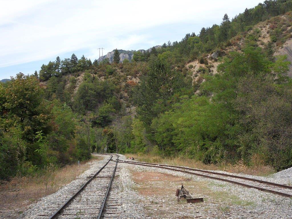
We leave Barreme Station on the train an immediately cross the L’Asse de Moriez just before its confluence with L’Asse de Blieux.
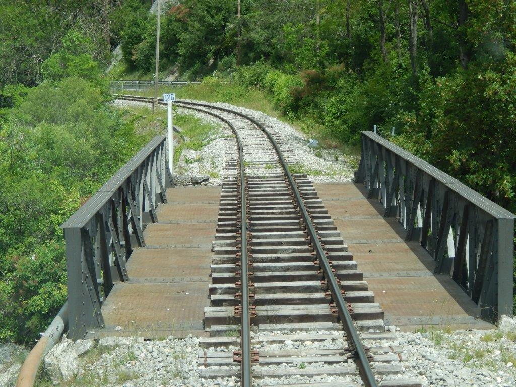
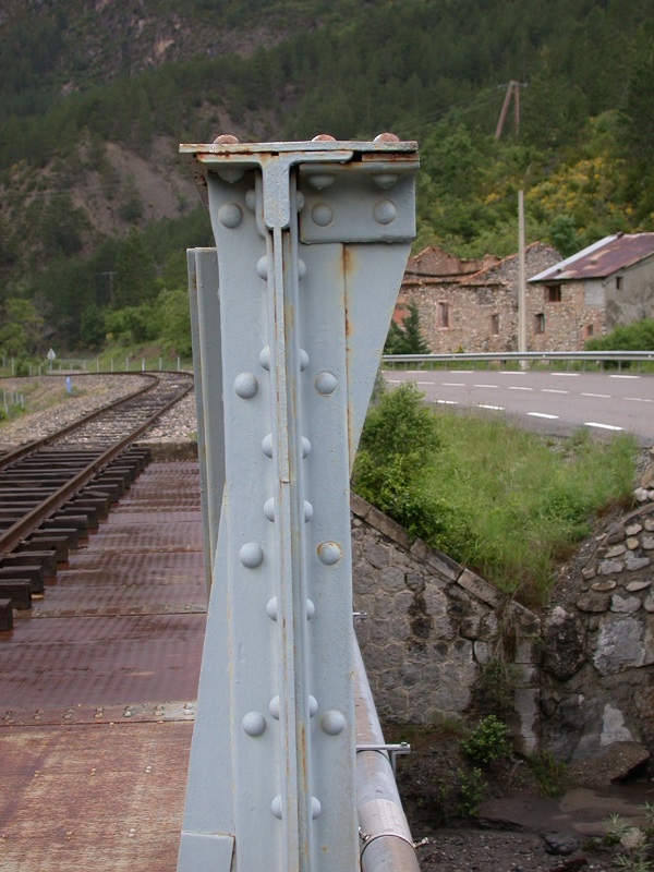
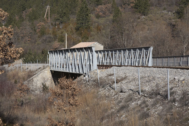
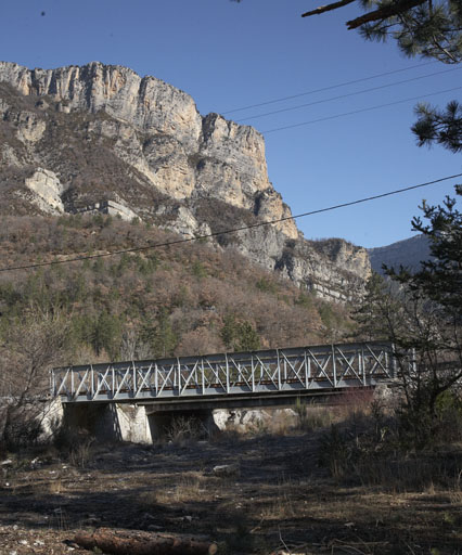
Barreme Bridge [15]
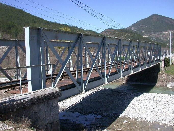
Barreme Bridge [14]
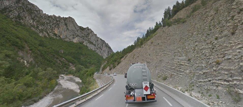
Beyond the village limits, road, rail and river once again run in very close proximity. The road is now the N85 and the river is now l’Asse. In the photograph below the road and river are immediately next to each other and the river can just be picked out beyond the first line of trees and vegetation.
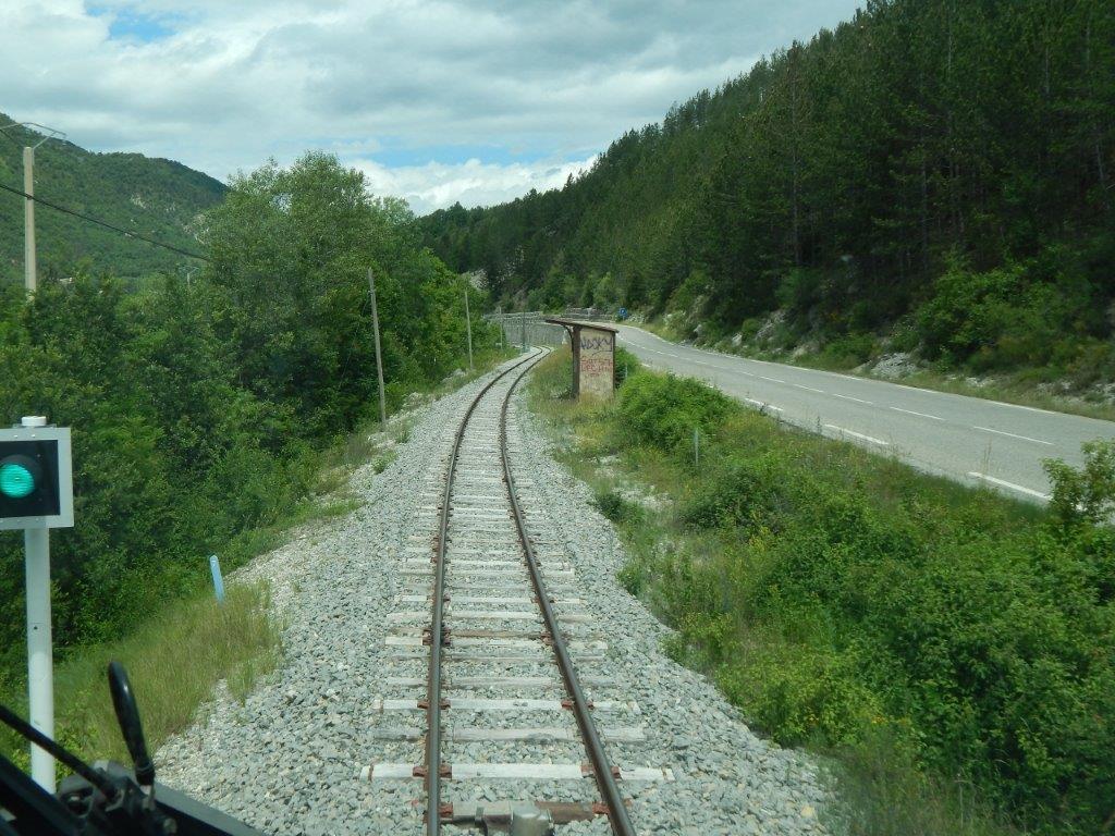
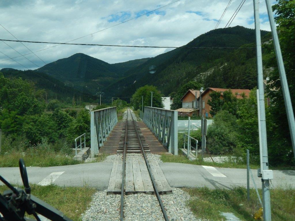
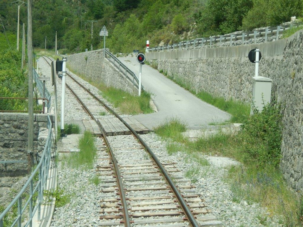
A driver’s eye view of the next Halt on the line – l’Arret de Saut de Loup. [15]
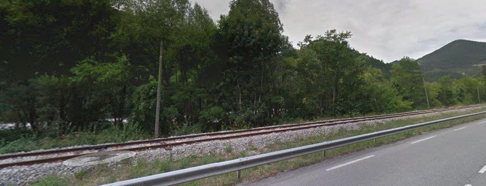
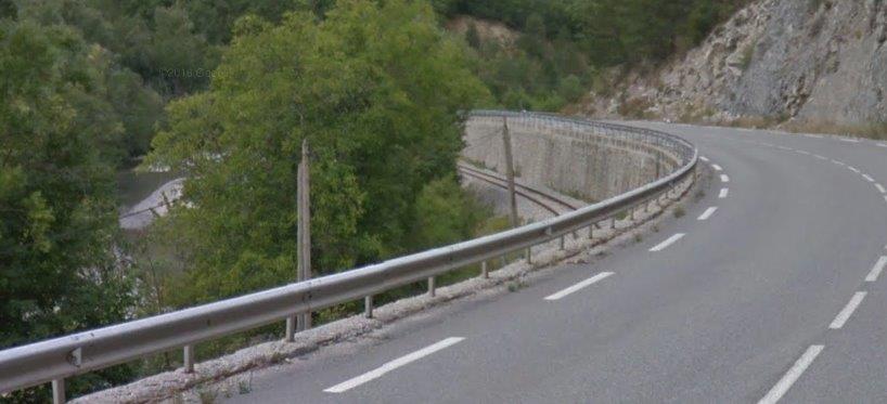
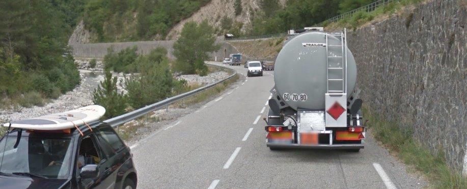
At times the River Asse runs through some relatively steep sided Gorges and road, rail and river squeeze through the narrow space available, as Google Streetview shows below.
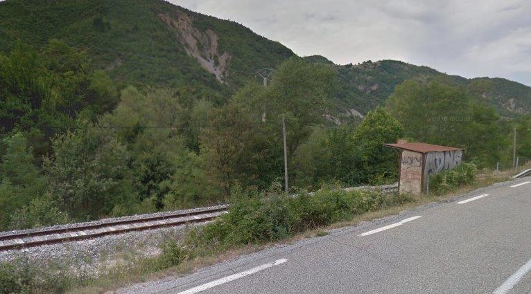
The next Halt is Arrêt du Poil-Majastres which can be seen in the image below.
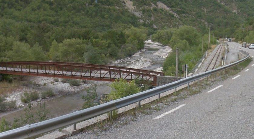
Road, rail and river continue in close proximity. The next image shows the bridge crossing L’Asse for the route,”Lu Buis Noire East.” It is followed by a driver’s eye view of the same location.
Le Buis Noire East seen from the cab of an Autorail. [15]
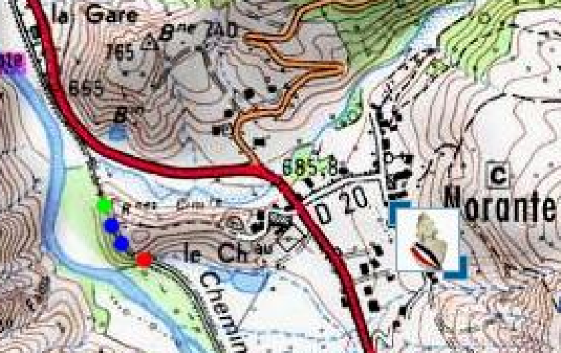
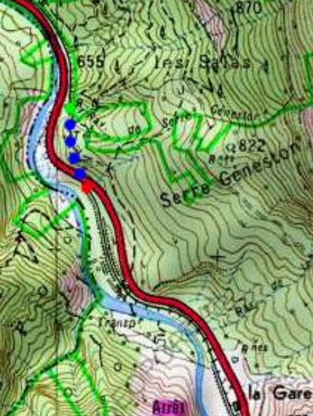
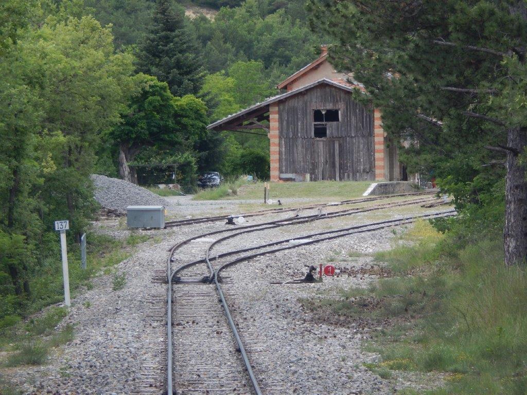
The line drops steadily down the valley of l’Asse towards Norante. Its route favours the river rather than the road until, close to Chaudon-Norante, it enters another tunnel – the Tunnel de Norante. By this time the line has dropped to an altitude of about 650 metres above sea-level. The tunnel is 137 metres long and is marked on the map below by the red, blue and green dots. [17] The next station is Chaudon-Norante and can be seen in the top left of the map.
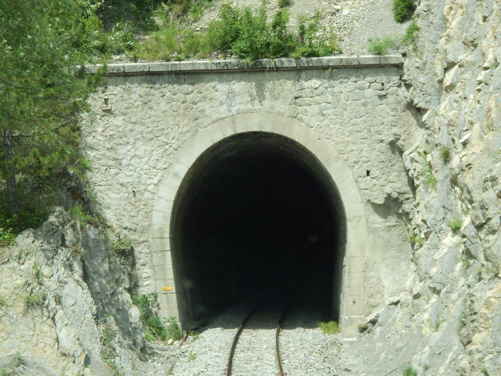
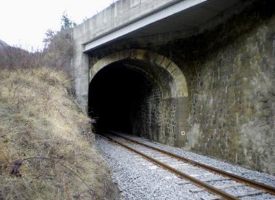
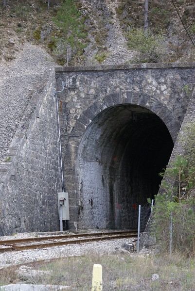
The southern portal of the Tunnel de Norante. [15]
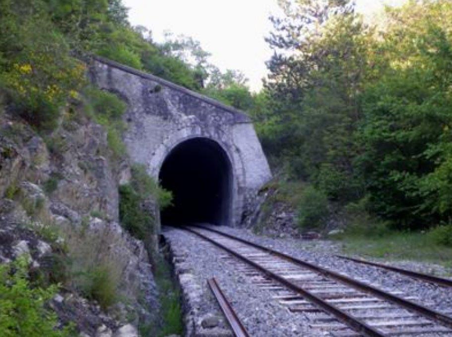
The Northern portal of the tunnel. [17]
Immediately after trains emerge from the Tunnel de Norante they cross another simple girder bridge. [15]
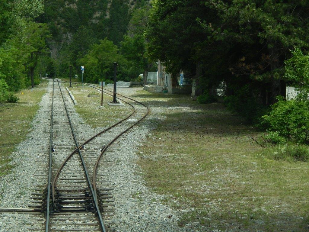
And then quickly arrive at Chaudon-Norante Railway Station. A driver’s eye view from the cab of an Autorail shows the approach to the station. [15]
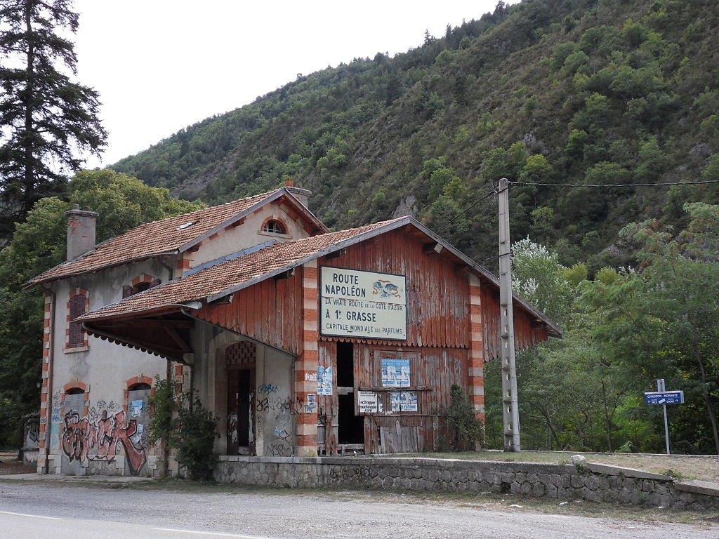
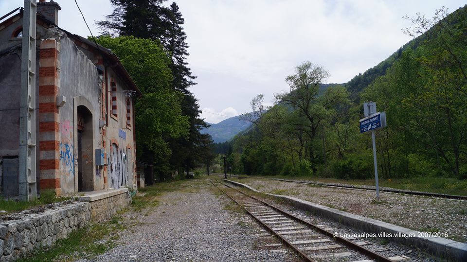
The station at Chaudon-Norante in 2013. [18]
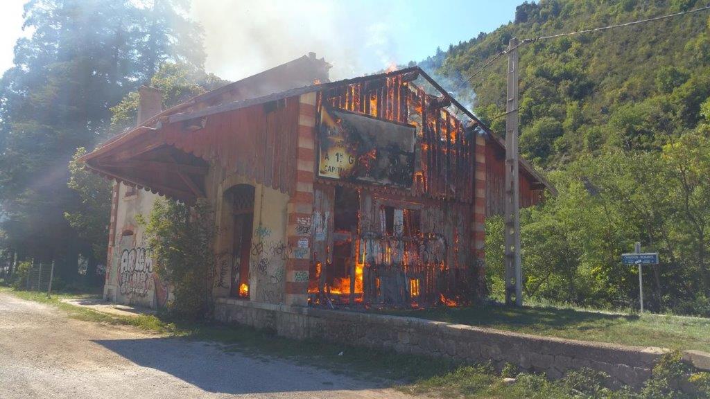
The station on fire in the winter of 2015/2016. [19]
The station after the fire, taken from the passenger platform in 2016, (c) Jean-Pierre Alpes. [20]
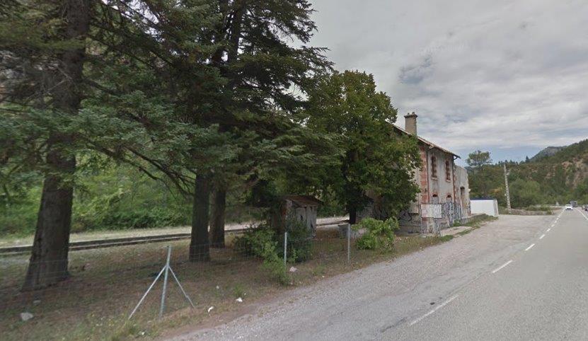
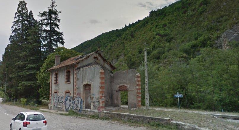
The two images above show the station viewed from the road in 2018, they are taken from Google Streetview and clearly show the damage to the building resulting from the fire a couple of years earlier.
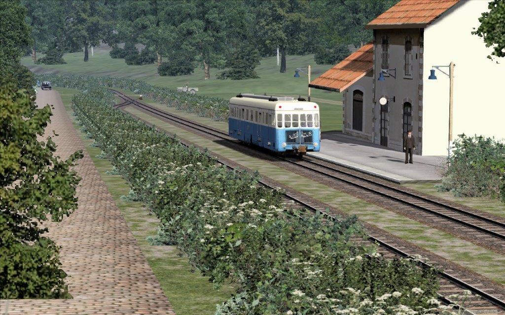
The station on the rail-simulator. [31]
The line ahead to Digne. [18]
Road rail and river continue in close proximity down the valley from Chaudon-Norente, until the railway passes under the road and into a tunnel.
Looking back up the valley of l’Asse (above) from over the portal of the tunnel.
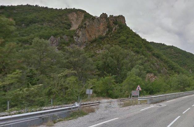
The Tunnel de Serre Geneston is at an altitude of 655 metres above sea-level and is 213 metres long. [21] The N85 has been realigned over the southern portal of the tunnel to remove a sharp bend in its alignment. This means that the original portal is shrouded by a concrete span.
This can been seen in the first image below.
The southern portal of the Tunnel de Serre Geneston. [21]
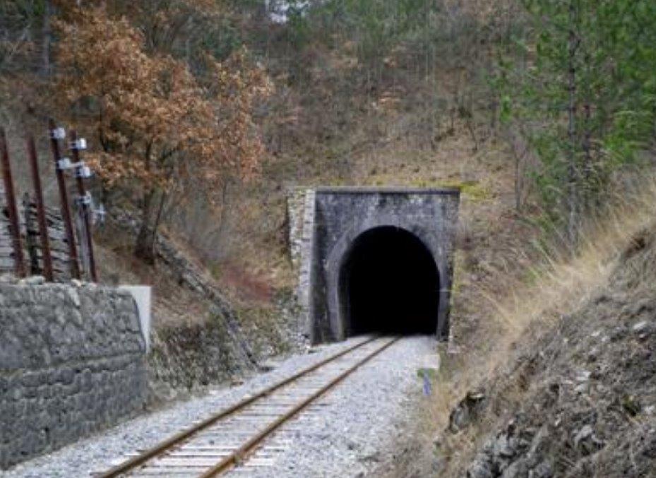
Northern portal of the Tunnel de Serre Geneston. [21]
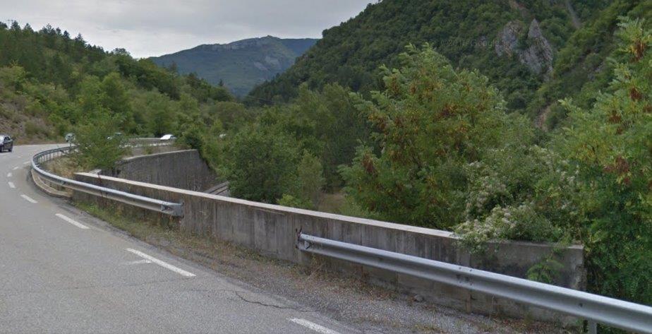
After the Tunnel de Serre Geneston the railway , road and river are once again close together, this time, however, the railway is considerably higher than both road and river and its formation is supported by a lengthy retaining wall.
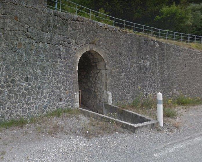
Arched masonry culverts permit drainage.
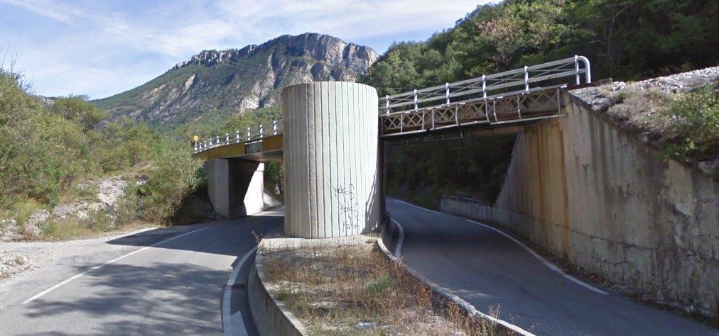
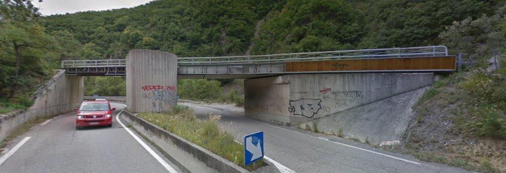
After quite a length of masonry retaining wall, the next significant structure on the railway is the bridge which carries it over the N85 at …………………………… The images below show the view of the structure from the south and then from the north. It probably constitutes the least attractive bridge on the Nice to Digne Railway line!
In a short distance the railway drops to be at a similar level to the river and while running in very close proximity once again, this time is is the road held up above the railway on a significant retaining wall.
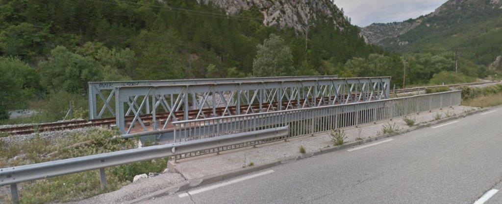
Within a couple of kilometres the road and railway are back at the same level and the railway is immediately alongside the road. The pictures below of the girder bridge over Ravin de Couinier show how closely road and rail are aligned. The first is from Google Streetview, the next three are from https://dossiersinventaire.maregionsud.fr. [22]
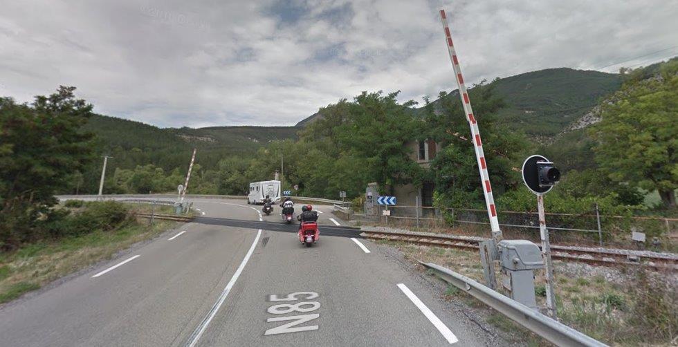
In Chabrières, Entrages, road and rail cross each other again, this time at a level-crossing which is shown in the three images below.

A train driver’s eye view approaching the crossing. [15]
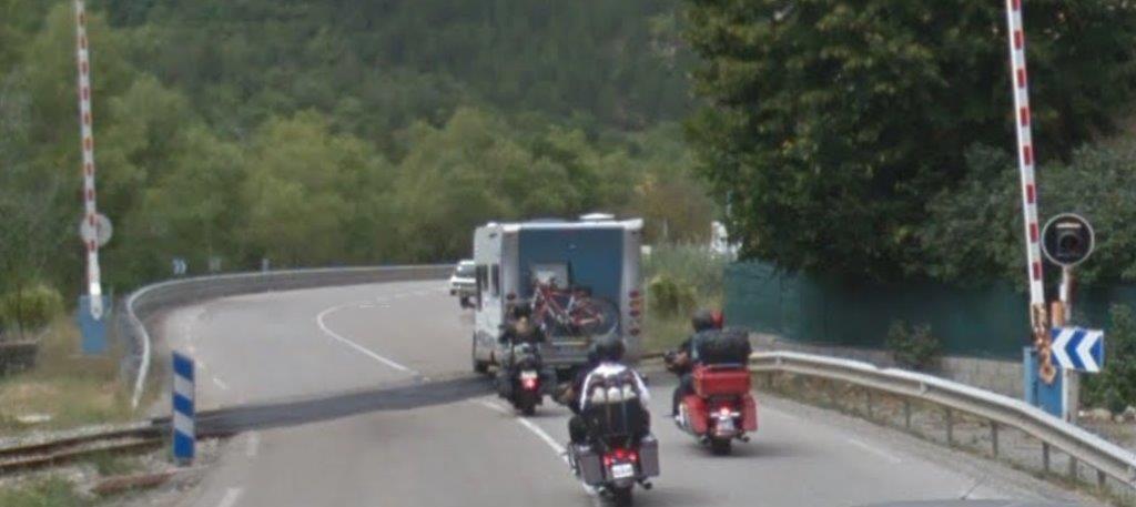
A van driver’s eye view approaching the level-crossing.
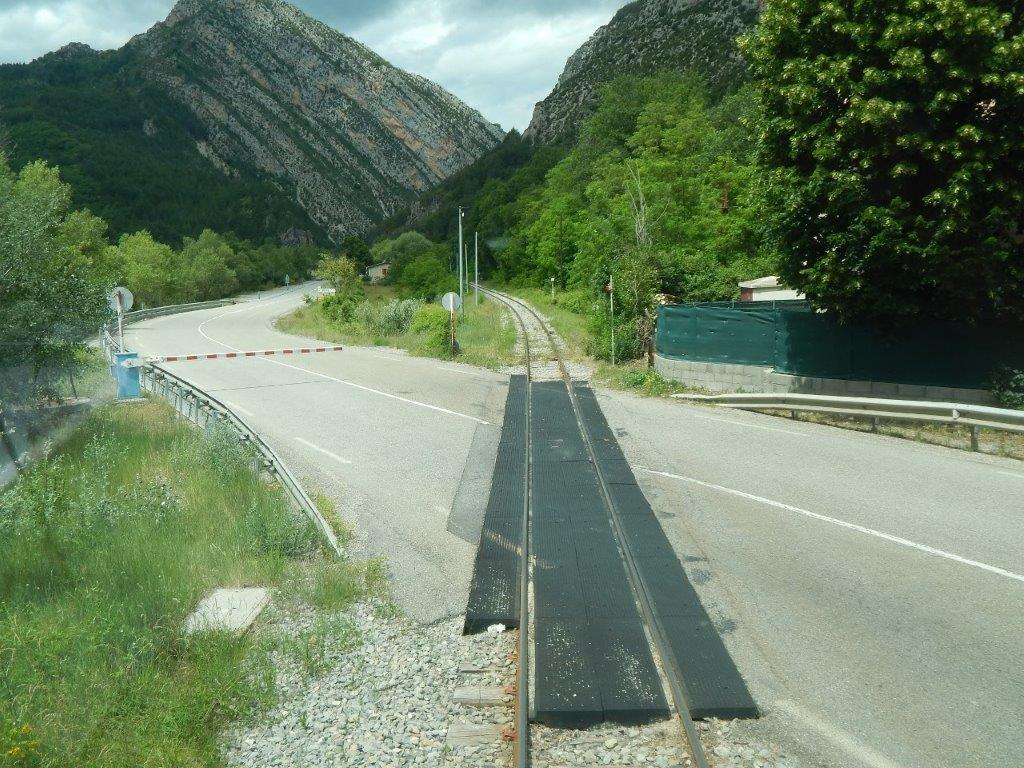
A view from the cab of a Autorail as it crosses the N85 at the level-crossing. [15]
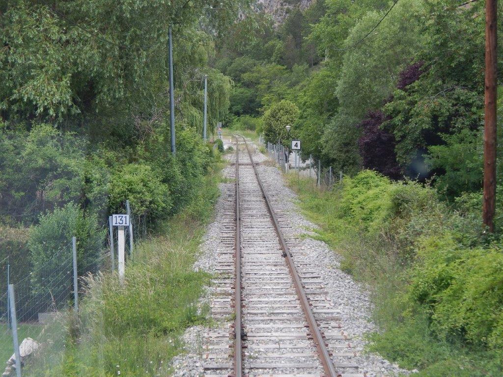
The approach to the Halt at Chabrieres. [15]
The Halt at Chabrieres. [15]
The halt at Chabrieres. [32]
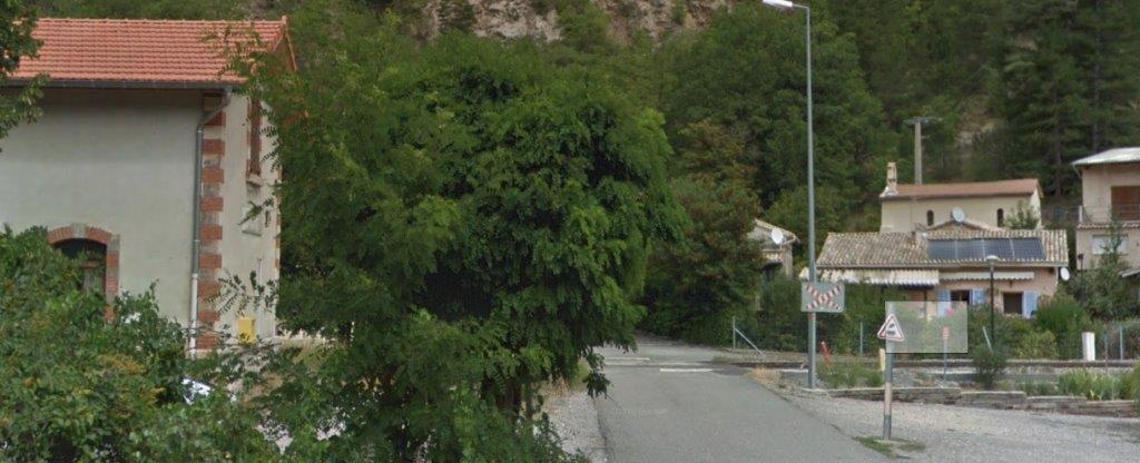
The Halt and crossing at Chabrieres seen from the N85.
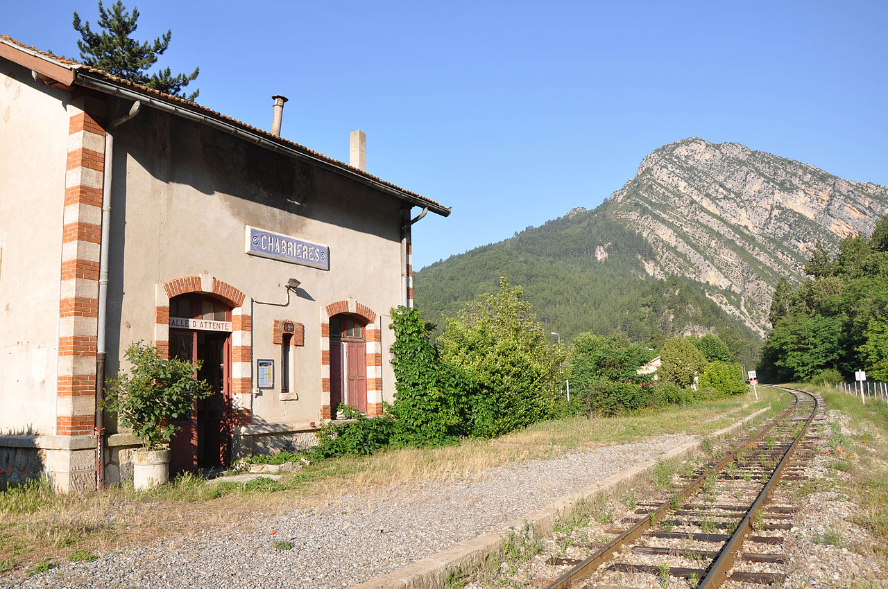
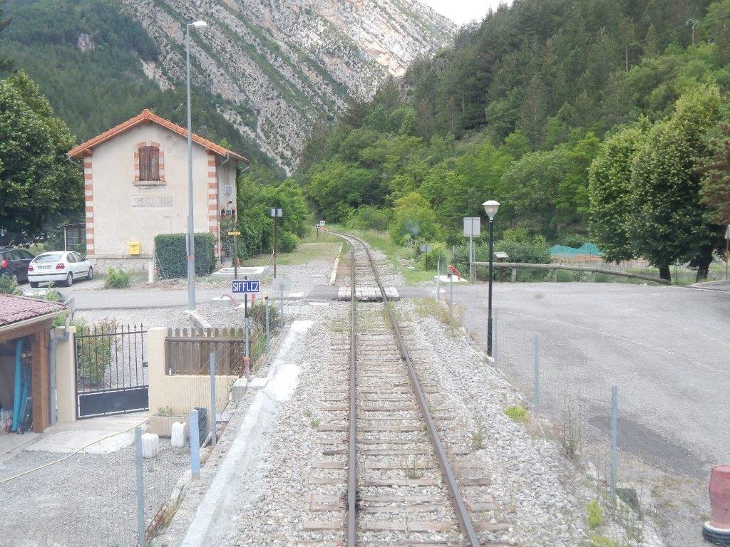
Chabrières Halt. [23]
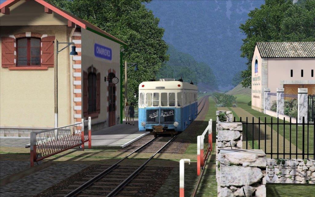
The station on the rail-simulator. [31]
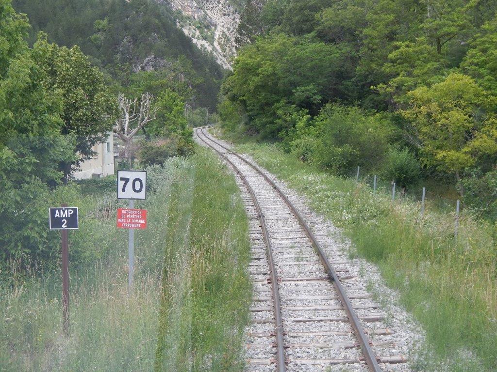
The line West of Chabrières. [15]
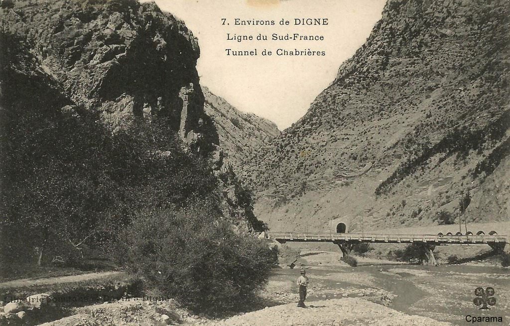
To the West of Chabieres, the line turns northwards and then enters the Tunnel de la Clue-de-Chabrières. We are now about 600 metres above sea-level and the tunnel is nearly 600 metres long! It is marked by the usual red, blue and green dots on the map below. [24]
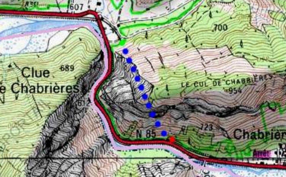
The South Portal from some distance upstream on the other bank of the river. [32]
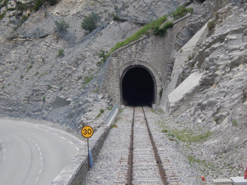
The South Portal of the tunnel. [15]
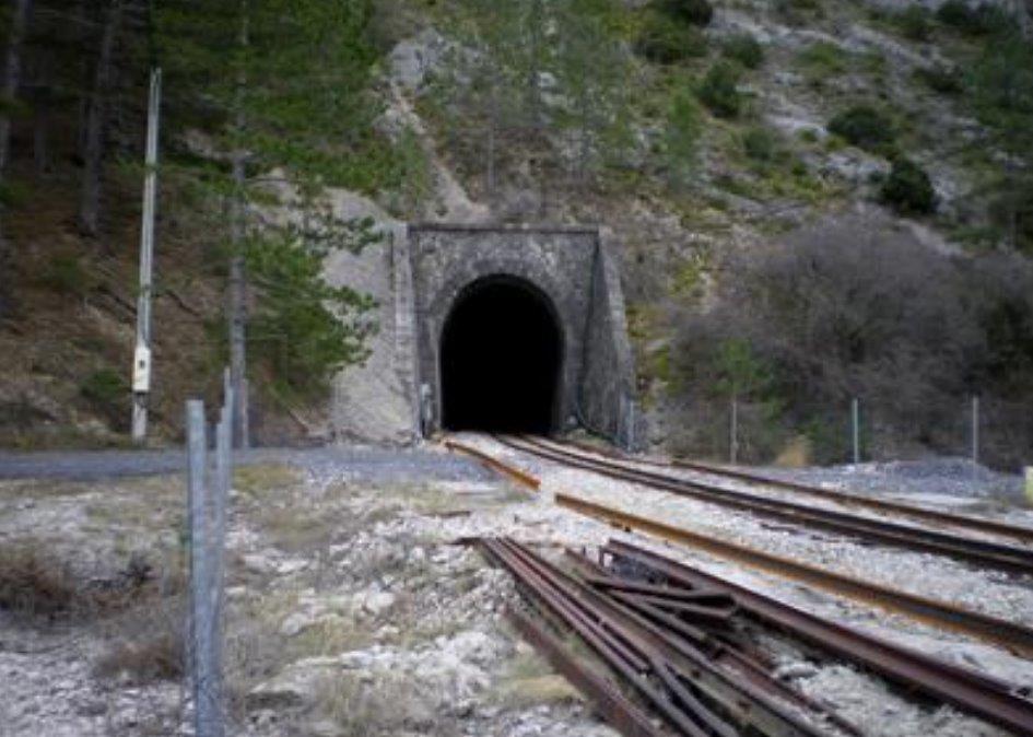
The North Portal of the Tunnel is shown in the two images above [24] and below, (c) Nicolas Janberg. [25]
A short distance after the train passed through the tunnel it went through another request halt – l’Arret de de Saint-Michel-de-Cousson. I have not been able to find pictures of this halt. It then, once again crossed the main road at a level-crossing.
Road, rail and river all once again in close proximity and a typical small span bridge carrying the railway over a minor tributary of l’Asse.
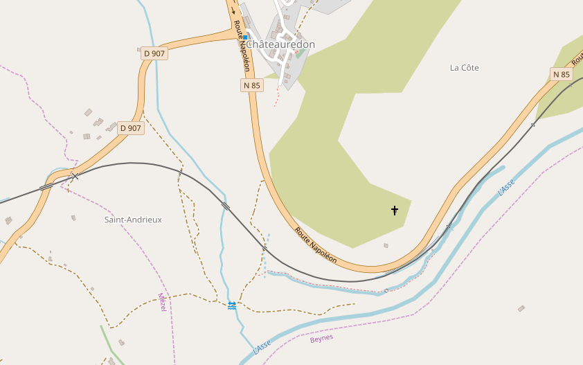
The line continues alongside the road for about a kilometre before swinging away to the south following the north bank of the l’Asse. A further kilometer West and the road rail and river are once again close for a short distance as the valley narrows. The N85 road then turns away north into the village of Chateauredon, and the river turns away south leaving the railway on its own to cross the valley of the Saint-Jean a tributary of l’Asse!
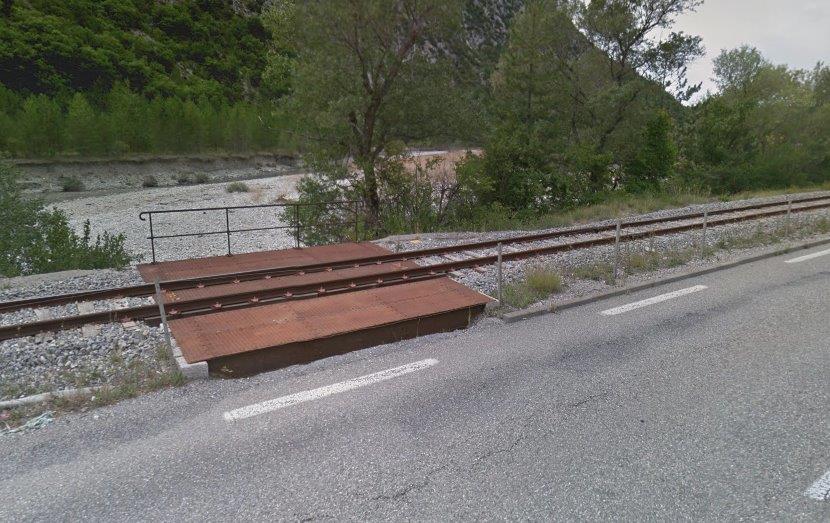
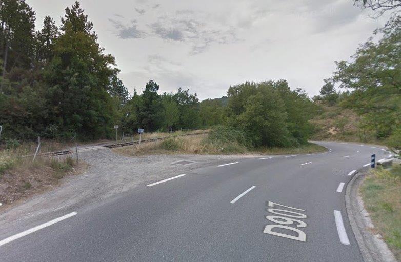
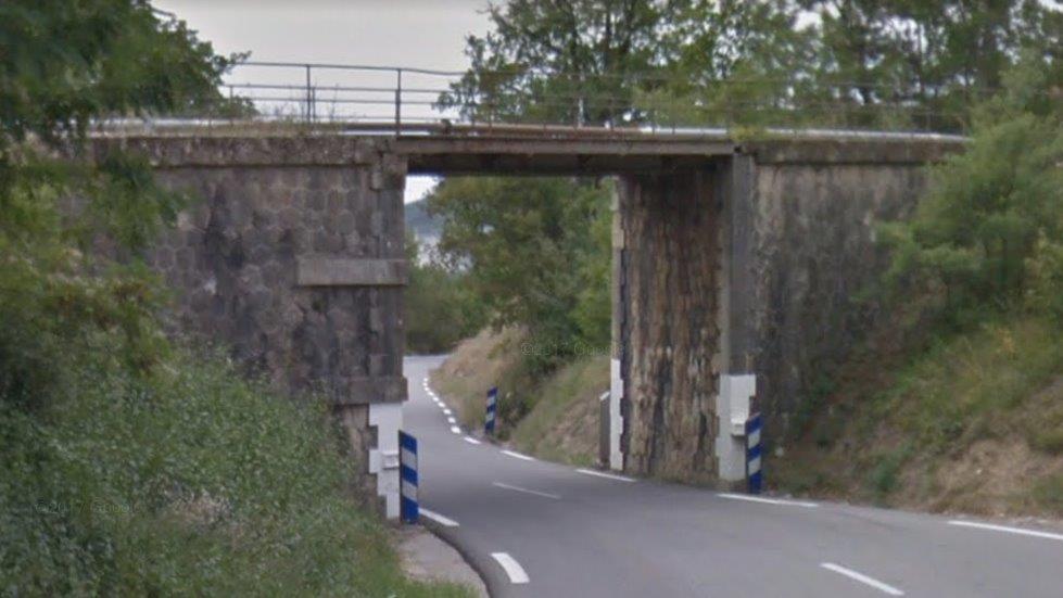
As we approach Mézel/Châteauredon station the ‘D907’ road approaches the railway and an accommodation level-crossing takes a very minor access road to the south of the line, see immediately below. In the second image below, the ‘D907’ has dropped below the level of the railway and passes under it via a small girder bridge.
The approach to the station from the east as seen from the cab of an approaching Autorail. [15]
The same Autorail enters the station. [15]
Mézel/Châteauredon Station [26]
Mézel/Châteauredon Station [27]
Mézel/Châteauredon Station Courtyard [28]
Mézel/Châteauredon Station [29]
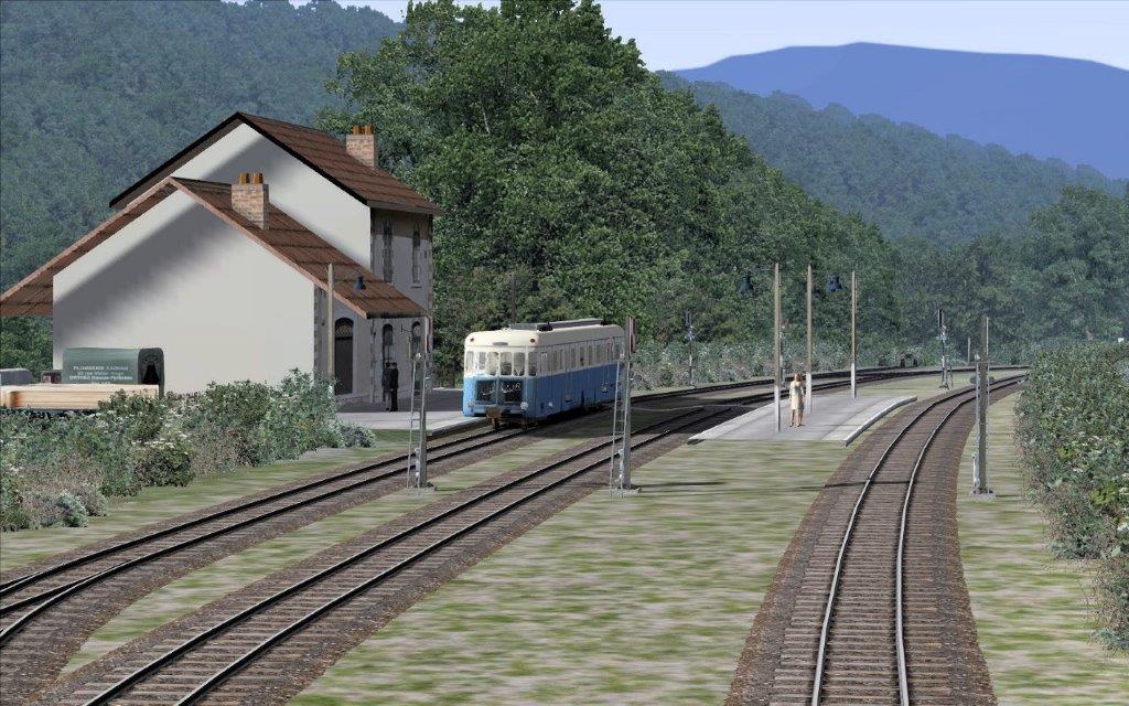
The station on the rail-simulator. [31]
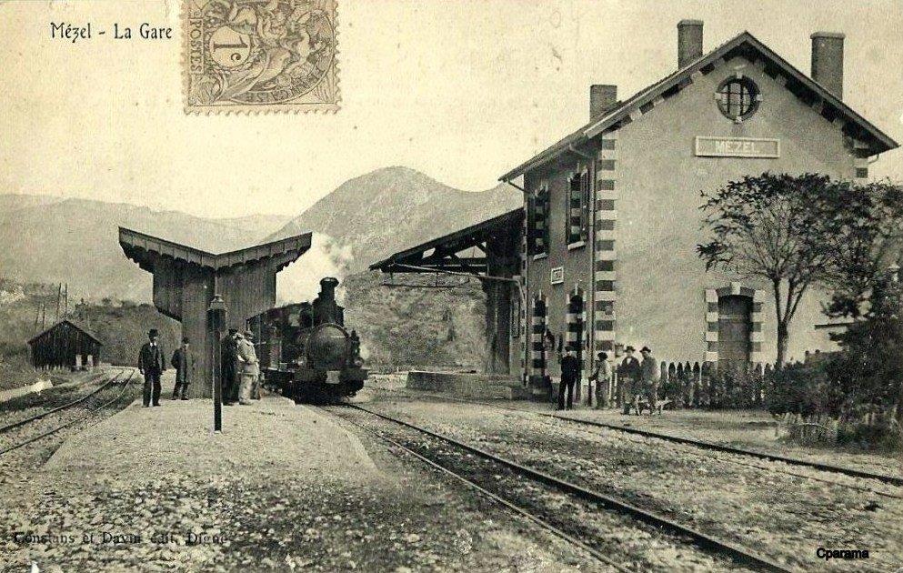
Mézel/Châteauredon Station in an old postcard. [30]
It is here at this station – Mézel/Châteauredon – that we take our next break.
References
- http://www.waymarking.com/waymarks/WMW8ER_La_gare_de_Barrme_Barrme_Paca_France, accessed on 17th August 2018.
- http://trip-suggest.com/france/provence-alpes-cote-d-azur/barreme, accessed on 17th August 2018.
- http://www.en-noir-et-blanc.com/barreme-p1-701.html, accessed on 17th August 2018.
- https://mapio.net/s/43790270, accessed on 17th August 2018.
- http://cccp.traindespignes.free.fr/gare-barreme.html, accessed on 17th August 2018.
- http://www.passion-metrique.net/forums/viewtopic.php?f=2&t=4143&start=765, accessed on 17th August 2018.
- http://www.verdon-info.net/2016/08/barreme-le-sequoia-le-plus-grand-de-paca.html, accessed on 17th August 2018.
- https://mapio.net/a/57410889/?lang=nl, accessed on 17th August 2018.
- https://www.delcampe.it/it/collections/item/373607900.html, accessed on 17th August 2018.
- https://www.facebook.com/289910237832039/photos/a.289916164498113/1051891281633927/?type=3&theater, accessed on 17th August 2018.
- https://dossiersinventaire.maregionsud.fr/gertrude-diffusion/dossier/gare-de-barreme/7ee076c7-a125-4622-b1a3-41f475e0f8ef/illustration/5, accessed on 17th August 2018.
- https://dossiersinventaire.maregionsud.fr/gertrude-diffusion/dossier/gare-de-barreme/7ee076c7-a125-4622-b1a3-41f475e0f8ef, accessed on 17th August 2018.
- http://dignois.fr/Barreme-vieux, accessed on 17th August 2018.
- https://dossiersinventaire.maregionsud.fr/gertrude-diffusion/dossier/ponts-des-chemins-de-fer-de-provence/6db00f0d-4794-4fb9-8d66-a7675e5c748b, accessed on 17th August 2018.
- http://www.rd-rail.fr/1-PHOTOS/PH43/index-ph43.html, accessed on 10th August 2018.
- http://aubertrain.com/modules.html, accessed on 17th August 2018. When the website was viewed in August 2018 the price of the completed model of the station buildings was 875 euros!
- http://www.tunnels-ferroviaires.org/tu04/04055.2.pdf, accessed on 18th August 2018.
- https://fr.wikipedia.org/wiki/Gare_de_Chaudon-Norante, accessed on 18th August 2018.
- https://www.google.co.uk/url?sa=i&source=images&cd=&ved=2ahUKEwiFqcumuvbcAhVQhRoKHbBrBnkQjhx6BAgBEAM&url=https%3A%2F%2Fwww.pinterest.co.uk%2Fbluebird_492000%2Flocomotives-%25C3%25A0-vapeur%2F&psig=AOvVaw0HSlDauOM5V4uBMFKql98x&ust=1534676352265699, accessed on 18th August 2018.
- https://www.facebook.com/photo.php?fbid=477991545741335&set=pcb.1058518700888525&type=3&theater, accessed on 18th August 2018.
- http://www.tunnels-ferroviaires.org/tu04/04055.1.pdf, accessed on 18th August 2018.
- https://dossiersinventaire.maregionsud.fr/gertrude-diffusion/recherche/globale?texte=couinier, accessed on 18th August 2018.
- https://fr.wikipedia.org/wiki/Gare_de_Chabri%C3%A8res, accessed on 18th August 2018.
- http://www.tunnels-ferroviaires.org/tu04/04074.1.pdf, accessed on 18th August 2018.
- https://structurae.net/structures/clue-de-chabrieres-tunnel, accessed on 18th August 2018.
- https://commons.wikimedia.org/wiki/File:Gare_de_M%C3%A9zel-Ch%C3%A2teauredon,_hangar_et_quai_%C3%A0_marchandises.JPG
- https://de.wikipedia.org/wiki/Ch%C3%A2teauredon
- https://mapio.net/a/56352403/?lang=sk
- http://gecp.asso.fr/mezel.html
- http://www.cparama.com/forum/mezel-t28158.html
- http://www.railsim-fr.com/forum/index.php?/topic/10163-le-train-des-pignes/&page=2, accessed on 20th August 2018.
- https://www.cparama.com/forum/entrages-t24780.html
