
Mezel and Châteauredon are two villages in the valley of l’Asse. Mézel is a small village, 15 km south of Digne-les-Bains. It’s a long, narrow village, with one long main street, the Rue Grande, set back from the D907 road that passes by on the East side of the village. Mezel is just under 1.5km south of the railway station. Châteauredon is also a small village. It is less than 1.5km to the Northeast of the railway station. The l’Asse flows to the Southeast of both villages.
Mezel/Châteauredon Station is roughly midway between the two villages and is sited between the ‘D907’ and the ‘D17’.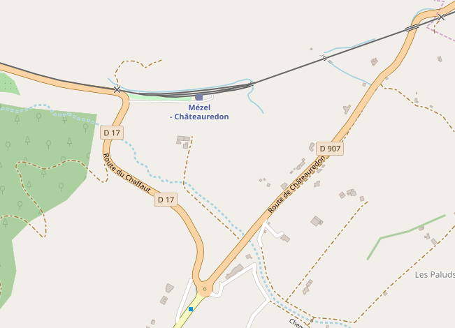
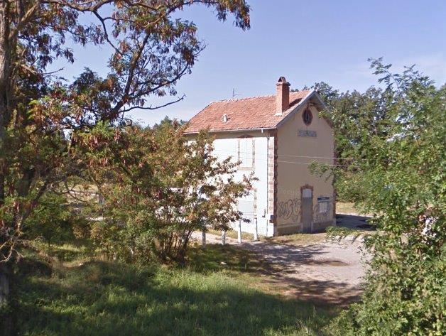
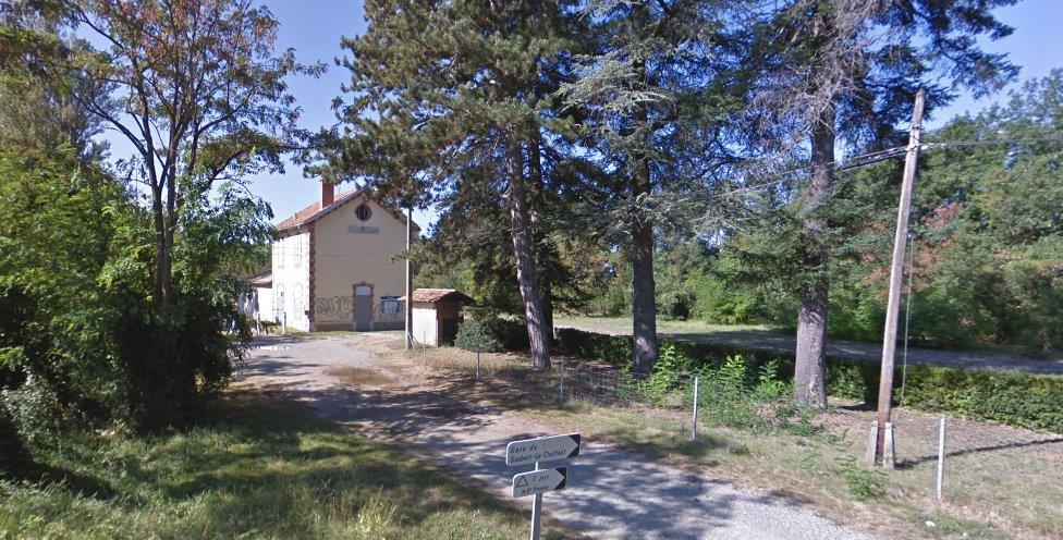
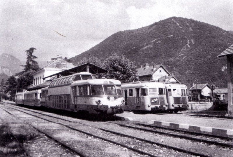
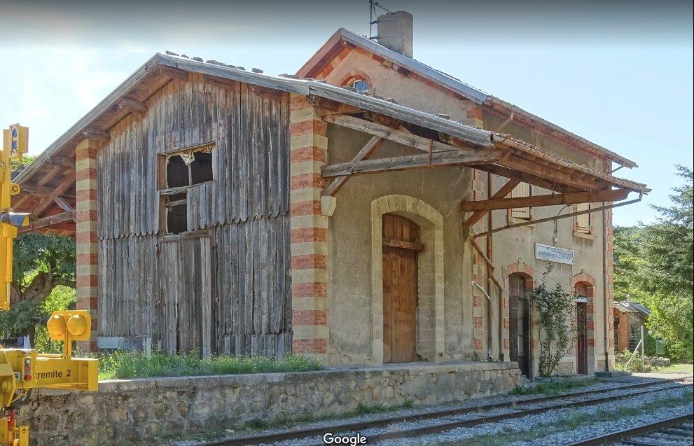 Mézel/Châteauredon Station, (c) Kjell Strandberg. [1]
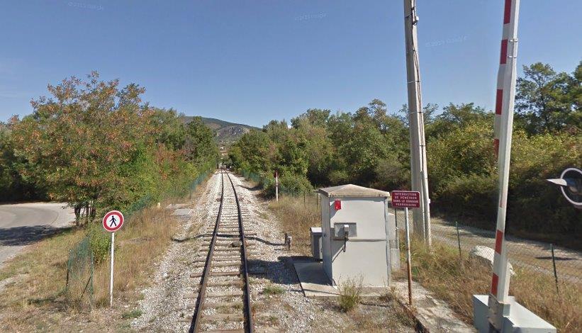
We set off from the station, initially in a westerly direction and the line runs on the north side of the ‘D17’ which can be seen to the left of the line in the first image below.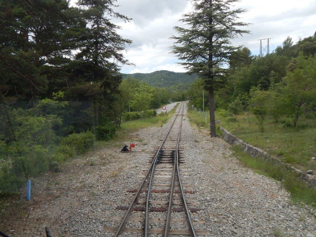 Just under a kilometre from the station, the ‘D17’ crosses the line by means of a level crossing.
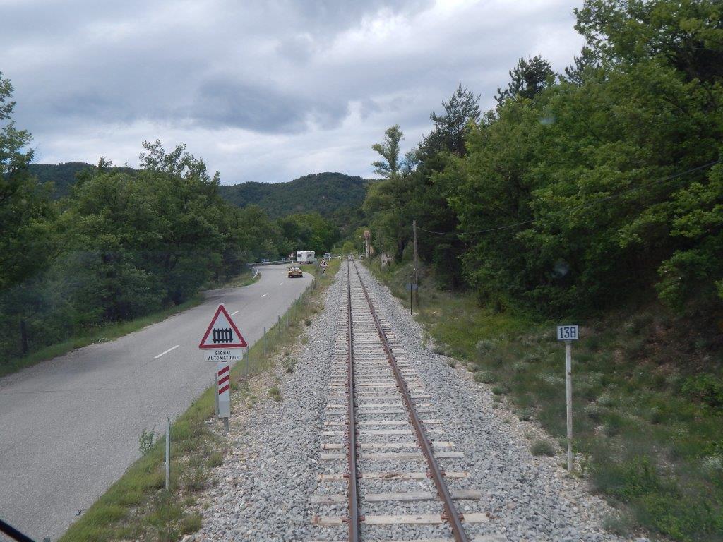
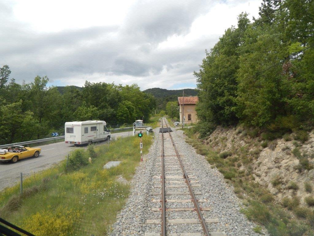 The two images above are taken from the cab of an autorail approaching the level crossing. [2]
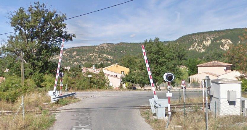
The two views below come from Google Streetview. The first is taken of the crossing looking northwest, the second is taken looking back to the Southeast.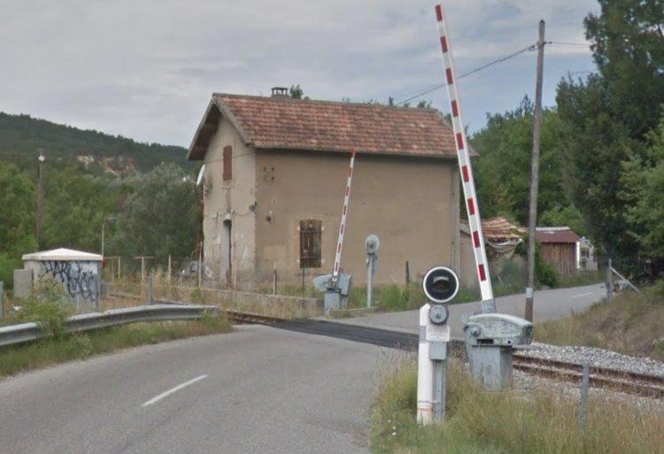
 The crossing keeper’s cottage remains!
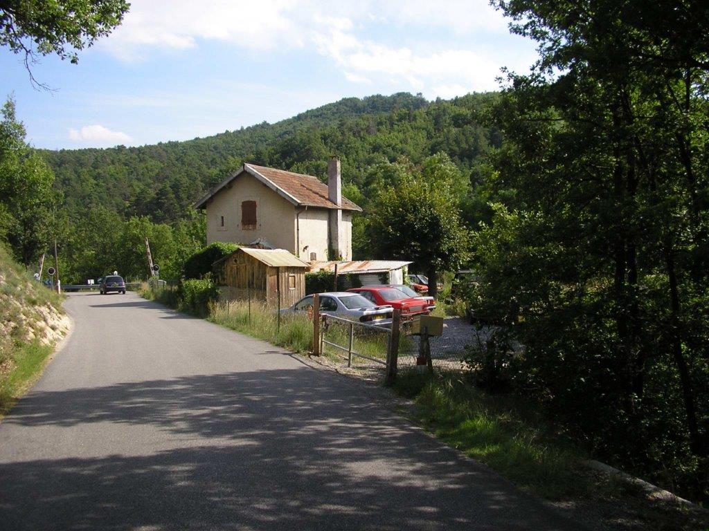
The road continues to follow the railway but now on its northeast side. They are immediately adjacent to one another once again by the time the railway reaches l’Arrêt des Lavandes.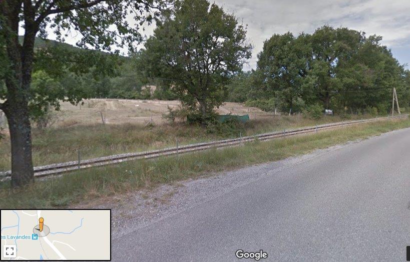
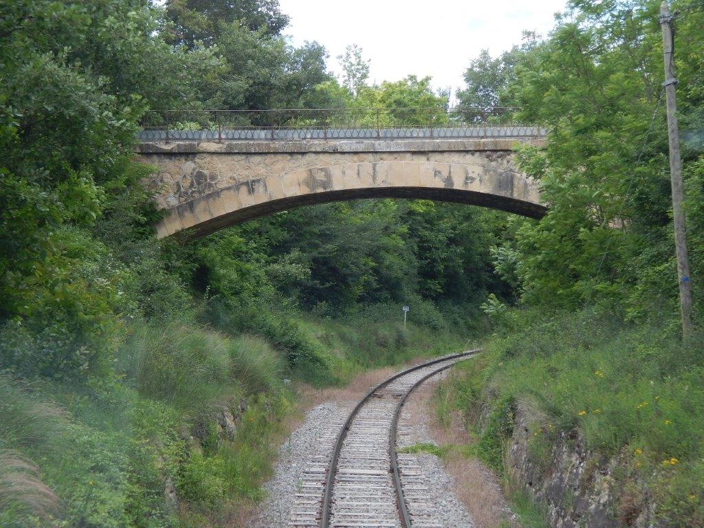
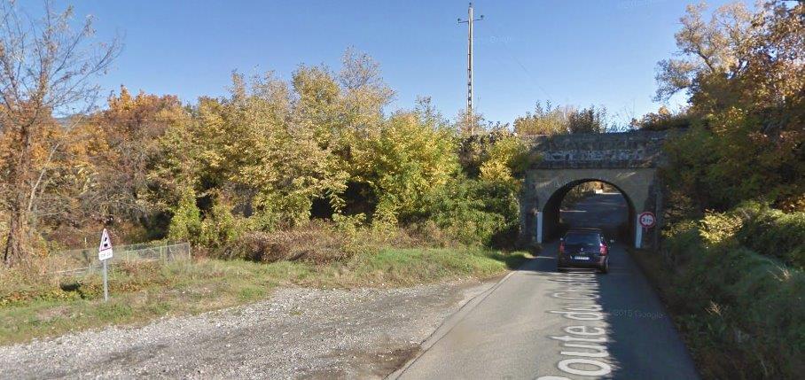
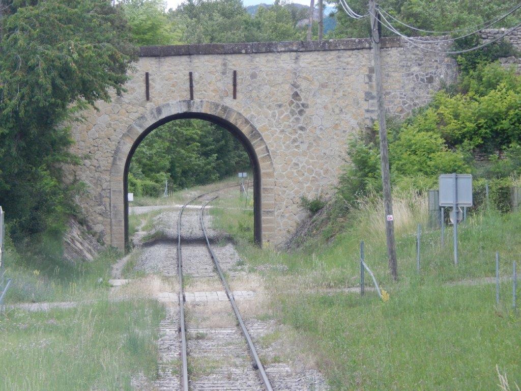
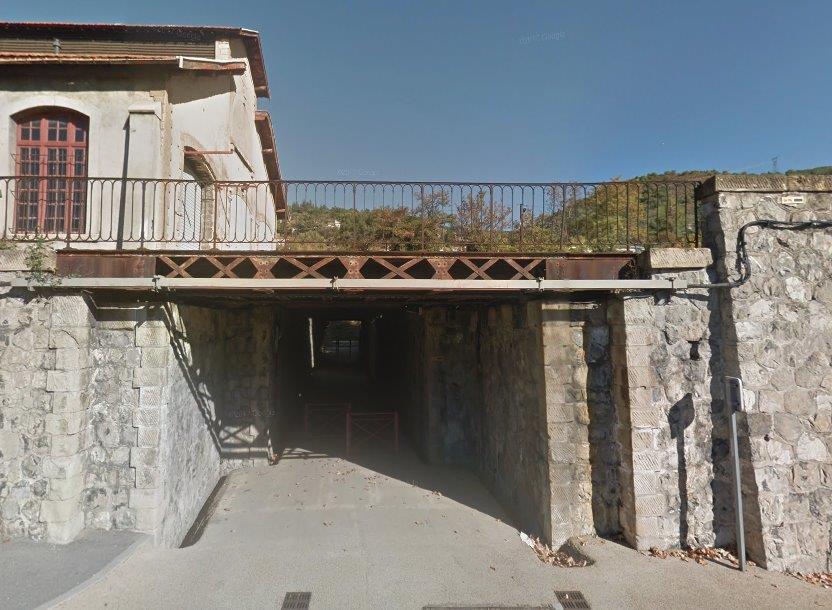
Road and rail remain close for a further kilometre or so before the road turns sharply under the railway through a low single lane bridge. Immediately after the bridge (below) the railway turns through 90 degrees from a northwesterly trajectory to a northeasterly alignment and gradually pulls away from the ‘D17’.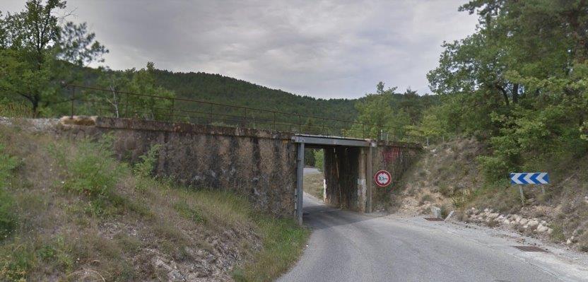
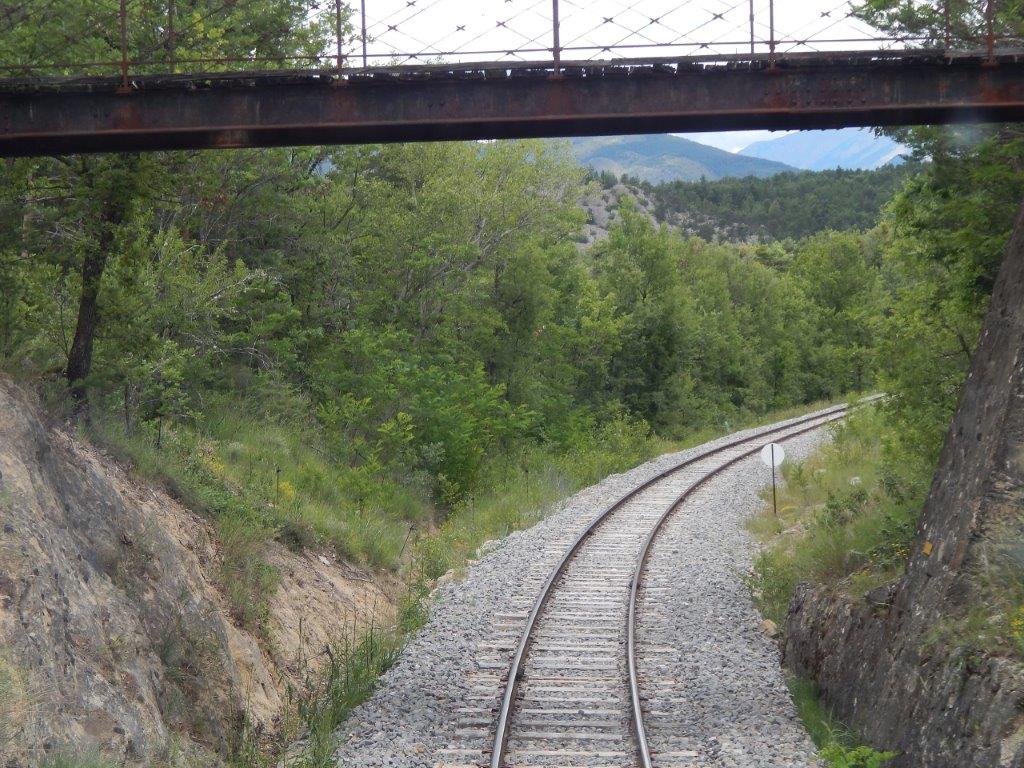 The railway curves away to the north. [2]
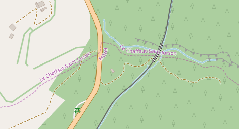 The next structure on the line is the bridge of Le Chaffaut de Saint-Jurson over the Torrent de Roche Chave as shown on the adjacent map and the staellite image below.
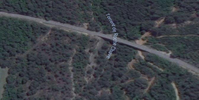
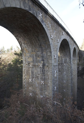 The bridge is a fine masonry arched viaduct, seen first from the upstream side. [3]
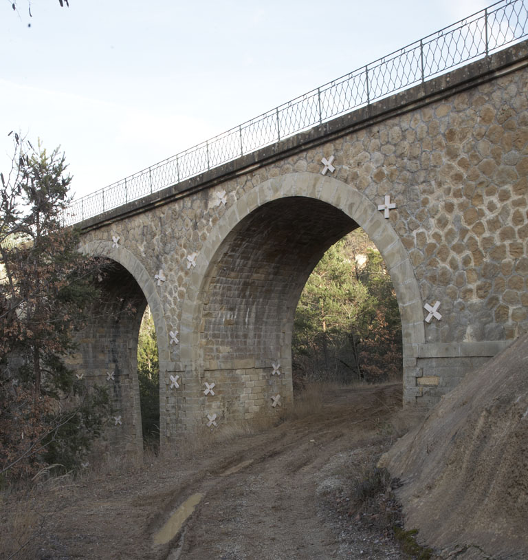 And then from the downstream side. [3]
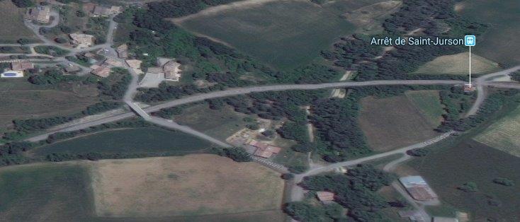
About a kilometre further north is the Arrêt de Saint-Jurson, immediately adjacent to a level crossing for the village road.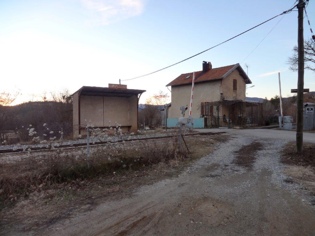 L’Arrêt de Saint-Jurson, immediately adjacent the level crossing and so very close to what was the crossing keepers cottage. [4]
After the Halt for Saint-Jurson, the railway curves gently round towards a Westerly direction, crossing the Torrent du Bat de l’Anesse and then passing under and accommodation bridge which carries part of the road called Les Hermittes over the line.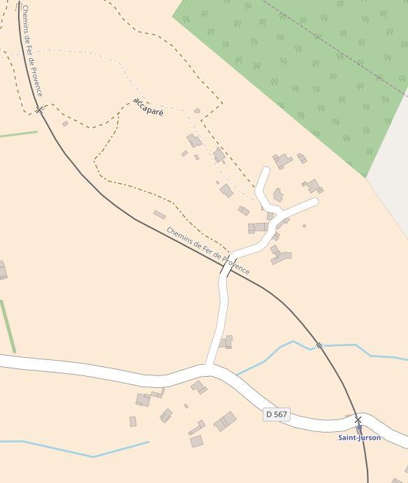
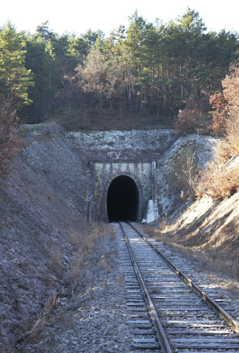
 After travelling under the overbridge, trains then sweep round to a more Northerly direction before entering the Tunnel des Hermittes. The tunnel is 300 metres long and sits about 580 metres above sea-level. Once again the tunnel is marked on the plan below with red, blue and green dots. [5]
 The southern portal. [6]
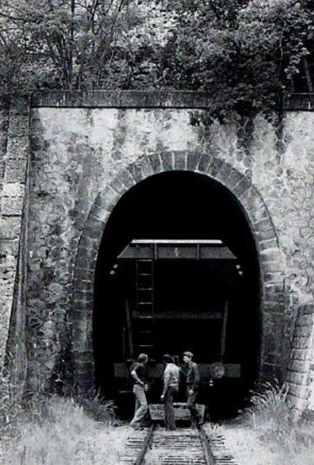
 Two images (above) of the northeastern portal. [5][6]
After leaving the northeastern portal of the Tunnel des Hermittes, trains crossed the Ravin de Saint-Pierre and entered the small halt which serves the Golf Course at Digne-les-Bains. 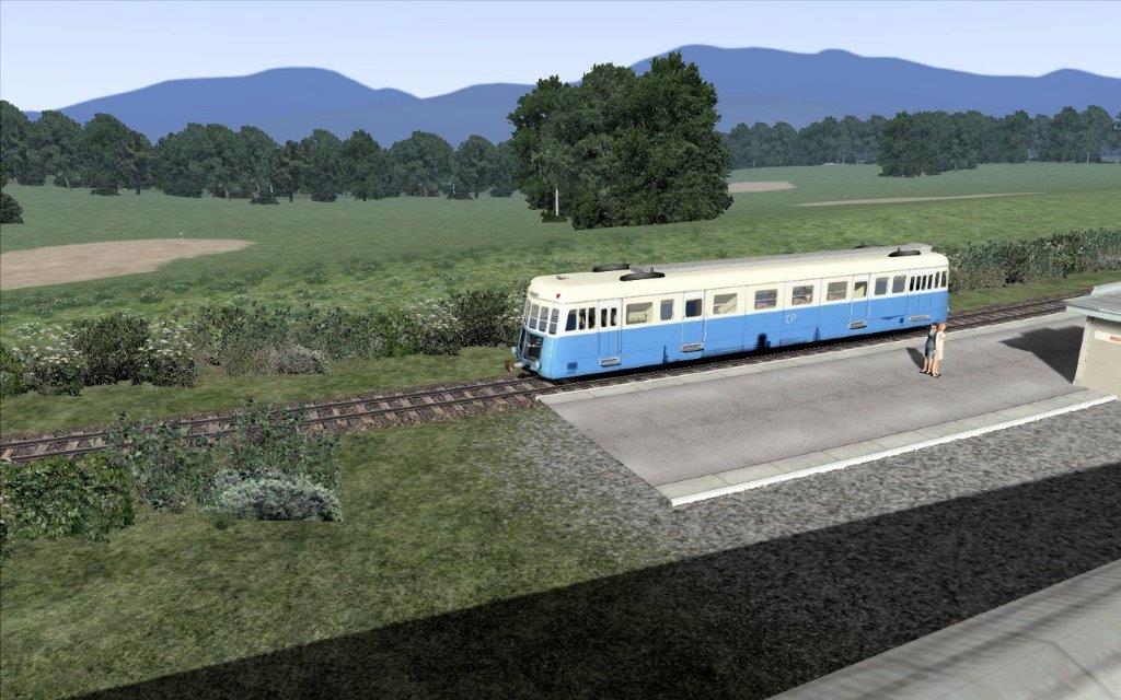 L’Arret on the rail-simulator. [7] I have not been able to find any photographs of the halt.
North of the Golf Course, the line begins to run alongside the Route de Chaffaut and then enters another Station – La Gare de Gaubert-Le Chaffaut.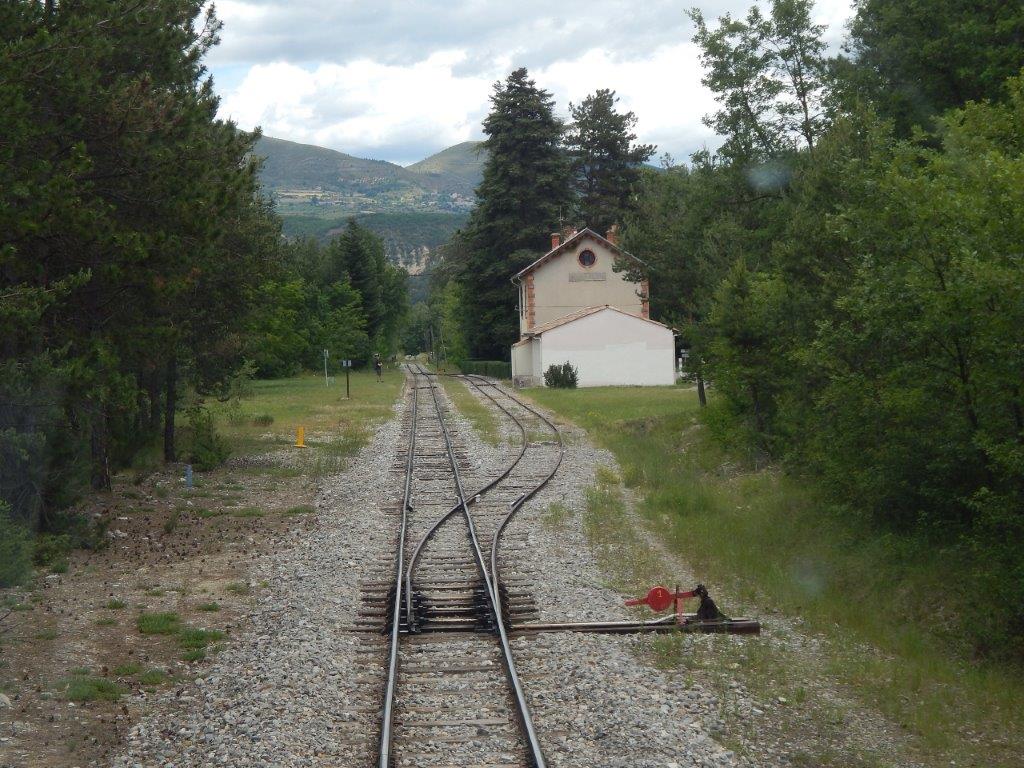
 A driver’s eye view (above) approaching the Gare de Gaubert-Le Chaffaut from Nice. [2]
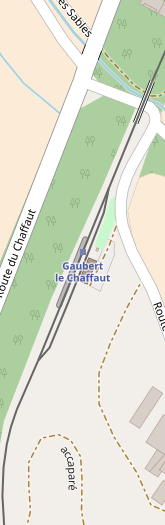
The adjacent map shows the station site and the viaduct to the north.
The first image below is taken from the narrow lane to the East of the station.
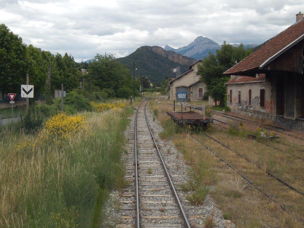
The next two are taken from the same lane, the first just north of the station building the next a little further to the north of the station buildings.
The fourth image below is a rail-simulator image of the station.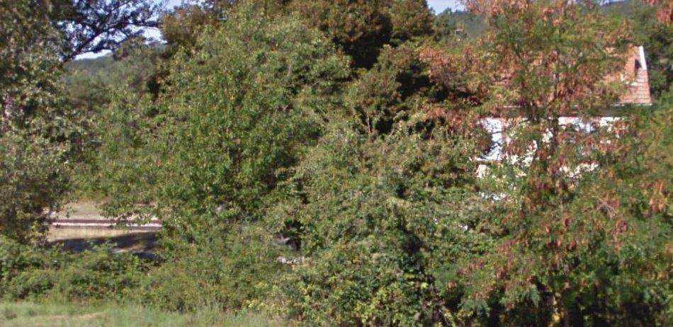
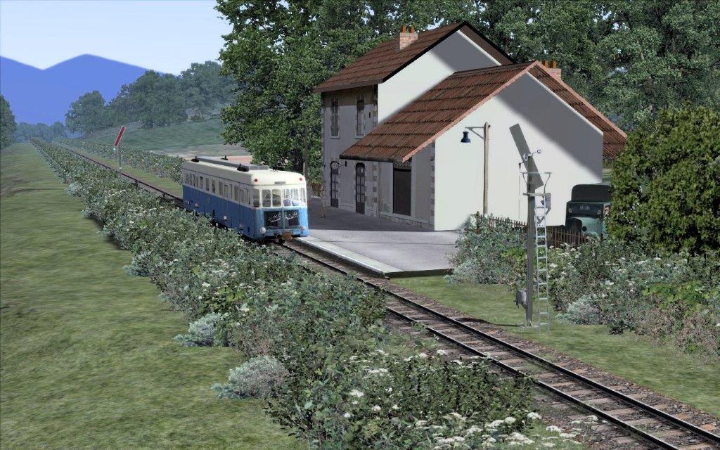 A rail-simulator image of la Gare de Gaubert-Le Chaffaut. [7]
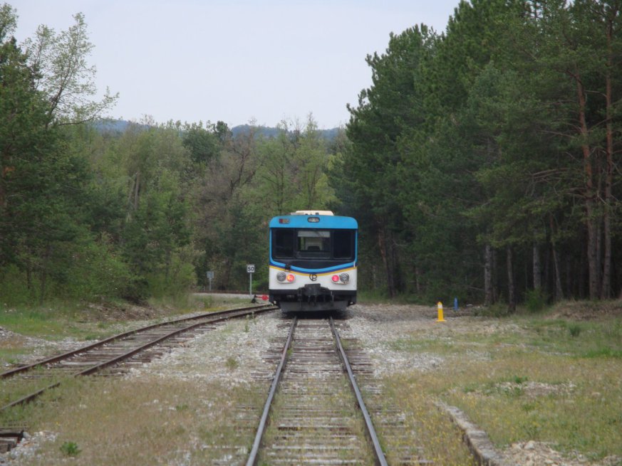 Looking toward Nice with an Autorail leaving the station. [8]
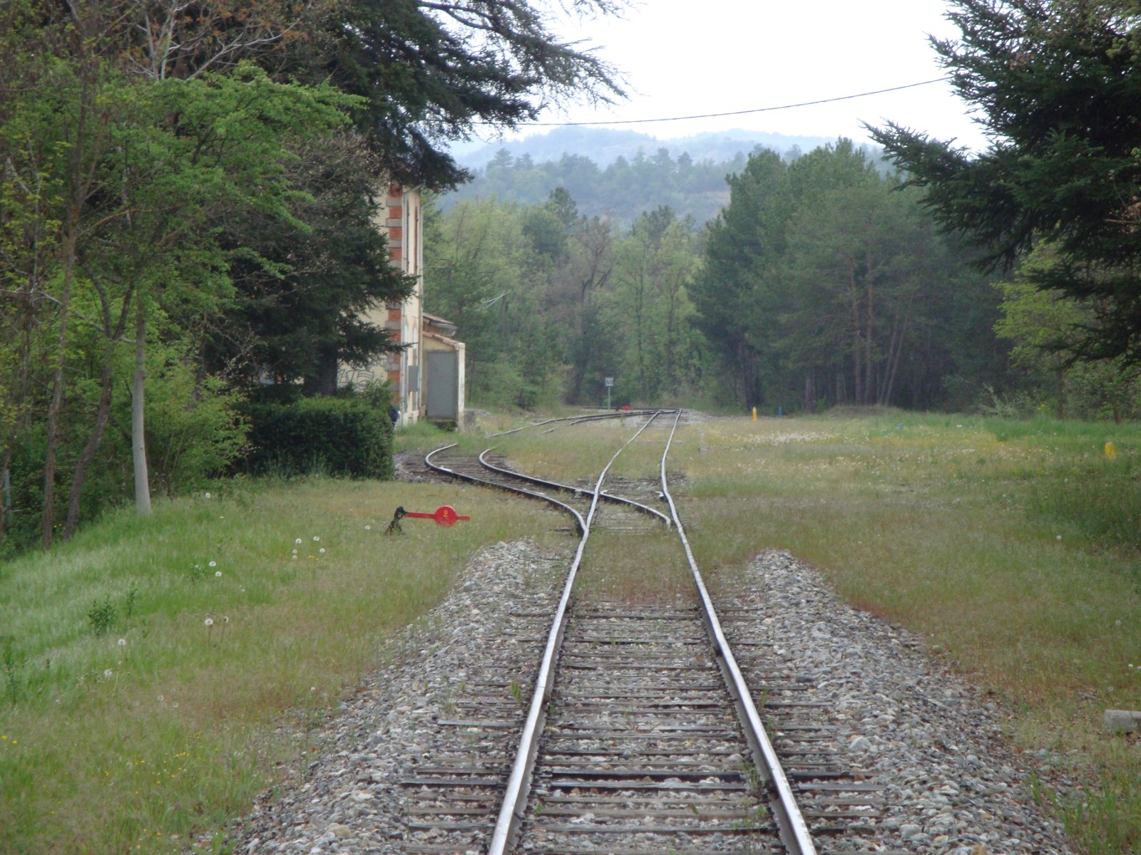 Looking back through the station site after the train sets off for Digne. [8]
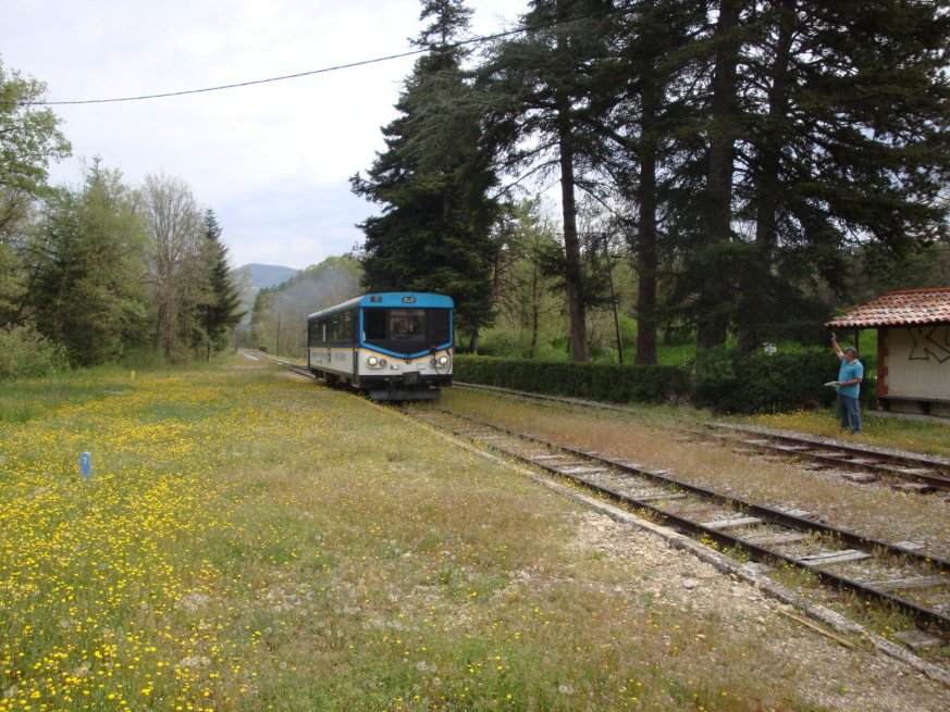 An Autorail arrives from Digne. [8]
Immediately after leaving the station heading for Digne trains pass over a small viaduct which takes the line across a single lane road and the Ravin des Beaumes.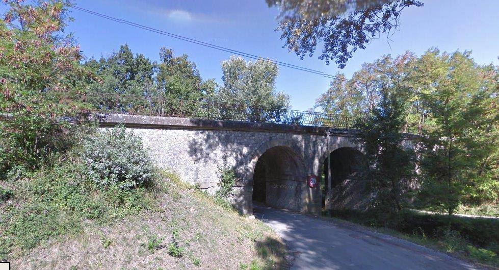 The Viaduct over the Ravin des Beaumes, viewed from the East.
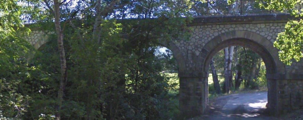 The Viaduct over the Ravin des Beaumes, viewed from the West.
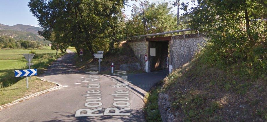 On the D12 looking Northeast, the line crosses the road on a low-headroom bridge.
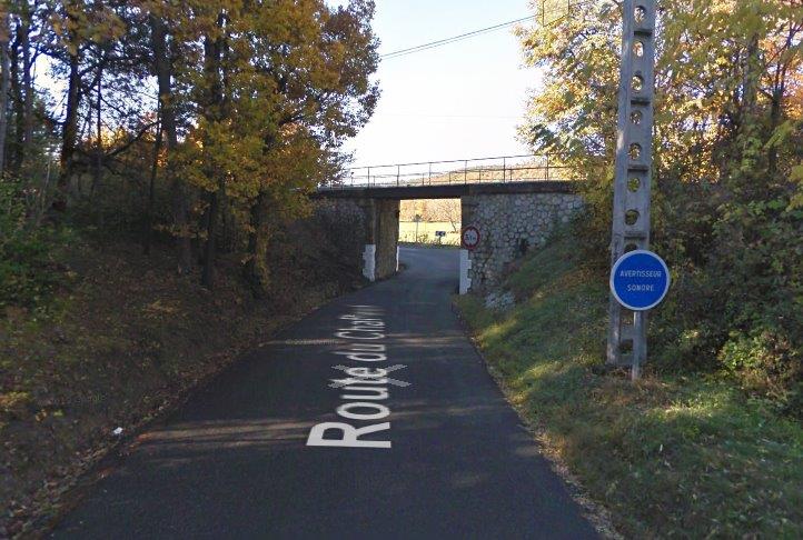 Looking back along the D12 to the railway over-bridge.
A little further along the line it encounters an aqueduct. As can be seen below the aqueduct is dry at the surface.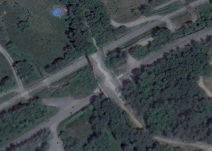 The first image below show an accommodation road-crossing on the left of the satellite image above, which is immediately followed by two views of the aqueduct. One showing its bridge of the D12 and the other over the railway. The last of the four images immediately below shows the line beyond the aqueduct and is taken from the D12.
 A driver’s eye view of the Aqueduc de Gaubert. [2]
The next point of reference on the line is the level-crossing at Route du Plan de Gaubert. The fist image below looks back along the line towards Mezel, the second looks forward to Digne, and the third shows the level-crossing viewed from the East.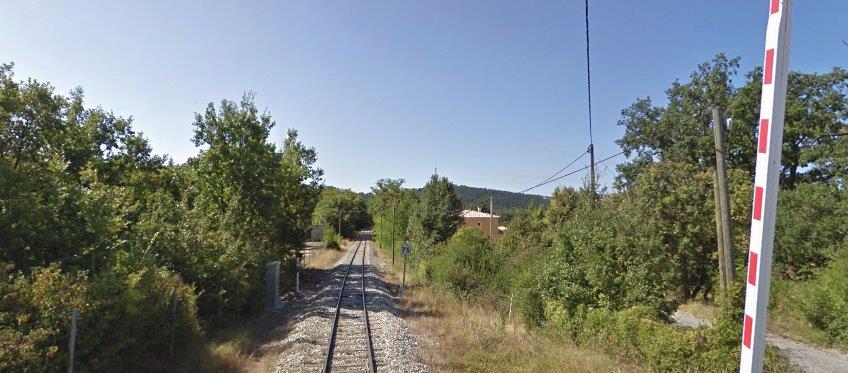
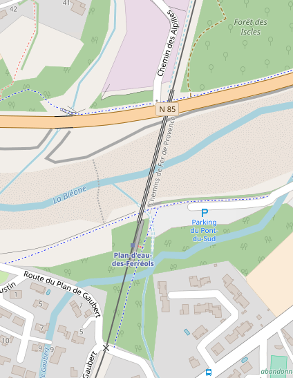 The level-crossing appears at the bottom of the adjacent map.
There is another halt just to the south of the river – L’Arret du Plan d’eau des Ferreols and then the line crosses La Bleone and the N85 on its way into Digne-les-Bains.
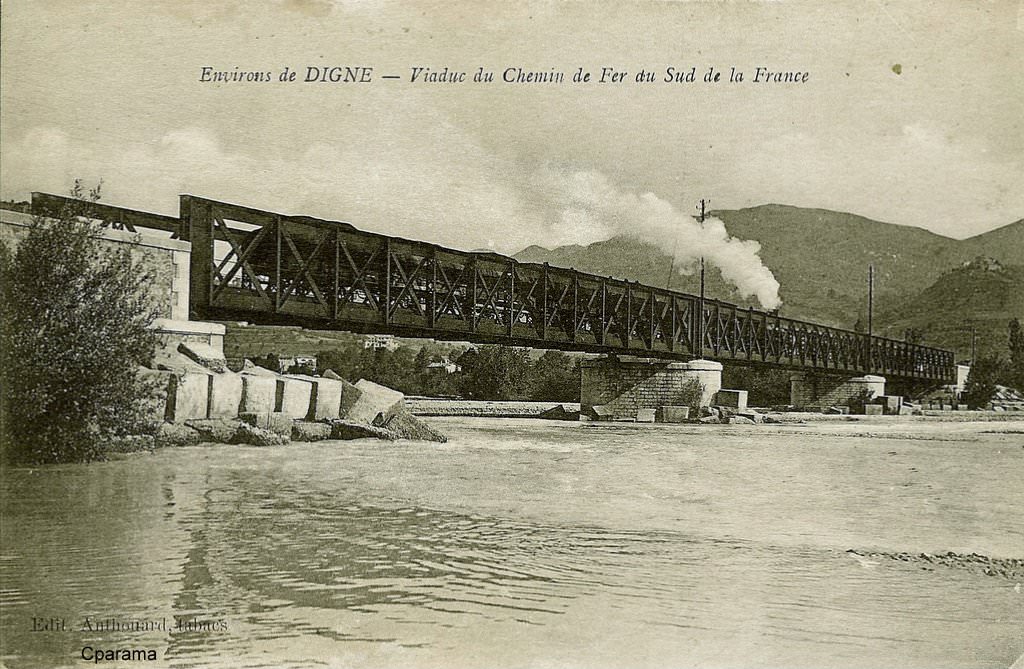 An early postcard image showing the bridge over La Bleone. [10]
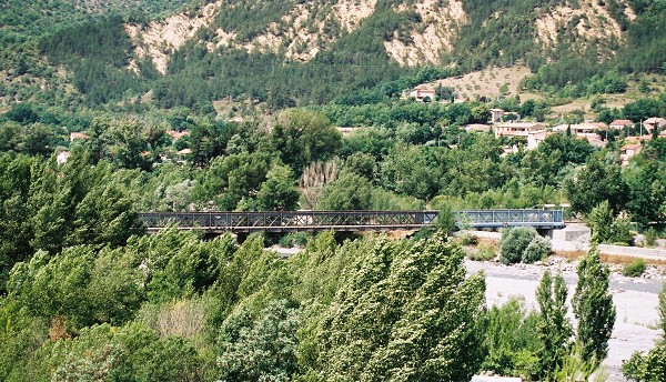 Railway bridge over La Bleone and the N85 with the span over the road appearing to be much newer than the spans over the river! [9]
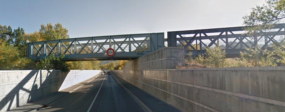 The railway bridge over the river and N85 viewed from the West on the N85.
 A plan of the whole station site.
 The level crossing on Route Napoléon, Avenue de Verdon.
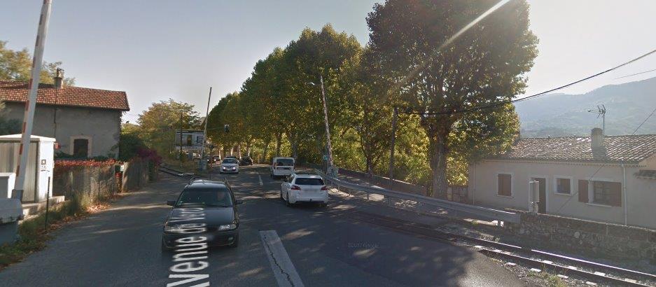 The level crossing on Route Napoléon, Avenue de Verdon.
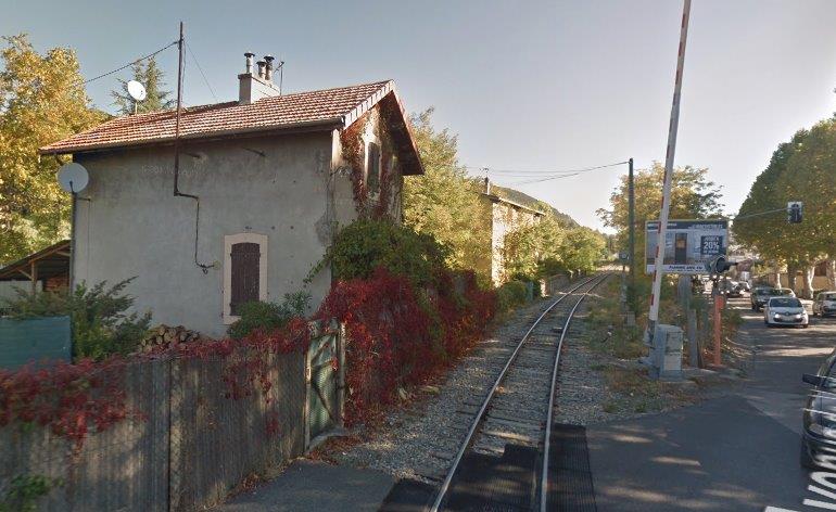 The crossing keeper’s cottage, looking towards the terminus at Digne.
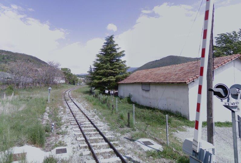 Looking ahead towards Digne Station from the level-crossing on Chemin du Hameau des Hautes Sieyès.
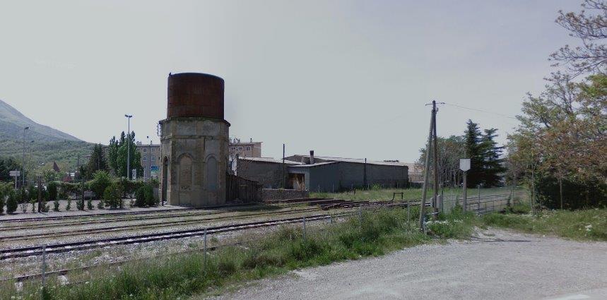 The water tower at the mouth of the station yard in Digne – the railway stations are off to the left by a few hundred yards. Then picture is taken from the north side of the tracks.
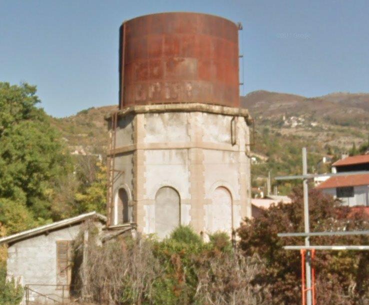 A view of the same water tower from the south.
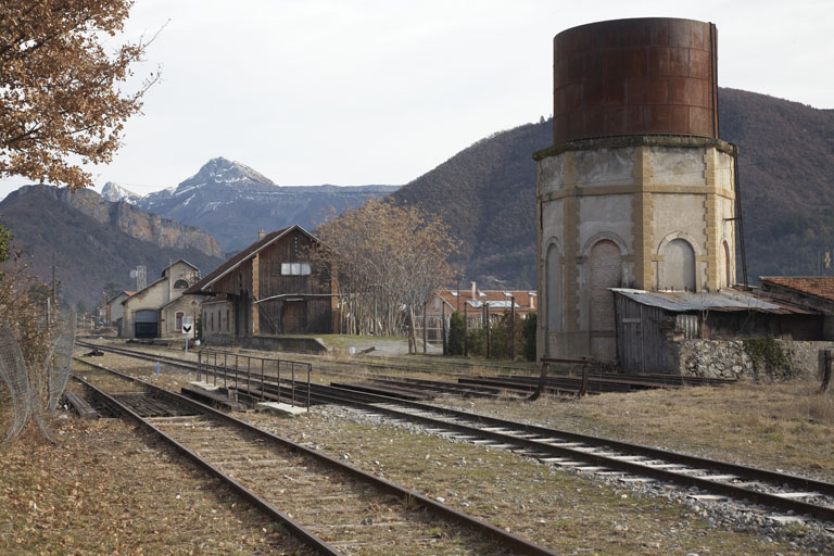 A line side view of the water tower and the station yard beyond. [15]
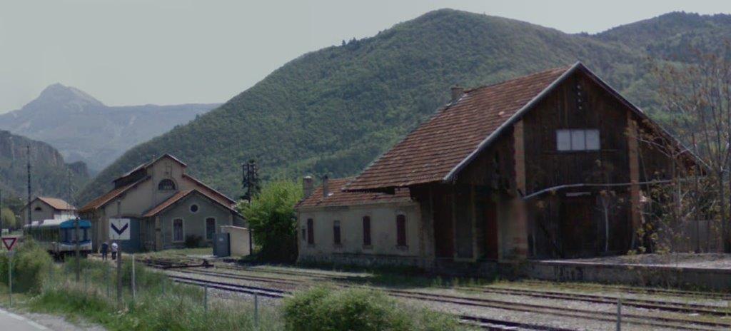
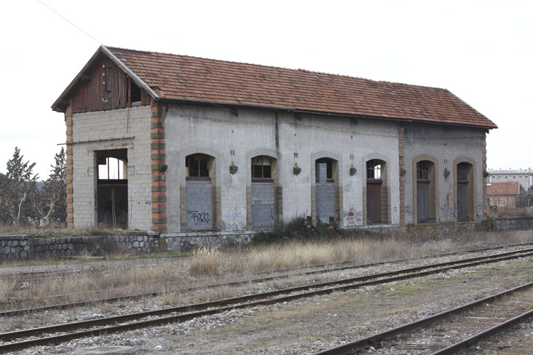
 Two images of the goods shed, the second is from the cab of an Autorail. [2]
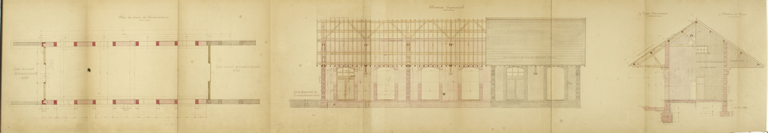 A drawing of the good shed. [15]
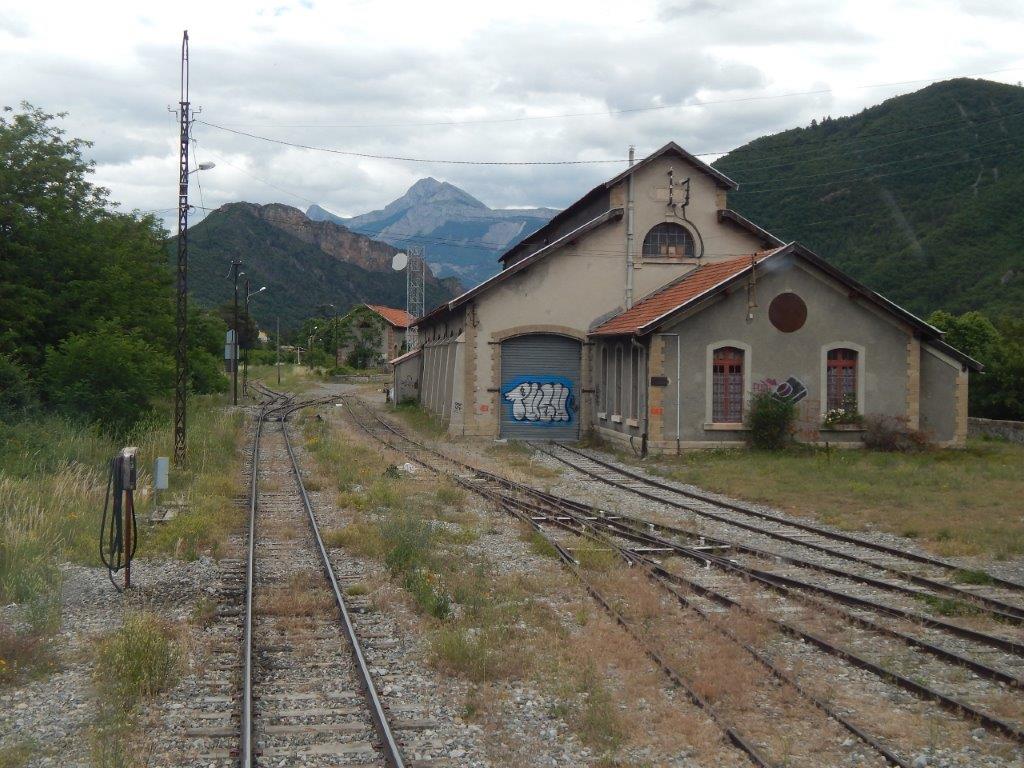 The Engine Shed seen from the cab of an Autorail travelling towards the passenger station buildings. [2]
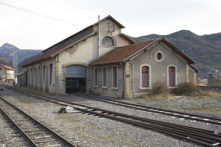 A line side view of the Engine shed looking East towards the passenger facilities at the station. [15]
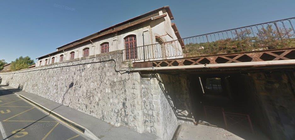 The Engine Shed from the south side of the station complex.
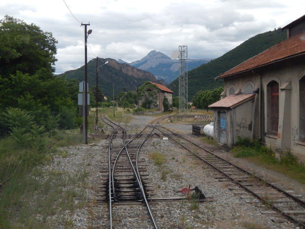 A driver’s eye view of the line from the engine shed looking east towards the station platforms. [2]
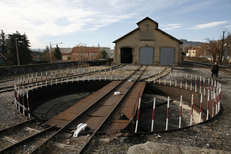 The turntable and Engine shed looking West. [15]
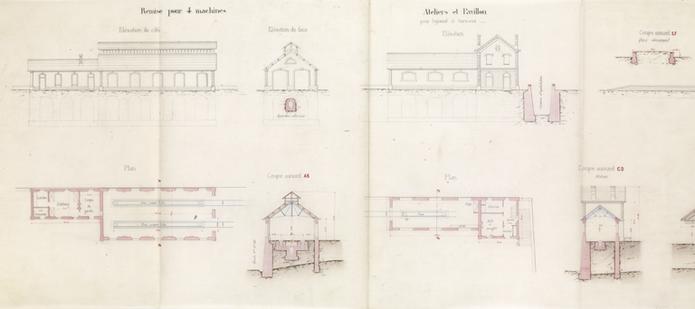
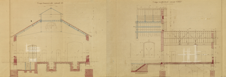 Two drawings (above) of the Engine Shed. [15]
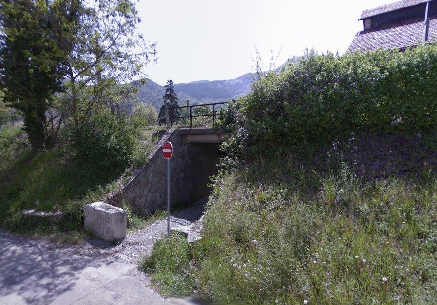
 Two images (above) of the pedestrian underpass just to the east of the Engine Shed. The first shows the north entrance and the second, the with entrance.
 Looking ahead from the cab of an Autorail. This gives a good idea of the length of the station site. The passenger facilities seem to be a very long way distant. [2]
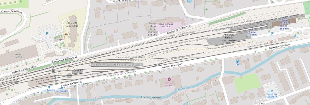 A larger scale map of the station complex.
 The transfer building and platform set aside for the transshipment of goods from the metre-gauge line from Nice to the standard-gauge branch which fed Digne from the mainline to the West. [15]
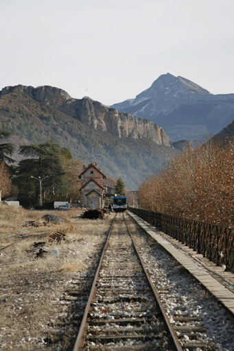 The original passenger station building for the metre-gauge line. [15]
 The station courtyard looking East, with the metre-gauge station building to the right and the original standard gauge facilities on the left. [15]
 Modern traction stabled on the line to the old station building. [13]
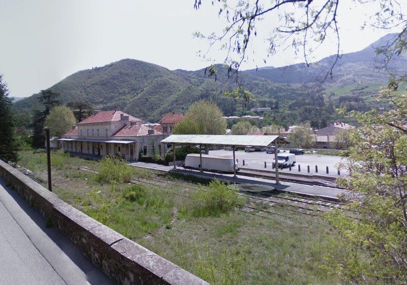 A view across the passenger facilities of the station complex taken from the northwest.
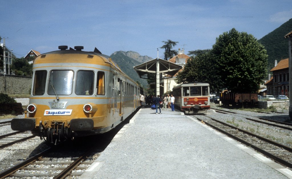 A view of the shared station platform at Digne in the 1980s. [12]
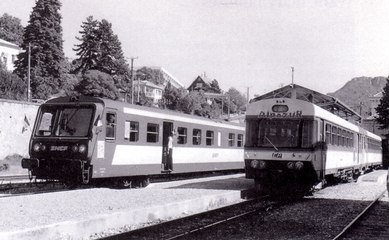
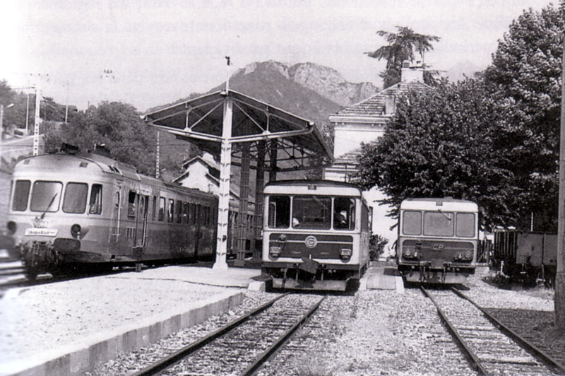
 Three images (above) in monochrome showing the shared passenger facilities at Digne. [16]
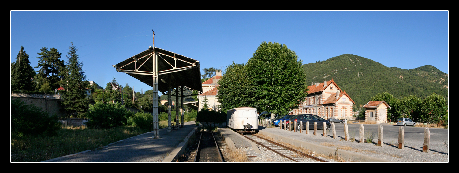 A later image of the station after the removal of the standard-gauge lines. [13]
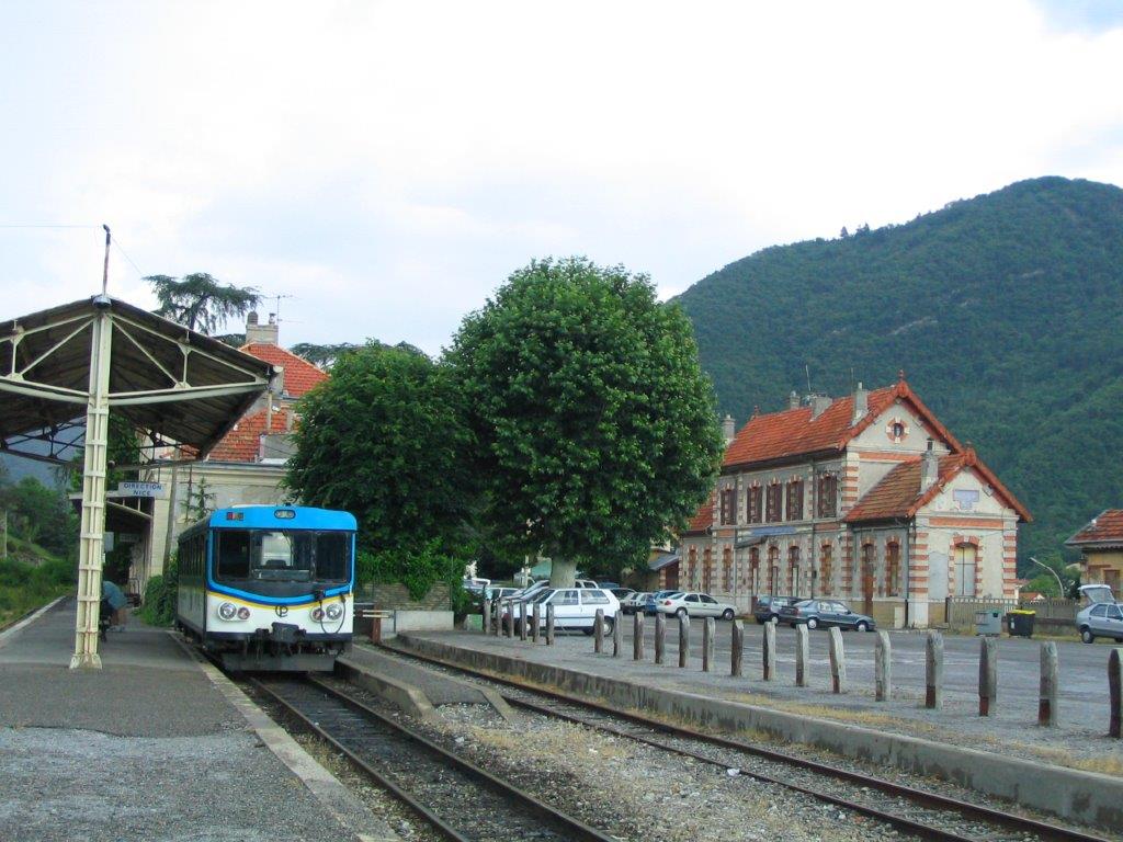 A closer view showing the platform in use in the early 21st Century and the old station building for the Nice to Digne line. [13]
 The early 21st Century station! [13]
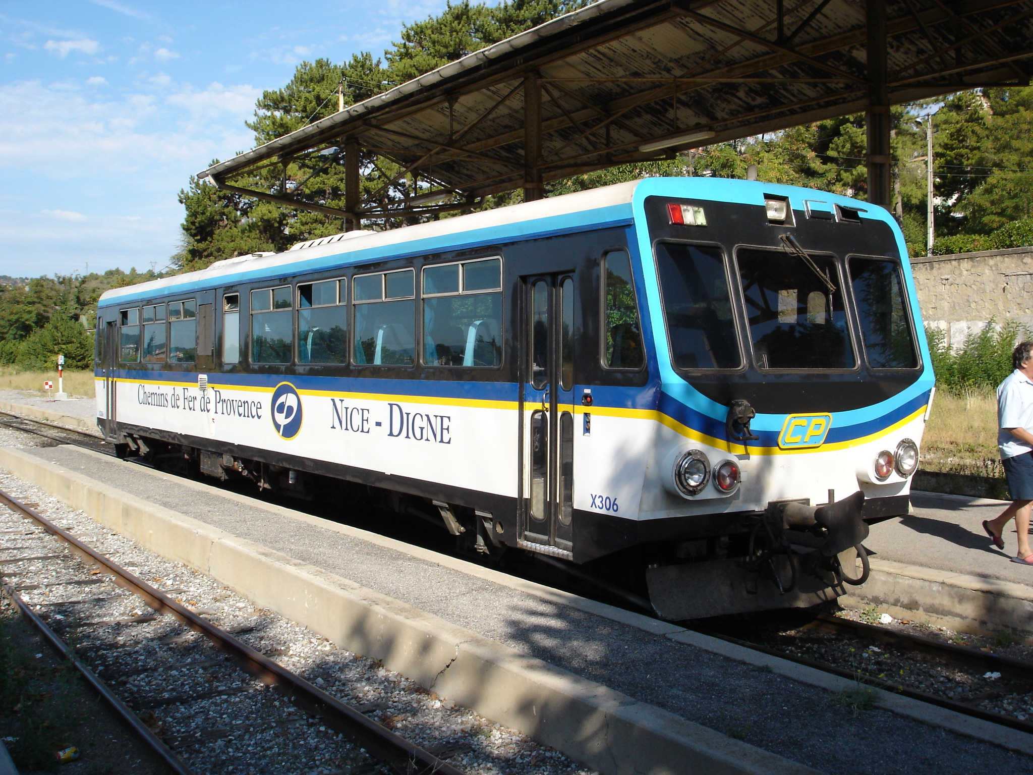 The early 21st Century station. [13]
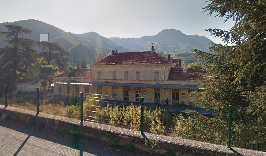
 Images of the standard gauge station from the North side of the complex.
 A closer view of the station forecourt highlighting the proximity of the two station buildings and their different architecture.
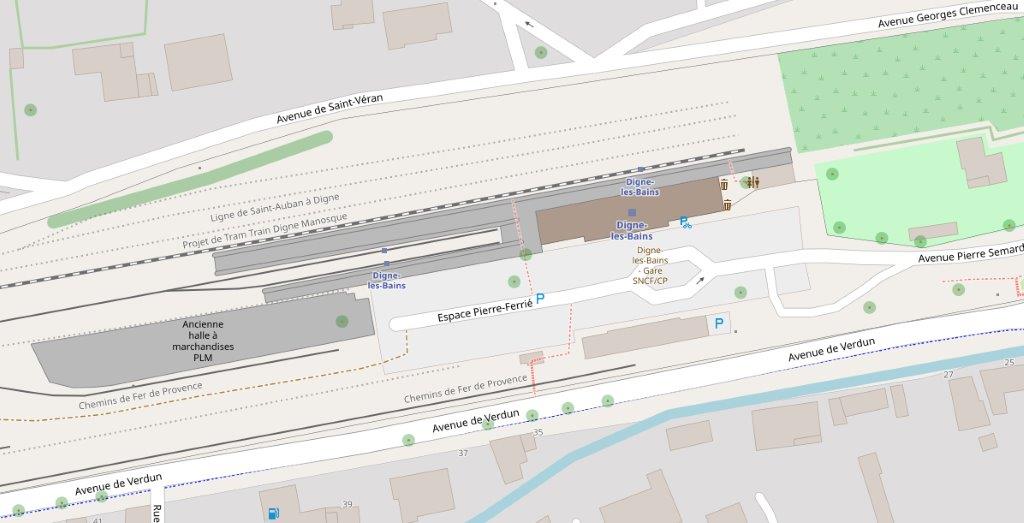 The immediate station plan in the early 21st Century.
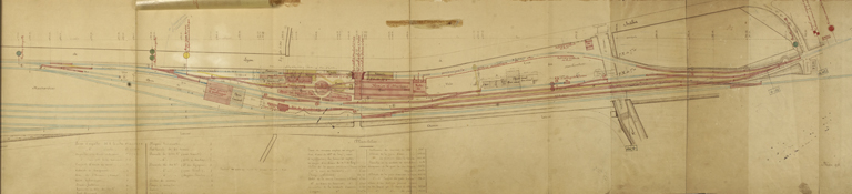
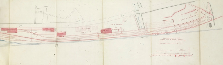
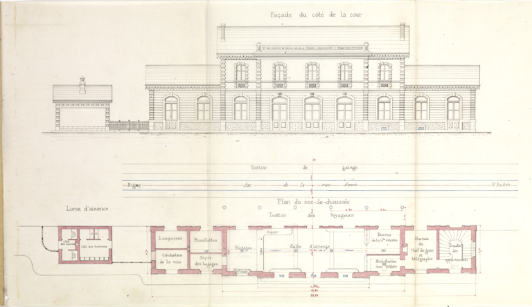
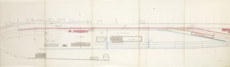 These three images (above) show different iterations in the planning of the station with the bottom image best reflecting what was built on the site. [15] In the 20th Century the facilities for the metre-gauge line were altered to provide a shared platform with the standard-gauge branch.
On the south side of the site the land drops away from the station and in order to maximise the space on the site a significant retaining wall had to be built on the south boundary of the site.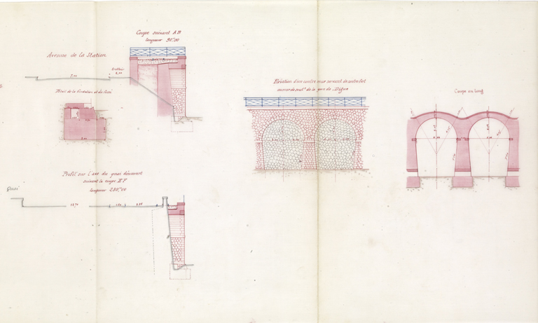 One plan showing the construction of the retaining wall. [11]
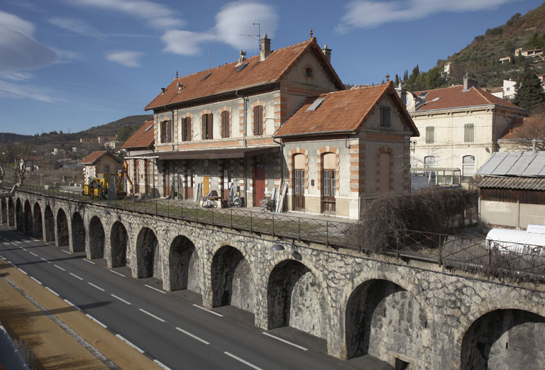 An impressive shot of the Nice-Digne Line Station building and the retaining wall supporting it above the Avenue de Verdun. [13]
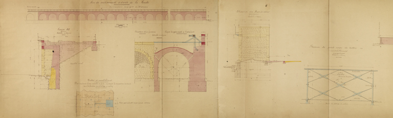 A further diagram of the retaining wall. [15]
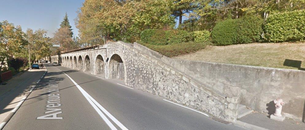
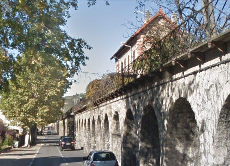 The retaining wall in the early 21st Century, two views (above) taken from Google Streetview.
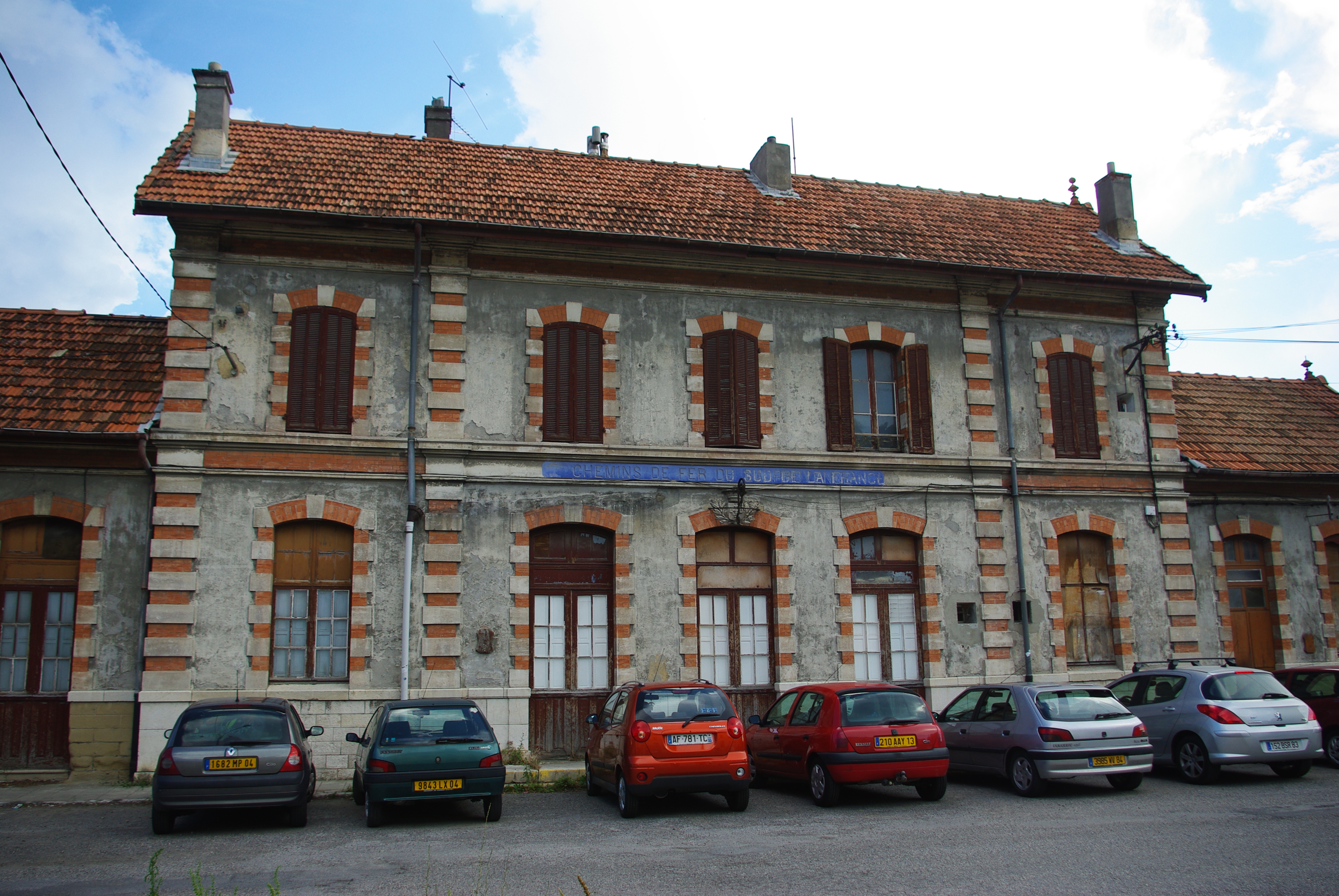 The Chemins de Fer de Provence Station Hall. [13]
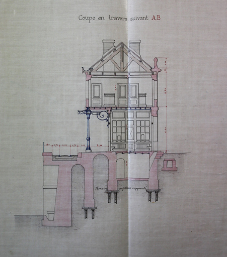
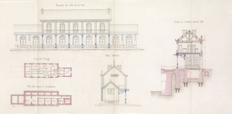 Three drawings of the Chemins de Fer de Provence Station Building. [15]
Two videos are included below which give a good idea of the condition of the station site. [14]
To finish this blog post I will include some postcard images of the station site from earlier year and then reflect a little on what might be happening in the future.
First the postcards from the CPArama website …..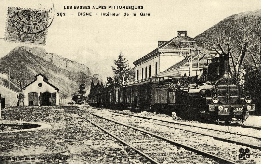 The standard-gauge PLM station and engine shed. [10]
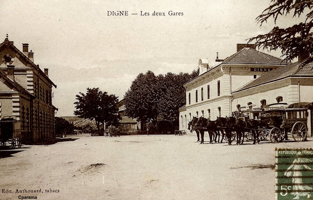 The station courtyard. [10]
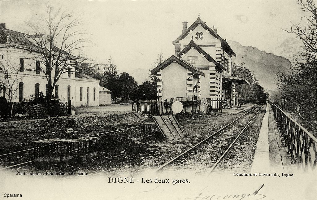 The two stations taken from the top of the retaining wall at the south side of the site. [10]
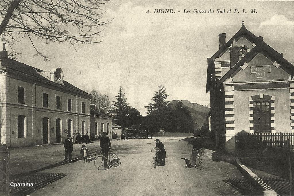 The station courtyard from the West. [10]
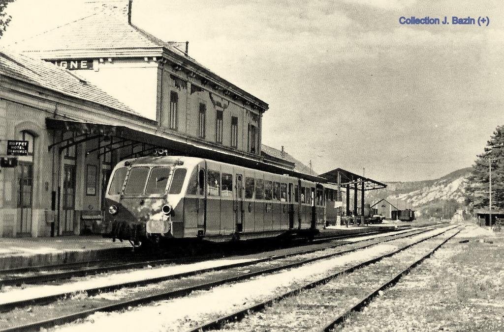 The PLM station looking West. [10]
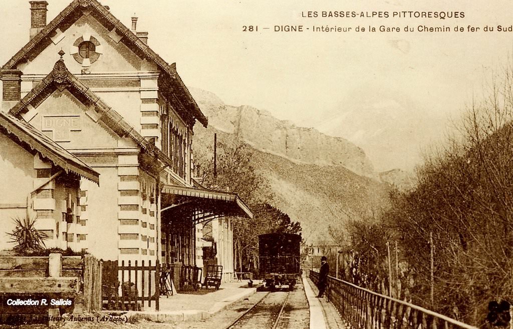 The Chemins de Fer de Provence Station Building. [10]
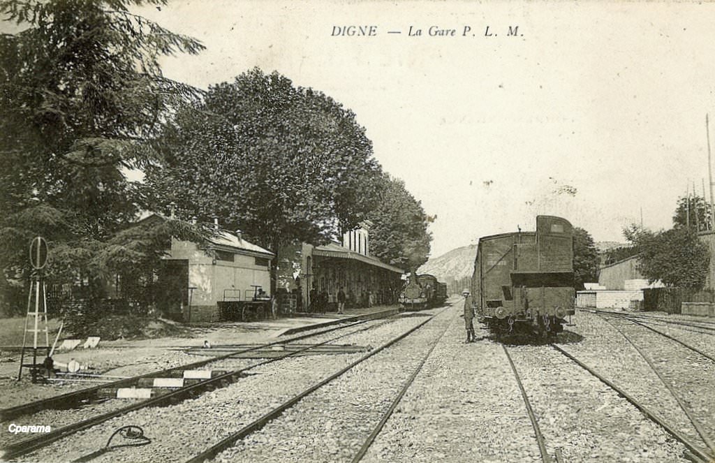 The PLM Station taken from alongside the standard-gauge Engine Shed. [10]
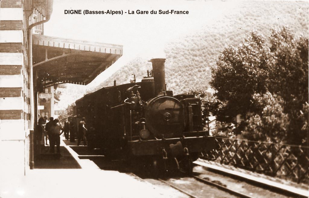 An early steam-hauled service is about to set off on the journey towards Nice. [10]
And finally, what about the future. ….
Traffic on the metre-gauge line is hampered by that fact that the standard-gauge connection to Digne has been cut. Christopher James has mentioned that there has been talk of a possible metre-gauge line extension to meet the SNCF mainline at Château-Arnoux Saint-Auban, however, this is probably beyond the resources of the Chemins de Fer de Provence.
In looking for plans of the Station Site at Digne les Bains, I noticed reference to a ‘Project de Tram Train Digne Manosque’. It can bee seen on the Openstreetmap plan below and is shown as a dotted line which runs from Digne (immediately below) to Château-Arnoux Saint-Auban.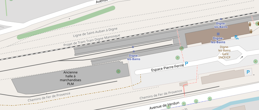
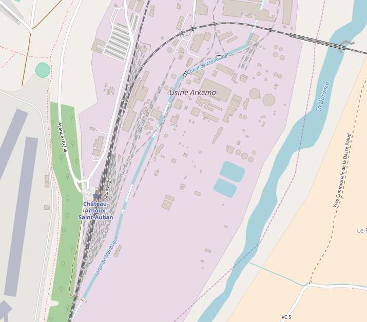 The project is intended to use the old standard-gauge formation and its line into Château-Arnoux Saint-Auban is shown above. The project now has a website: http://transport-provence-alpes.centerblog.net/12-projet-multimodal-digne-sisteron-manosque. Is the scheme feasible? There are some questions about this which appear in the comments on the website.
How likely is this scheme, does anyone know?
References
- https://www.google.co.uk/maps/place/M%C3%A9zel%2FCh%C3%A2teauredon/@44.010038,6.201066,3a,75y,90t/data=!3m8!1e2!3m6!1sAF1QipMAOPyxuAbfSVVUTAyfZOew2a0G07LK1iGfYxyI!2e10!3e12!6shttps:%2F%2Flh5.googleusercontent.com%2Fp%2FAF1QipMAOPyxuAbfSVVUTAyfZOew2a0G07LK1iGfYxyI%3Dw129-h86-k-no!7i1500!8i1000!4m5!3m4!1s0x12cb91840c767ed3:0xa02521aa30f35bdd!8m2!3d44.0097448!4d6.2007228, accessed on 19th August 2018.
- http://www.rd-rail.fr/1-PHOTOS/PH43/index-ph43.html, accessed on 12th August 2018.
- https://dossiersinventaire.maregionsud.fr/gertrude-diffusion/dossier/ponts-des-chemins-de-fer-de-provence/6db00f0d-4794-4fb9-8d66-a7675e5c748b, accessed on 12th August 2018.
- https://fr.wikipedia.org/wiki/Le_Chaffaut-Saint-Jurson, accessed on 20th August 2018.
- http://www.tunnels-ferroviaires.org/tu04/04070.2.pdf, accessed on 20th August 2018.
- https://dossiersinventaire.maregionsud.fr//gertrude-diffusion/dossier/tunnel-ferroviaire-des-hermittes/77ea863f-d328-4776-b1ec-90bb186ff2aa/illustration/0, accessed on 20th August 2018.
- http://www.railsim-fr.com/forum/index.php?/topic/10163-le-train-des-pignes/&page=2, accessed on 15th August 2018.
- https://leonardetsesamis.com/1er-mai-2010-a-la-gare-de-gaubert-le-chaffaut, accessed on 20th August 2018.
- https://structurae.net/structures/digne-railroad-bridge, accessed on 21st August 2018.
- https://www.cparama.com/forum/digne-les-bains-t8.html, accessed on 21st August 2018.
- https://dossiersinventaire.maregionsud.fr//gertrude-diffusion/illustrations/info?id=89daf5fe-9604-4fba-8755-6a48acf5a242&slug=ivr9320110400342nuc2a, accessed on 21st August 2018.
- https://fr.wikipedia.org/wiki/Ligne_de_Saint-Auban_%C3%A0_Digne, accessed on 1st August 2018.
- https://mapio.net/place/16814242, accessed on 21st August 2018.
- These two videos are available on YouTube.
- https://dossiersinventaire.maregionsud.fr/gertrude-diffusion/dossier/gare-de-digne-les-bains/704d17b3-45a1-4cec-bd88-9dc73d3724af, accessed on 21st August 2018.
- http://cccp.trainprovence.free.fr/cccp/article-alpazur2007.html, accessed on 21st August 2018.
