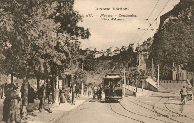
The line between Nice and Monte Carlo opened in a series of stages. First from Monaco to Place d’Armes in Monte Carlo on 14th May 1898; then from Place Massena in Nice to Villefranche, on 1st February 1900; Villefranche to Beaulieu on 3rd November 1900; TNL trams were permitted to run on Monaco’s tramways from 28th May 1903; and the remaining length, Beaulieu to Monaco Place d’Armes opened on 7th November 1903. Over the next few years some single track lengths were doubled.
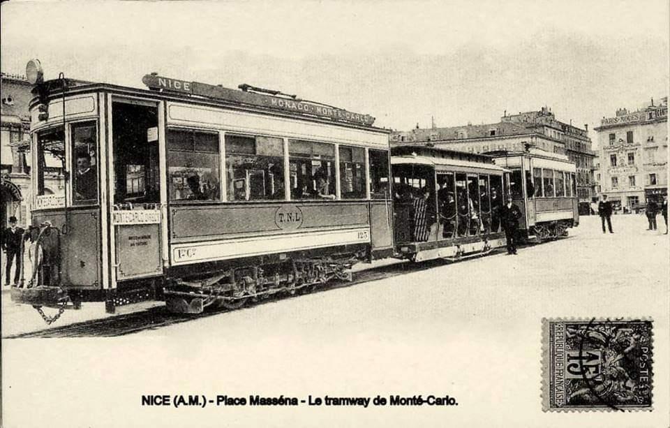
Trams to Villefranche, Beaulieu and Monte-Carlo left the TNL station at Place Masséna and entered Rue Gioffredo sharing the double track with the urban lines to Gendarmerie and St. Pons. At Rue Defly, the route branched off to the right to cross the River Paillon to Place Garibaldi. The right bank lines to the Boulevard du Pont-Vieux and Abattoirs were crossed there. The line then ran along Rue Cassini to Place Cassini (today Ile-de-Beauté) where several urban lines serving the port terminated.
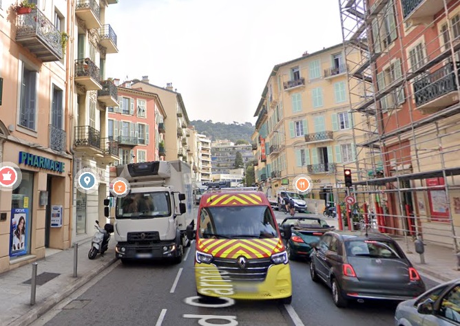
After leaving the port, trams headed towards Papacino and Deux-Emmanuel quays. With the Riquier line heading up Rue Arson, the Monte-Carlo trams began a steep climb along Boulevard Carnot on the western slope of Mont Boron.
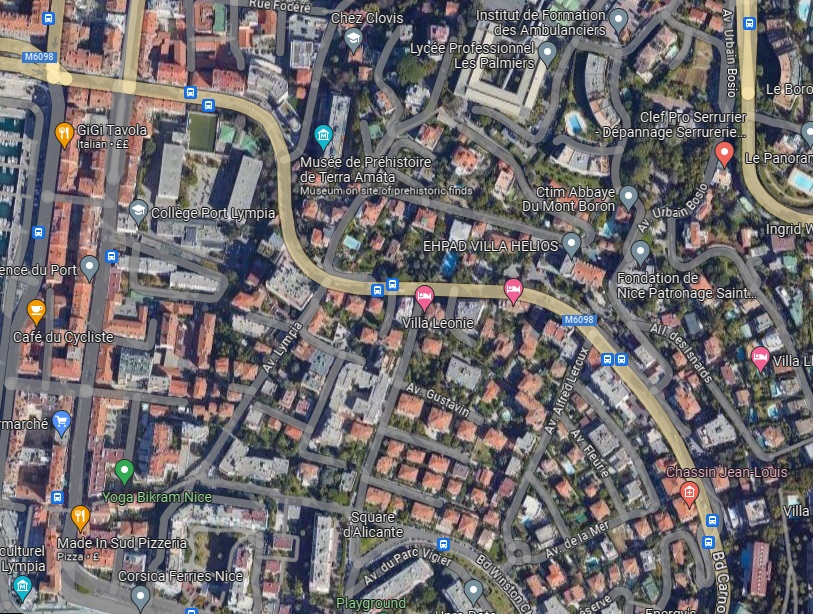
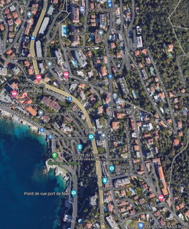
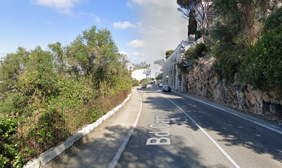
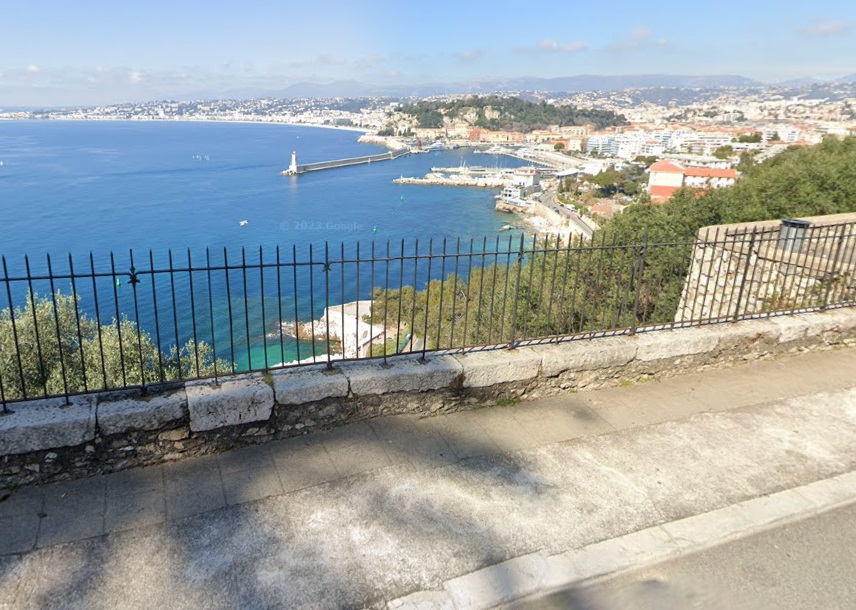
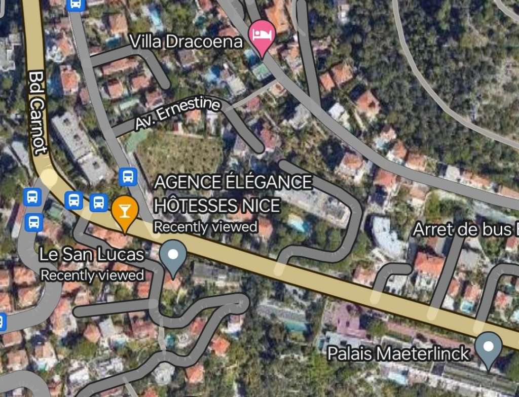
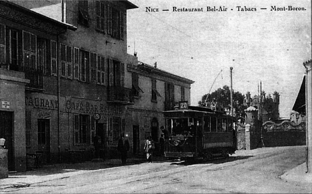
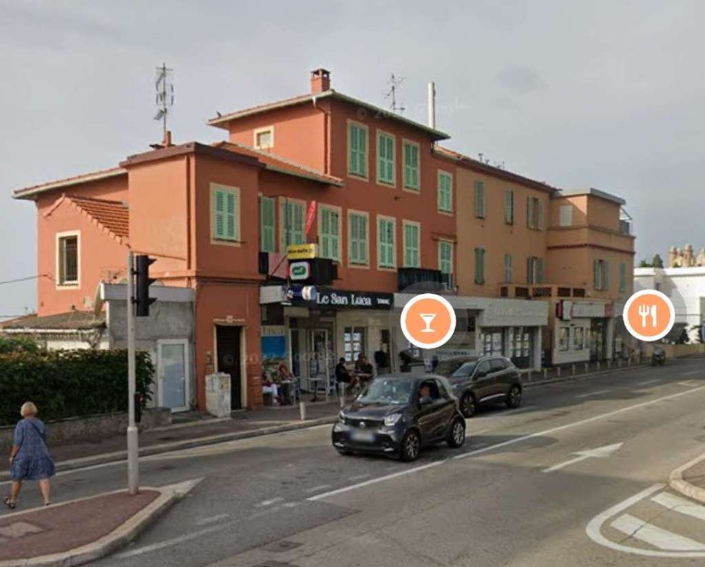

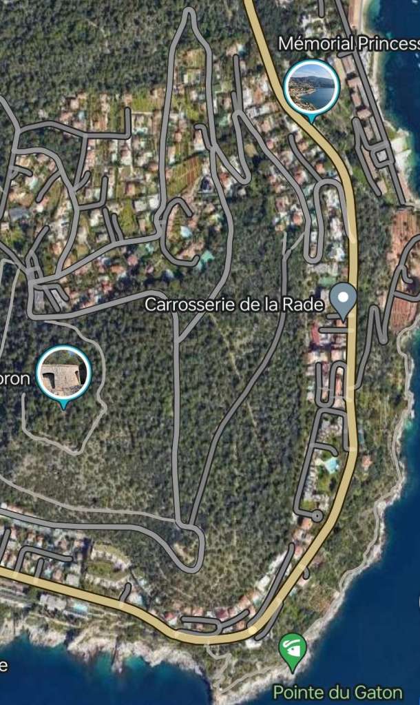
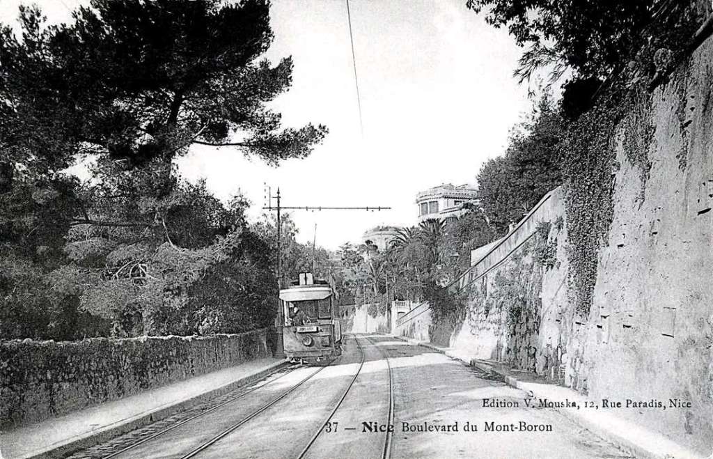
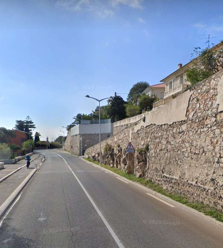
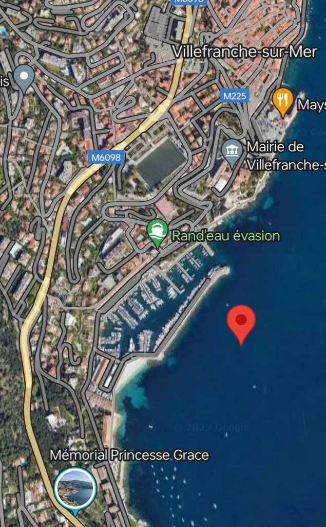
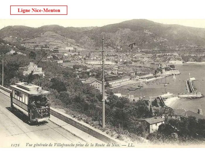
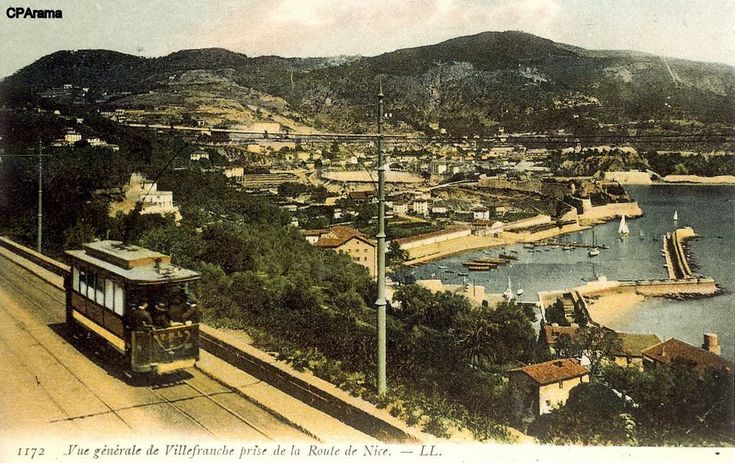
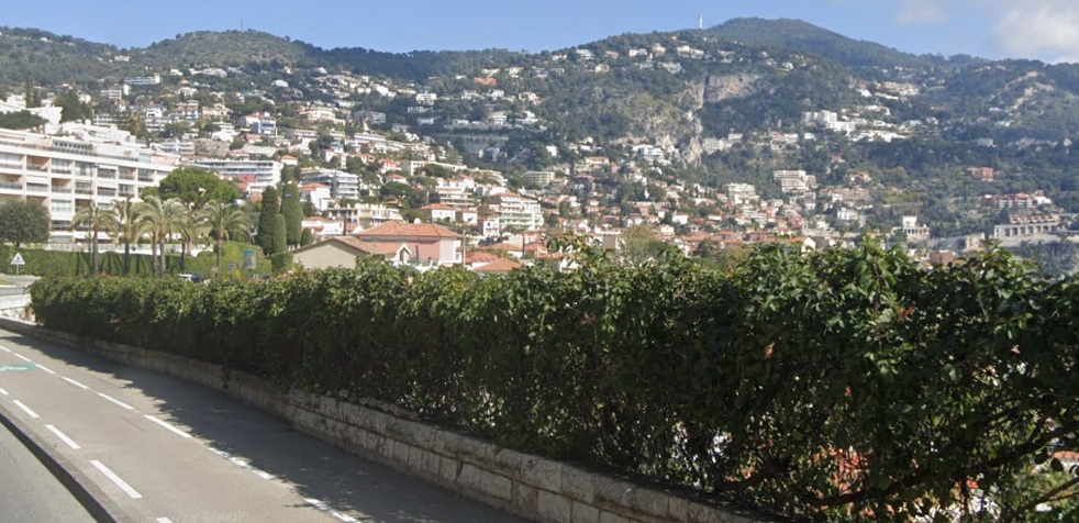
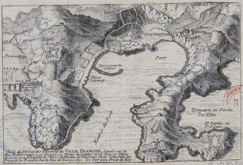
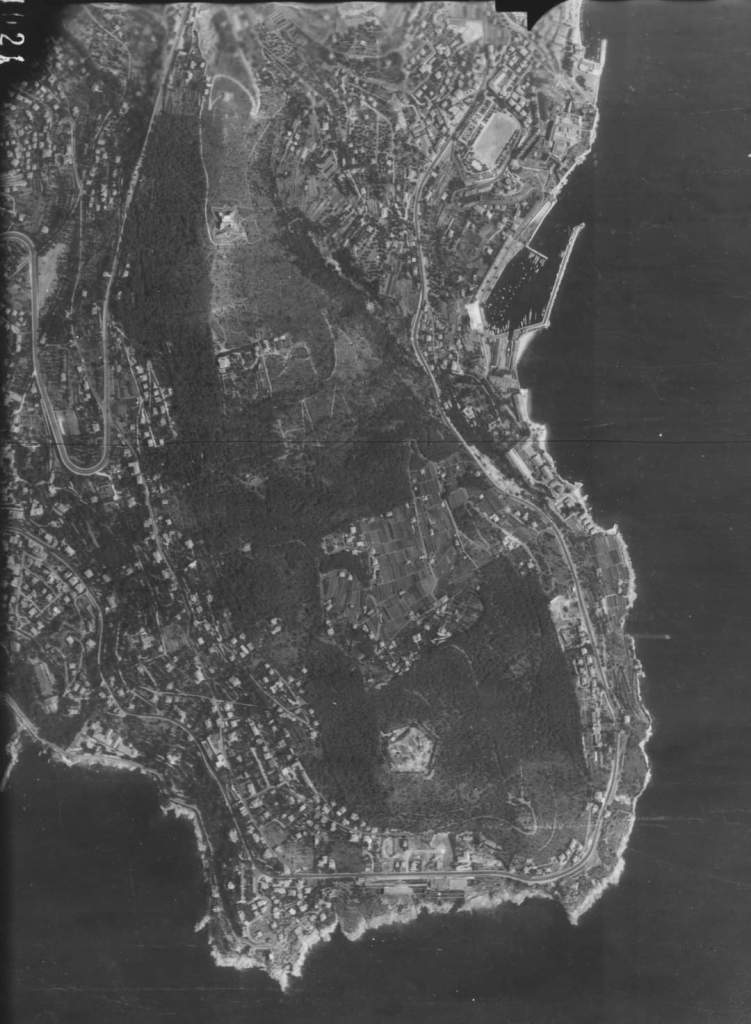
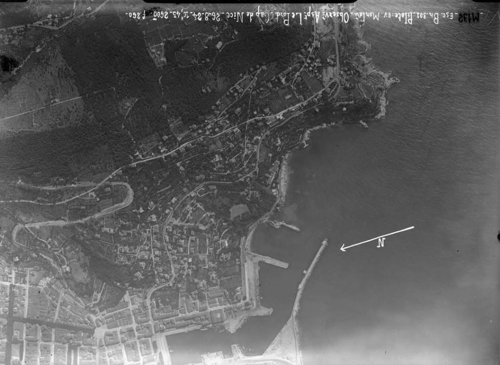
Trams then headed down into Villefranche, which Banaudo reminds us, was the “military port of the House of Savoy and always a popular stopover for cruise and warships. The tramway passed above the dock and the citadel, … crossed ‘l’octroi’ and reached the Villefranche station located in the upper part of the town.” [1: p41] ‘L’octroi’ was the point where visas were granted and taxes were collected. According to the “Petit Robert de la Langue Française,” an ‘octroi’ was, historically, an “indirect contribution collected by a municipality on goods for local consumption (entrance fees).” [2]
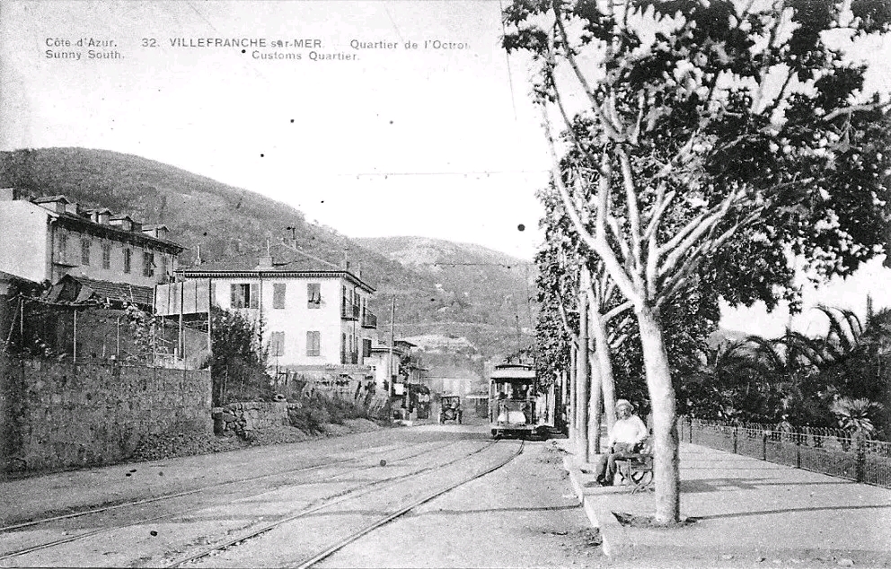
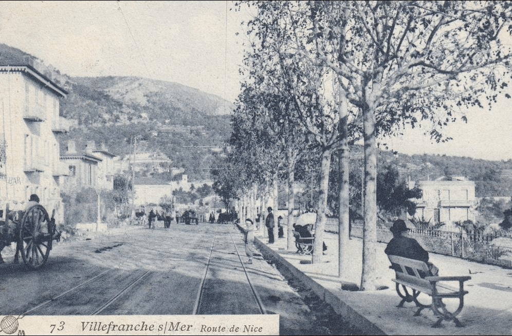
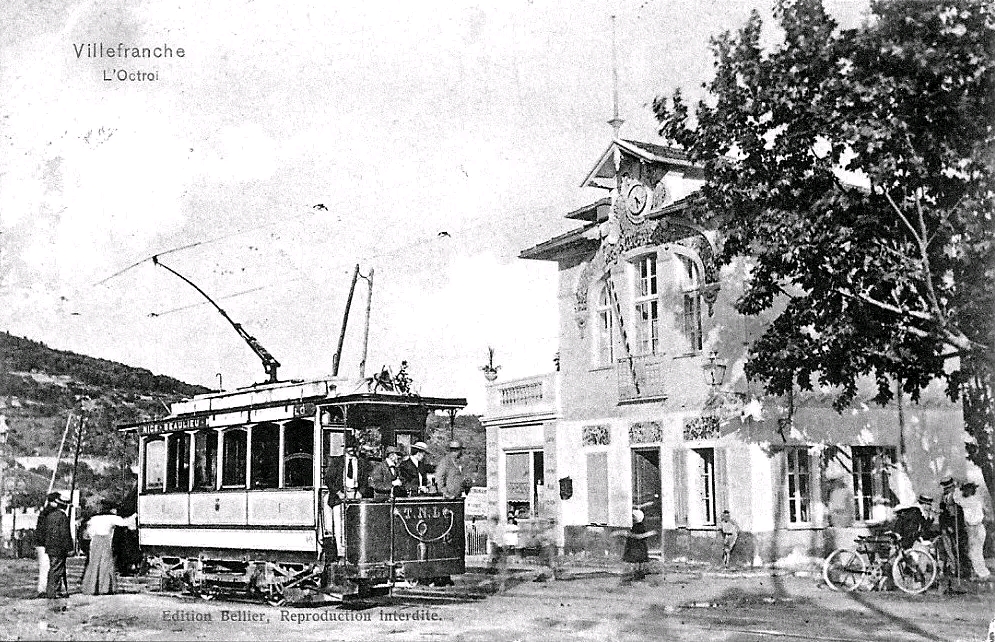
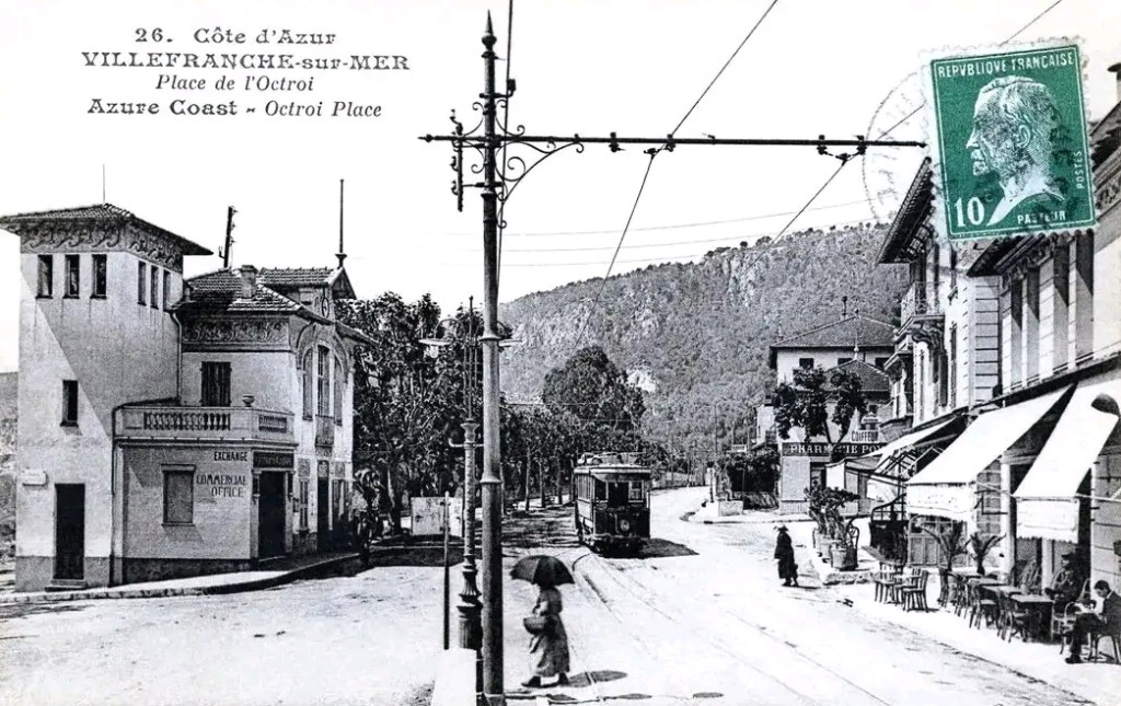
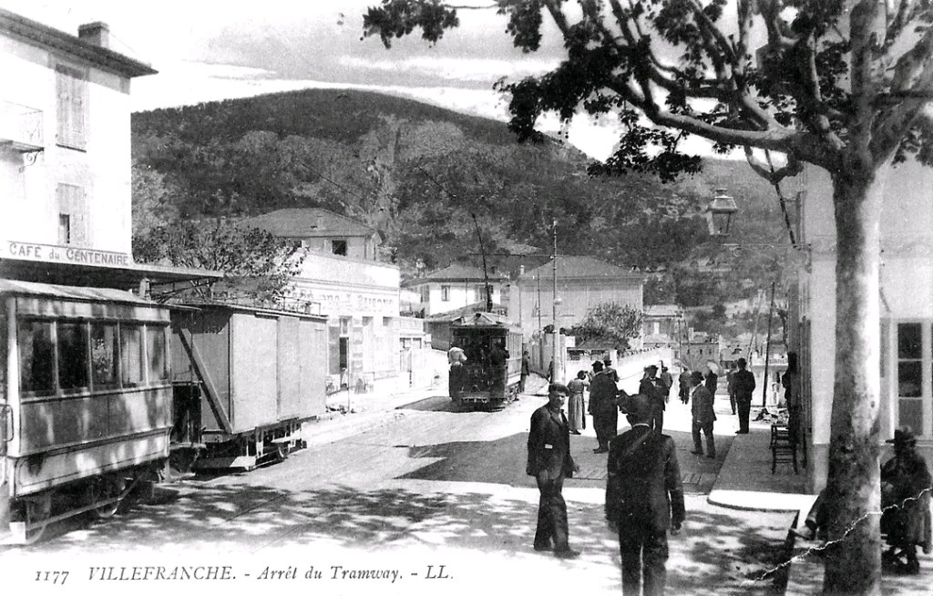
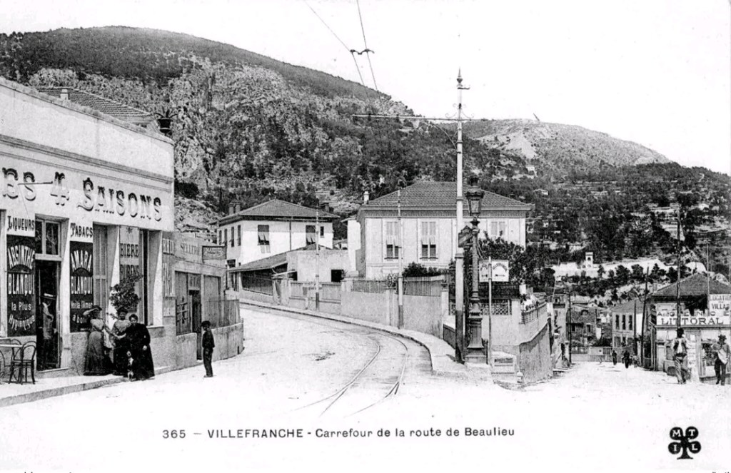
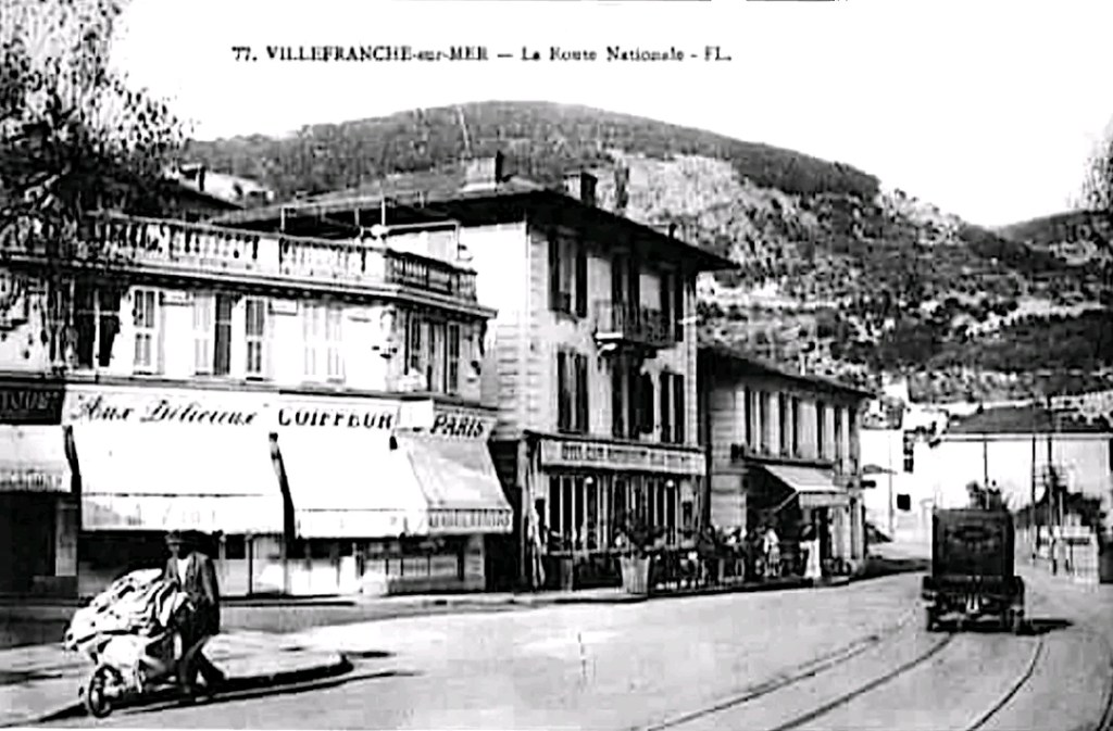
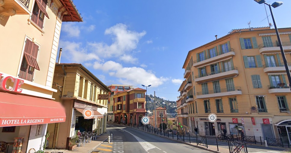
At Villefranche station, according to Banaudo, “certain partial services had their terminus and a particular branch served a building materials warehouse, (un entrepot de materiaux de construction).” [1: p40]
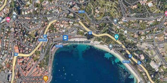
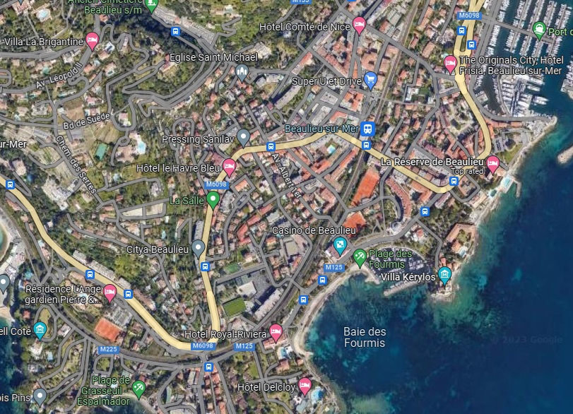
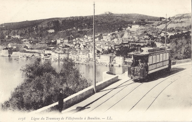
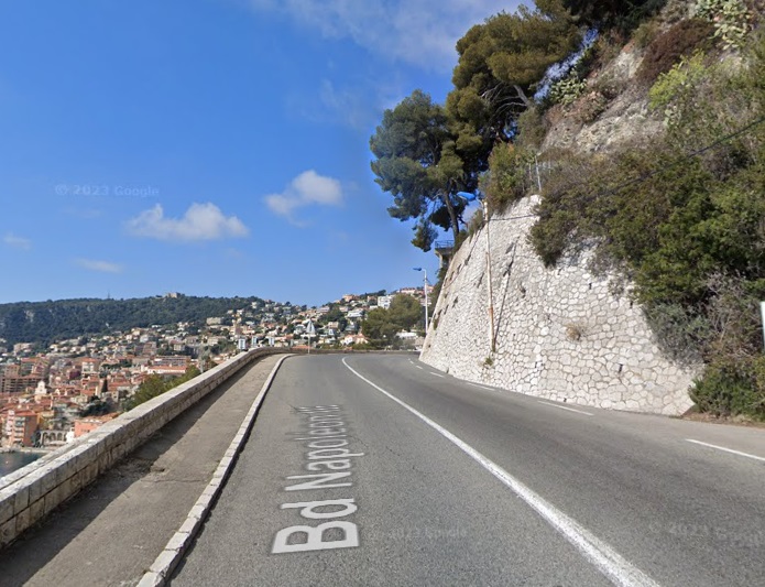
To accommodate the trams, the RN7, the Basse Corniche, was widened using large retaining walls. The tramway, “skirted the bottom of Villefranche harbour and approached the base of Cap Ferrat. ” [1: p41]

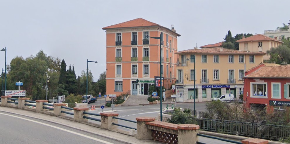
“At the Pont-St. Jean, where the St. Jean-Cap-Ferrat branch turned away, [trams] arrived in the town of Beaulieu, where a centuries-old olive tree marked the entrance adjacent to l’octroi pavilion. Following modifications made during the First World War, the double track ended … shortly after [l’Octroi] stop. Crossing Beaulieu, the line followed Boulevard Félix-Faure (today Maréchal-Joffre), passed under the PLM Nice – Ventimiglia artery near the station then went down towards the seaside where it ran alongside the town hall, the church and the port.” [1: p41]
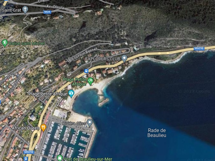
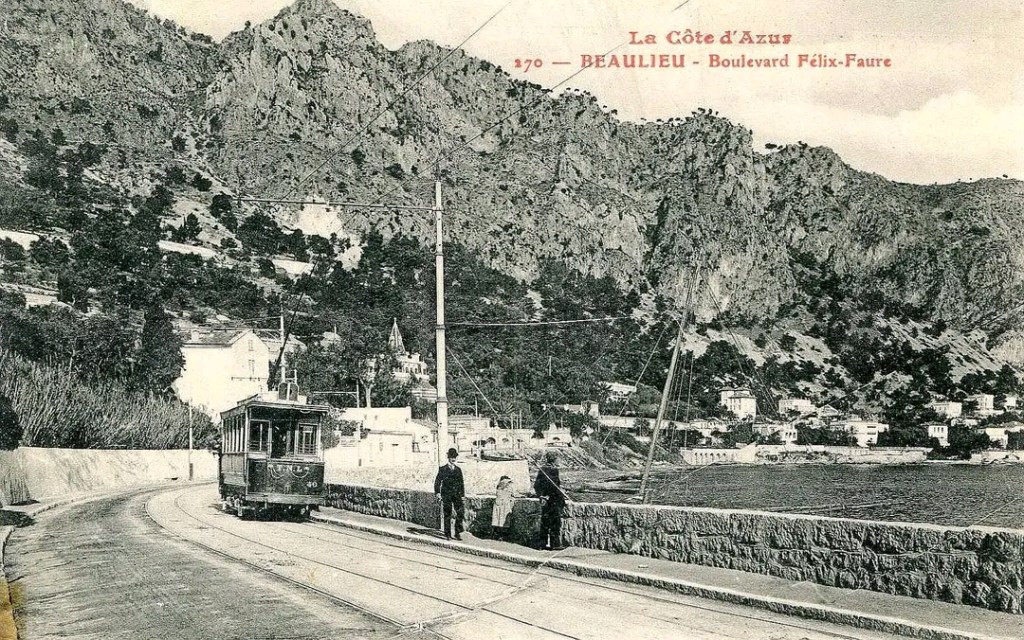
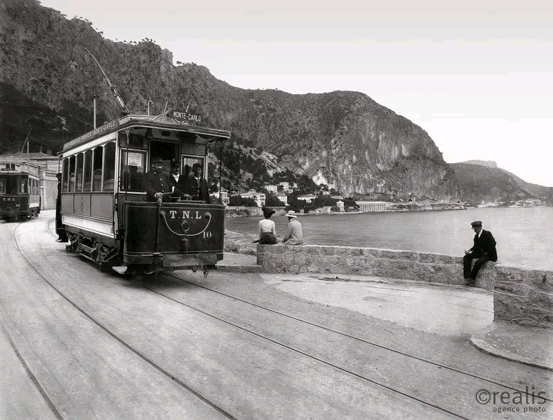
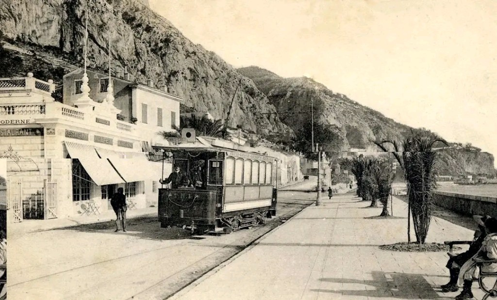
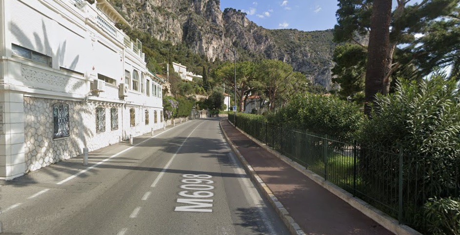
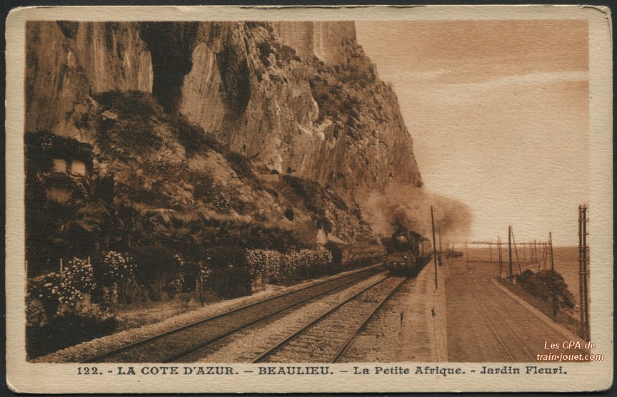
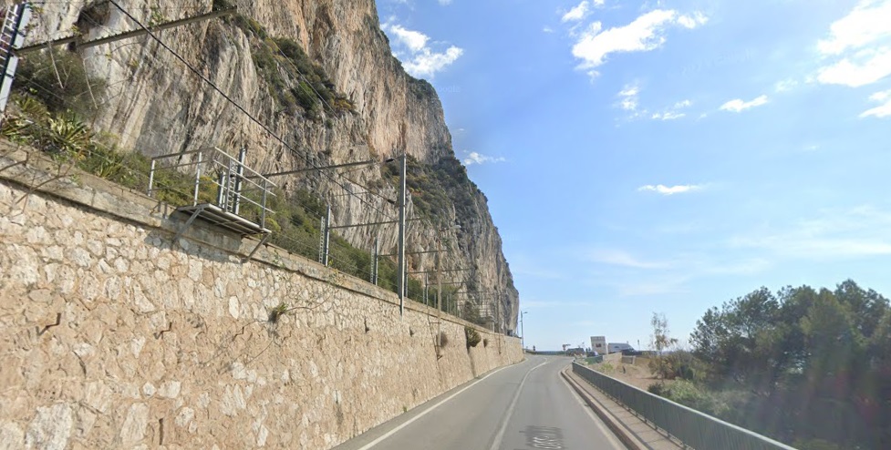
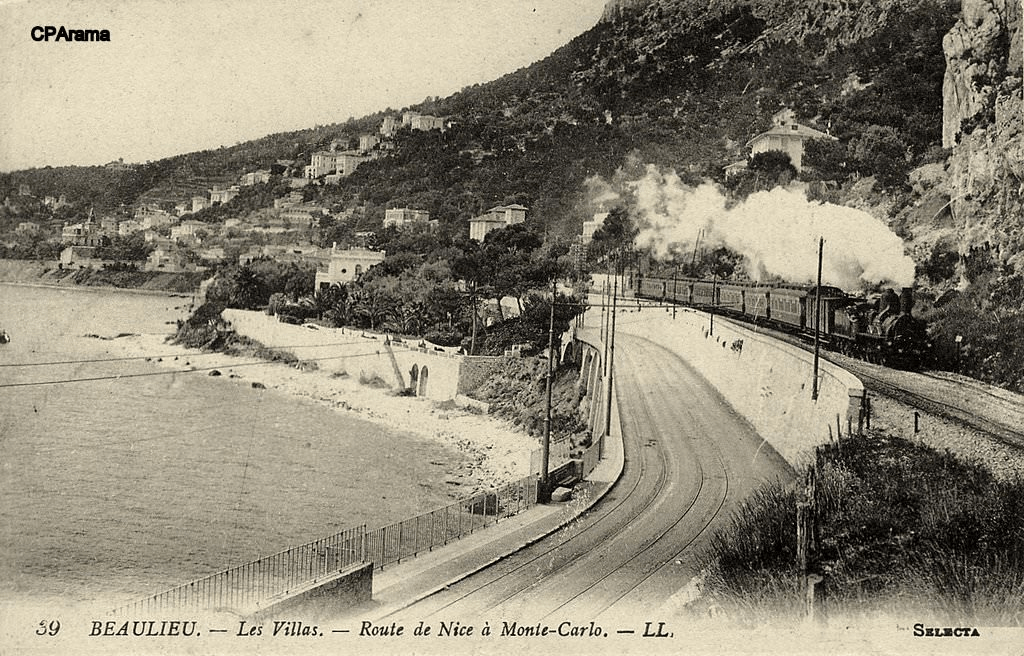
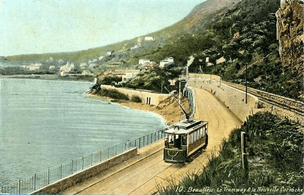
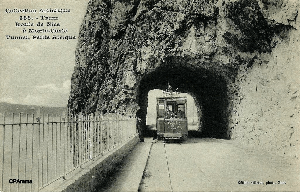
Leaving the town, a siding at the foot of the railway embankment constituted an intermediate terminus in the residential district of ‘Petit Afrique’, “where,” Banaudo tells us, “a micro-climate favours the blossoming of luxuriant vegetation among Moorish and exotic villas.” [1: p41]
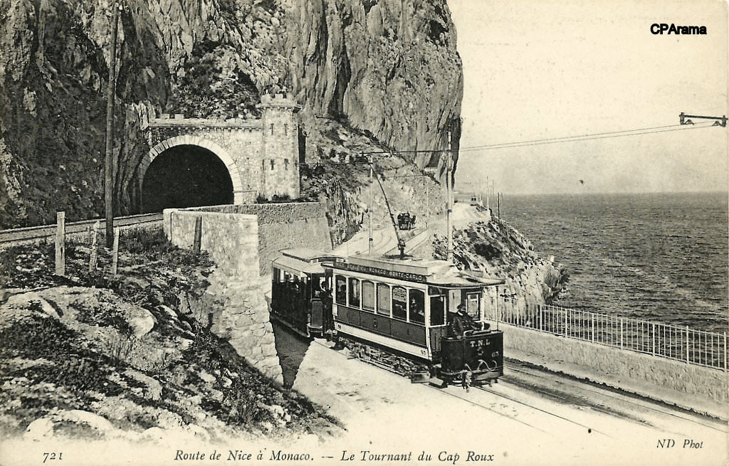
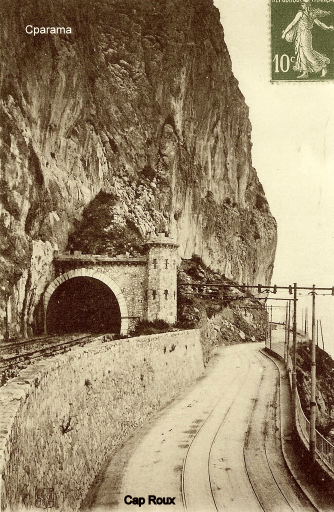
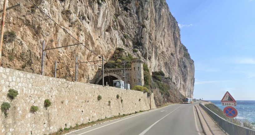
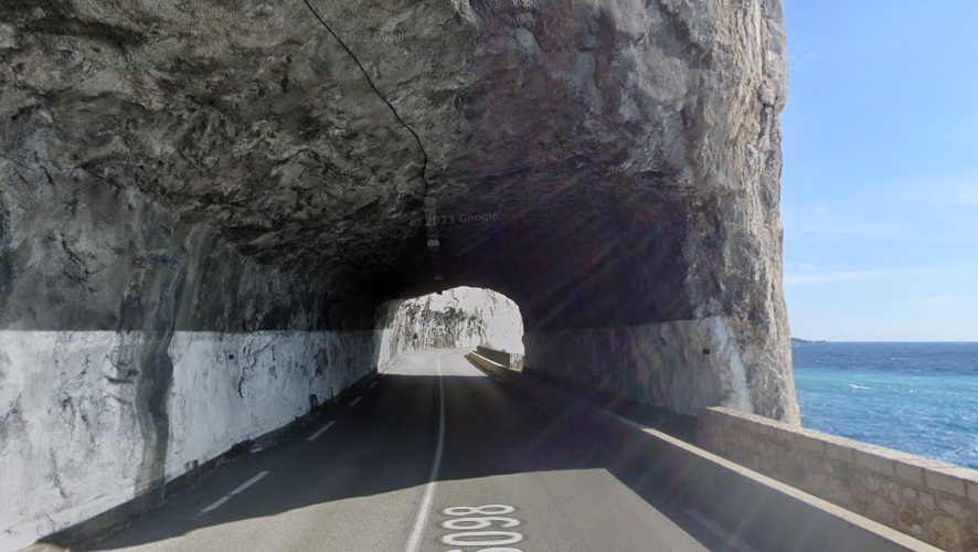
As Banaudo comments: “Shortly after, the high limestone cliffs of Cap Roux fall directly into the sea and form an apparently impassable obstacle to communications on the coast. The PLM line crossed this location via a 419 m tunnel decorated with a superb fortified portal, while a short tunnel cut directly into rock provided for the road and the tramway. It had to be widened when the latter was made double track.” [1: p41]
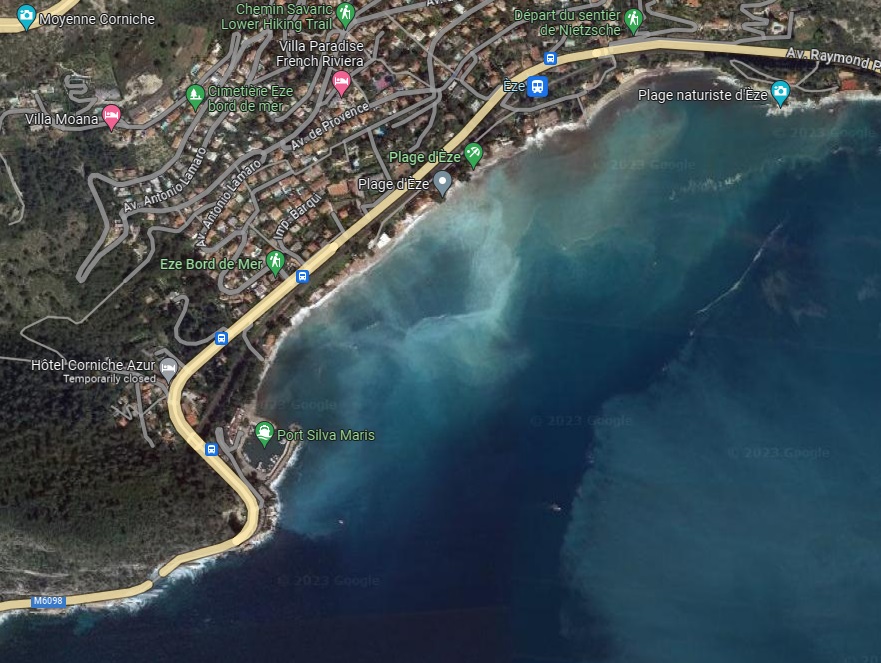
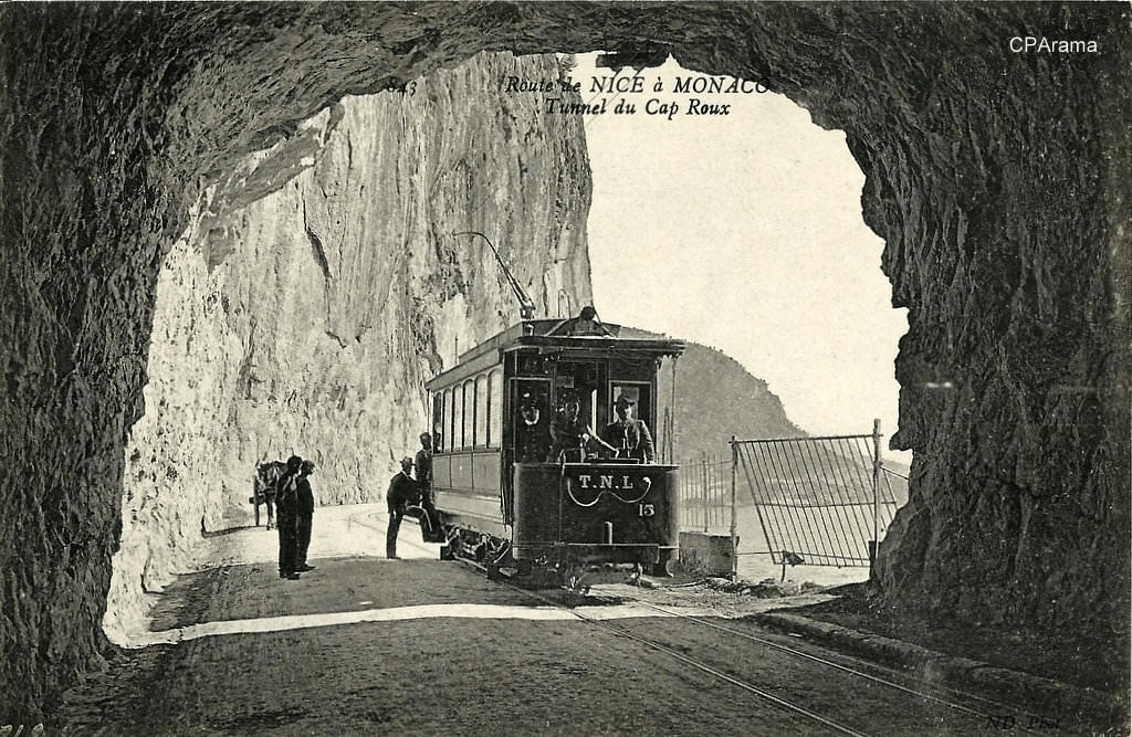
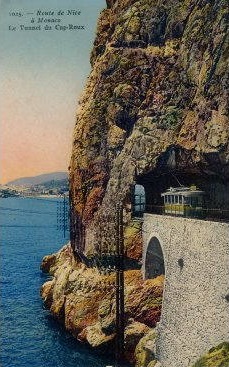
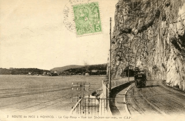
At the point where the PLM line emerged from the Cap Roux, the tramway passed above it on the road bridge and ran along the verge through the location of Eze station. Banaudo tells us that, “In this residential area, the villas are spread out between a well-sheltered beach at the bottom of a bay and the foot of the mountain where the medieval village of Eze perches, at an altitude of 427 m.” 1: p41]
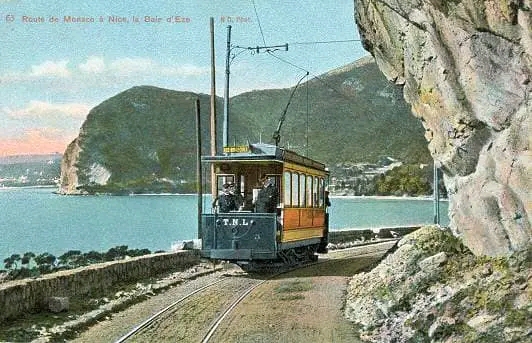
From this point, the terrain along the coast became increasingly steep and the Basse Corniche and the tramway track had to gain height again, passing above Point de L’Isoletta and through Pointe de Cabéel and Cape Estelle, (today, Estel).
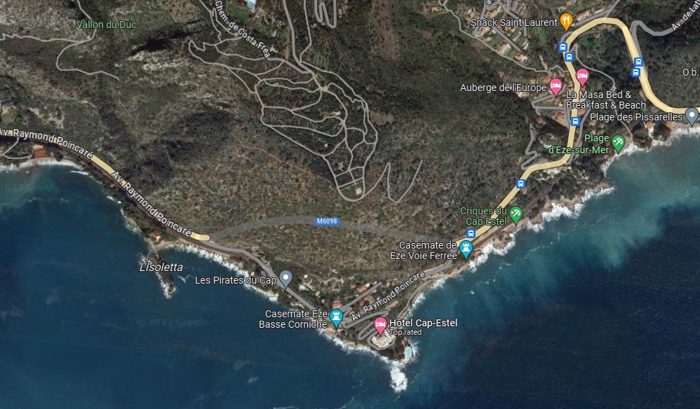
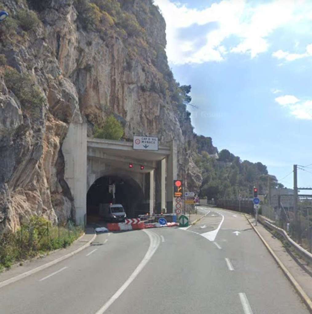
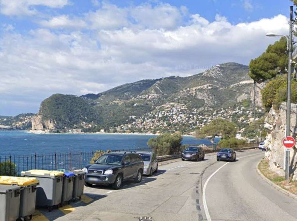
The route rose up from the coast and looped inland below the hamlet of St. Laurent d’Eze. The line soon reached 85m above sea level (its highest point) near the passing loop in the Pissarelles district.
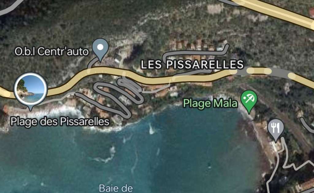
Two tunnels cut into the cliff above Plage Mala preceded the start of the descent to Cap-d’Ail. Both of these tunnels remain and continue to carry the Basse Corniche. Banaudo tells us that this was in “the former coastal district of La Turbie which obtained its municipal autonomy in 1908.” [1: p42]
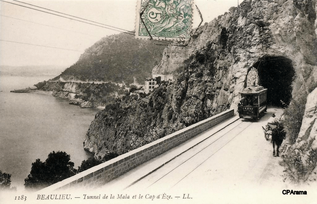
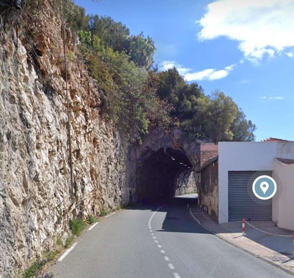

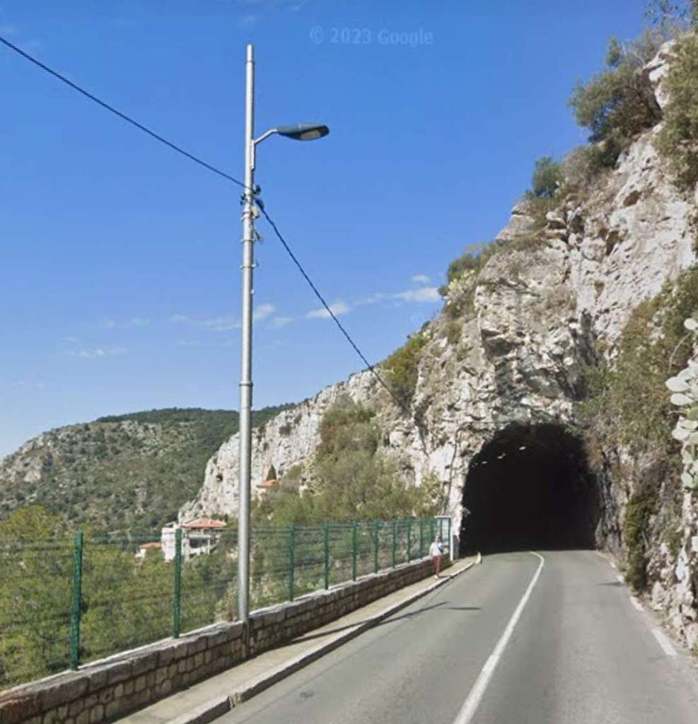
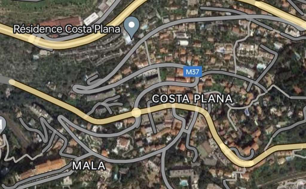
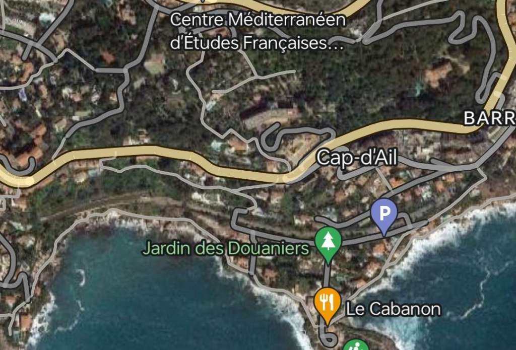
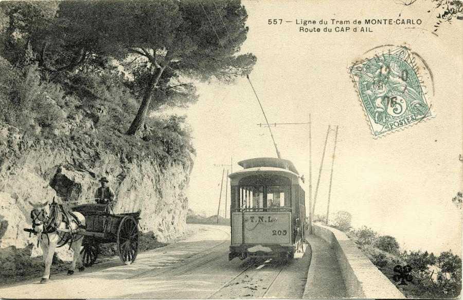
The tramway then ran down past customs barracks and crossed the border into the principality of Monaco. The extract below shows the route of the tramway as it approached the border, which is just off the top of the map extract.
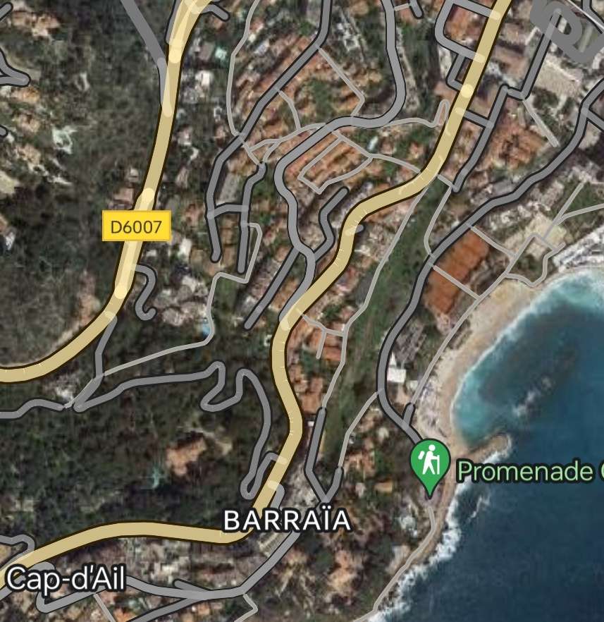
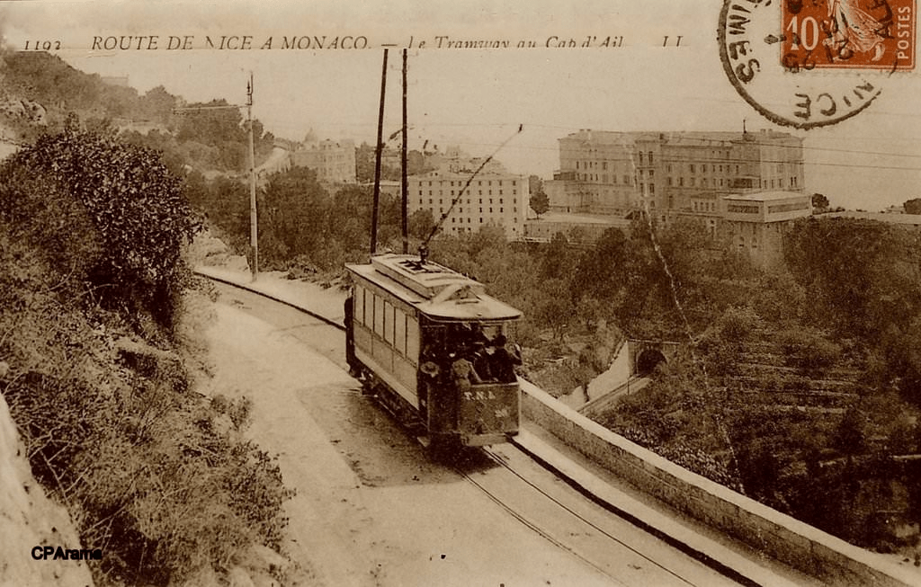
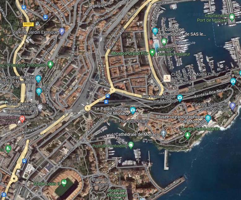
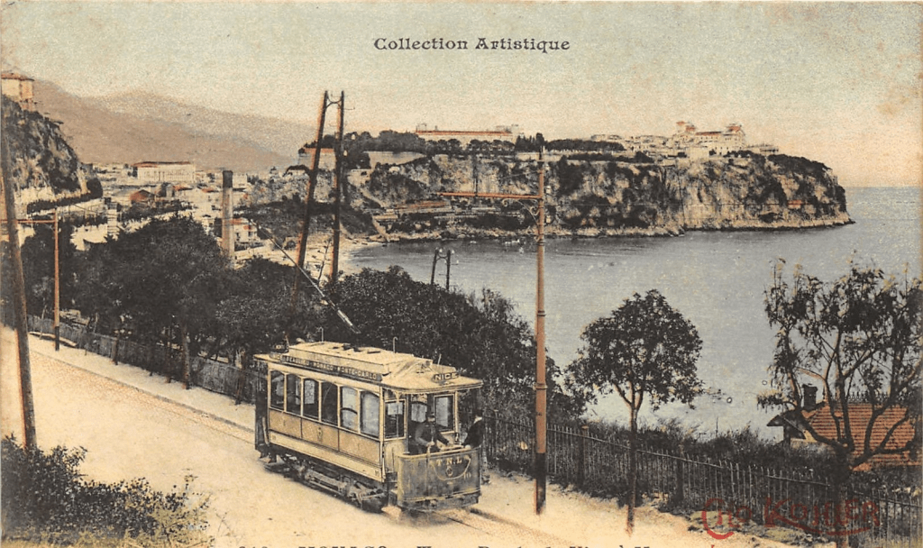
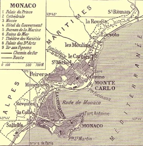
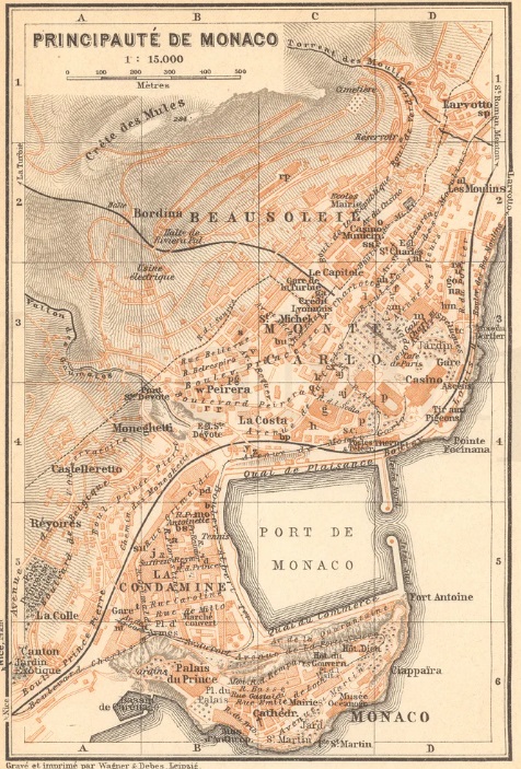
“A warehouse of materials and fuels was located on the border itself in the St. Antoine district.” [1: p42] The tramway then passed under the PLM tracks at the Württemberg bridge, where a passing loop was created in 1913.
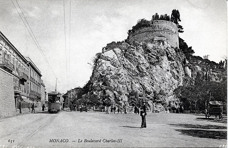
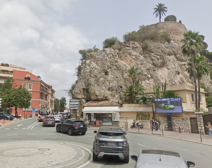
The tramway then followed Boulevard Charles III to Place du Canton where a siding was established at the foot of the bastion at the western end of the rock which supported the palace. Banaudo continues: “Industrialists in the Fontvieille district (brewery, chocolate factory and pasta factory) used this siding for unloading and shipping their goods.” [1: p42]
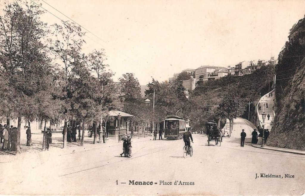
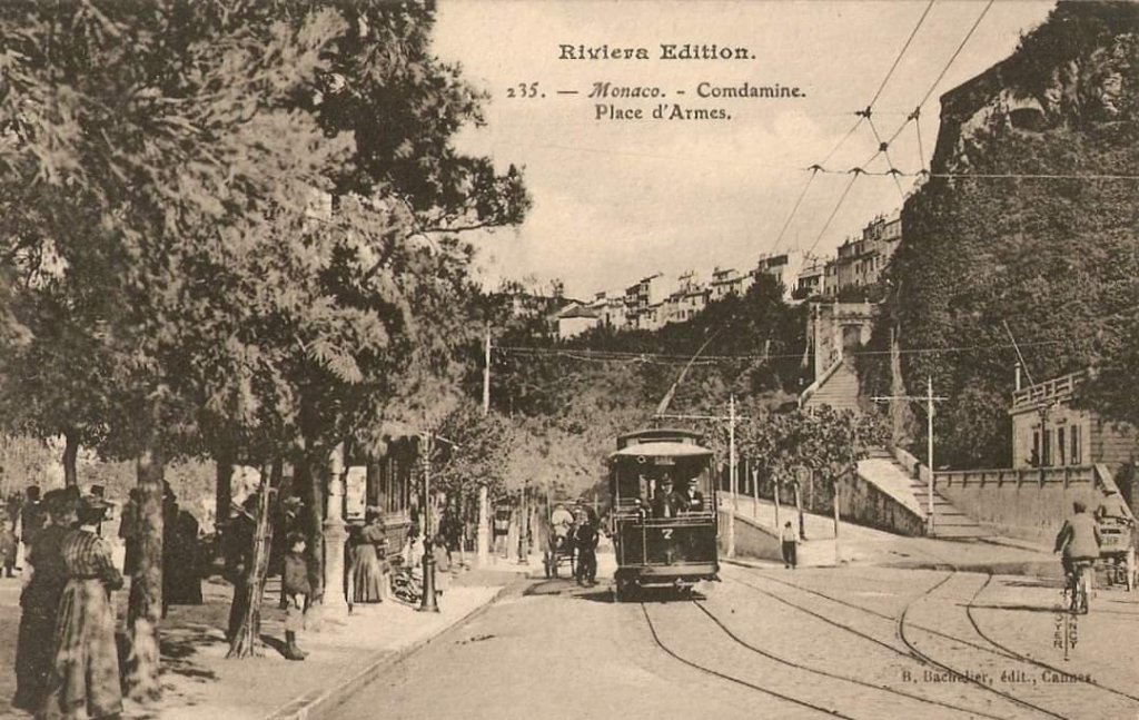
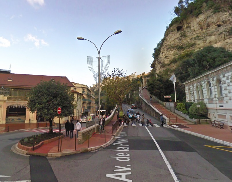
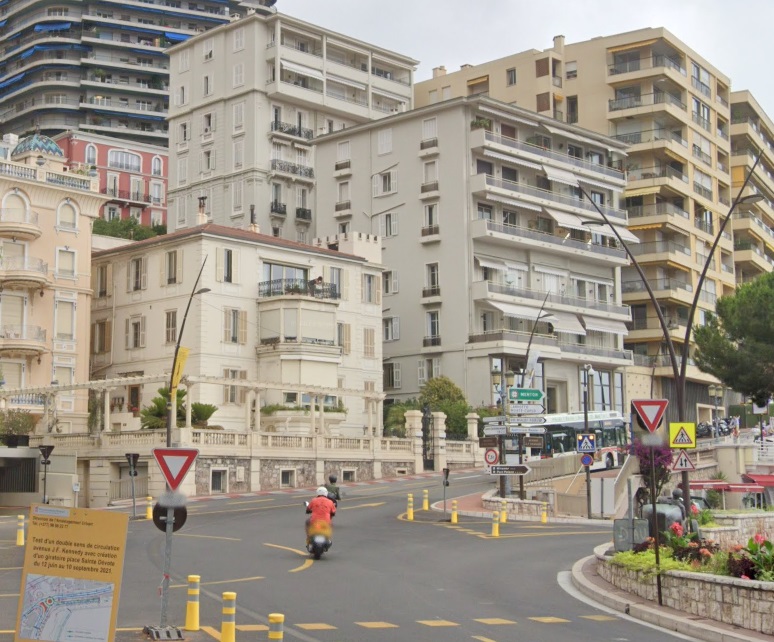
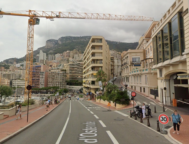
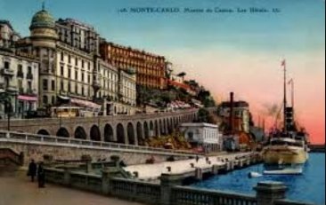
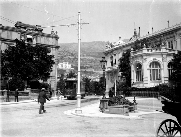
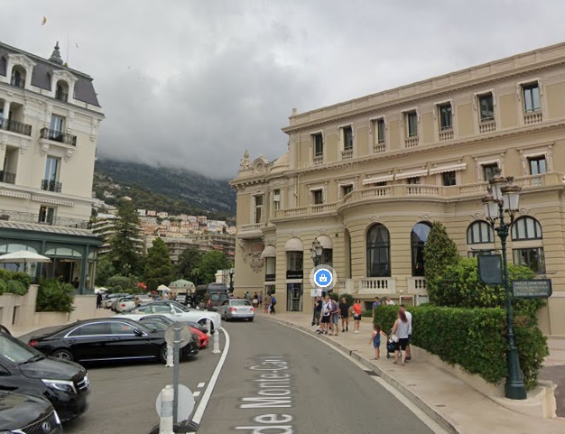
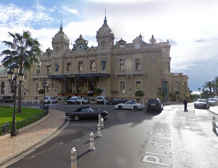
The TNL line joined the urban network of Monaco on the Place d’Armes, where two branch lines left the route: on the left towards the PLM station; and on the right towards Place de la Visitation, on the Rock. The tramway ran along Avenue du Port on a “brief double-track section, then arrived at the gasometer bend, it ran alongside the port by going down Boulevard de la Condamine (today Albert 1er). On Place Ste. Devote, the double track resumed to climb Avenue de Monte-Carlo, whose inclination constituted an absolute record for the entire TNL network: 80 mm/m average over 415 m, including a “peak” at 93 mm/m over 41 m! A bridge spanned the PLM line below ‘l’Hotel Ermitage’, then the tramway left the urban line at la Poste to reach le Plateau de Spélugues, where the terminus was located between ‘l’Hotel de Paris’ and l’e Casino de Monte-Carlo‘.” [1: p42]
Banaudo also highlights a number of structures along the route from Nice to Monaco: “In Nice: Garibaldi bridge over the Paillon (3 cast iron arches). Between Beaulieu and Eze: Cap-Roux tunnel (26 m) and bridge on the PLM Nice – Ventimiglia line. Between Eze and Cap-d’Ail: La Mala 1 (30 m) and La Mala 2 (50 m) tunnels. In Monte-Carlo: L’Ermitage bridge on the PLM Nice – Ventimiglia line.” [1: p43]
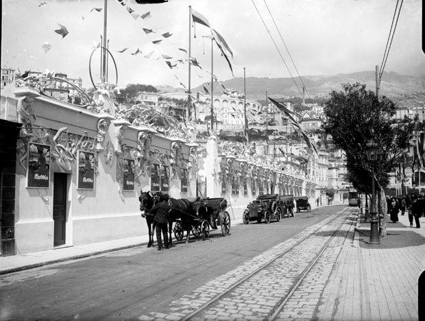
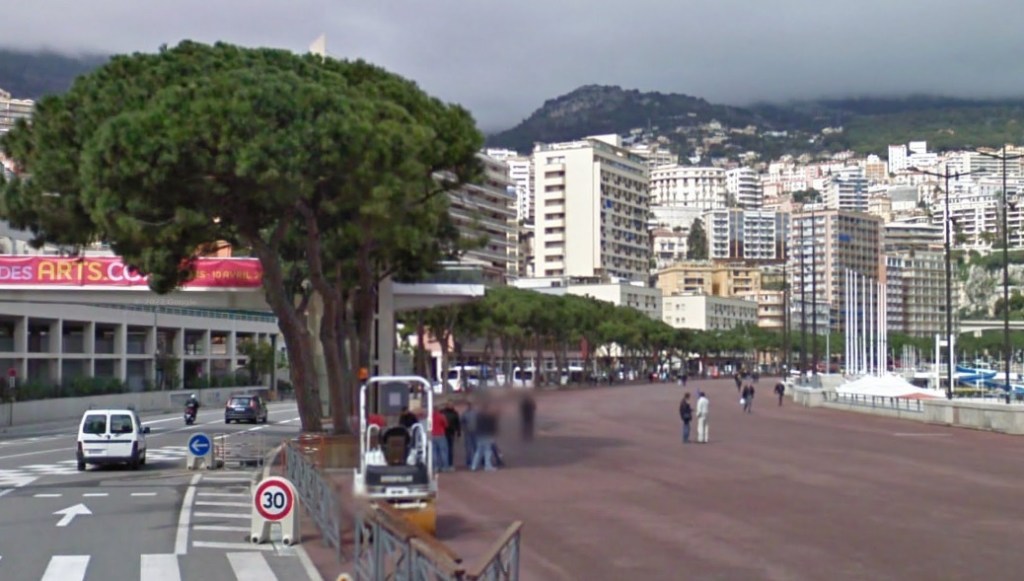
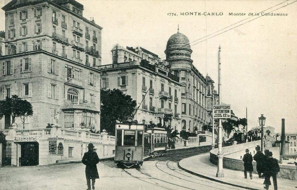

Two branch lines left the main tramway between Nice and Monte Carlo. These were:
- Pont-St. Jean to St. Jean-Cap-Ferrat
- Monaco-Gare to Monaco-Ville (Place d’Armes to Place de la Visitation on the Rock).
These will be the subject of future article(s), as will be the length of the line from Monte Carlo to Menton.
References
- José Banaudo; Nice au fil du Tram, Volume No. 2: Les Hommes, Les Techniques; Les Editions de Cabri, Breil-sur-Roya, France, 2005.
- https://dictionnaire.lerobert.com/definition/octroi, accessed on 14th October 2023.pwe
- https://www.facebook.com/groups/ciccoli/permalink/3705752563003919, accessed on 20th October 2023.
- https://m.facebook.com/groups/ciccoli/permalink/3693480434231132, accessed on 20th October 2023.
- https://m.facebook.com/groups/ciccoli/permalink/3726228004289708, accessed on 20th October 2023.
- https://slideplayer.fr/slide/3703631, accessed on 11th April 2019.
- https://i.pinimg.com/736x/59/3a/b4/593ab4398089380e93e36f57e3986208.jpg, accessed on 20th October 2023.
- http://transporturbain.canalblog.com/pages/les-tramways-de-nice—de-l-apogee-au-declin/31975780.html, accessed on 20th October 2023.
- https://m.facebook.com/groups/ciccoli/permalink/3478397479072763, accessed on 21st October 2023.
- https://www.facebook.com/groups/ciccoli/permalink/1917168321862361, accessed on 21st October 2023.
- https://m.facebook.com/groups/ciccoli/permalink/2545681792344341, accessed on 21st October 2023.
- https://m.facebook.com/groups/ciccoli/permalink/3372278223018023, accessed on 21st October 2023.
- https://www.facebook.com/groups/ciccoli/permalink/3720422128203629, accessed on 21st October 2023.
- https://www.cparama.com/forum/cartes2013a/1367699129-721.jpg, accessed on 21st October 2023.
- https://www.cparama.com/forum/cartes2013a/1367700498-06-Eze-t.du-Cap-Roux.jpg, accessed on 21st October 2023.
- https://www.cparama.com/forum/cartes2013a/1367699408-843.jpg, accessed on 21st October 2023.
- https://octo-puces.com/20713-large_default/vichy.jpg, accessed on 21st October 2023.
- https://picclick.fr/Carte-Route-de-Nice-%C3%A0-Monaco-Le-Cap-266462066907.html, accessed on 21st October 2023.
- https://www.geneanet.org/cartes-postales/view/7748918#0, accessed on 21st October 2023.
- https://www.geneanet.org/cartes-postales/view/5253150#0, accessed on 21st October 2023.
- https://www.cparama.com/forum/cartes2013a/1367698172-06-Cap-d-Ail-tram.jpg, accessed on 21st October 2023.
- https://www.cparama.com/forum/cartes2013a/1367694969-06-Beaulieu-39-001.jpg, accessed on 21st October 2023.
- https://www.cparama.com/forum/cartes2013a/1367695565-06-Beaulieu-388-.jpg, accessed on 21st October 2023.
- https://www.cparama.com/forum/cartes2013a/1367695792-06-Beaulieu-1183-.jpg, accessed on 21st October 2023.
- https://www.cparama.com/forum/download/file.php?id=71728, accessed on 21st October 2023.
- https://www.train-jouet.com/PA/Vente-CPA-Ferroviaire/Train-06/TR3719-2.jpg, accessed on 21st October 2023.
- https://www.geneanet.org/cartes-postales/view/7700125#0, accessed on 21st October 2023.
- https://upload.wikimedia.org/wikipedia/commons/b/b7/Station_des_tramways_au_casino%2C_Monte-Carlo%2C_avril_1905_%285686522389%29.jpg, accessed on 21st October 2023.
- https://upload.wikimedia.org/wikipedia/commons/2/2a/Exposition_des_canots_autos%2C_Monaco%2C_avril_1905_%285619067954%29.jpg, accessed on 21st October 2023.
- https://www.google.com/search?q=monaco+trams+cartes+postales+ancienne&tbm=isch&ved=2ahUKEwi22qipp4SCAxXvWaQEHUO_CVsQ2-cCegQIABAD&oq=monaco+trams+cartes+postales+ancienne&gs_lcp=ChJtb2JpbGUtZ3dzLXdpei1pbWcQAzIFCAAQogQ6BAgjECc6BAgeEApQ7w5YziNgtTJoAHAAeACAAaQBiAHcCZIBAzIuOJgBAKABAcABAQ&sclient=mobile-gws-wiz-img&ei=m0cyZfagNe-zkdUPw_6m2AU&bih=664&biw=360&client=ms-android-oppo-rvo3&hl=en#imgrc=2d6uTfkjSefGVM, accessed on 21st October 2023.
- https://www.detaille.mc/en/hier, accessed on 23rd October 2023.
- https://wardmapsgifts.com/products/monaco-1930, accessed on 23rd October 2023.
- https://www.facebook.com/groups/ciccoli/permalink/3790242024554972, accessed on 25th October 2023.
- https://m.facebook.com/groups/ciccoli/permalink/1729856960593499, accessed on 26th October 2023.
- https://www.ebay.co.uk/itm/304773417554?mkcid=16&mkevt=1&mkrid=711-127632-2357-0&ssspo=ngW_GOApSZS&sssrc=4429486&ssuid=afQhrar7TGK&var=&widget_ver=artemis&media=MORE, accessed on 26th October 2023.
- https://www.monaco-tribune.com/2023/03/lancien-tramway-de-monaco, accessed on 26th October 2023.
- https://www.delcampe.net/en_GB/collectables/postcards/monaco/harbor/monte-carlo-le-boulevard-de-la-condamine-935509054.html, accessed on 26th October 2023.
- https://www.fortunapost.com/monaco/56820-monaco-la-condamine-et-l-avenue-de-la-costa-a-monte-carlo-vers-1905.html, accessed on 26th October 2023.
- https://www.etsy.com/hk-en/listing/962449177/monte-carlo-vintage-postcard-set-four, accessed on 26th October 2023
- https://cronobook.com/pic/317b6f78-4763-4f52-b8a6-bc625f310c79, accessed on 26th October 2023.
- https://picclick.fr/Monaco-Monte-Carlo-Mont%C3%A9e-Du-Casino-Les-H%C3%B4tels-266021428207.html, accessed on 28th October 2023.
- https://m.facebook.com/story.php?story_fbid=pfbid037Agoz1RnVkMM6FYgqS999TT5pM1brTsYaKoX8V6TXtMfRovpbYUMepmzxSpTZLqfl&id=100066989205256, accessed on 28th October 2023.
- https://m.facebook.com/story.php?story_fbid=pfbid034LetSqTPvanReBnsQi4NbvfNRU5vXtfnjSnCRP1hXApywdEB5Ko9KKhTraEYDqR5l&id=100066989205256, accessed on 28th October 2023.

