
In early September 2020, while staying in Bream in the Forest of Dean we walked around the Titanic Steel Works and the Dark Hill Ironworks of father and son David and Robert Mushet. These two establishments sit adjacent to what was the Coleford branch of the Severn and Wye Joint Railway. They were also served, in its time, by the Milkwall branch of Severn and Wye Tramway.
The location is significant in the development of the Bessemer Process for making hardened steel. Robert Mushet took the relatively novel ideas of Bessemer and refined them to the point where the process became functional in an industrial context. [3]
The tramway closed when the Coleford Branch opened as the route of the new railway closely followed the old tramway. There are only a few places where the route of the old tramway diverged from the newer railway and one of these locations is in the area of the Mushet owned works. The next few OS Map extracts come from the very early series of 25″ OS Maps which were drawn in the period from 1873-1888, nonetheless, the old tramway was by this time only a memory,
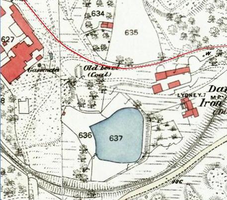
At the Eastern end of the Dark Hill Iron Works site, the old tramway diverged from the line of the Severn and Wye Joint railway. The loop shown here was no doubt provided to lessen the gradient. Steam power enabled the newer railway to take a more direct route. The Severn and Wye Joint Railway is shown by the double black lines which curve from the right of the map extract to pass through the words ‘Darkhill Iron Works’ at the bottom of the extract. [1]

The tramway route shown by the thin red line ran across the North side of Darkhill Iron Works and then on the Northeast side of the Titanic Steel Works. The Severn and Wye Joint Railway looped round the South side of the two sites. [1]
The two distinct red lines which appear on this map extract are both part of the old Milkwall branch of the Severn and Wye Tramroad. That to the West of the Map extract became the Sling Branch which left the Coleford Branch of the Severn and Wye Joint Railway at the small Milkwall Station to the North. That railway can be seen running to the West side of the Titanic Steel Works. The other red line is just to the Northeast of the Titanic Steel Works. [1]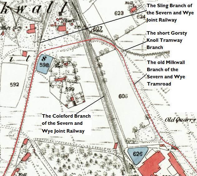 The two arms of the tramway which are seen as red lines on the map extract prior to this one are shown coming together just to the South of the Milkwall Station on the Severn and Wye Joint Railway which is sited just off the North side of this map extract.
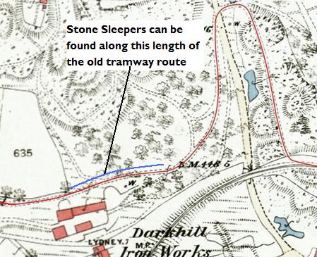
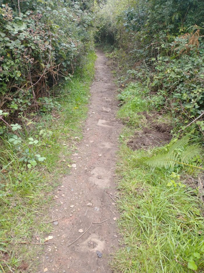
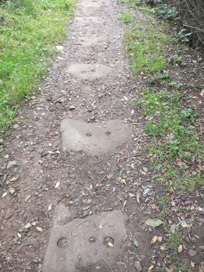
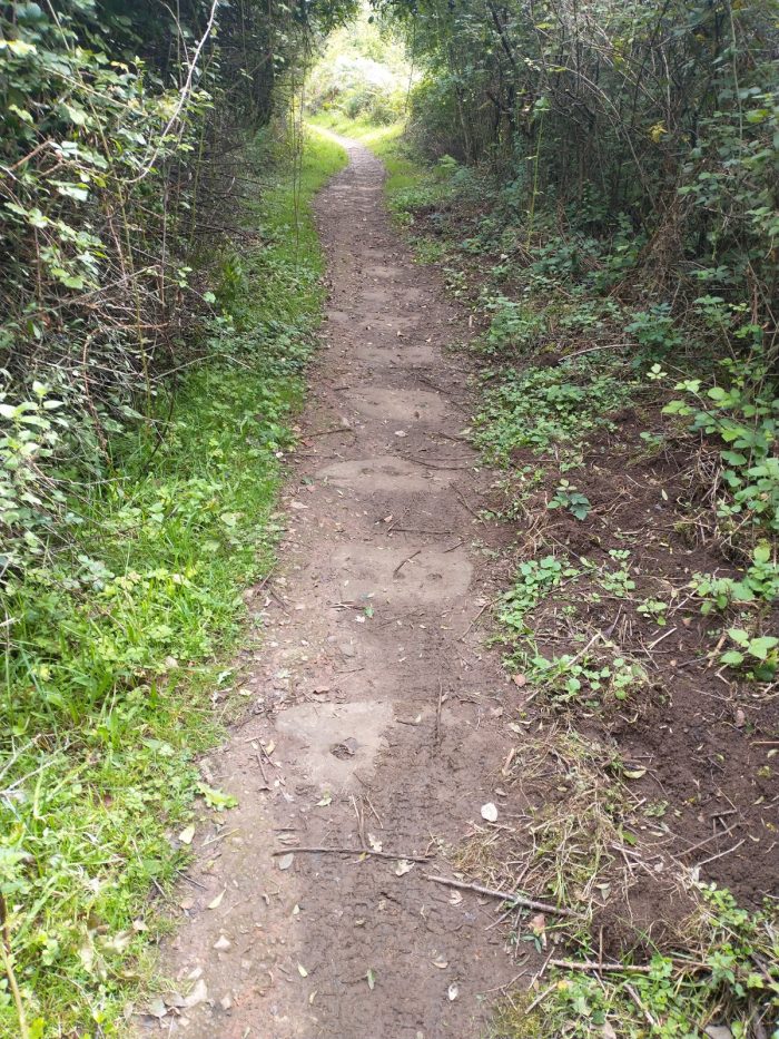
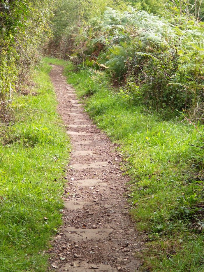
Generally the modern footpaths which follow the routes of these old tramways are not wide enough to allow both rows of stone sleepers to be seen.
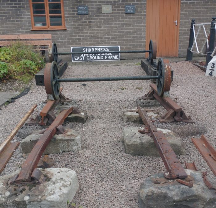
The different gauges used at different times in the Forest can be seen clearly in this picture taken at the Dean Forest Railway at Norchard on 2nd September 2020. The tramway gauge and construction can be seen in the foreground. Tramways in the forest were of 3’6″ to 3’8″ track gauge. Each plate was fixed in place by a metal chair which in turn was supported by an independent stone block/sleeper. All the photographs above are my own.
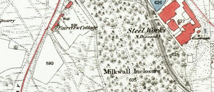
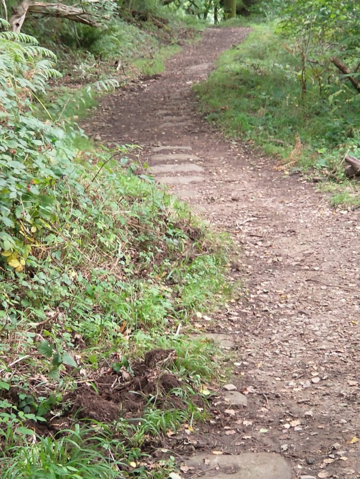
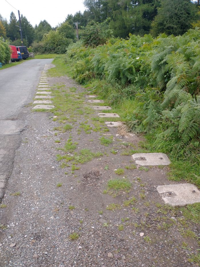
As we noted when looking at the map extracts above, the Sling branch of the Severn and Wye Joint Railway followed the line of the older Milkwall Tramway. Our walk took us, for a short distance, along the line of the Sling Branch. The more modern rails of the branch were supported on concrete blocks similar in size to the stone blocks which once supported the tramway. My picture below shows these concrete blocks where they are still visible outside Fairview Cottage which appears in the third of the four map extracts above.
References
- https://maps.nls.uk/geo/explore/#zoom=15.577087890792386&lat=51.77809&lon=-2.59762&layers=178&b=1, accessed on 3rd September 2020.
- There is an app which can be downloaded to mobile phones which provides access to a number of different Walks, one of these is the Coleford Heritage Walk, part of which we followed: https://www.forestersforest.uk/projects/12/hidden-heritage-app, accessed on 3rd September 2020.
- David and Robert Mushet: http://www.wyedeantourism.co.uk/mushets#, accessed on 8th September 2020.
