
The city of Narbonne was served by three tramway routes. The first travelled West to Thezan and the remainder of the network of the Tramways de l’Aude. That tram route is covered in the post which can be found on the link below:
Trams left the station building which was opposite the Gare du Midi and headed South and West through the city before leaving in the direction of Thezan. This was Line No. 1 on the sketch plan below. [16]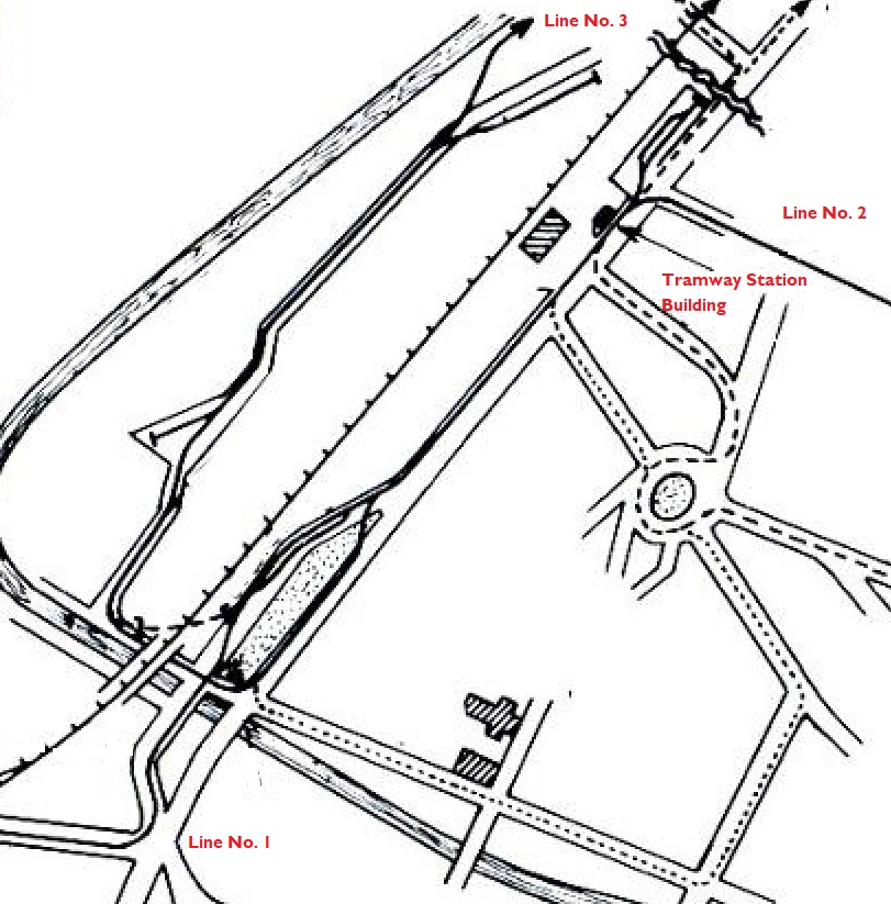
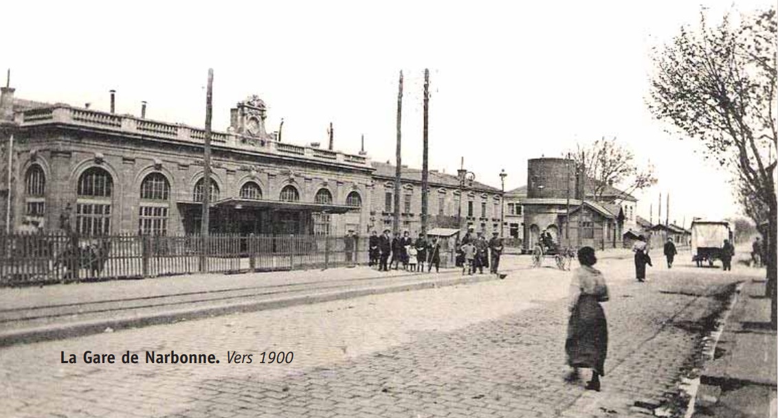
 The tramway station building was small. It can be seen above, just in front of the water tanks outside the Gare du Midi. The tramway itself is also visible above, running from the tramway station building off to the left of the picture. [1]
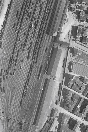
The tramway ran on the right-hand side of the Gare du Midi boundary wall and can just be picked out on the adjacent aerial image from 1930s. [17] The tramway building can be seen on the right of this image. [2]
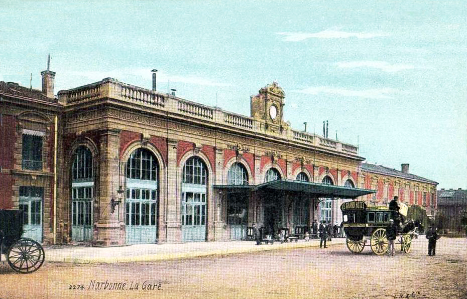 The Gare du Midi [3][10]
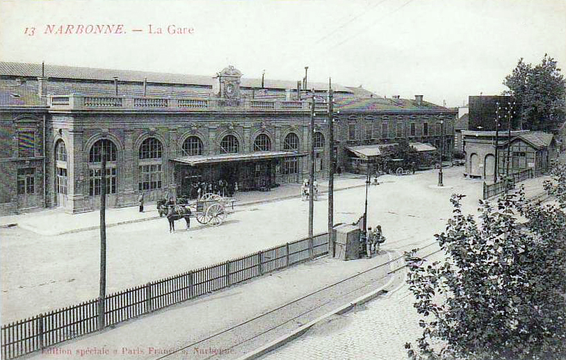 The Gare du Midi with the tramway in front. The water tanks and the tramway station are visible once again. [3]
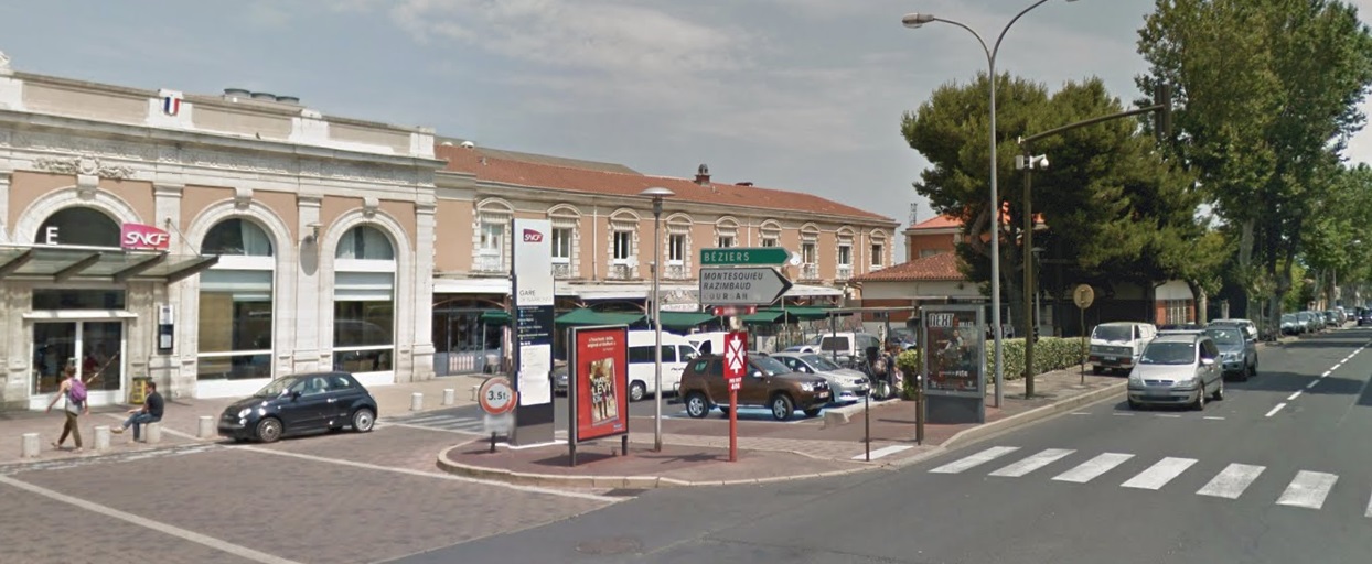 A similar view taken in the early 21st century.
 A great shot (above) of the tramway station with the Gare du Midi behind and the tramway track just in front – in the bottom left of the picture. [18]
The Gare du Midi building dominates the adjacent picture. The relative size of the tramway building can easily be seen. The building sits to the right of the two watertanks. The tramway can also be seen on the right-hand side of the image. [17] The station shown from the opposite direction. The photographer is standing close to the tramway building. [4]
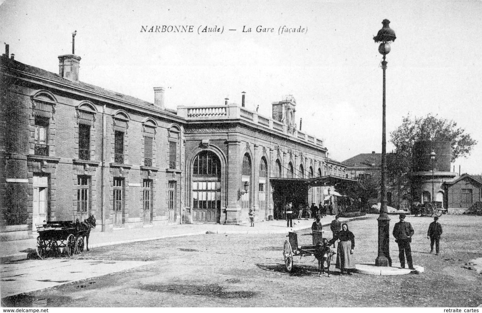 One final postcard view of the station forecourt in the early 1900s. [9]
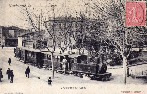
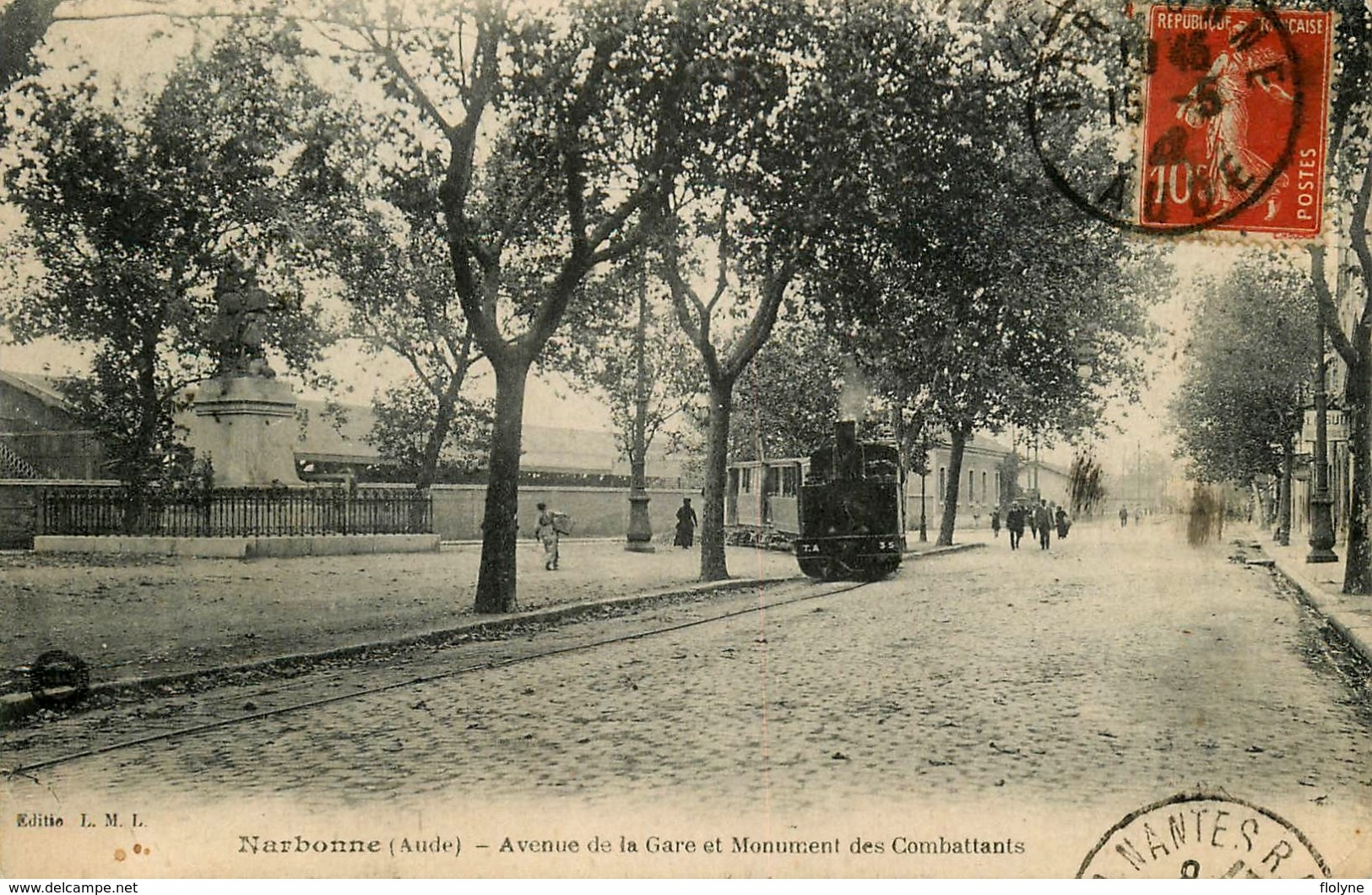 The tram (above) leaves the station and heads Southwest. There are two routes travelling in this direction. The one pictured to the East of the Statue des Combatants and one (not visible) to the West of the statue. The route to the West of the statue is the one which heads for Thezan. The tram in this picture is on the first part of the tramway to Ouveillan. [8]
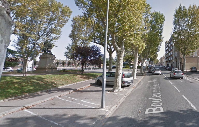 Approximately the same view in the early 21st century.
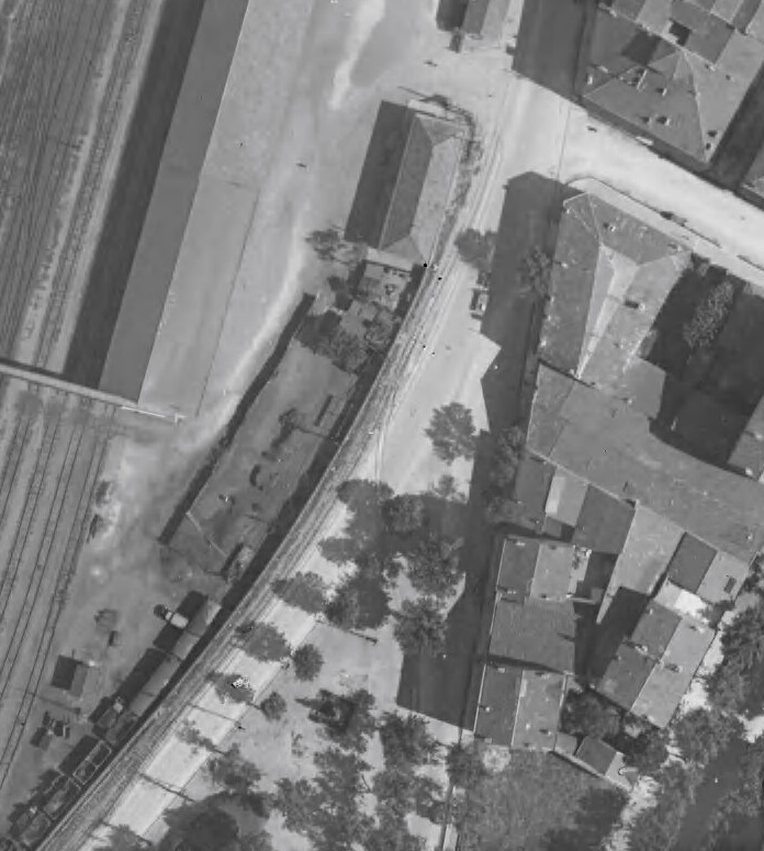 This 1930 aerial image shows the tramway junction to the North of the Statue des Combatants. [17]
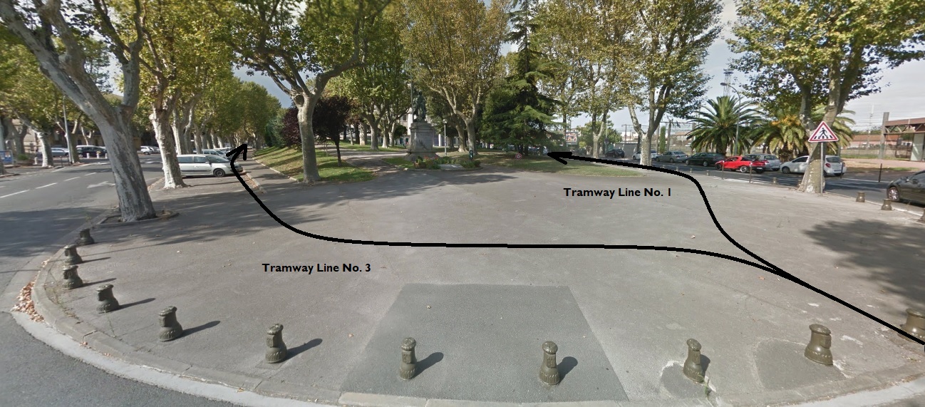 Taken from the Northeast, this view shows the Statue des Combatants and the approximate alignment of the two tramway routes heading Southwest from the Gare du Midi. Line No. 1 heads for Thezan de Corbieres. Line No. 3 heads Southwest before turning through 180 degrees, passing under the railway line and heading for Ouveillan.
 A little further Southwest the Boulevard du Gare (now Boulevard Frederic Mistral) met the Boulevard du College (now Boulevard Marcel Sembat). The tramway track was on the left-hand side of the Boulevard du Gare which is on the left of the picture. [10]
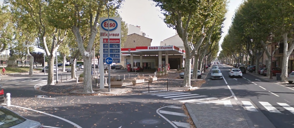 The same location in the early 21st century.
 Heading South towards the Canal du Midi. [10]
 This image shows a tram further along the route to Ouveillan (Line No. 3 on the sketch plan above). It has reached the point on its route which is furthest to the Southwest and is now passing under the standard gauge line before turning Northeast. [13]
 This image shows the three bridges over the Canal du Midi and I have added the two tramway routes for clarity. Both can be picked out on the image.[5]
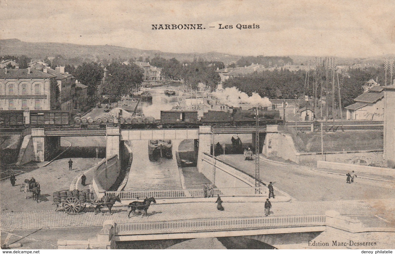 The same location and again it is just possible to pick out the tramway tracks. [6]
 The under-bridge in the 21st century.
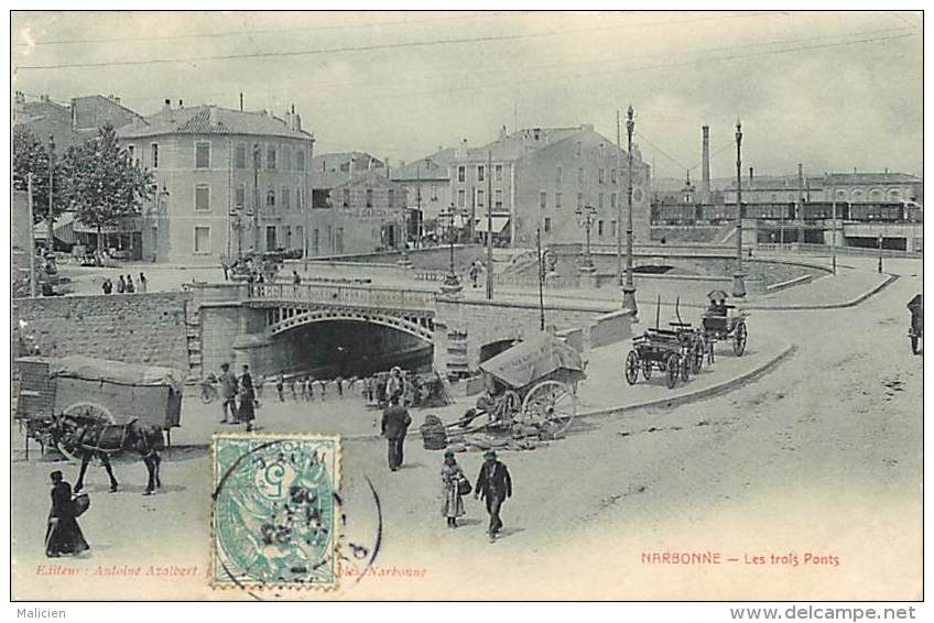 The Standard Gauge Line can be glimpsed in the upper right quadrant of this picture. The bridge carrying what we have called Line No. 1 in just in front of the railway bridge. Line No. 3 does not quite make it onto the right-hand side of the image. [7]
 A tram returning from Ouveillan. The railway bridge can just be glimpsed in the left background. This location is marked on the sketch plan of the tramways above as a single dot which is elsewhere given the name, ‘Arret Narbonne Ville.’ [15][16]
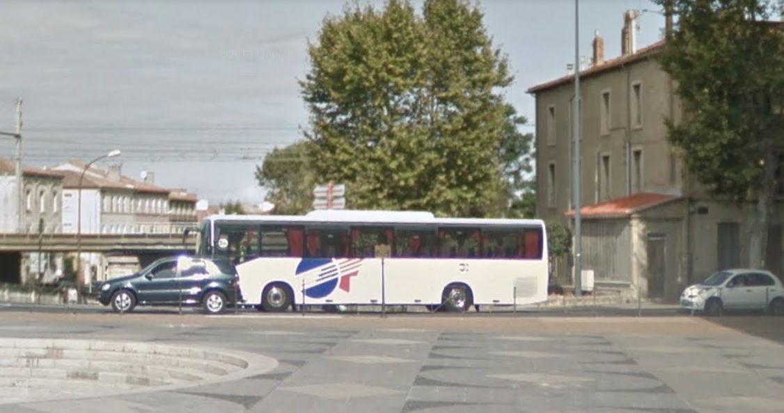 A 21st Century picture of the same location but with the camera much closer to road level. The building on the right is that on he right of the monochrome image and the building on the left clearly match those in the monochrome image above.
 This picture shows the location of the Arret Narbonne Ville with a tram leaving to the right to head for the Gare du Midi. The same direction as the tram in the monochrome image above. [16]
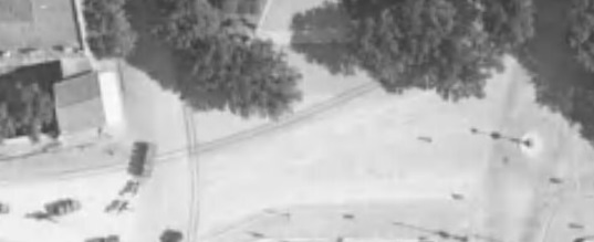 The two tramways are easily seen on this 1930s aerial photograph. Line No. 1 runs from top to bottom of the image, Line No. 3 runs left to right. The Canal du Midi in just off the bottom of the photo. [17]
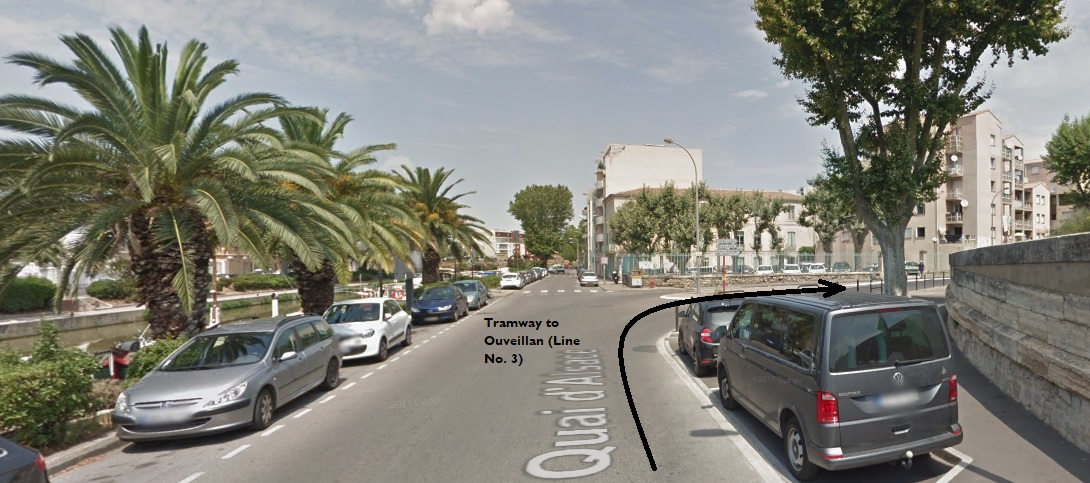 The tramway route to Ouveillan ran along what is now the Quai d’Alsace and then turned Northeast as shown below.
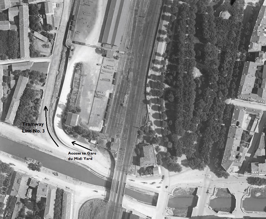
 The tramway passed under the Standard Gauge line as shown in the 1930 aerial image above and then turned North around the boundary wall of the station goods yard. [17]
It then followed that boundary wall in a northeasterly direction. Its own marshalling yard is shown on the adjacent image. [17]
This location was not the only possible point of exchange between the metre-gauge line and the standard gauge line. The relative size of the facilities is striking. The tramway’s compact facilities kept the tramway overheads low.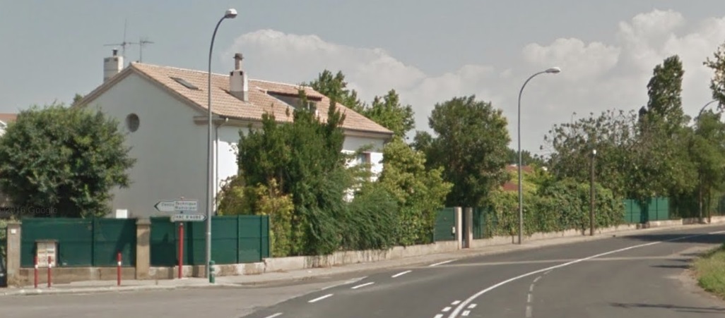 This image is taken from a point on the bottom edge of the aerial image immediately above looking North into the area of the tramway sidings which has now been completely redeveloped.
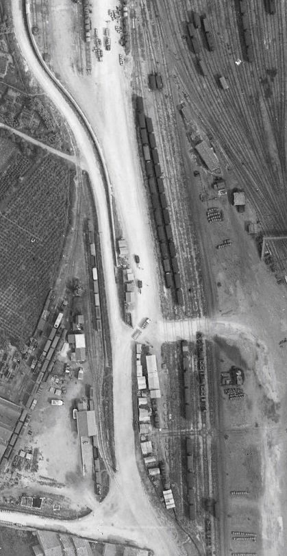
The monochrome images above have been aligned to show the tramway running up and down the photograph. It actually ran in a more northeasterly direction. The tramway followed what is now the D913 Rue de Cuxac along the western side of the large standard gauge facilities until it reached a further series of sidings and a transshipment wharf/shed. [17] This image from the 1930s shows the main tramway route following the banks of the Canal while a branch runs into the Gare du Midi facilities to the East of the D913, where a transshipment wharf and shed are provided. [17]
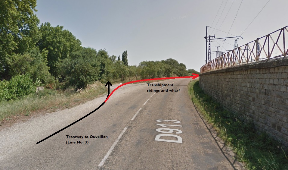 This Google Streetview image shows the line of the tramway to Ouveillan in black and the approximate line of the route into the transshipment yard and wharf in red.
 The location of the sidings and transshipment shed/wharf in the early 21st Century.
 North of the Tramway Station at the Gare du Midi the tramway had further sidings alongside the standard gauge facilities. The third line in Narbonne (Line No. 2, on our sketch plan above) set off North from the Station as well.
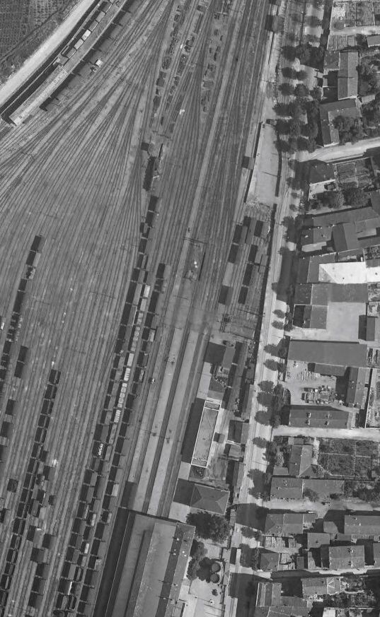
On the adjacent aerial image, again from 1930, the transshipment facilities near the line to Ouveillan can be seen in the top left. The tramway station building, bottom centre. The tramway sidings to the East of the Standard Gauge line can just be picked out at the top right of the picture. Careful inspection of the image will show the tramway departing to the East from a point where the sidings begin. This is shown more clearly below.[17]
The modern Avenue de Carnot follows the line of the old road and tramway. The tramway then turns East as on the aerial images from 1930. The road is now known as Rue Beaumarchais. As can be seen on the image immediately above it led to open fields. In the early 21st century the are is now part of the suburbs of Narbonne.
This completes the survey of the tramways in Narbonne. The two routes to Ouveillan and Fleury remain to be covered as they travel North and East out of the city. Once those posts are completed our survey of the Tramways de l’Aude will also be complete.
References
- http://www.commune1871.org/bulletins/pdf/Bulletin_40.pdf, accessed on 2nd November 2018.
- http://www.trains-de-jardin.net/images/?dossier=Mirliton34/CorbieresAnciens, accessed on 2nd November 2018.
- http://transpressnz.blogspot.com/2012/10/gare-d3e-narbonne-france.html, accessed on 2nd November 2018.
- https://www.gares-sncf.com/fr/gare/frxna/narbonne, accessed on 2nd November 2018.
- https://www.delcampe.net/fr/collections/cartes-postales/france/narbonne/narbonne-faubourgs-du-canal-train-55510337.html, accessed on 2nd November 2018.
- https://www.delcampe.net/fr/collections/cartes-postales/france/narbonne/11-narbonne-les-quais-avec-train-sur-le-pont-525985727.html, accessed on 2nd Novembr 2018.
- https://www.delcampe.net/fr/collections/cartes-postales/france/narbonne/departs-div-ref-ee90-aude-narbonne-3-ponts-chariot-douillard-gruissan-canal-canaux-train-trains-363690920.html, accessed on 2nd November 2018.
- https://www.delcampe.net/fr/collections/cartes-postales/france/narbonne/narbonne-train-locomotive-avenue-de-la-gare-et-monument-des-combattants-chemin-de-fer-belle-animation-453866037.html, accessed on 2nd November 2018.
- https://www.delcampe.net/fr/collections/cartes-postales/france/narbonne/narbonne-la-gare-facade-tres-beau-plan-anime-612931234.html, accessed on 2nd November 2018.
- https://www.delcampe.net/fr/collections/cartes-postales/france/narbonne/aude-11-narbonne-joli-plan-sur-les-boulevards-de-la-gare-et-du-college-avec-voiture-ancienne-animation-janson-343316390.html, accessed on 2nd November 2018.
- https://www.cparama.com/forum/narbonne-t220-20.html, accessed on 2nd November 2018.
- http://www.wiki-narbonne.fr/index.php?title=Gare_de_Narbonne, accessed on 3rd November 2018.
- https://collection-jfm.fr/t/cartes-postales-anciennes/france/11-aude/narbonne-11, accessed on 4th November 2018.
- https://phil1101.skyrock.com, accessed on 7th November 2018.
- https://www.geneanet.org/cartes-postales/view/5928211#0, accessed on 7th November 2018.
- http://www.cpaaude.fr/THEMES/TRAMWAYS/index_fichiers/Page1963.htm, accessed on 2nd November 2018.
- https://remonterletemps.ign.fr, accessed on 8th November 2018.
- https://www.cparama.com/forum/narbonne-t220-40.html, 5th November 2018.

Pingback: Tramways de l’Aude – Narbonne to Fleury d’Aude | Roger Farnworth
I am staying at Cessares and the main road is called Rue de la Gare..I am trying to find out about the railways in this area but am having trouble in finding any information on this/these. Any advice would be greatly appreciated. Regards,
Bob Reynolds
Hi Bob, if you mean Cesseras then this link should help ….https://rogerfarnworth.com/2018/10/13/tramways-de-laude-siran-to-lezignan-corbieres/
Best wishes
Roger
Dear Roger, Unbelievable, thank you.It is exactly what I was looking for, and it all makes sense now.We dined at Siran at The Cave last night, travelling adjacent to the old track…took our rubbish to the community rubbish and recycling centre at what was the station at Cessares, attended a soirée last week at the site of the station at Azillanet, drove to Beaufort and Olanzac adjacent to the path of the railway. All being so obvious now…Many many thanks, I will now study the details sent in depth and will travel along the route/routes again taking it all in.Incidentally, we have travelled to Brittany from the UK for the past 41 years for our family holidays and it was only in 2019 that I realised that there had been a network of narrow gauge railways throughout the region. There are certainly some gems about in France but it seems harder to find information about them though compared to the history of the railways in Britain.Many thanks again,From an Enlightened and Grateful,Bob
Sent from Sky Yahoo Mail for iPad
You are very welcome!🙂